Planets and Moons
ID: 4014
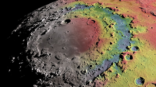
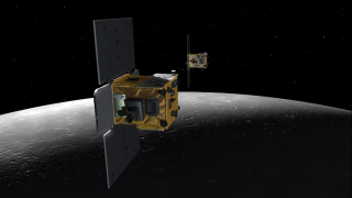
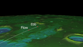
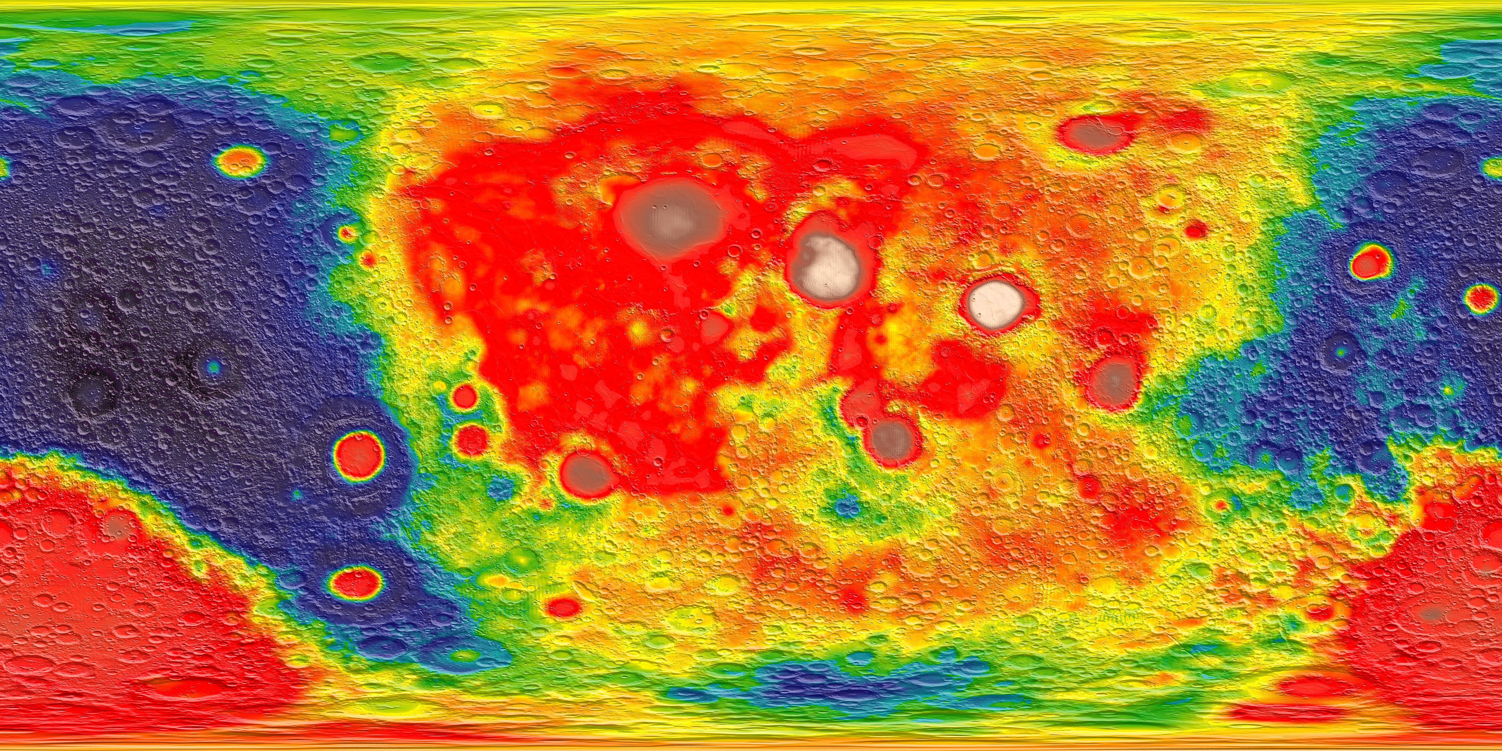
The Gravity Recovery and Interior Laboratory (GRAIL) mission comprises a pair of satellites launched in September, 2011 and placed in orbit around the Moon in January, 2012. The two satellites, named Ebb and Flow, used radio signals to precisely measure their separation as they flew in formation, one following the other in the same nearly circular polar orbit. These measurements allowed mission scientists to build up an accurate and detailed gravity map of the Moon.
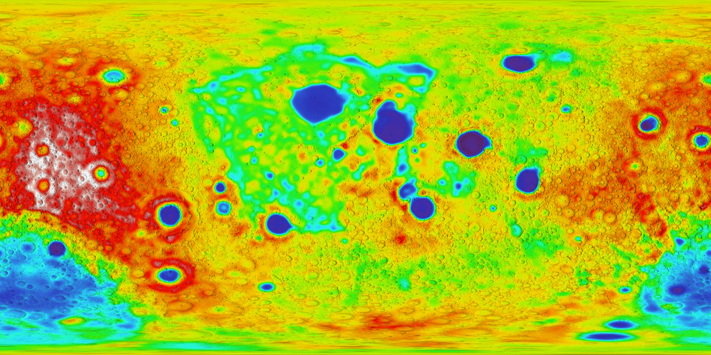
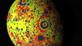
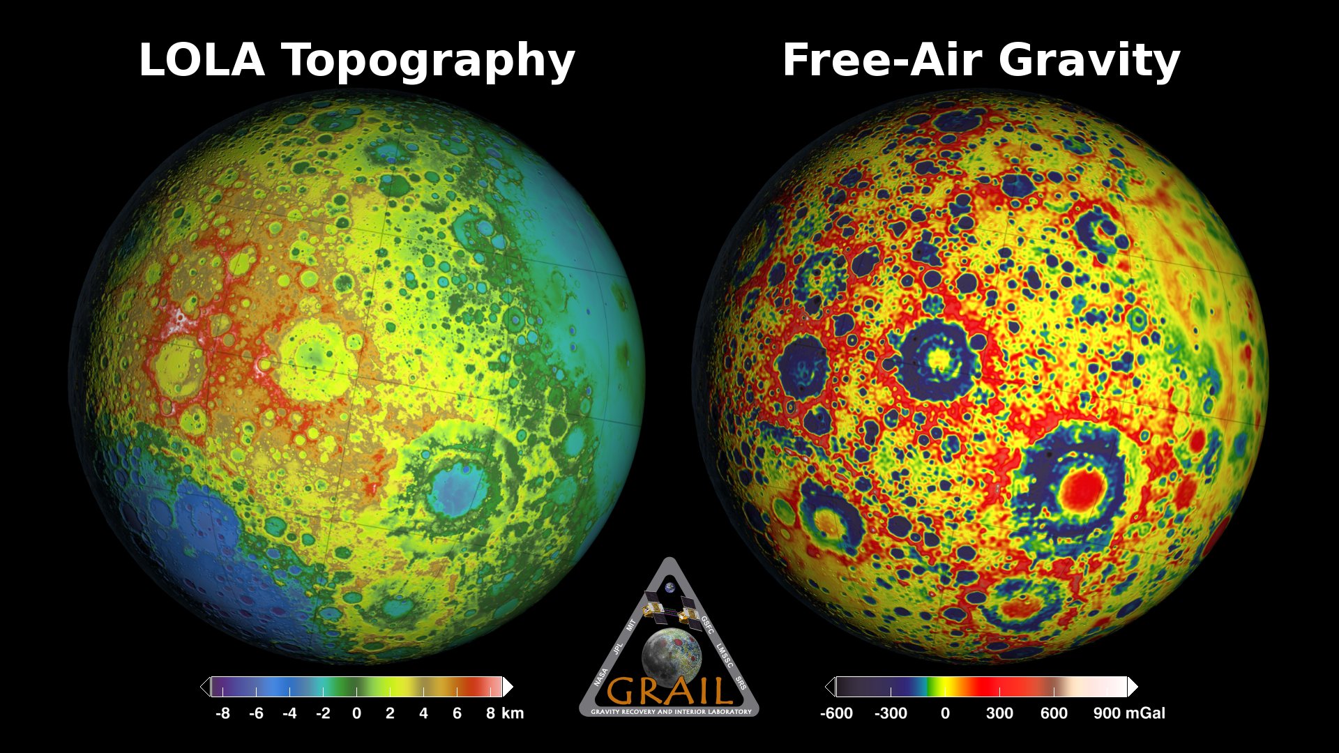
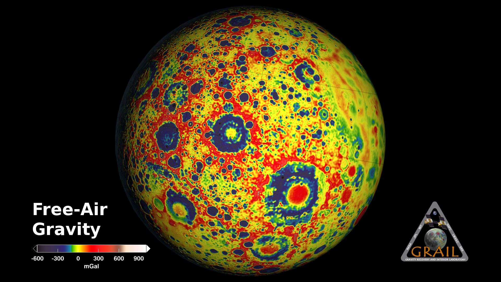
If the Moon were a perfectly smooth sphere of uniform density, the gravity experienced by the spacecraft would be exactly the same everywhere. But like other rocky bodies in the solar system, including the Earth, the Moon has both a bumpy surface and a lumpy interior. As the spacecraft fly in their orbits, they experience slight variations in gravity caused by both of these irregularities, variations which show up as small changes in the separation of the two spacecraft.
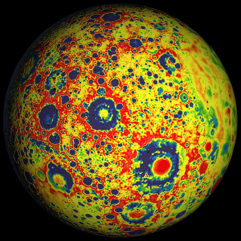
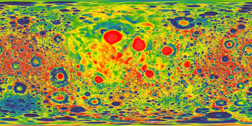
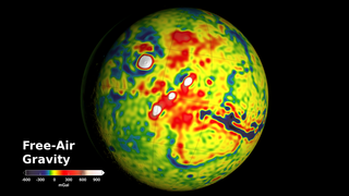
The free-air gravity map shows these variations directly. (
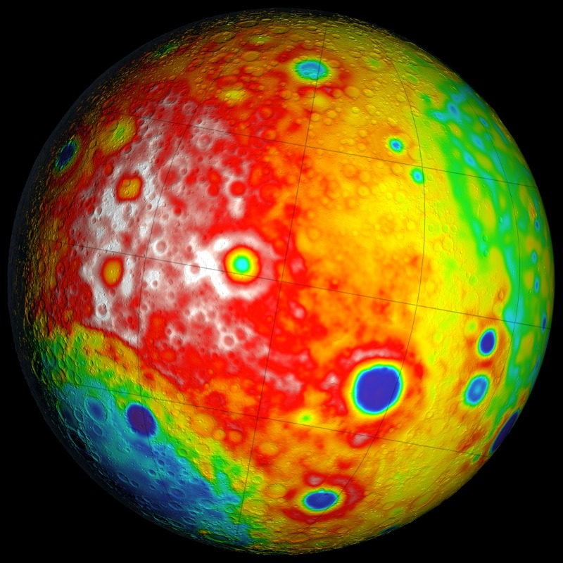
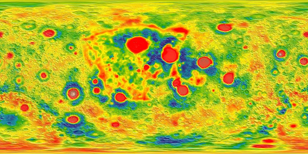
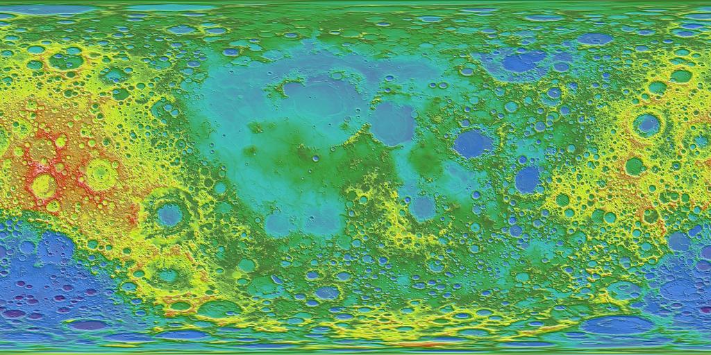
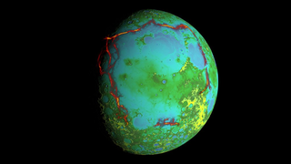
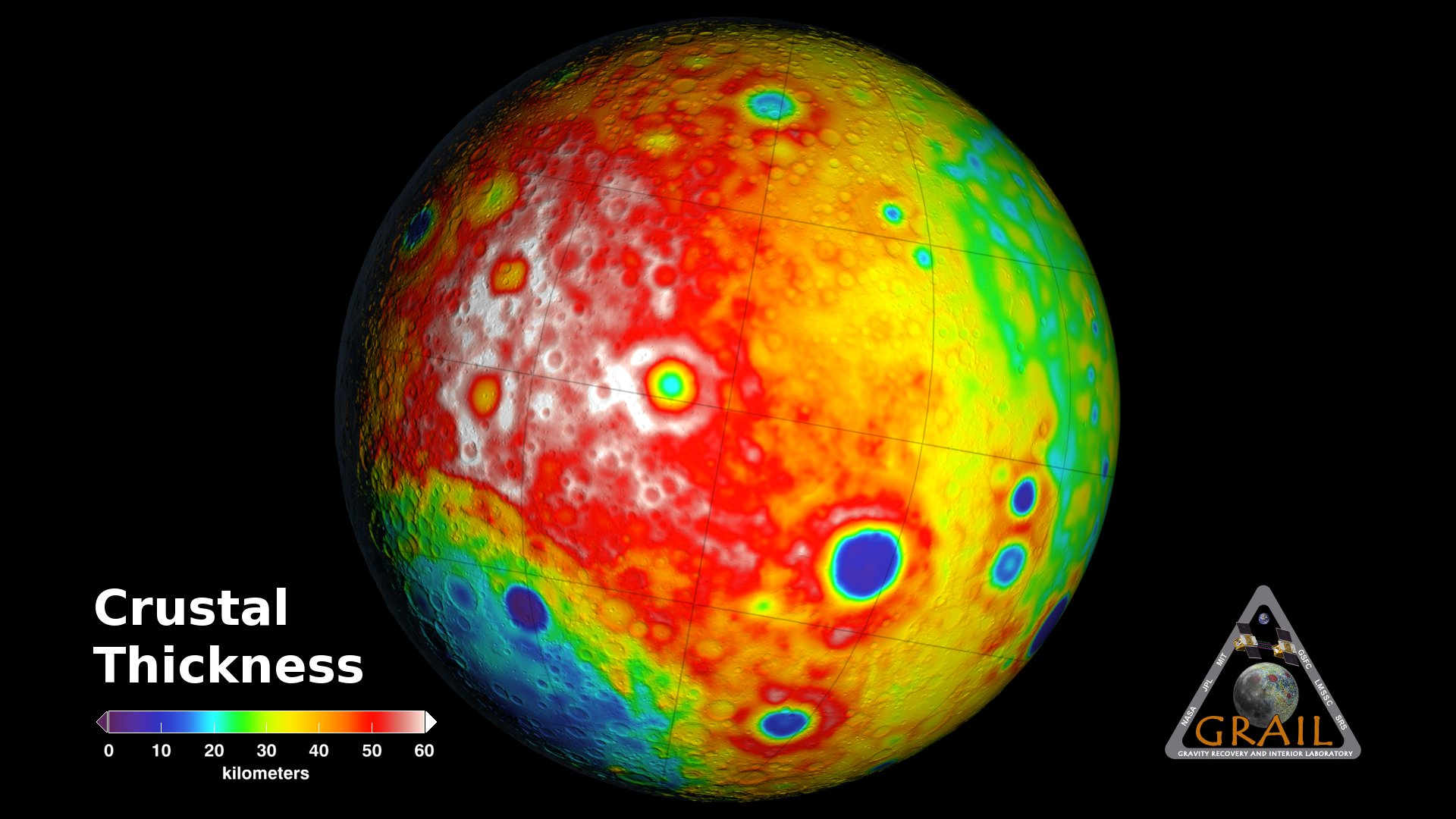
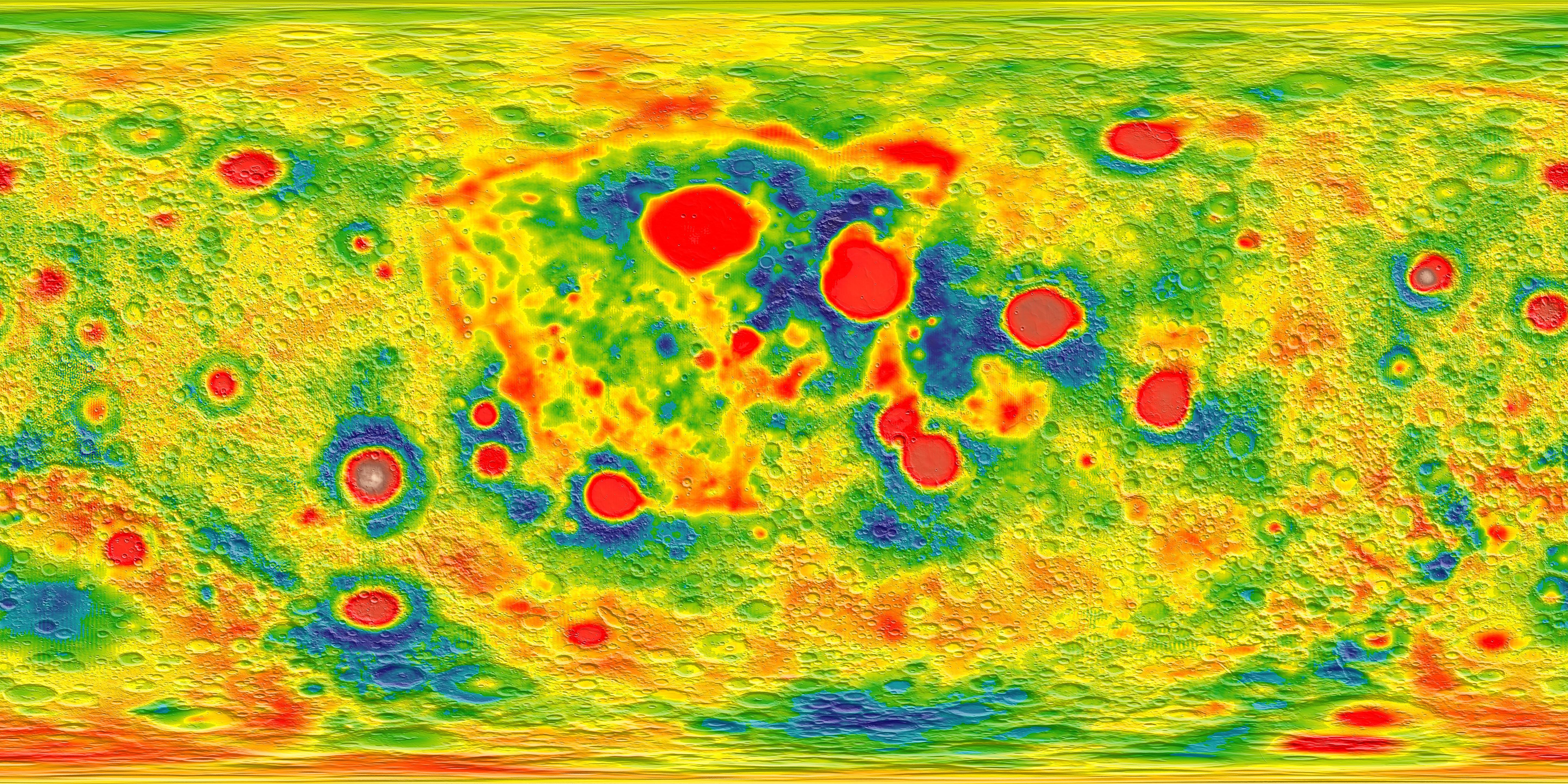
The crustal thickness map is inferred from the Bouguer map: If the density of the crust is assumed to be uniform, then the gravity anomalies visible in the Bouguer gravity map can be explained by variations in the thickness of the crust. Highs in gravity indicate places where the denser mantle is closer to the surface, and hence where the crust is thinner.
While aiding navigation for future lunar missions, GRAIL's gravity measurements reveal information about the internal structure of the Moon, improving our understanding of the origin and development of not just the Moon, but also the Earth and the rest of the inner solar system.
GRAIL Primary Mission Gravity Maps (AGU 2012)
If the Moon were a perfectly smooth sphere of uniform density, the gravity experienced by the spacecraft would be exactly the same everywhere. But like other rocky bodies in the solar system, including the Earth, the Moon has both a bumpy surface and a lumpy interior. As the spacecraft fly in their orbits, they experience slight variations in gravity caused by both of these irregularities, variations which show up as small changes in the separation of the two spacecraft.
The free-air gravity map shows these variations directly. (
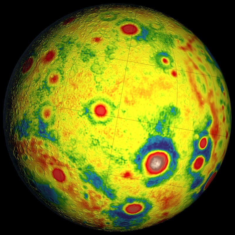
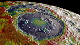
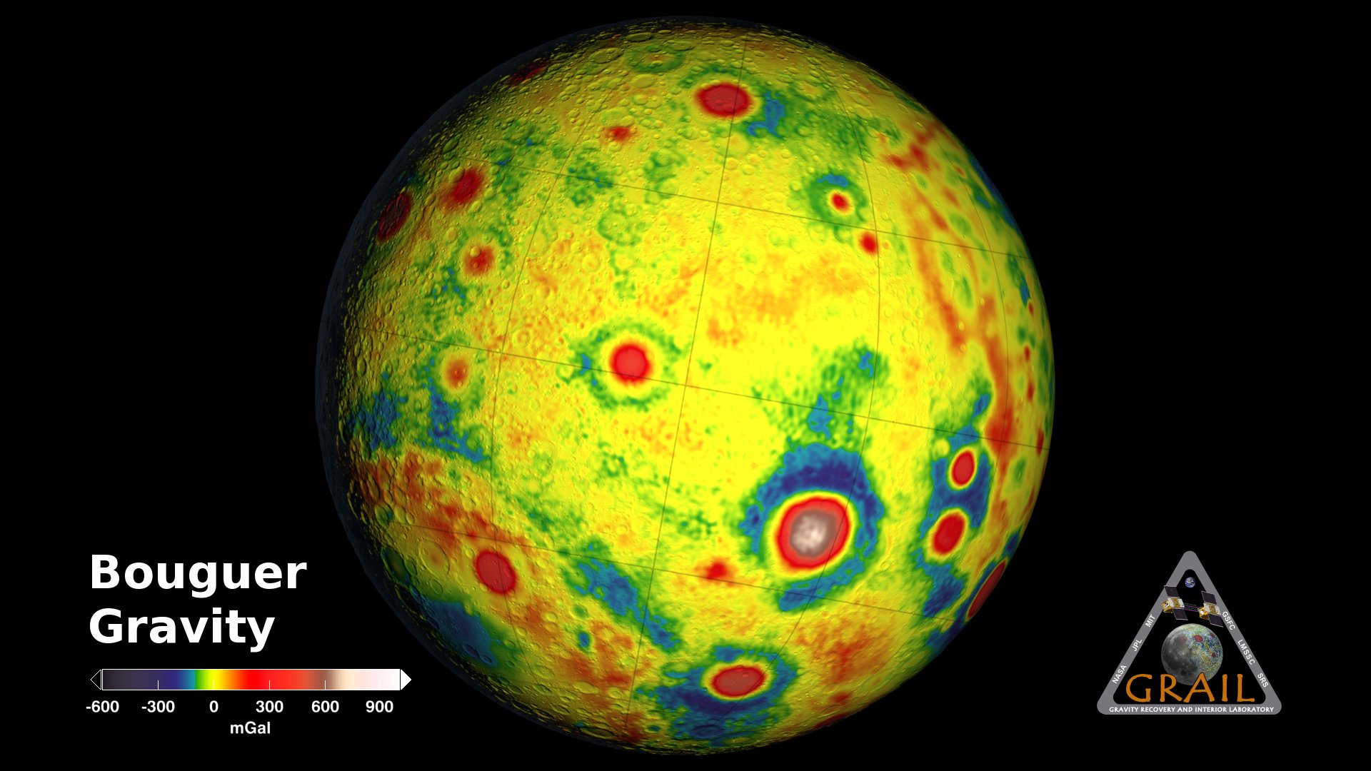
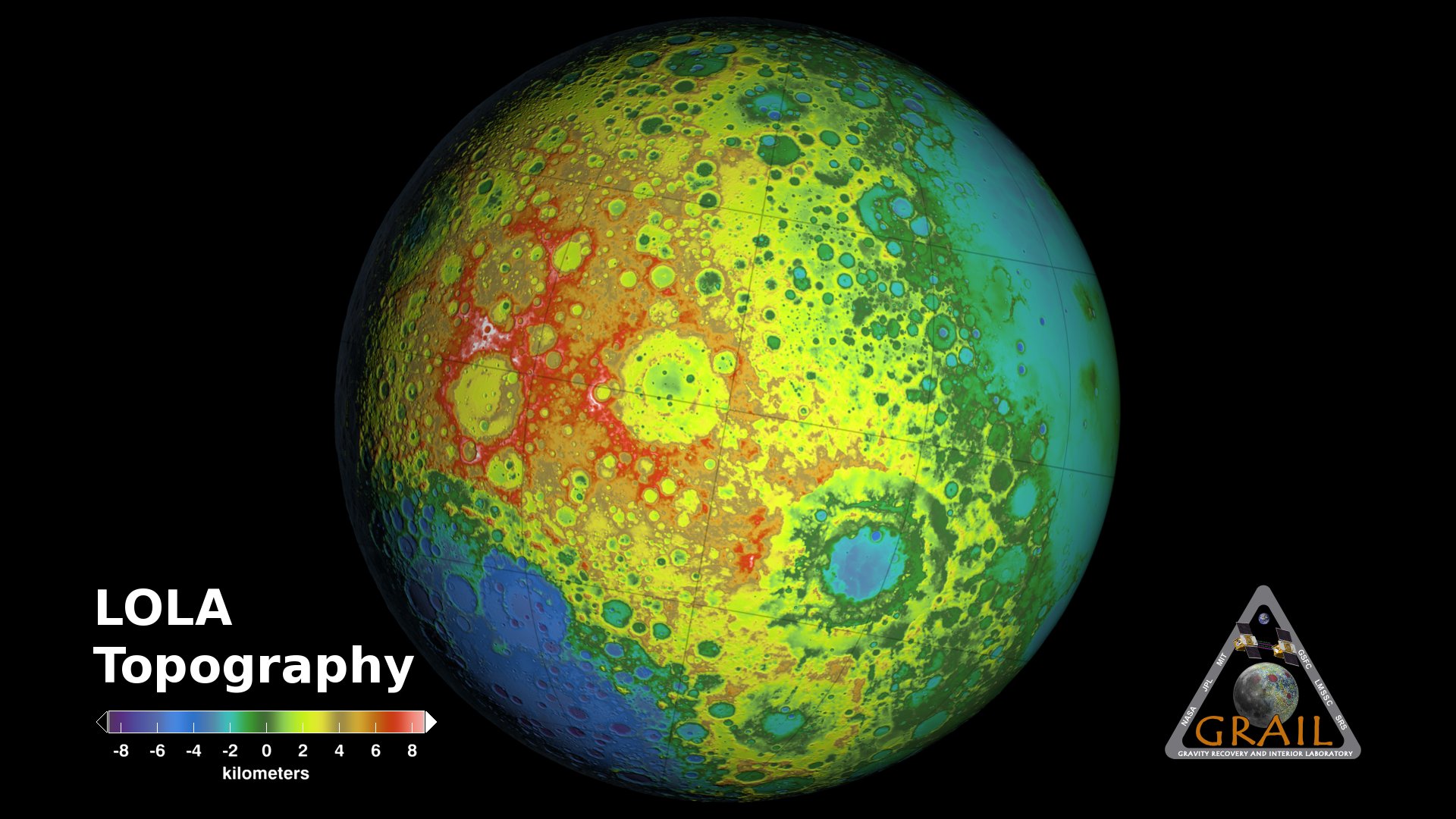
Free-airis a historical term; there is, of course, no air on the Moon.) The Bouguer gravity map subtracts the effect of the bumpy surface to show the lumpiness underneath. The elevation maps from the laser altimeter on Lunar Reconnaissance Orbiter (LRO) were used to create a model of what the gravity would be if the Moon were bumpy but not lumpy. This model was then subtracted from the free-air map to produce the Bouguer map. (Note: The Bouguer map shown here was filtered to emphasize smaller features; harmonic degrees 1 to 6 were excluded.)
The crustal thickness map is inferred from the Bouguer map: If the density of the crust is assumed to be uniform, then the gravity anomalies visible in the Bouguer gravity map can be explained by variations in the thickness of the crust. Highs in gravity indicate places where the denser mantle is closer to the surface, and hence where the crust is thinner.
While aiding navigation for future lunar missions, GRAIL's gravity measurements reveal information about the internal structure of the Moon, improving our understanding of the origin and development of not just the Moon, but also the Earth and the rest of the inner solar system.
Related
For More Information
Visualization Credits
Ernie Wright (USRA): Lead Animator
Maria Zuber (Massachusetts Institute of Technology): Scientist
Erwan M. Mazarico (Massachusetts Institute of Technology): Scientist
Maria Zuber (Massachusetts Institute of Technology): Scientist
Erwan M. Mazarico (Massachusetts Institute of Technology): Scientist
Please give credit for this item to:
NASA's Goddard Space Flight Center Scientific Visualization Studio
NASA's Goddard Space Flight Center Scientific Visualization Studio
Science Paper:
M. T. Zuber et al., Gravity field of the Moon from the Gravity Recovery and Interior Laboratory (GRAIL), Science 10.1126/science.1231507 (Dec. 5, 2012)
Short URL to share this page:
https://svs.gsfc.nasa.gov/4014
Missions:
GRAIL
LRO (Lunar Reconnaissance Orbiter)
Data Used:
Note: While we identify the data sets used in these visualizations, we do not store any further details nor the data sets themselves on our site.
This item is part of this series:
The Moon
Keywords:
SVS >> Gravity
SVS >> HDTV
SVS >> Laser Altimeter
SVS >> Lunar
SVS >> Moon
SVS >> LRO
SVS >> Lunar Reconnaissance Orbiter
SVS >> Lunar Topography
SVS >> Lunar Elevation Map
NASA Science >> Planets and Moons
SVS >> Free-Air Gravity
SVS >> Bouguer Gravity
SVS >> Crustal Thickness
SVS >> GRAIL
SVS >> Gravity Recovery and Interior Laboratory
M. T. Zuber et al., Gravity field of the Moon from the Gravity Recovery and Interior Laboratory (GRAIL), Science 10.1126/science.1231507 (Dec. 5, 2012)
Short URL to share this page:
https://svs.gsfc.nasa.gov/4014
Missions:
GRAIL
LRO (Lunar Reconnaissance Orbiter)
Data Used:
LRO/LOLA/Digital Elevation Map also referred to as: DEM
GRAIL/Lunar Gravity Ranging System/Free-Air Gravity also referred to as: GRAIL Free-Air Gravity
Analysis - NASAGRAIL/Lunar Gravity Ranging System/Bouguer Gravity also referred to as: GRAIL Bouguer Gravity
Analysis - NASAGRAIL/Lunar Gravity Ranging System/Crustal Thickness also referred to as: GRAIL Crustal Thickness
Analysis - NASAThis item is part of this series:
The Moon
Keywords:
SVS >> Gravity
SVS >> HDTV
SVS >> Laser Altimeter
SVS >> Lunar
SVS >> Moon
SVS >> LRO
SVS >> Lunar Reconnaissance Orbiter
SVS >> Lunar Topography
SVS >> Lunar Elevation Map
NASA Science >> Planets and Moons
SVS >> Free-Air Gravity
SVS >> Bouguer Gravity
SVS >> Crustal Thickness
SVS >> GRAIL
SVS >> Gravity Recovery and Interior Laboratory


