GRAIL Impacts the Moon
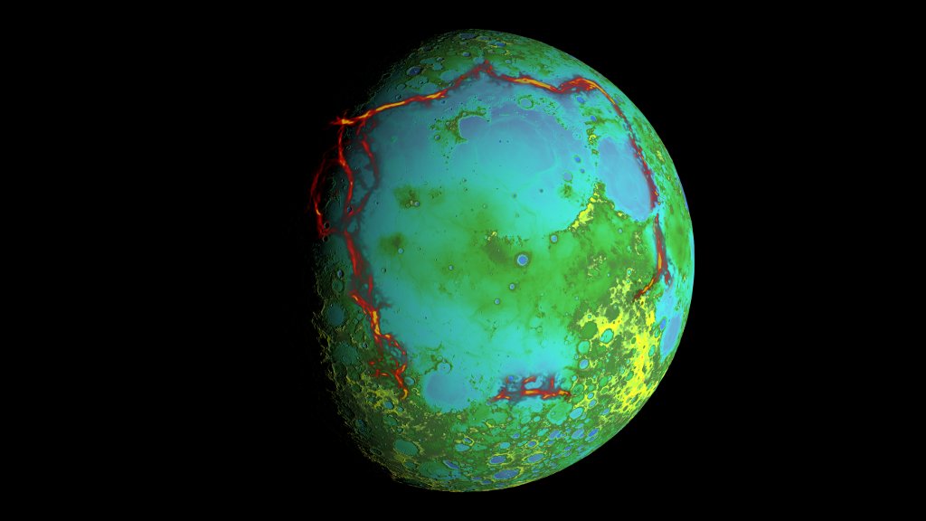
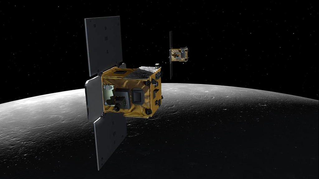
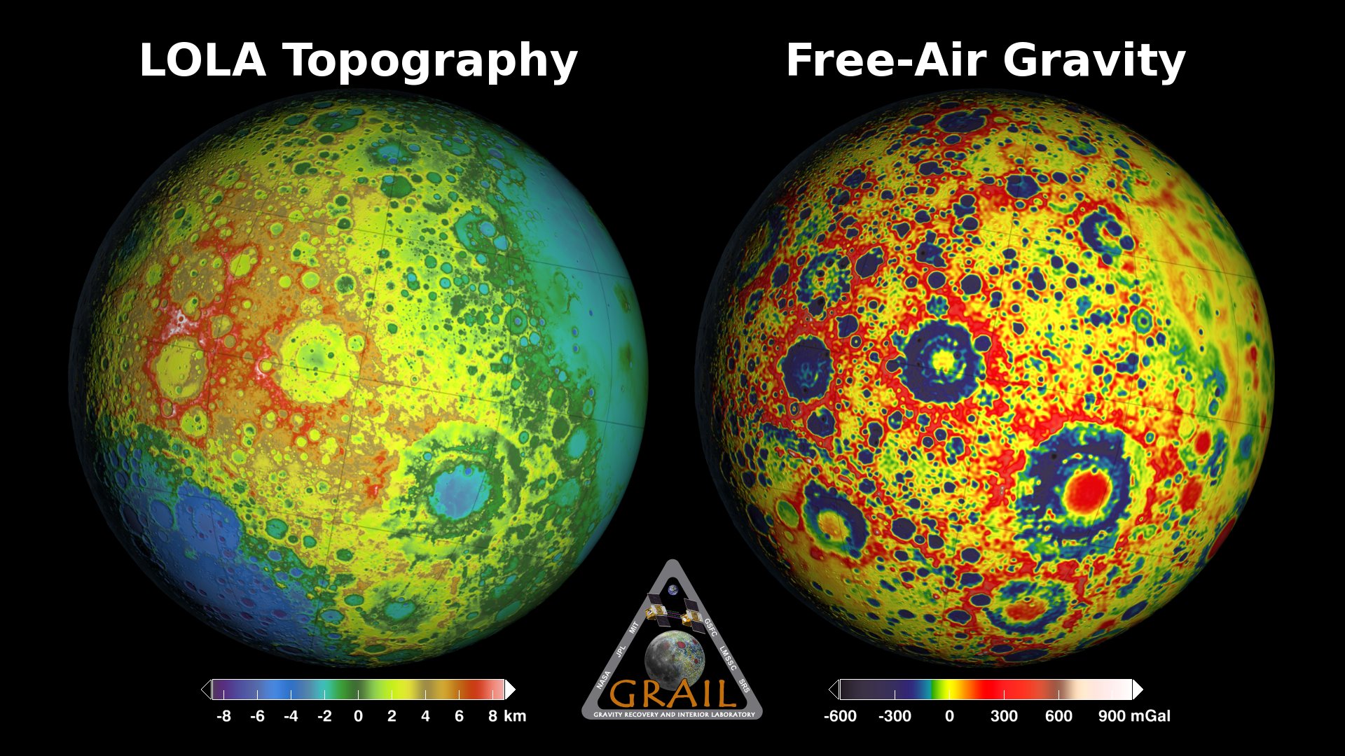
The Gravity Recovery and Interior Laboratory (GRAIL) mission comprises a pair of satellites launched in September, 2011 and placed in orbit around the Moon in January, 2012. The two satellites, named Ebb and Flow, used radio signals to precisely measure their separation as they flew in formation, one following the other in the same nearly circular polar orbit. These measurements allowed mission scientists to build up an accurate and detailed gravity map of the Moon.
GRAIL ends its successful mission by impacting the Moon on December 17, 2012 at approximately 5:27 p.m. EST (22:27 UT). The two spacecraft were placed in an orbit that takes them within a kilometer of the surface, so low that they will hit the side of an unnamed mountain that lies between Mouchez and Philolaus craters, near the north pole at 75°45'N, 26°11'W. Ebb strikes first, followed 24 seconds later by Flow.
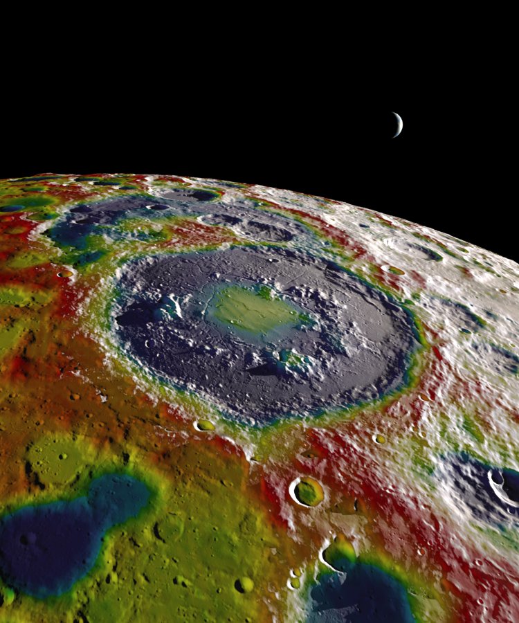
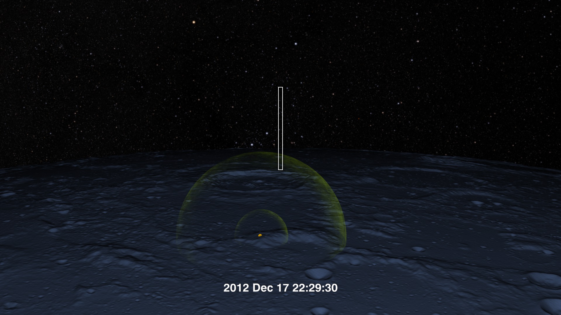
This animation shows the last three orbits of the two spacecraft, with views of the impact site. The impact occurs on the night side of a waxing crescent Moon, so the view shifts from a natural color Moon to a false-color elevation map.
GRAIL's final three orbits, with close-ups of the impact site.

One of GRAIL's last orbits across the night side of a waxing crescent Moon.
On their penultimate orbit, Ebb and Flow just miss the mountain they will hit on their next pass.
A more distant view of the impact site, just seconds before the impact of Ebb.
Credits
Please give credit for this item to:
NASA's Goddard Space Flight Center Scientific Visualization Studio
-
Animator
-
Ernie Wright
(USRA)

-
Ernie Wright
(USRA)
-
Scientists
- Maria Zuber (Massachusetts Institute of Technology)
- Erwan M. Mazarico (Massachusetts Institute of Technology)
Missions
This page is related to the following missions:Series
This page can be found in the following series:Datasets used
-
DEM (Digital Elevation Map) [LRO: LOLA]
ID: 653
Note: While we identify the data sets used on this page, we do not store any further details, nor the data sets themselves on our site.
Related
- ID: 4218
 Visualization
 - ID: 4175
- ID: 4054
 Visualization
 - ID: 11186
 Produced Video
 - ID: 4014
 Visualization
Release date
This page was originally published on Monday, December 17, 2012.
This page was last updated on Sunday, January 5, 2025 at 10:18 PM EST.