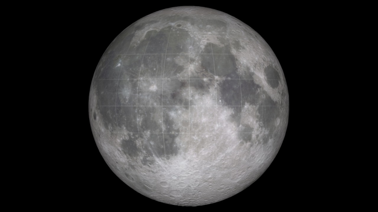
The Moon's South Pole
Overview
This is a collection of the media resources available on the Scientific Visualization Studio website related to the south pole of the Moon, an area of special interest for future exploration. It has been studied intensively by every instrument aboard Lunar Reconnaissance Orbiter (LRO). It includes cold, permanently shadowed craters that have collected water and other volatiles and shielded them from the Sun. Its rugged terrain also offers temperate high spots with persistent sunshine ideal for continuous solar power generation. More information and media are available at
- LRO Camera Images (search for
south pole
) - LRO Diviner temperature measurements
- Lyman-Alpha Map
Water
- ID: 4574 Visualization
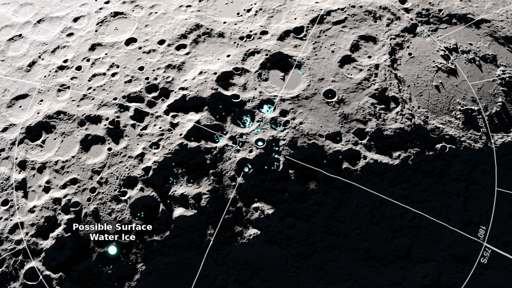
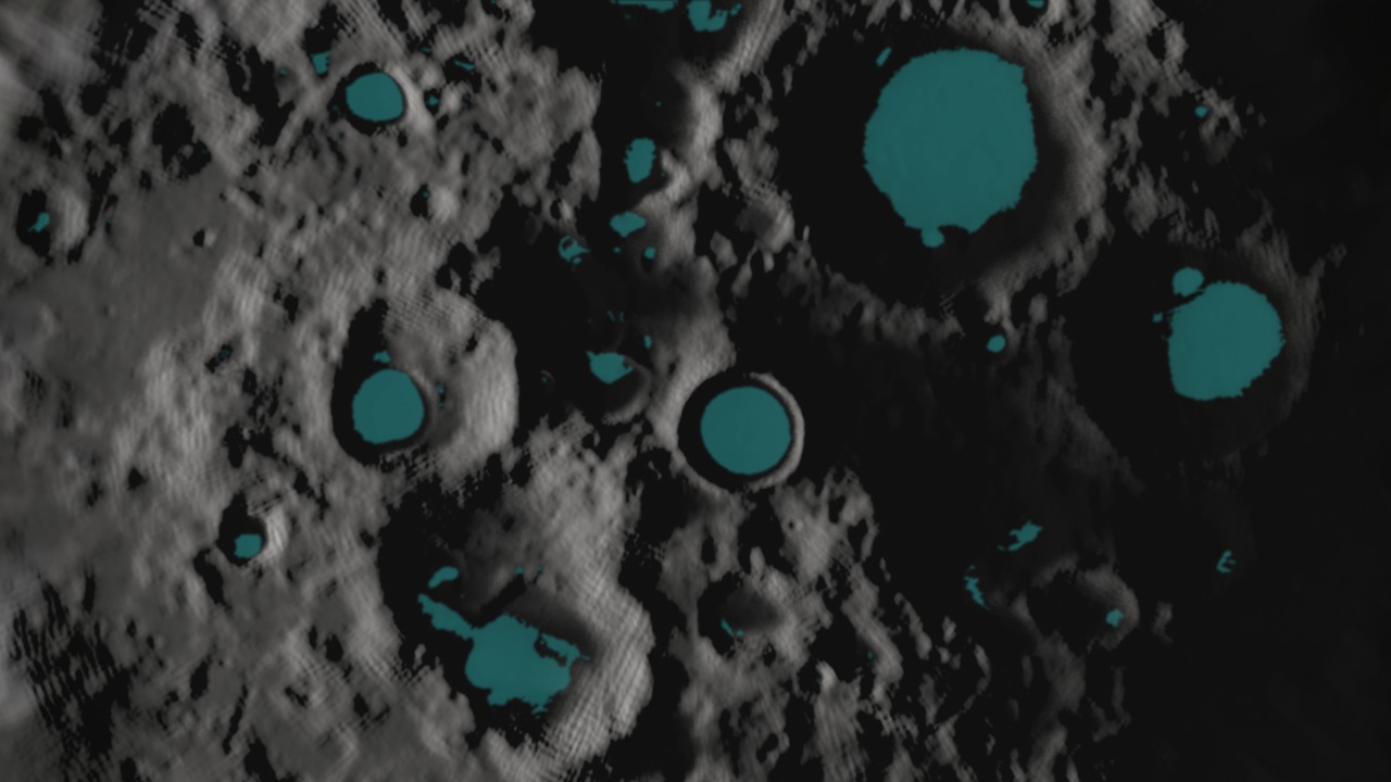
Temperature, Reflectance Point to Frost near the Moon's Poles
Go to this pageA view of the south pole of the Moon showing where reflectance and temperature data indicate the possible presence of surface water ice. Includes music and narration. Music by Killer Tracks: Full Charge - Zubin Thakkar. || 4574_LROMoonFrost_YouTube.00780_print.jpg (1024x576) [236.8 KB] || 4574_LROMoonFrost_YouTube.mp4 (1920x1080) [75.8 MB] || 4574_LROMoonFrost_Facebook.mp4 (1280x720) [65.4 MB] || 4574_LROMoonFrost_Twitter.mp4 (1280x720) [11.8 MB] || 4574_LROMoonFrost_Facebook.webm (1280x720) [5.2 MB] || 4574_LROMoonFrost_MASTER.mov (1920x1080) [639.4 MB] || 4574_LroMoonFrost_Captions.en_US.srt [761 bytes] || 4574_LroMoonFrost_Captions.en_US.vtt [774 bytes] || 4574_LROMoonFrost_YouTube.mp4.hwshow [191 bytes] ||
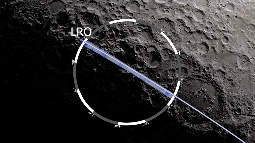
- ID: 4057 Visualization

LEND Looks for Water at the South Pole
Go to this pageSince Lunar Reconnaissance Orbiter (LRO) entered lunar orbit in 2009, its neutron detector, LEND, has been counting the neutrons coming from the Moon's surface.Neutrons are created when galactic cosmic rays strike atoms in the lunar regolith. These neutrons bounce from atom to atom like billiard balls, losing energy with each collision. Along the way, some of these neutrons escape into space, where LEND can detect them.The presence of hydrogen in the lunar soil reduces the number of neutrons that escape. To map out likely deposits of water ice, LEND scientists look for this deficit of neutrons in the epithermal (medium) energy range.If the deficit were simply due to random fluctuations, the hydrogen map would never coalesce into a sharp image, but as this animation shows, the map of epithermal neutron deficit at the south pole of the Moon improves over time and converges on particular spots. These include especially strong signals in the permanently shadowed parts of Cabeus and Shoemaker craters, where ice would be completely shielded from the sun. But LEND and other missions have found signs of water in places that aren't permanently shadowed while apparently excluding some places that are, both of which are surprising and exciting discoveries. ||
- ID: 11292 Produced Video
Water on the Moon
Go to this pageSince the 1960’s, scientists have suspected that frozen water could survive in cold, dark craters at the Moon’s poles. While previous lunar missions have detected hints of water on the Moon, new data from the Lunar Reconnaissance Orbiter (LRO) pinpoints areas near the south pole where water is likely to exist. The key to this discovery is hydrogen, the main ingredient in water: LRO uses its Lunar Exploration Neutron Detector, or LEND, to measure how much hydrogen is trapped within the lunar soil. By combining years of LEND data, scientists see mounting evidence of hydrogen-rich areas near the Moon’s south pole, strongly suggesting the presence of frozen water. ||
- ID: 4619 Visualization
Tour of the Moon 4K Redux
Go to this pageThe camera flies over the lunar terrain, coming in for close looks at a variety of interesting sites and some of the LRO data associated with them. Includes narration, music, feature titles, research sources, and the location and scale of the image center. Music Provided By Killer Tracks: "Never Looking Back" - Frederick Wiedmann. "Flying over Turmoil" - Benjamin Krause & Scott Goodman.Watch this video on the NASA Goddard YouTube channel.This video is also available on the SVS YouTube channel. || narrated.1000_print.jpg (1024x576) [197.1 KB] || moontour_narrated_1080p30.webm (1920x1080) [40.4 MB] || moontour_narrated_1080p30.mp4 (1920x1080) [458.9 MB] || moontour_narrated.en_US.srt [5.9 KB] || moontour_narrated.en_US.vtt [5.9 KB] || moontour_narrated_2160p30.mp4 (3840x2160) [1.4 GB] || moontour_narrated_2160p30_prores.mov (3840x2160) [18.1 GB] ||
- ID: 3480 Visualization
Lunar Prospector Hydrogen Concentration - South Pole
Go to this pageIn 1998 NASA's Lunar Prospector mission used the presence of hydrogen as a sign of potential ice deposits. As you can see in this video, Prospector data showed significantly more hydrogen at the south pole of the moon (areas colored blue). Lunar Reconnaissance Orbiter will build on this data and narrow down the regions that may contain water ice deposits. ||
Permanent Shadows
- ID: 4893 Visualization
Shadows near the Moon's South Pole
Go to this pageThis video shows the movement of shadows near the Moon's South Pole, over the course of two lunar days, which is approximately two months on Earth. The visualization was created from data gathered by the Lunar Reconnaissance Orbiter spacecraft.Music Provided by Universal Production Music: “Two Horizons” – Anthony d’AmarioWatch this video on the NASA Goddard YouTube channel. || ShadowsMoonSouthPole_Thumbnail1.jpg (1920x1080) [381.7 KB] || ShadowsMoonSouthPole_Thumbnail1_print.jpg (1024x576) [133.0 KB] || ShadowsMoonSouthPole_YouTubeHD.webm (1920x1080) [10.8 MB] || ShadowsMoonSouthPole_YouTubeHD.mp4 (1920x1080) [157.1 MB] || ShadowsMoonSouthPole_FacebookHD.mp4 (1920x1080) [118.7 MB] || ShadowsMoonSouthPole_CAPTIONS.en_US.srt [1.3 KB] || ShadowsMoonSouthPole_CAPTIONS.en_US.vtt [1.3 KB] || ShadowsMoonSouthPole_MASTER.mov (1920x1080) [1.3 GB] || ShadowsMoonSouthPole_FacebookHD.mp4.hwshow ||
- ID: 4770 Visualization

From Apollo Sites To The South Pole
Go to this pageBeginning on the near side of the Moon, with the Apollo sites marked, the view quickly moves to the South Pole and zooms in to show the changing illumination conditions there for an entire year. || pole.0126_print.jpg (1024x576) [63.6 KB] || pole.0126_searchweb.png (320x180) [32.6 KB] || pole.0126_thm.png (80x40) [3.1 KB] || apollo_to_south_pole_1080p30.mp4 (1920x1080) [86.6 MB] || apollo_to_south_pole_720p30.mp4 (1280x720) [44.9 MB] || apollo_to_south_pole_720p30.webm (1280x720) [20.0 MB] || apollo (1920x1080) [0 Item(s)] || apollo_to_south_pole_360p30.mp4 (640x360) [16.2 MB] || apollo (3840x2160) [0 Item(s)] || apollo_to_south_pole_2160p30.mp4 (3840x2160) [354.9 MB] ||
- ID: 11218 Produced Video
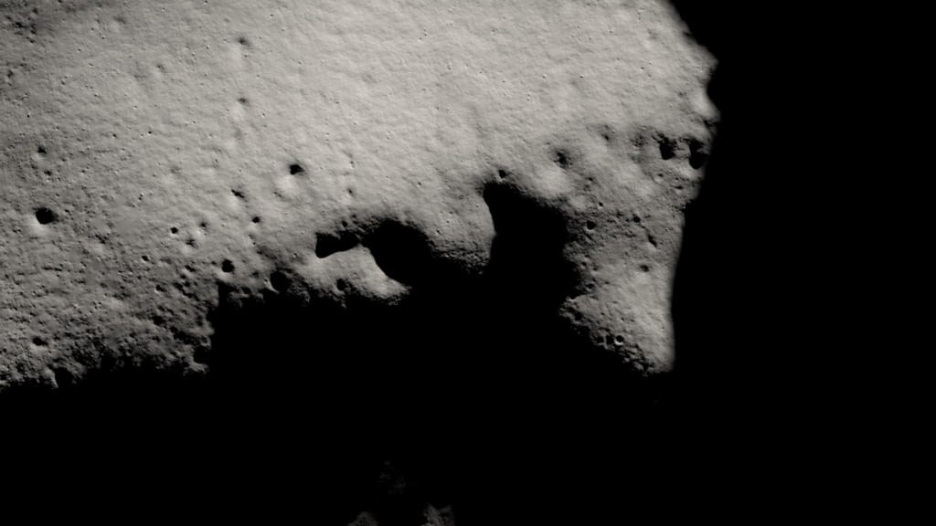
The Moon's Permanently Shadowed Regions
Go to this pageAs you watch the Moon over the course of a month, you'll notice that different features are illuminated by the Sun at different times. However, there are some parts of the Moon that never see sunlight. These areas are called permanently shadowed regions, and they appear dark because unlike on the Earth, the axis of the Moon is nearly perpendicular to the direction of the sun's light. The result is that the bottoms of certain craters are never pointed toward the Sun, with some remaining dark for over two billion years. However, thanks to new data from NASA's Lunar Reconnaissance Orbiter, we can now see into these dark craters in incredible detail. ||
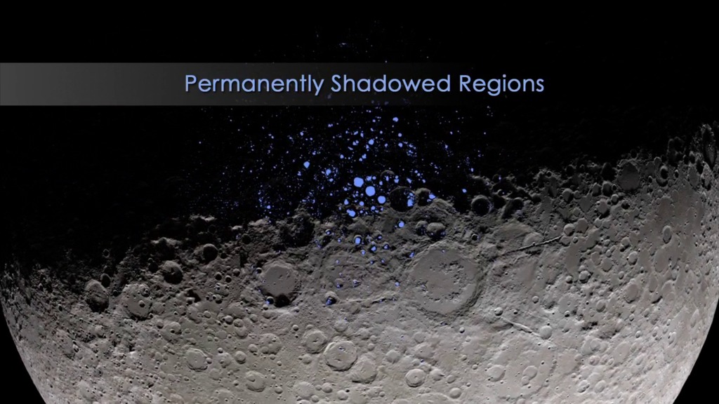
- ID: 4043 Visualization
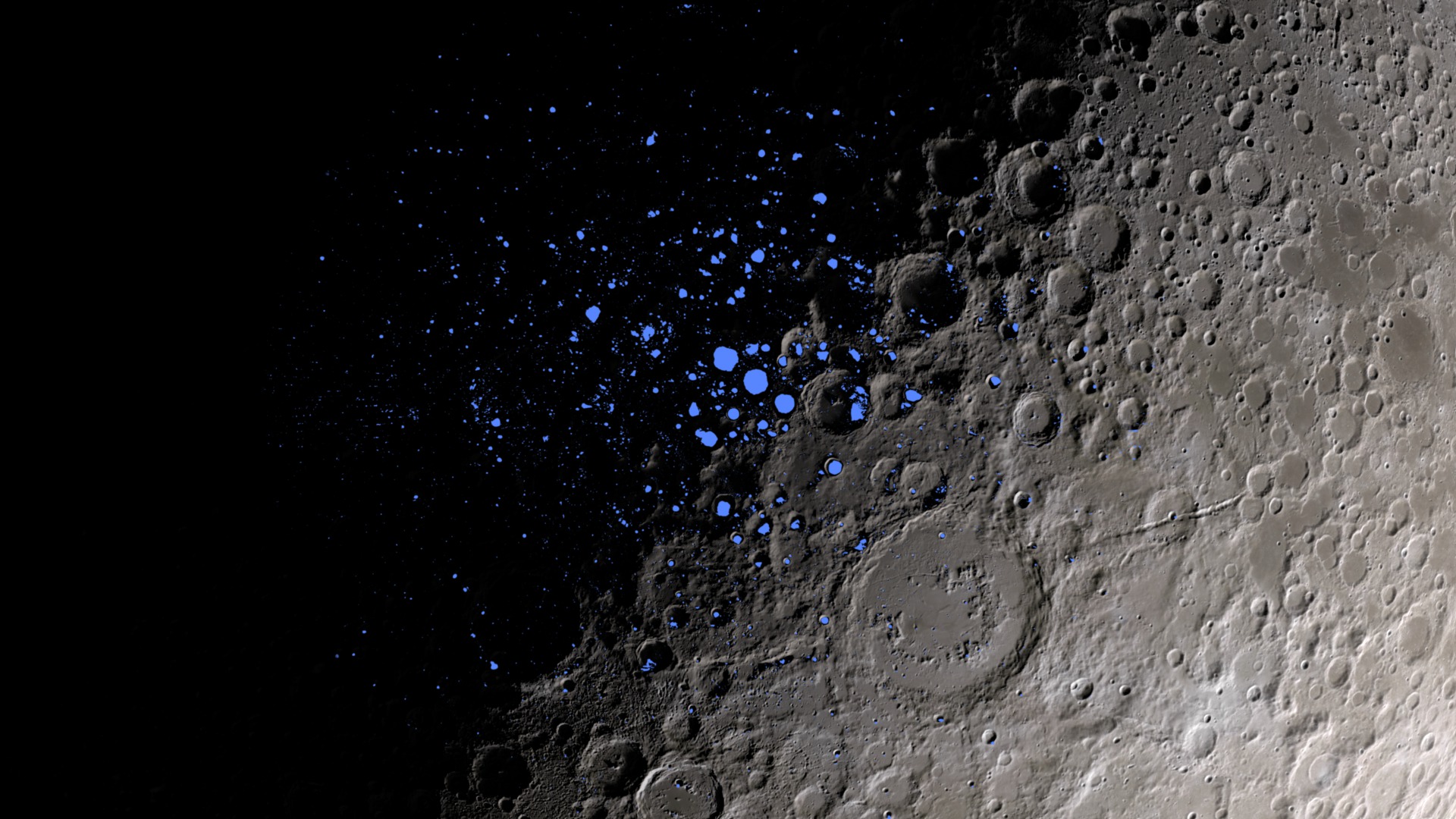
LRO Peers into Permanent Shadows
Go to this pageThe Moon's permanently shadowed regions, or PSRs, are places on the Moon that haven't seen the Sun in millions, or even billions, of years. The Earth's tilted axis allows sunlight to fall everywhere on its surface, even at the poles, for at least part of the year. But the Moon's tilt relative to the Sun is only 1.6°, not enough to get sunlight into some deep craters near the lunar north and south poles. PSRs are therefore some of the coldest, darkest places in the solar system.Because of that, PSRs are expected to be excellent traps for volatiles, chemicals that would normally vaporize and escape into space, and this includes water. Lunar Reconnaissance Orbiter (LRO) includes several instruments designed to peer into the PSR darkness and measure temperature, reflectivity, and neutron absorption, all of which are clues to what chemicals might be hiding there. This animation shows where the PSRs are and in what ways LRO can see inside them. ||
- ID: 4716 Visualization
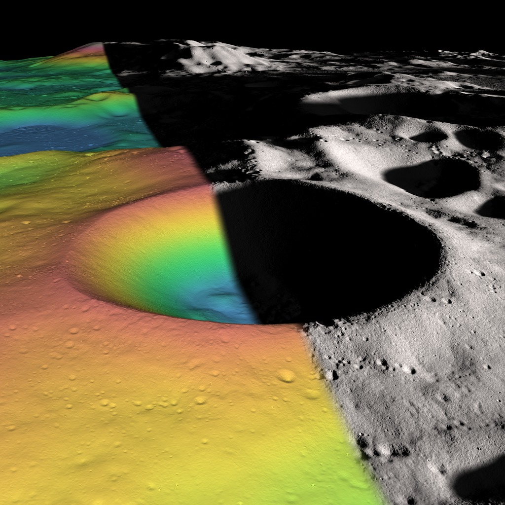
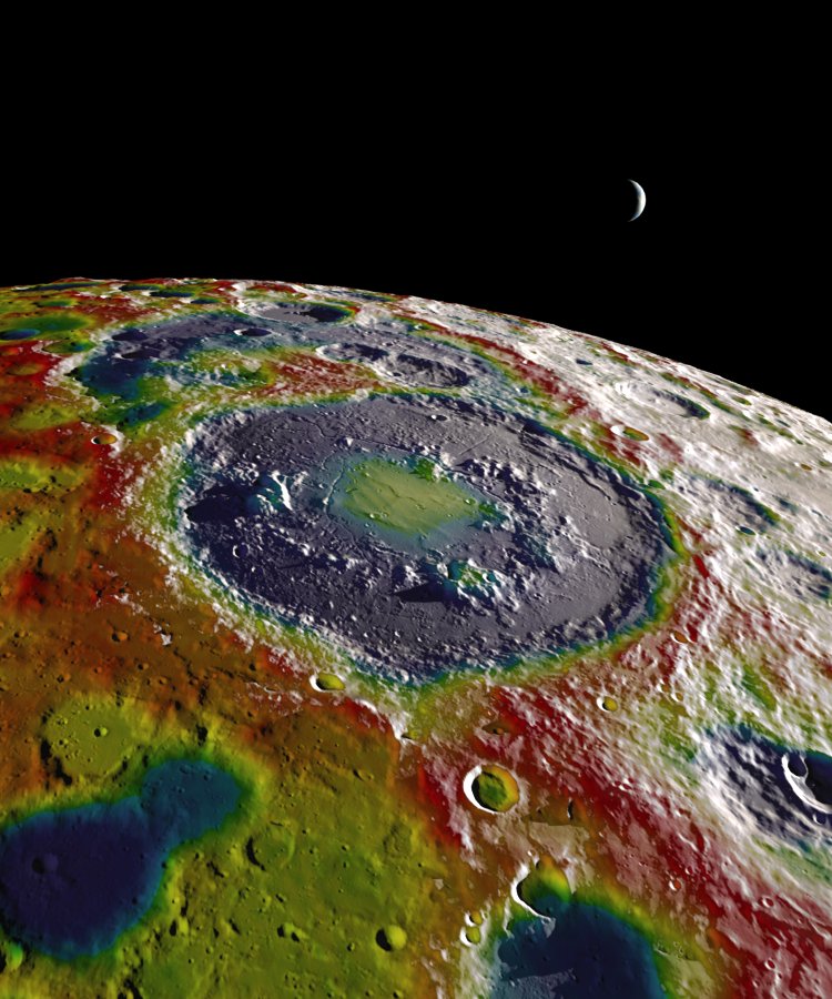
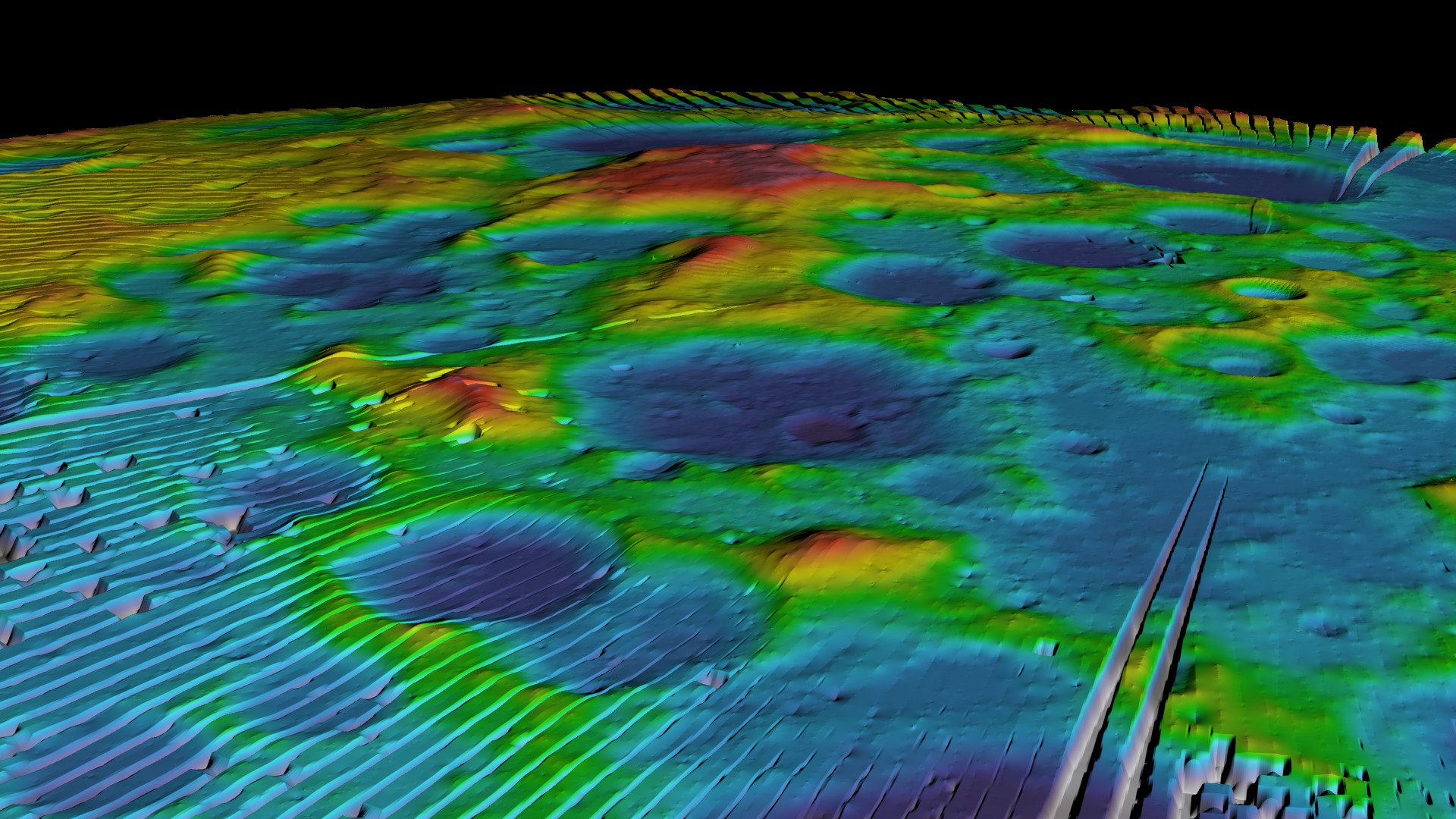
Visualizing Shackleton Crater
Go to this pageA visualization of Shackleton crater. The near (Earth-facing) side of the Moon is to the right. In the false-color elevation on the left, red is higher and blue is lower. || shackleton_split_final_print.jpg (1024x1024) [280.9 KB] || shackleton_split_final_searchweb.png (320x180) [87.2 KB] || shackleton_split_final_thm.png (80x40) [7.1 KB] || shackleton_split_final.tif (3600x3600) [12.8 MB] ||
- ID: 3577 Visualization
Permanent Shadows on the Moon
Go to this pageAs the Earth and Moon orbit around the Sun, there are places on the Moon that never receive direct sunlight. Most of these permanently shadowed regions are at the lunar poles. This animation approximates the permanently shadowned regions pertaining to the Moon's south pole by maintaining a maximum sun angle to the surface of 1.5 degrees. These permanently shadowed areas are of interest because they could hold water ice. (NOTE: South Pole Digital Elevation Maps [DEM] based on publically released JAXA/Selene data.) ||
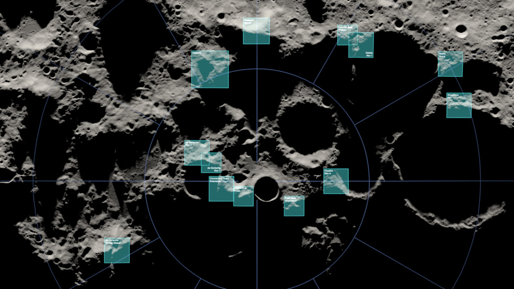
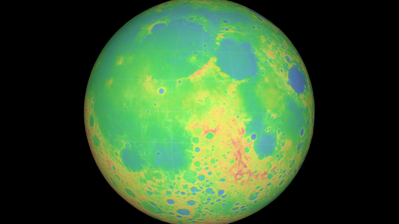
Topography
- ID: 5013
 Visualization
 - ID: 4937
 Visualization
 - ID: 4969
 Visualization
 - ID: 4944
 Visualization
 - ID: 4770Visualization
- ID: 4226
 Visualization
 - ID: 4175
- ID: 4075
 Visualization
 - ID: 3633
- ID: 3686
 Visualization
 - ID: 3727
 Visualization
 - ID: 3731
 Visualization
 - ID: 3443
 Visualization
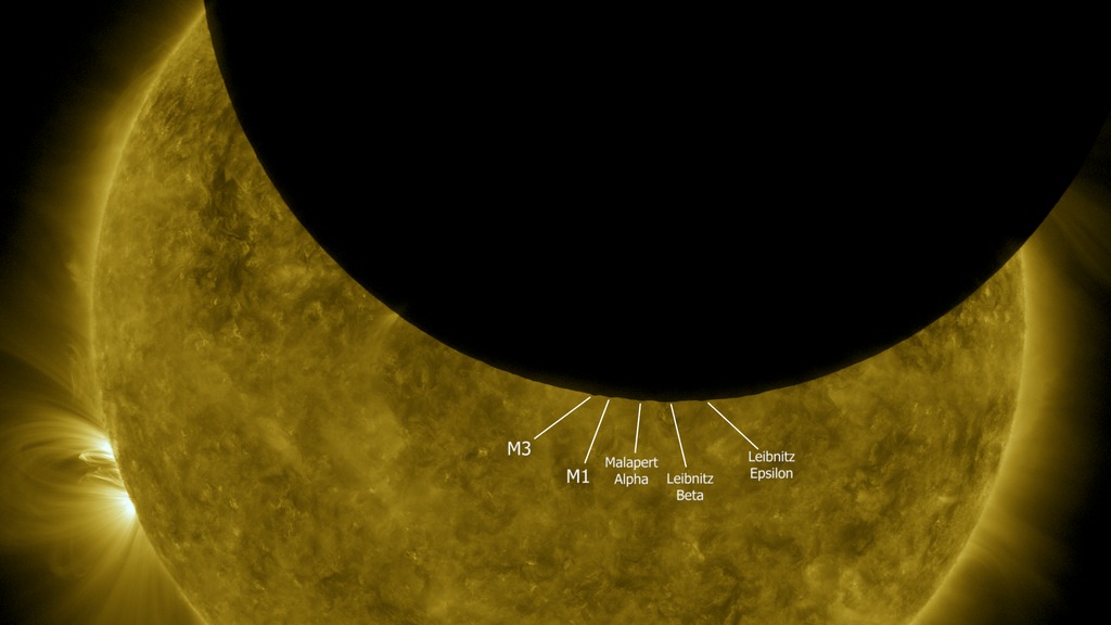
LCROSS
- ID: 3654 Visualization
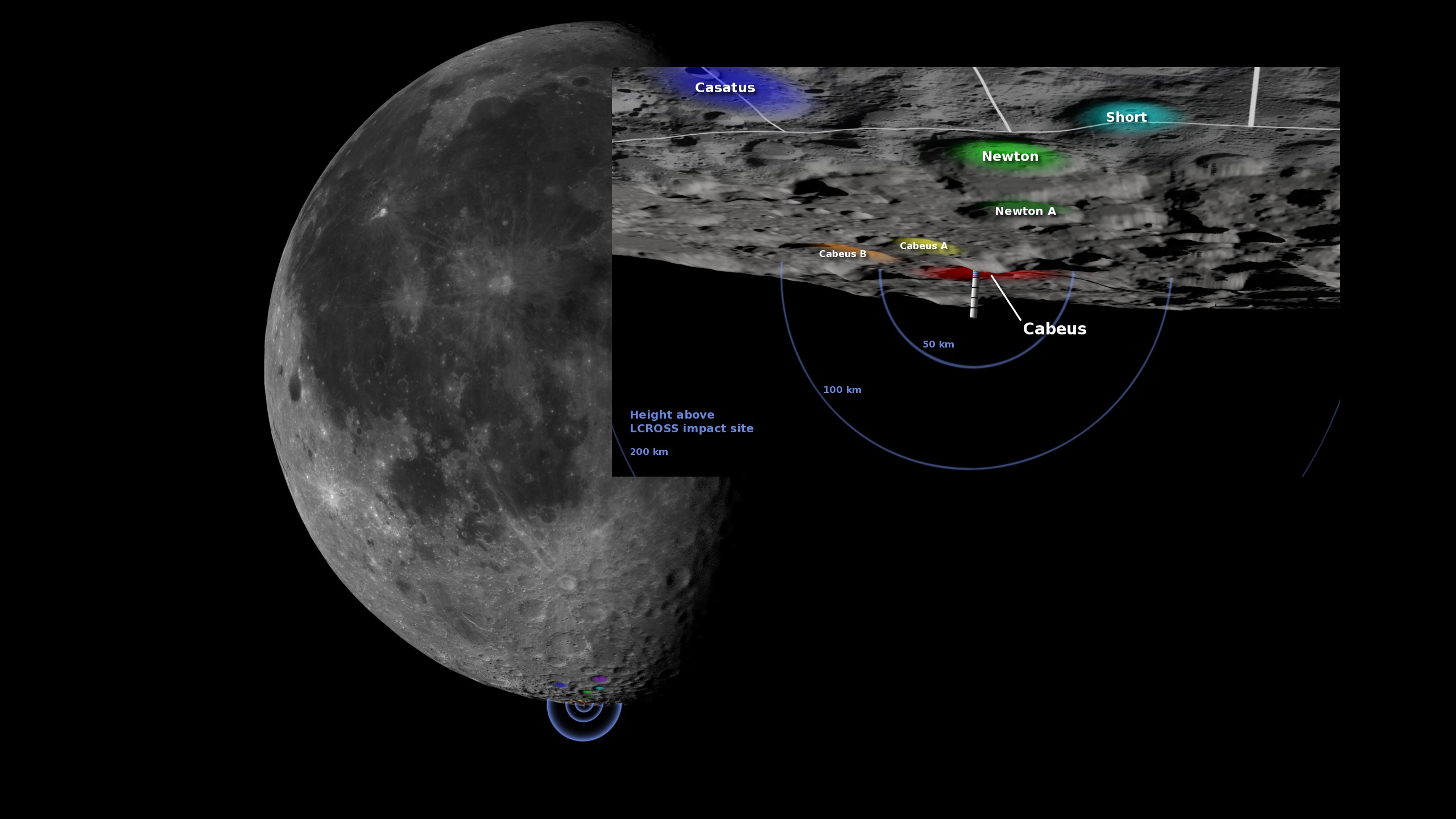
Modeling the LCROSS Impact Site
Go to this pageA two-ton Atlas Centaur rocket body, part of the Lunar Crater Observation and Sensing Satellite (LCROSS), struck the floor of Cabeus crater, near the south pole of the moon, at 11:31 UT on October 9, 2009. The purpose of the crash was to create a plume of debris that could be examined for the presence of water and other chemicals in the lunar regolith. The effects of the impact were captured by sensors onboard a shepherding satellite travelling four minutes behind the Centaur. They were also watched by Earth-based observatories and several Earth-orbiting satellites, including the Hubble Space Telescope.The images here were created in the weeks prior to the impact. They visualize the viewing angle, terrain, and shadows around the target crater at the time of the impact. Astronomers in New Mexico, Arizona, California, and Hawaii used them as visual reference while guiding their telescopes. LCROSS project scientists also used these and similar images to evaluate a number of potential impact locations.Using the Jet Propulsion Laboratory's DE421 ephemeris and early terrain data from Lunar Reconnaissance Orbiter's laser altimeter, the artist was able to accurately depict the sunlight direction, shadows, moon orientation, terrain, and field of view for several representative observing locations on the Earth. ||
- ID: 3760 Visualization
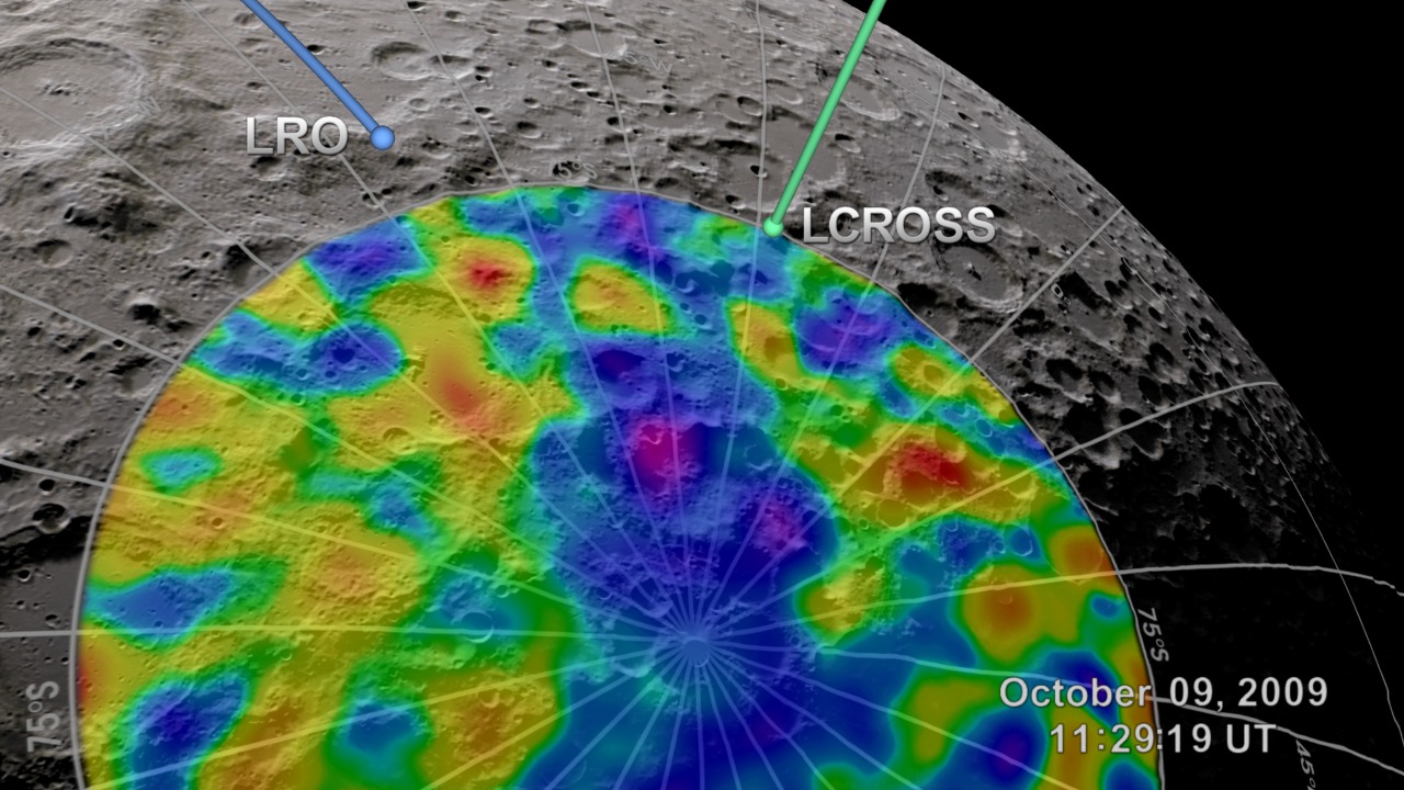
LRO Supports LCROSS
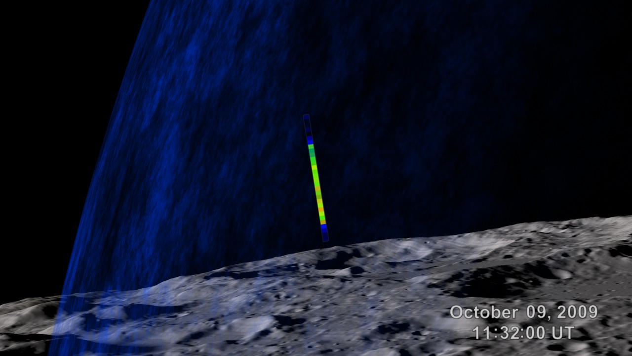
Go to this pageLunar Reconnaissance Orbiter (LRO) and the Lunar Crater Observation and Sensing Satellite (LCROSS) were launched together on the same Atlas V rocket on June 18, 2009. Months later, after following very different paths to the moon, LRO and LCROSS met once more. LCROSS struck the floor of Cabeus crater, near the south pole of the moon, at 11:31 UT on October 9, 2009. LRO witnessed the impact from its orbit 50 kilometers (30 miles) above the surface.The purpose of the crash was to create a plume of debris that could be examined for the presence of water and other chemicals in the lunar regolith. LRO's early reconnaissance of the moon gave LCROSS mission planners valuable data in the months before LCROSS arrived, allowing them to choose an impact site with a high probability of producing interesting findings. LRO was also there for the event itself, using its array of instruments to gather data in the aftermath of the impact.This animation shows LRO and LCROSS from 5 minutes before to 5 minutes after the impact. Data gathered before the impact is represented by early results from LRO's Lunar Exploration Neutron Detector (LEND). LEND can sense hydrogen, and therefore possible water, in the lunar soil. The area of high hydrogen concentration in Cabeus (purple) is like a bullseye for LCROSS.Data gathered by LRO after the impact is represented by Diviner temperature measurements taken seconds after the crash. Diviner detected the heat from lunar soil melted and vaporized by the enormous energy of the impact. ||
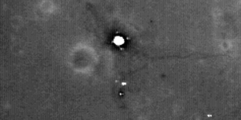
- ID: 3785 Visualization
LAMP Observes the LCROSS Impact
Go to this pageA two-ton Atlas Centaur rocket body, part of the Lunar Crater Observation and Sensing Satellite (LCROSS), struck the floor of Cabeus crater, near the south pole of the moon, at 11:31 UT on October 9, 2009. The purpose of the crash was to create a plume of debris that could be examined for the presence of water and other chemicals in the lunar regolith.The Lyman-Alpha Mapping Project (LAMP) instrument aboard Lunar Reconnaissance Orbiter (LRO) observed the tenuous vapor cloud created by the LCROSS impact. LAMP is LRO's "night vision." Most of the time, it uses the ultraviolet light in starlight to peer into deep shadows on the moon's surface. For the LCROSS impact, LAMP was pointed just above the lunar horizon to watch for the arrival of a rapidly expanding cloud of vaporized debris from the crash.In this animation, the viewer looks down the LAMP boresight and through its narrow window. The LAMP sensor lights up as the leading edge of the expanding vapor cloud passes through its field of view. What's shown here is actually the difference between the data recorded after the LCROSS impact and that recorded on LRO's previous orbit. See this entry for more about the process of subtracting the background to enhance the LAMP signal. ||
Images and Data
- ID: 4289 Visualization
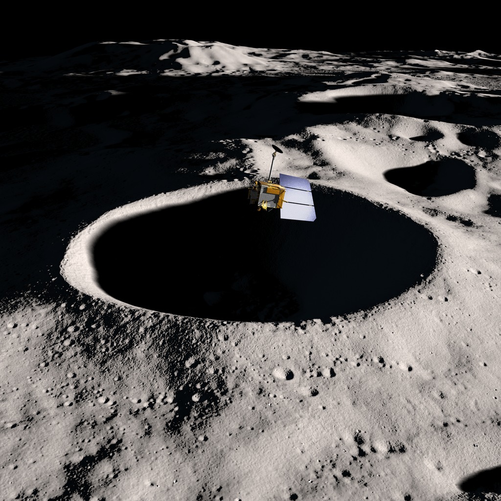
LRO Lowers Periapsis
Go to this pageLunar Reconnaissance Orbiter flies over Shackleton crater near the lunar south pole in this computer rendering. || lro_south_pole_print.jpg (1024x1024) [293.7 KB] || lro_south_pole_web.jpg (320x320) [32.7 KB] || lro_south_pole_searchweb.png (320x180) [89.9 KB] || lro_south_pole_thm.png (80x40) [6.6 KB] || lro_south_pole.tif (2400x2400) [6.3 MB] ||
- ID: 11494 Produced Video

Jim Garvin's Top "Pics" - LROC Images
Go to this pageIn this video series, NASA Scientist Jim Garvin highlights his favorite pictures taken throughout the solar system. This episode focuses on images taken by LROC – the Lunar Reconnaissance Orbiter Camera. Jim explains which pictures made his “top 5” list. ||
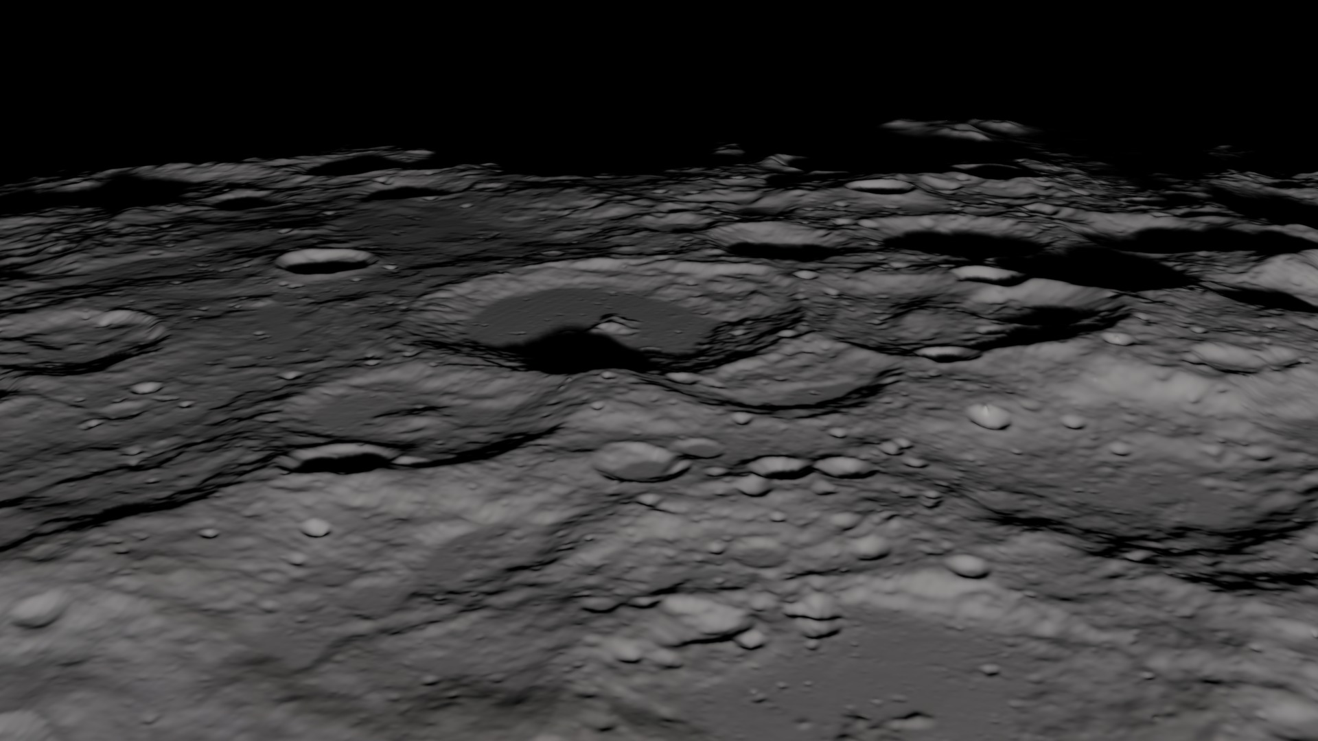
- ID: 3634 Visualization
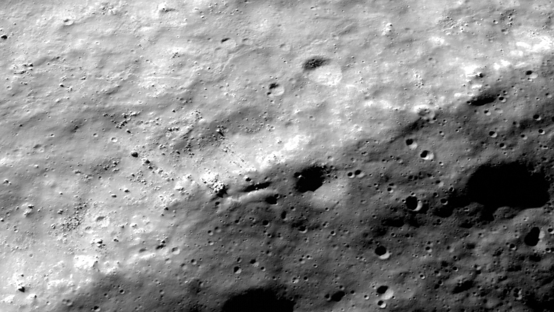
Shackleton's Rim Through the Eyes of LRO/LROC
Go to this pageDuring the Lunar Reconnaissance Oribiter's (LRO) Commissioning Phase, the high resolution Narrow Angle Camera (NAC) on the LRO Camera (LROC) instrument captured this 0.8-meter per pixel scale (angular resolution) two-image mosaic of Shackleton Crater on the moon's south pole. Many more images of this area will be obtained by the NAC over the coming months as the lunar south pole emerges from the shadows of winter. At meter scales, the geology of this region reminds us that the polar regions of the Moon are still waiting to be explored. The rim of Shackleton crater is a prime candidate for future human exploration due to its proximity to permanently shadowed regions and nearby peaks that are illuminated for much of the year.Last year, Japan's Selene and India's Chandrayaan spacecraft gave us our first high resolution look at the lunar south pole, which includes Shackleton crater. For its size, Shackleton has an exceptionally deep and rugged interior. Usually craters fill in with time as their walls slump and material from afar is thrown in by distant impacts. Much of Shackleton's rim appears rounded and is peppered with smaller craters, indications of a relatively ancient age. Right now it is not clear if Shackleton crater is relatively old or young. This NAC image reveals a shelf on the southeast flank of the crater that is more than two kilometers across and perfectly suitable for a future landing. The extreme Sun angle exaggerates the apparent roughness, however if you look closely at this scale any area that is between small craters could be good candidates for a potential landing site. ||
- ID: 10595 Produced Video
Ten Cool Things Seen in the First Year of LRO
Go to this pageHaving officially reached lunar orbit on June 23nd, 2009, the Lunar Reconnaissance Orbiter (LRO) has now marked one full year on its mission to scout the moon. Maps and datasets collected by LRO's state-of-the-art instruments will form the foundation for all future lunar exploration plans, as well as be critical to scientists working to better understand the moon and its environment. In only the first year of the mission, LRO has gathered more digital information than any previous planetary mission in history. To celebrate one year in orbit, here are ten cool things already observed by LRO. Note that the stories here are just a small sample of what the LRO team has released and barely touch on the major scientific accomplishments of the mission. If you like these, visit the official LRO web site at www.nasa.gov/LRO to find out even more! ||
- ID: 10528 Produced Video
LRO Early Results Press Conference
Go to this pageNASA showcased new images from the Lunar Reconnaissance Orbiter's seven instruments and provided updates about the topography of the moon's south pole during a news conference on September 17. NASA also provided an update about the spacecraft's status and mission plans. The briefing took place at NASA's Goddard Space Flight Center in Greenbelt, Md. (no transcript available) || LRO_1stResults_PressConf_ipod.00002_print.jpg (1024x576) [115.7 KB] || LRO_1stResults_PressConf_ipod_web.png (320x180) [138.1 KB] || LRO_1stResults_PressConf_ipod_thm.png (80x40) [16.1 KB] || LRO_1stResults_PC_appleTV.webmhd.webm (960x540) [499.4 MB] || LRO_1stResults_PC_appleTV.m4v (960x540) [1.4 GB] || LRO_1stResults_PressConf_ipod.m4v (640x360) [586.3 MB] ||