Tour of the Moon 4K Redux
The camera flies over the lunar terrain, coming in for close looks at a variety of interesting sites and some of the LRO data associated with them. Includes narration, music, feature titles, research sources, and the location and scale of the image center. Music Provided By Killer Tracks: "Never Looking Back" - Frederick Wiedmann. "Flying over Turmoil" - Benjamin Krause & Scott Goodman.
Watch this video on the NASA Goddard YouTube channel.
In the fall of 2011, the Lunar Reconnaissance Orbiter (LRO) mission released its original Tour of the Moon, a five-minute animation that takes the viewer on a virtual tour of our nearest neighbor in space. Six years later, the tour has been recreated in eye-popping 4K resolution, using the same camera path and drawing from the vastly expanded data trove collected by LRO in the intervening years.
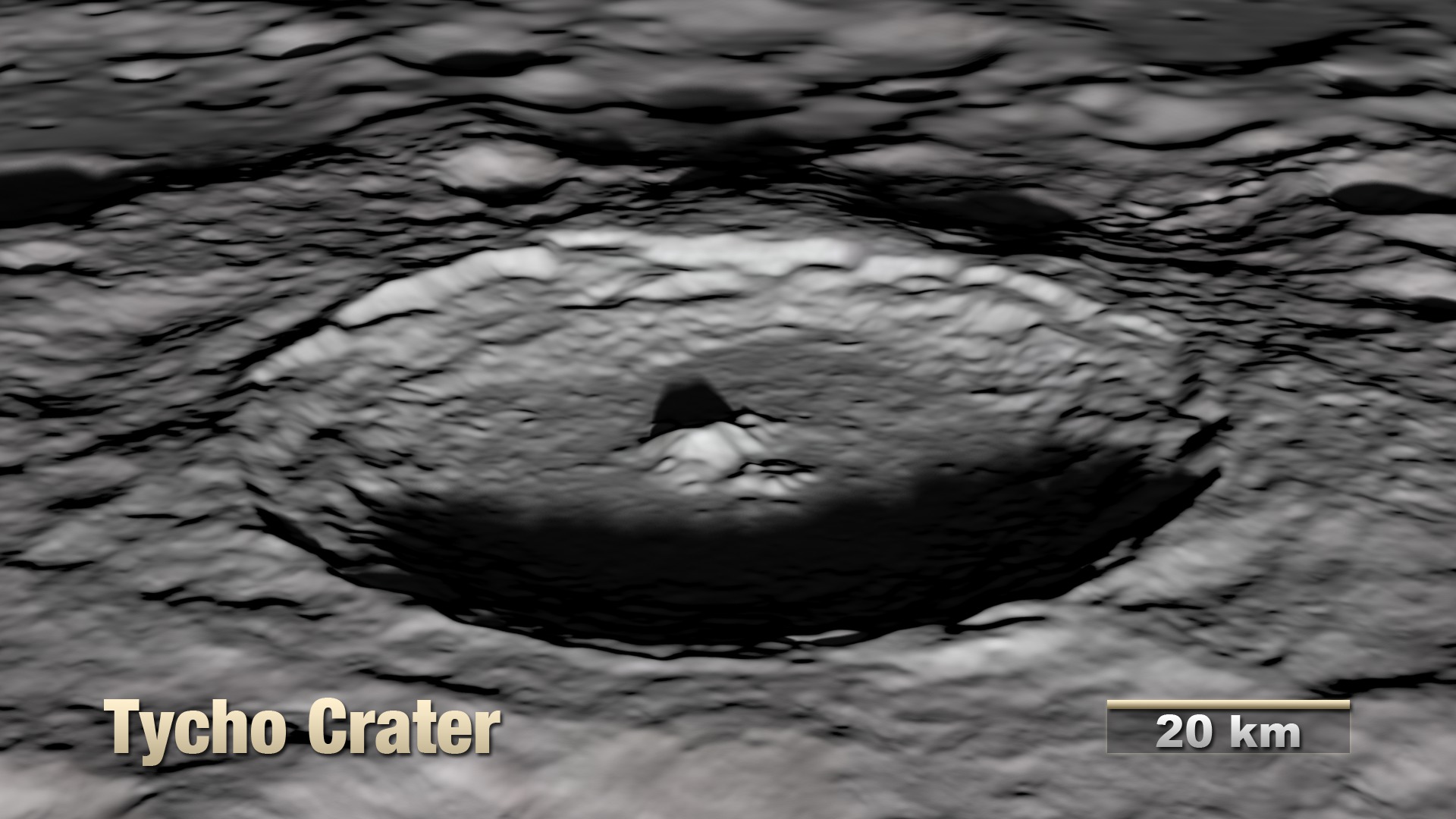
The tour visits a number of interesting sites chosen to illustrate a variety of lunar terrain features. Some are on the near side and are familiar to both professional and amateur observers on Earth, while others can only be seen clearly from space. Some are large and old (Orientale, South Pole-Aitken), others are smaller and younger (Tycho, Aristarchus). Constantly shadowed areas near the poles are hard to photograph but easier to measure with altimetry, while several of the Apollo landing sites, all relatively near the equator, have been imaged at resolutions as high as 25 centimeters (10 inches) per pixel.
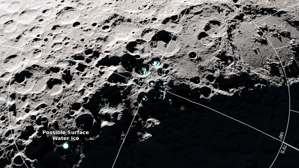
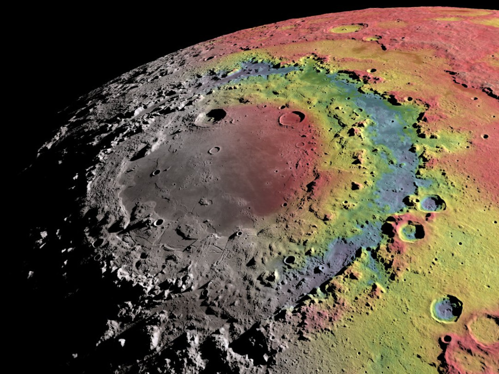
The new tour highlights the mineral composition of the Aristarchus plateau, evidence for surface water ice in certain spots near the south pole, and the mapping of gravity in and around the Orientale basin.
The camera flies over the lunar terrain, coming in for close looks at a variety of interesting sites and some of the LRO data associated with them. Includes feature titles, research sources, and the location and scale of the image center.
 and the 2018 version (top). The data gathered by LRO in the intervening years is reflected in the improved quality of the newer images.")
Comparisons of certain frames from the original 2011 tour (bottom) and the 2018 version (top). The data gathered by LRO in the intervening years is reflected in the improved quality of the newer images.
The tour as rendered, without titles. The frames contain an alpha channel.
The background stars visible in the first 14 seconds of the tour.
The animated location and scale display.
The title slides, including keys (color bars) for the gravity, elevation, and Christiansen feature data overlays.
Credits
Please give credit for this item to:
NASA's Scientific Visualization Studio
-
Visualizer
- Ernie Wright (USRA)
-
Producer
- David Ladd (USRA)
-
Video editor
- David Ladd (USRA)
-
Scientist
- Noah Petro (NASA/GSFC)
Release date
This page was originally published on Monday, April 9, 2018.
This page was last updated on Monday, July 15, 2024 at 12:05 AM EDT.
Missions
This visualization is related to the following missions:Datasets used in this visualization
-
[LRO: Diviner]
ID: 213 -
NAC (Narrow Angle Camera) [LRO: LROC]
ID: 652 -
DEM (Digital Elevation Map) [LRO: LOLA]
ID: 653 -
GRAIL Free-Air Gravity (Free-Air Gravity) [GRAIL: Lunar Gravity Ranging System]
ID: 766 -
WAC 643nm High Sun Global Mosaic [LRO: LROC]
ID: 803 -
SLDEM2015 (DIgital Elevation Model) [LRO/SELENE: LOLA/TC]
ID: 948A digital elevation model of the Moon derived from the Lunar Orbiter Laser Altimeter and the SELENE Terrain Camera. See the description in Icarus. The data is here.
See all pages that use this dataset
Note: While we identify the data sets used in these visualizations, we do not store any further details, nor the data sets themselves on our site.
Related
- ID: 13861
- ID: 13575
 Produced Video
 - ID: 13270
 Produced Video
 - ID: 13204
 Produced Video
 - ID: 13226
- ID: 4574
- ID: 4499
 Visualization
Older Versions
- ID: 3874
 Visualization
Used as a Source In
- ID: 13908
 Produced Video
 - ID: 13078
 Produced Video