Visualizations of Hunga Tonga Hunga Ha'apai and the Martian Landscape
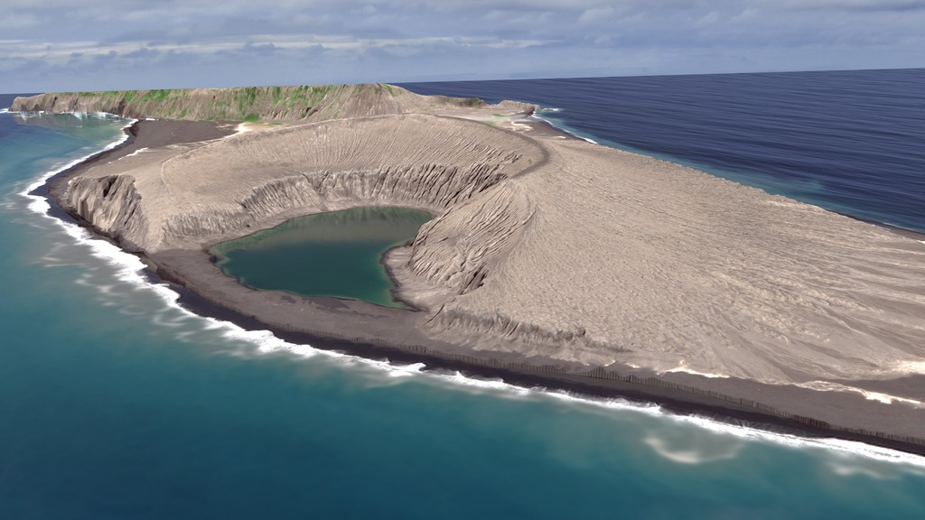
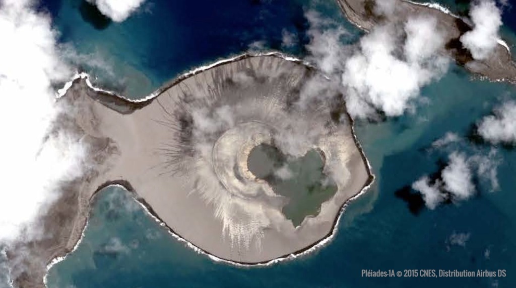
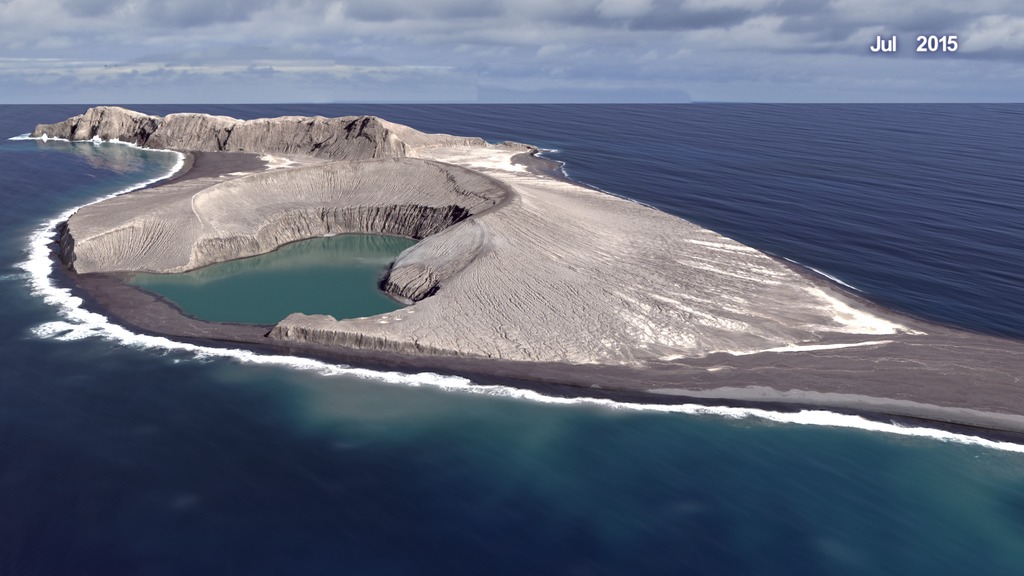
In early 2015, a volcanic eruption in the Kingdom of Tonga created a new island informally known as Hunga Tonga Hunga Ha'apai (HTHH). The subsequent evolution of the new island was previously described in "The Birth of a New Island" available here. Below are additional visualizations, including an updated view of the island's appearance in March 2018 as well as some visualizations of the martian surface. Results of this study can enhance our understanding of numerous small volcanic landforms on Mars whose formation may have been in shallow-water environments during epochs when persistent surface water was present.
The complete visualization of "Using Earth to understand how water may have affected volcanoes on Mars" is available here.
Learn more about the evolution of Earth's newest island and how it could reveal new information about the presence of water on Mars: https://agupubs.onlinelibrary.wiley.com/doi/full/10.1002/2017GL076621
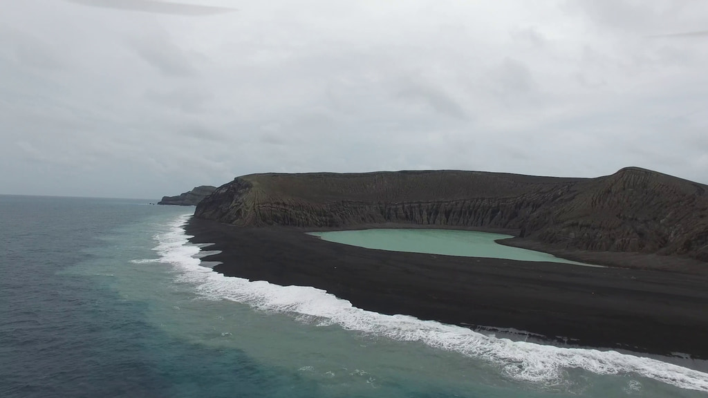
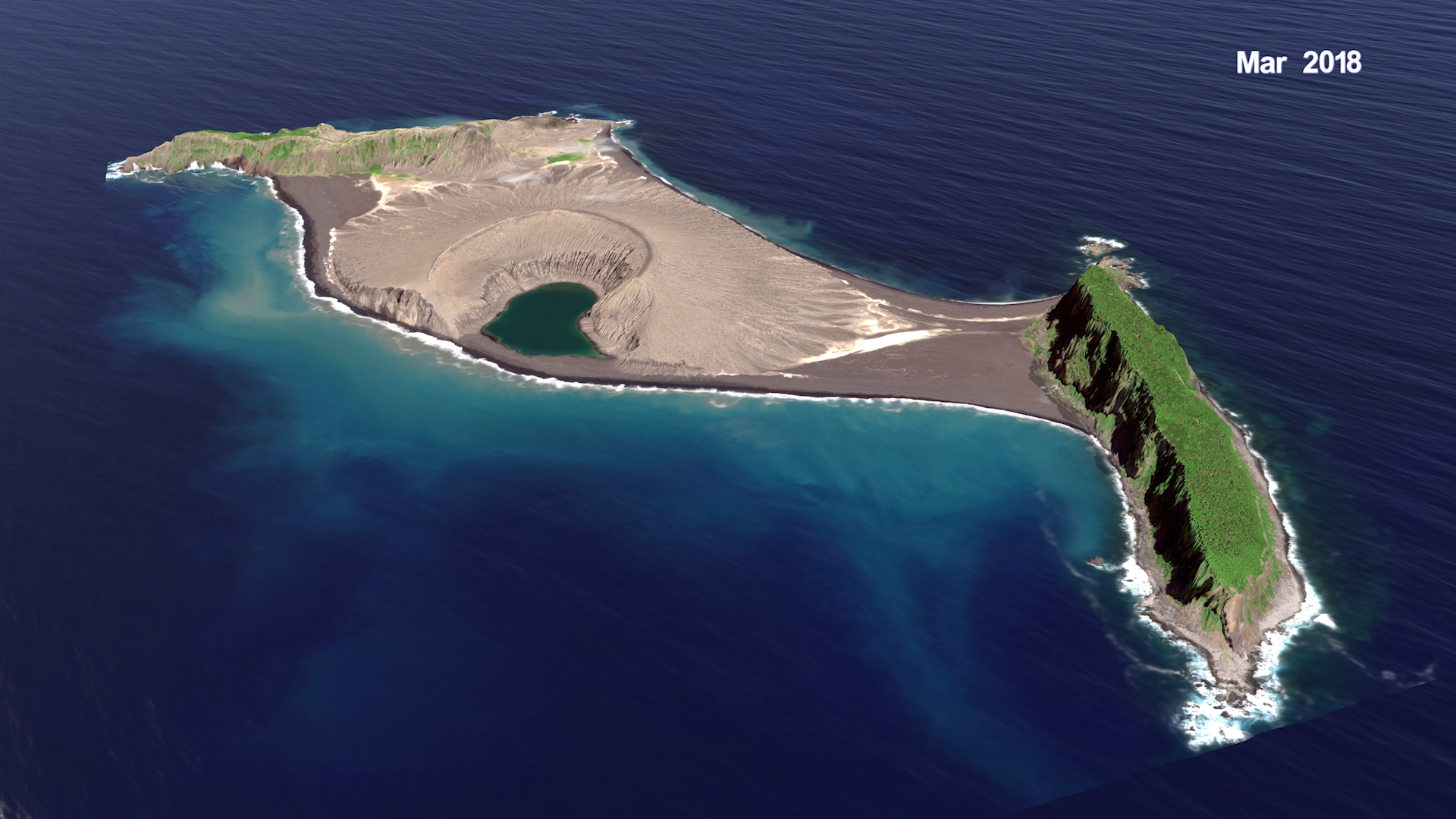
This visualization shows the two original islands in Tonga, Hunga Tonga and Hunga Ha'apai, as they appeared in December of 2014. The visualization fades to the new island informally known as Hunga Tonga Hunga Ha'apai as it appeared in March 2018, after the severe tropical cyclone Gita passed over the region.
This video is also available on our YouTube channel.
This visualization portrays a slow flyover of the Martian landscape.
This video is also available on our YouTube channel.
This visualization is similar to the one above except that artificial water has been added to show how water may have eroded landforms on Mars during epochs when persistent surface water was present.
Coming soon to our YouTube channel.
This visualization shows the location of the Kingdom of Tonga in the South Pacific.
Credits
Please give credit for this item to:
NASA's Scientific Visualization Studio
-
Visualizer
-
Cindy Starr
(Global Science and Technology, Inc.)

-
Cindy Starr
(Global Science and Technology, Inc.)
-
Scientists
- James Garvin (NASA, Chief Scientist Goddard)
- Daniel A. Slayback (SSAI)
-
Producer
- LK Ward (USRA)
-
Narrators
- LK Ward (USRA)
- James Garvin (NASA, Chief Scientist Goddard)
-
Project support
- Joycelyn Thomson Jones (NASA/GSFC)
- Leann Johnson (Global Science and Technology, Inc.)
- Eric Sokolowsky (Global Science and Technology, Inc.)
-
Technical support
- Laurence Schuler (ADNET Systems, Inc.)
- Ian Jones (ADNET Systems, Inc.)
Related papers
Garvin J. B. et al. (GRL 45, no. 8, pp. 3445–3453; https://doi.org/10.1002/2017GL076621)
Garvin J. B. et al. (GRL 45, no. 8, pp. 3445–3453; https://doi.org/10.1002/2017GL076621)
Datasets used
-
HiRISE [Mars Reconnaissance Orbiter (MRO): High Resolution Imaging Science Experiment (HiRISE)]
ID: 898 -
WorldView-2 © 2010 DigitalGlobe
ID: 996 -
Worldview-2 © 2018 DigitalGlobe
ID: 1006
Note: While we identify the data sets used on this page, we do not store any further details, nor the data sets themselves on our site.
Related
- ID: 14214
- ID: 4726
 Visualization
 - ID: 12784
 Produced Video
 - ID: 12800
 Produced Video
 - ID: 4602
 Visualization
Used as a Source In
- ID: 13301
 Produced Video
 - ID: 12932
Release date
This page was originally published on Friday, June 15, 2018.
This page was last updated on Friday, June 20, 2025 at 12:08 AM EDT.