A New Look at the Apollo 11 Landing Site
Apollo 11 landed on the Moon on July 20th, 1969, a little after 4:00 in the afternoon Eastern Daylight Time. The Lunar Module, nicknamed Eagle and flown by Neil Armstrong and Edwin "Buzz" Aldrin, touched down near the southern rim of the Sea of Tranquility, one of the large, dark basins that contribute to the Man in the Moon visible from Earth. Armstrong and Aldrin spent about two hours outside the LM setting up experiments and collecting samples. At one point, Armstrong ventured east of the LM to examine a small crater, dubbed Little West, that he'd flown over just before landing.
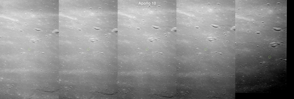
The trails of disturbed regolith created by the astronauts' boots are still clearly visible in photographs of the landing site taken by the Lunar Reconnaissance Orbiter (LRO) narrow-angle camera (LROC) more than four decades later.
LROC imagery makes it possible to visit the landing site in a whole new way by flying around a three-dimensional model of the site. LROC scientists created the digital elevation model using a stereo pair of images. Each image in the pair shows the site from a slightly different angle, allowing sophisticated software to infer the shape of the terrain, similar to the way that left and right eye views are combined in the brain to produce the perception of depth.
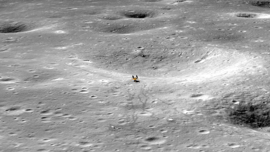
The animator draped an LROC photograph over the terrain model. He also added a 3D model of the LM descent stage—the real LM in the photograph looks oddly flat when viewed at an oblique angle.
Although the area around the site is relatively flat by lunar standards, West Crater (the big brother of the crater visited by Armstrong) appears in dramatic relief near the eastern edge of the terrain model. Ejecta from West comprises the boulders that Armstrong had to avoid as he searched for a safe landing site.
Apollo 11 was the first of six increasingly ambitious crewed lunar landings. The exploration of the lunar surface by the Apollo astronauts, when combined with the wealth of remote sensing data now being returned by LRO, continues to inform our understanding of our nearest neighbor in space.
The Apollo 11 landing site visualized in three dimensions using photography and a stereo digital elevation model from the Lunar Reconnaissance Orbiter Camera. Transcript.
This video is also available on our YouTube channel.
The unedited visualization used in the feature. The camera zooms up to the Apollo 11 Lunar Module as seen in LROC NAC image M175124932R, then the view tilts and rotates to reveal the topography of the landing site. The animation loops seamlessly.

Three photographs taken on the surface of the Moon by Apollo 11 astronaut Neil Armstrong. Fellow moonwalker Buzz Aldrin is setting up the retroreflector and seismometer experiments that are also visible in LROC images of the site. The flag and TV camera are in the background to the left of the LM.
The waxing crescent Moon as it appeared from Earth on July 20, 1969. The blue dot marks the site of the Apollo 11 landing in Mare Tranquillitatis, where it was early morning.
Credits
Please give credit for this item to:
NASA's Scientific Visualization Studio
-
Animator
-
Ernie Wright
(USRA)

-
Ernie Wright
(USRA)
-
Producers
- David Ladd (USRA)
- Andrew Chaikin
-
Scientist
-
Noah Petro
(NASA/GSFC)
-
Noah Petro
(NASA/GSFC)
-
Project support
- Laurence Schuler (ADNET Systems, Inc.)
- Ian Jones (ADNET Systems, Inc.)
Missions
This page is related to the following missions:Series
This page can be found in the following series:Tapes
The media on this page originally appeared on the following tapes:-
Apollo11_Landing Site
(ID: 2014064)
Friday, July 18, 2014 at 4:00AM
Produced by - Marit Jentoft-Nilsen (RSIS)
Datasets used
-
NAC (Narrow Angle Camera) [LRO: LROC]
ID: 652 -
Stereo DEM [LRO: LROC NAC]
ID: 835
Note: While we identify the data sets used on this page, we do not store any further details, nor the data sets themselves on our site.
Related
- ID: 4989
 Visualization
 - ID: 4918
 Visualization
 - ID: 4883
 Visualization
 - ID: 4767
 Visualization
 - ID: 13258
 Produced Video
 - ID: 13246

- ID: 13226

- ID: 4733
 Visualization
 - ID: 11679
 Produced Video
Release date
This page was originally published on Friday, July 18, 2014.
This page was last updated on Monday, January 6, 2025 at 12:06 AM EST.