Earth
ID: 3660
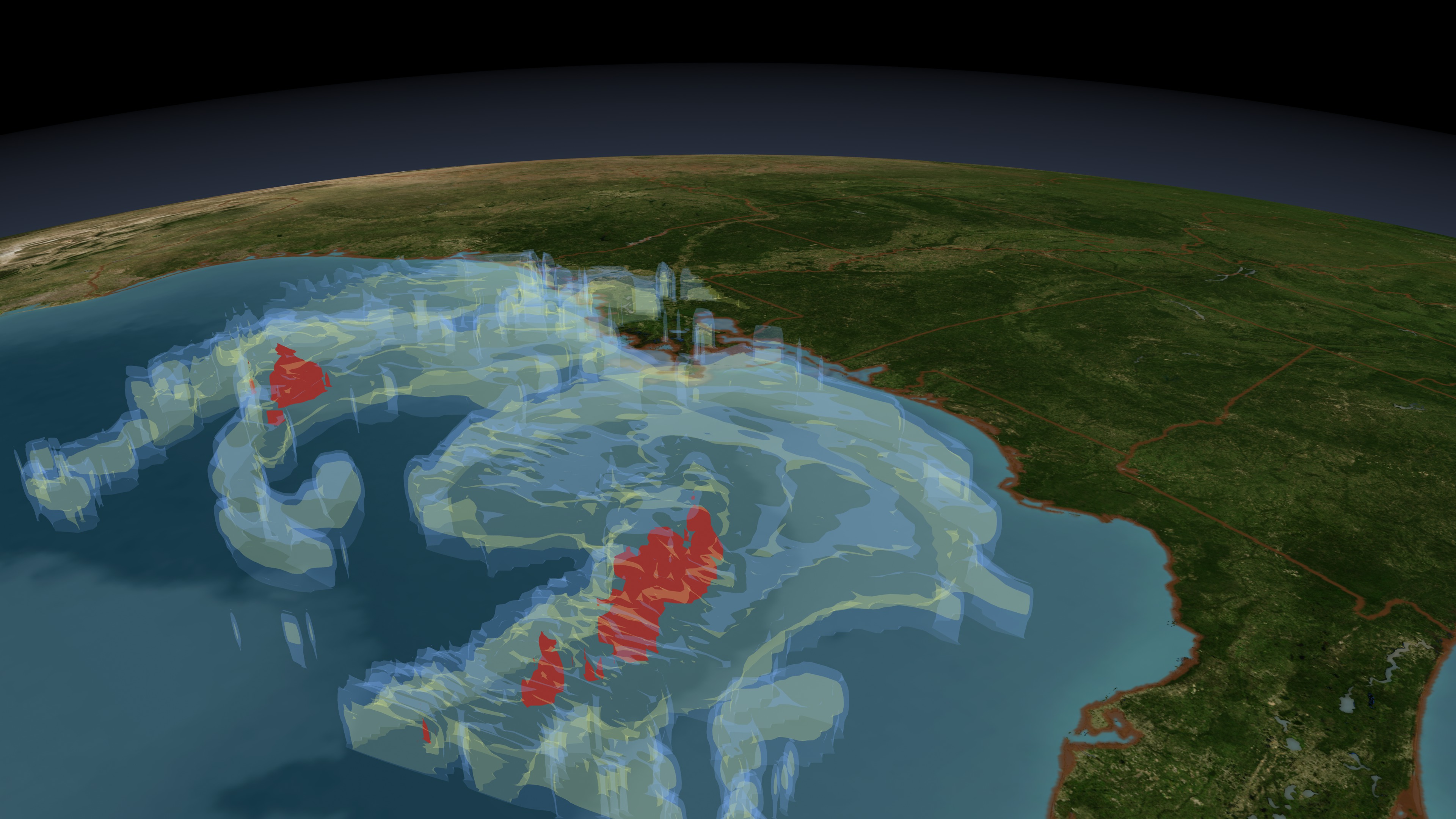
NASA's TRMM spacecraft observed this view of Tropical Storm Ida on November 9, 2009 at 1218 UTC (7:18 AM EST). Scattered convective thunderstorms are shown producing moderate to heavy rainfall of over 50 millimeters per hour (~2 inches) north of IDA's center of circulation and in a strong band on the eastern side. At the time of this image IDA had winds estimated at 70 knots (~80.5 mph). IDA is predicted by the National Hurricane Center in Miami, Florida to hit the Gulf coast near Pensacola, Florida on Tuesday morning. The rain structure is taken by TRMM's Tropical Microwave Imager (TMI) and TRMM's Precitation Radar(PR) instruments. TRMM looks underneath of the storm's clouds to reveal the underlying rain structure. The colored isosurface under the clouds show the rain seen by the PR instrument.
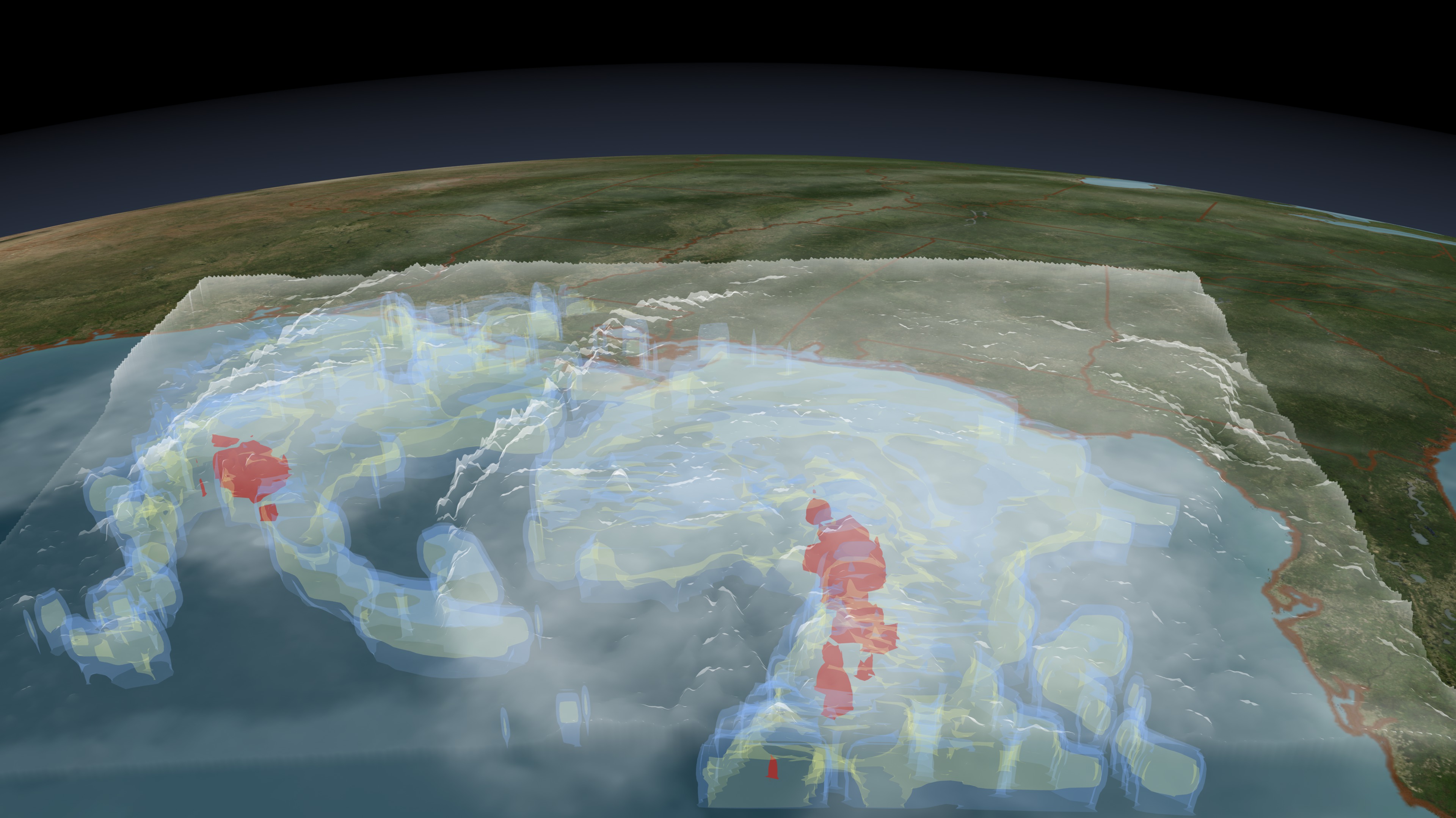
Tropical Storm Ida Observed on November 9, 2009 at 1218 UTC
Visualization Credits
Please give credit for this item to:
NASA/Goddard Space Flight Center Scientific Visualization Studio
NASA/Goddard Space Flight Center Scientific Visualization Studio
Short URL to share this page:
https://svs.gsfc.nasa.gov/3660
Mission:
Tropical Rainfall Measuring Mission - TRMM
Data Used: Note: While we identify the data sets used in these visualizations, we do not store any further details nor the data sets themselves on our site.
This item is part of these series:
Hurricanes
TRMM 3D Hurricanes
Keywords:
SVS >> HDTV
DLESE >> Natural hazards
GCMD >> Earth Science >> Atmosphere >> Atmospheric Phenomena >> Hurricanes
SVS >> GOES
SVS >> Copenhagen
SVS >> For Educators
SVS >> Water Cycle >> Condensation
NASA Science >> Earth
GCMD keywords can be found on the Internet with the following citation: Olsen, L.M., G. Major, K. Shein, J. Scialdone, S. Ritz, T. Stevens, M. Morahan, A. Aleman, R. Vogel, S. Leicester, H. Weir, M. Meaux, S. Grebas, C.Solomon, M. Holland, T. Northcutt, R. A. Restrepo, R. Bilodeau, 2013. NASA/Global Change Master Directory (GCMD) Earth Science Keywords. Version 8.0.0.0.0


