Earth
ID: 4945
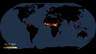
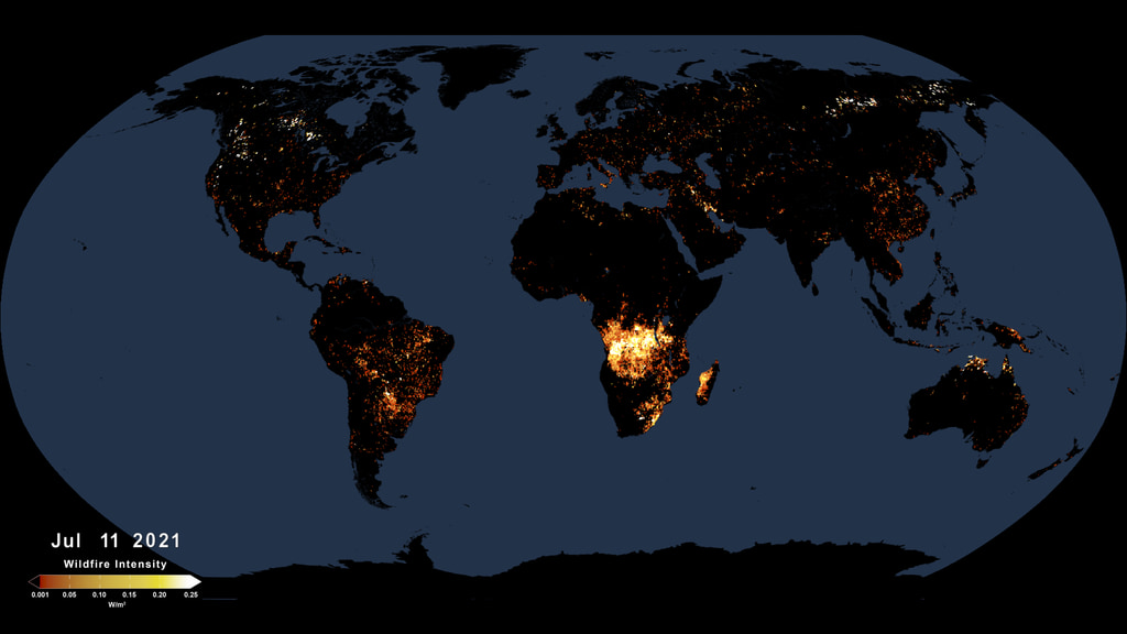
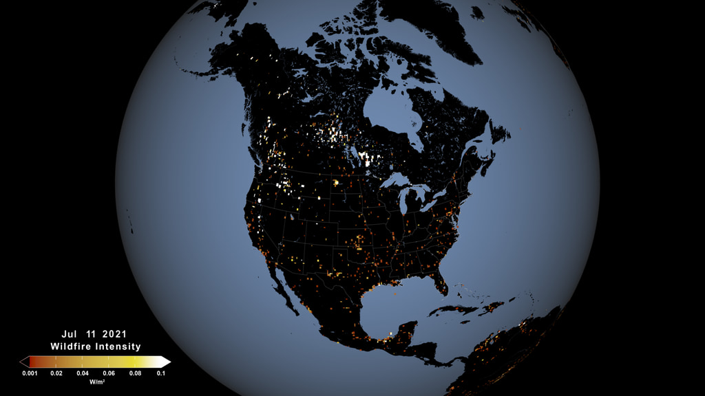
This visualization shows active fires as observed by the Visible Infrared Imaging Radiometer Suite, or VIIRS, between January 1 and September 24 2021. The VIIRS instrument flies on the Joint Polar Satellite System’s Suomi-NPP and NOAA-20 polar-orbiting satellites. Instruments on polar orbiting satellites typically observe a wildfire at a given location a few times a day as they orbit the Earth from pole to pole. VIIRS detects hot spots at a resolution of 375 meters per pixel, which means it can detect smaller, lower temperature fires than other fire-observing satellites. Its observations are about three times more detailed than those from the MODIS instrument, for example. VIIRS also provides nighttime fire detection capabilities through its Day-Night Band, which can measure low-intensity visible light emitted by small and fledgling fires. This visualization uses data from the Suomi-NPP VIIRS instrument, and will be updated periodically until the end of 2021.
Active Fires As Observed by VIIRS, January-September 2021
There is a newer version of this story located here: https://svs.gsfc.nasa.gov/5113
Used Elsewhere In
Newer Version

Older Version
Related
Visualization Credits
Please give credit for this item to:
NASA's Scientific Visualization Studio
NASA's Scientific Visualization Studio
Short URL to share this page:
https://svs.gsfc.nasa.gov/4945
Data Used:
Note: While we identify the data sets used in these visualizations, we do not store any further details nor the data sets themselves on our site.
Keywords:
SVS >> Fire Management
DLESE >> Human geography
DLESE >> Natural hazards
GCMD >> Earth Science >> Biosphere >> Ecological Dynamics >> Fire Occurrence
GCMD >> Earth Science >> Human Dimensions >> Natural Hazards >> Fires
SVS >> Hyperwall
SVS >> VIIRS
NASA Science >> Earth
SVS >> Suomi
GCMD >> Earth Science >> Biosphere >> Ecological Dynamics >> Fire Ecology
GCMD keywords can be found on the Internet with the following citation: Olsen, L.M., G. Major, K. Shein, J. Scialdone, S. Ritz, T. Stevens, M. Morahan, A. Aleman, R. Vogel, S. Leicester, H. Weir, M. Meaux, S. Grebas, C.Solomon, M. Holland, T. Northcutt, R. A. Restrepo, R. Bilodeau, 2013. NASA/Global Change Master Directory (GCMD) Earth Science Keywords. Version 8.0.0.0.0
https://svs.gsfc.nasa.gov/4945
Data Used:
Terra and Aqua/MODIS/Blue Marble: Next Generation also referred to as: BMNG
Credit:
The Blue Marble data is courtesy of Reto Stockli (NASA/GSFC).
The Blue Marble data is courtesy of Reto Stockli (NASA/GSFC).
Suomi NPP/VIIRS/Fire Pixels
Analysis - NASA/GSFCKeywords:
SVS >> Fire Management
DLESE >> Human geography
DLESE >> Natural hazards
GCMD >> Earth Science >> Biosphere >> Ecological Dynamics >> Fire Occurrence
GCMD >> Earth Science >> Human Dimensions >> Natural Hazards >> Fires
SVS >> Hyperwall
SVS >> VIIRS
NASA Science >> Earth
SVS >> Suomi
GCMD >> Earth Science >> Biosphere >> Ecological Dynamics >> Fire Ecology
GCMD keywords can be found on the Internet with the following citation: Olsen, L.M., G. Major, K. Shein, J. Scialdone, S. Ritz, T. Stevens, M. Morahan, A. Aleman, R. Vogel, S. Leicester, H. Weir, M. Meaux, S. Grebas, C.Solomon, M. Holland, T. Northcutt, R. A. Restrepo, R. Bilodeau, 2013. NASA/Global Change Master Directory (GCMD) Earth Science Keywords. Version 8.0.0.0.0


