Planets and Moons
ID: 4918
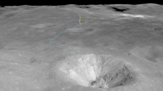
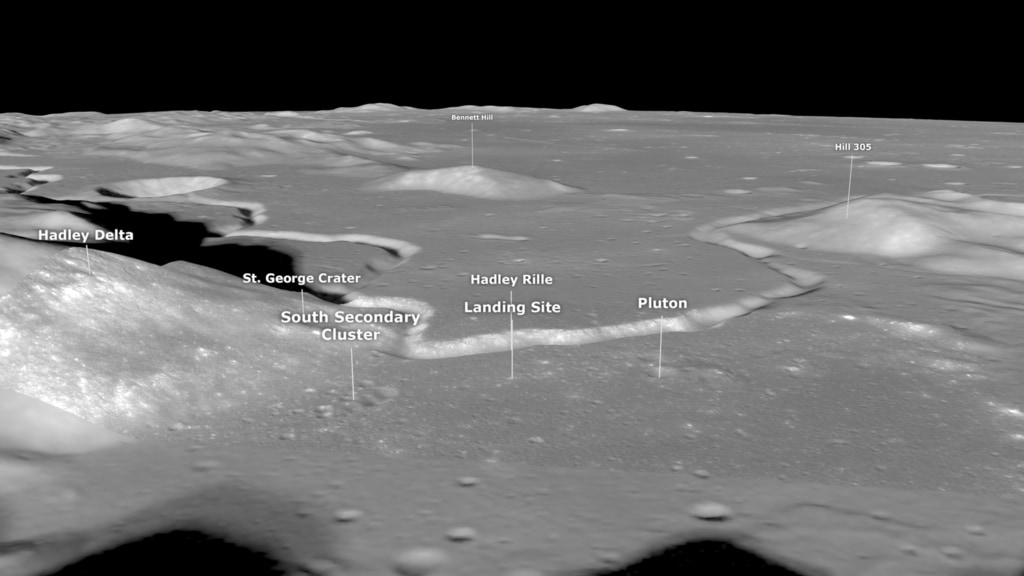
Apollo 15 landed on the Moon at 5:16 p.m. Houston time (22:16 UTC) on July 30, 1971. Two hours later, Commander Dave Scott and Lunar Module Pilot Jim Irwin depressurized the cabin of the Lunar Module and opened the top hatch. Scott then stood on the ascent engine cover, poked his head through the hatch, and for the next 25 minutes described and photographed the terrain of their landing site in the Hadley-Apennine region. This was the stand-up extravehicular activity (SEVA), an opportunity to quickly survey and report on the lunar landscape they'd be exploring over the next three days.
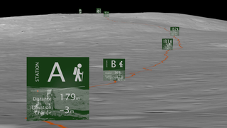
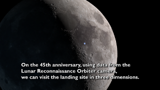
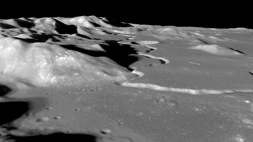
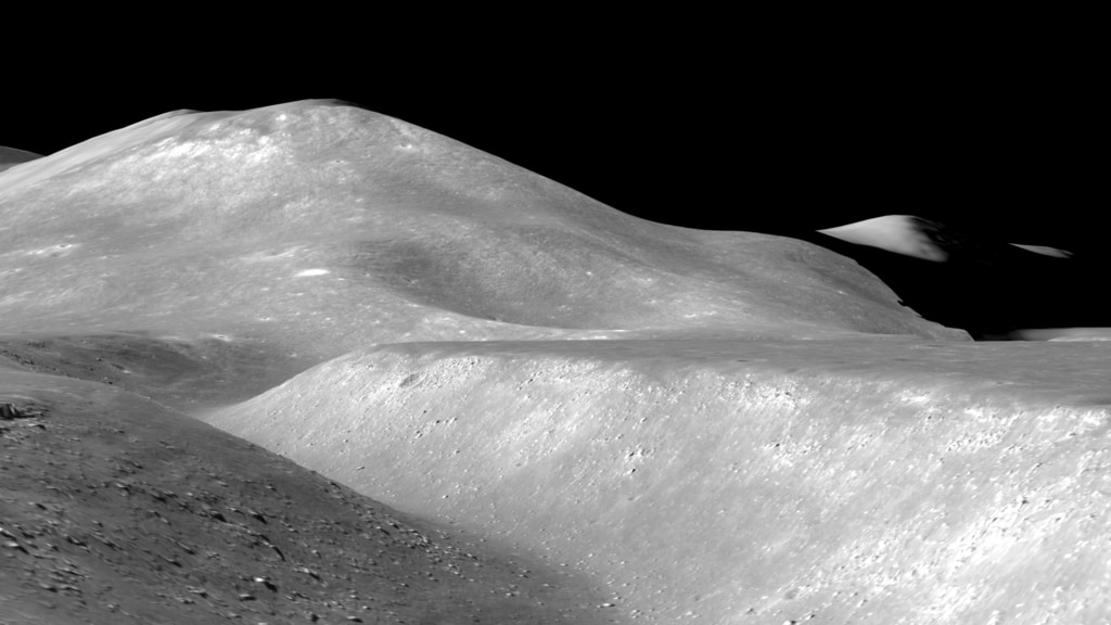
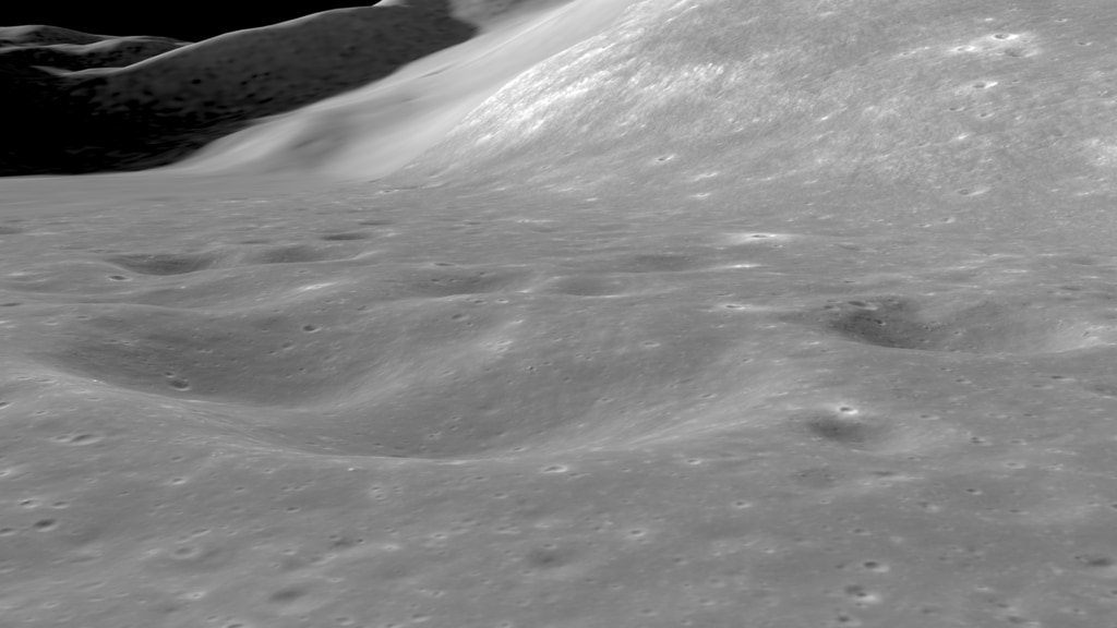
For the 50th anniversary of the Apollo 15 mission, the video presented here uses elevation maps and images from Lunar Reconnaissance Orbiter (LRO) to visualize the Hadley-Apennine terrain. The camera pans across the Apennine mountains and Hadley Rille that border the region, then flies low over the surface to features that were explored up-close by the astronauts. The visuals are matched to audio excerpts of Commander Scott's descriptions during the SEVA.
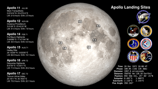
Because of its unique timing, Apollo 15 was the only mission to include a stand-up EVA. It was also the first of three missions to bring a lunar rover, an electric Moon car that allowed the astronauts to travel a total of 17 miles (28 km) and collect 170 pounds (77 kg) of samples.
Apollo 15 Stand-Up EVA
For the 50th anniversary of the Apollo 15 mission, the video presented here uses elevation maps and images from Lunar Reconnaissance Orbiter (LRO) to visualize the Hadley-Apennine terrain. The camera pans across the Apennine mountains and Hadley Rille that border the region, then flies low over the surface to features that were explored up-close by the astronauts. The visuals are matched to audio excerpts of Commander Scott's descriptions during the SEVA.
Because of its unique timing, Apollo 15 was the only mission to include a stand-up EVA. It was also the first of three missions to bring a lunar rover, an electric Moon car that allowed the astronauts to travel a total of 17 miles (28 km) and collect 170 pounds (77 kg) of samples.
Related

Visualization Credits
Ernie Wright (USRA):
Lead Visualizer
David Ladd (Advocates in Manpower Management, Inc.):
Lead Producer
Lead Video Editor
Noah Petro (NASA/GSFC):
Lead Scientist
Laurence Schuler (ADNET Systems, Inc.):
Technical Support
Ian Jones (ADNET Systems, Inc.):
Technical Support
Lead Visualizer
David Ladd (Advocates in Manpower Management, Inc.):
Lead Producer
Lead Video Editor
Noah Petro (NASA/GSFC):
Lead Scientist
Laurence Schuler (ADNET Systems, Inc.):
Technical Support
Ian Jones (ADNET Systems, Inc.):
Technical Support
Please give credit for this item to:
NASA's Scientific Visualization Studio
Music provided by Universal Production Music: "Spread Our Wings" – Ben Beiny
Short URL to share this page:
https://svs.gsfc.nasa.gov/4918
Missions:
Apollo
LRO (Lunar Reconnaissance Orbiter)
Data Used:
Note: While we identify the data sets used in these visualizations, we do not store any further details nor the data sets themselves on our site.
This item is part of this series:
The Moon
Keywords:
SVS >> HDTV
SVS >> Landing Site
SVS >> Lunar
SVS >> Moon
SVS >> Hyperwall
SVS >> LRO
SVS >> Lunar Reconnaissance Orbiter
SVS >> LROC
SVS >> Apollo Missions
SVS >> Lunar Surface
SVS >> Lunar Topography
SVS >> Apollo 15
SVS >> Lunar Elevation Map
NASA Science >> Planets and Moons
https://svs.gsfc.nasa.gov/4918
Missions:
Apollo
LRO (Lunar Reconnaissance Orbiter)
Data Used:
LRO/LROC/Narrow Angle Camera also referred to as: NAC
2013-04-21LRO/LROC NAC/Stereo DEM
Model - 2019-08-27LRO/Wide Angle Camera also referred to as: LROC WAC
Observed DataLRO/SELENE/LOLA/TC/DIgital Elevation Model also referred to as: SLDEM2015
Model
A digital elevation model of the Moon derived from the Lunar Orbiter Laser Altimeter and the SELENE Terrain Camera. See the description in Icarus. The data is here.
This item is part of this series:
The Moon
Keywords:
SVS >> HDTV
SVS >> Landing Site
SVS >> Lunar
SVS >> Moon
SVS >> Hyperwall
SVS >> LRO
SVS >> Lunar Reconnaissance Orbiter
SVS >> LROC
SVS >> Apollo Missions
SVS >> Lunar Surface
SVS >> Lunar Topography
SVS >> Apollo 15
SVS >> Lunar Elevation Map
NASA Science >> Planets and Moons


