Earth
ID: 4025
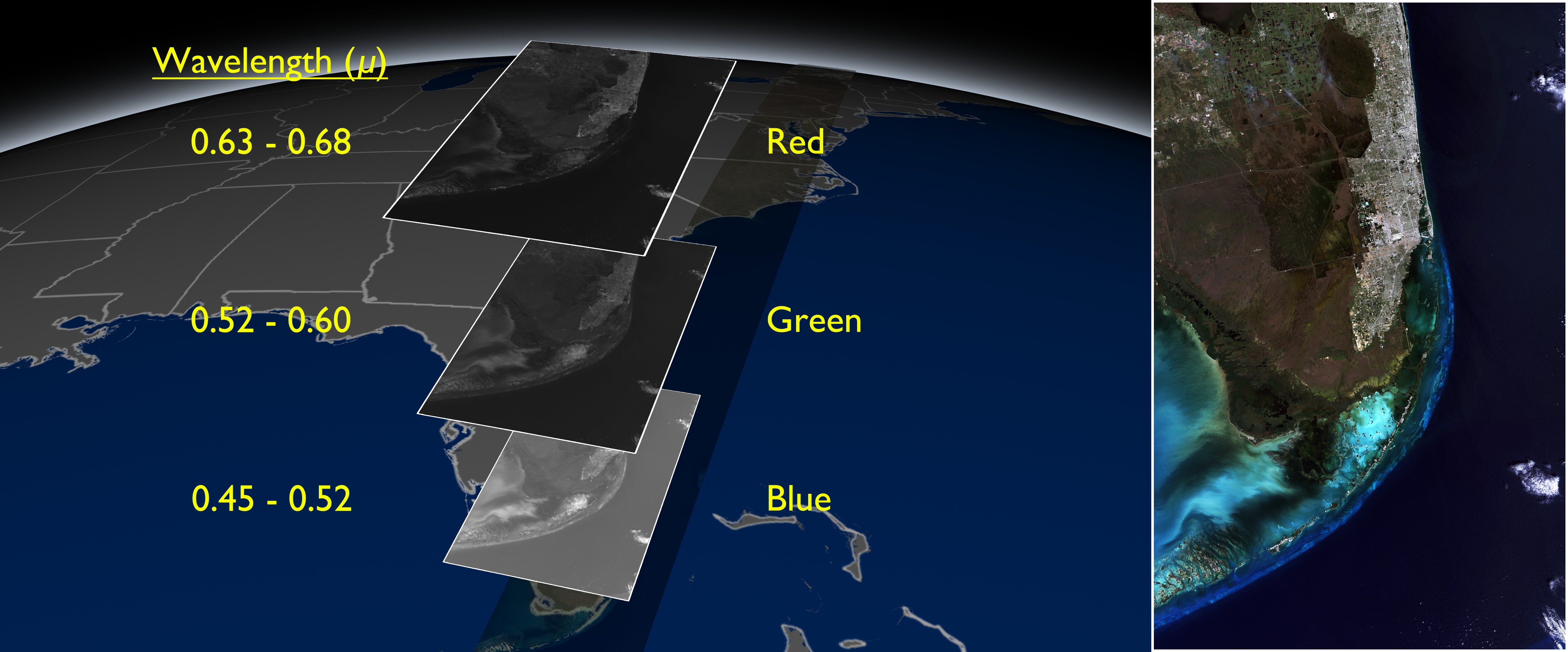
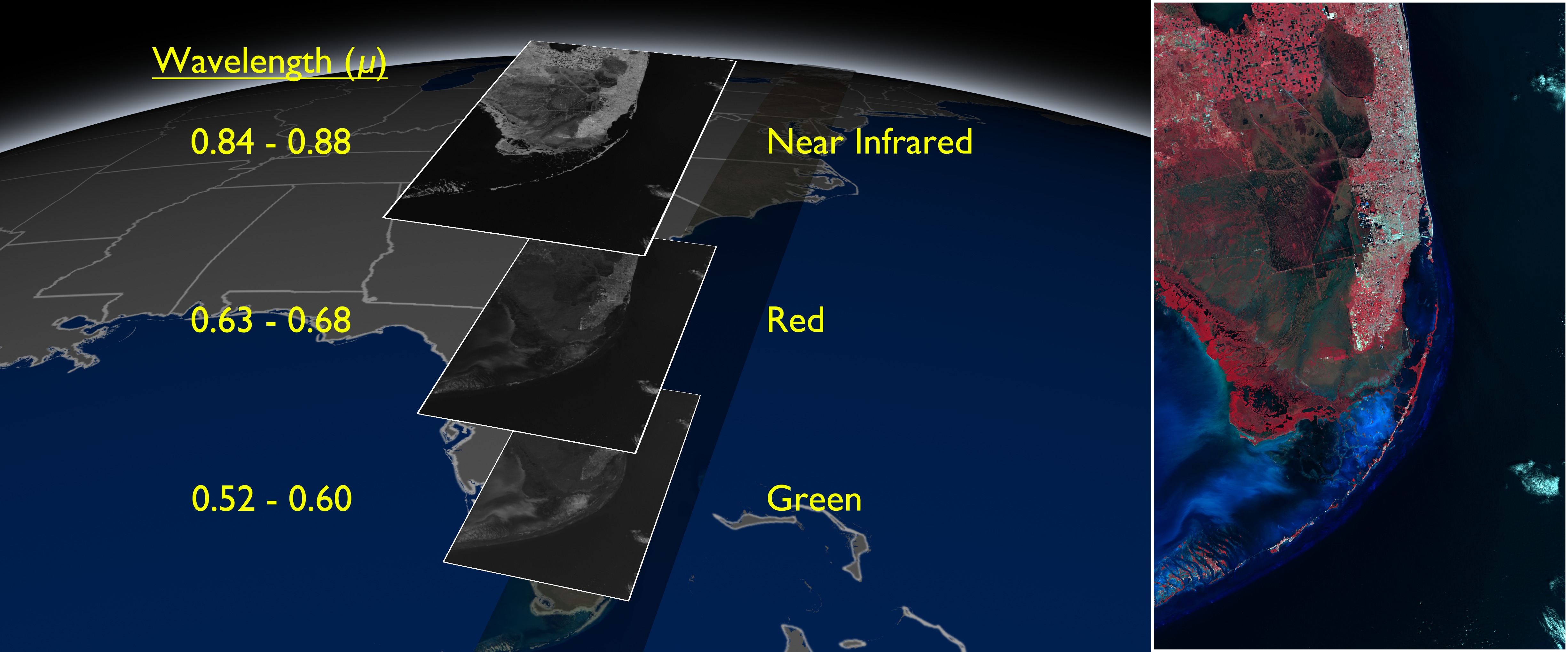
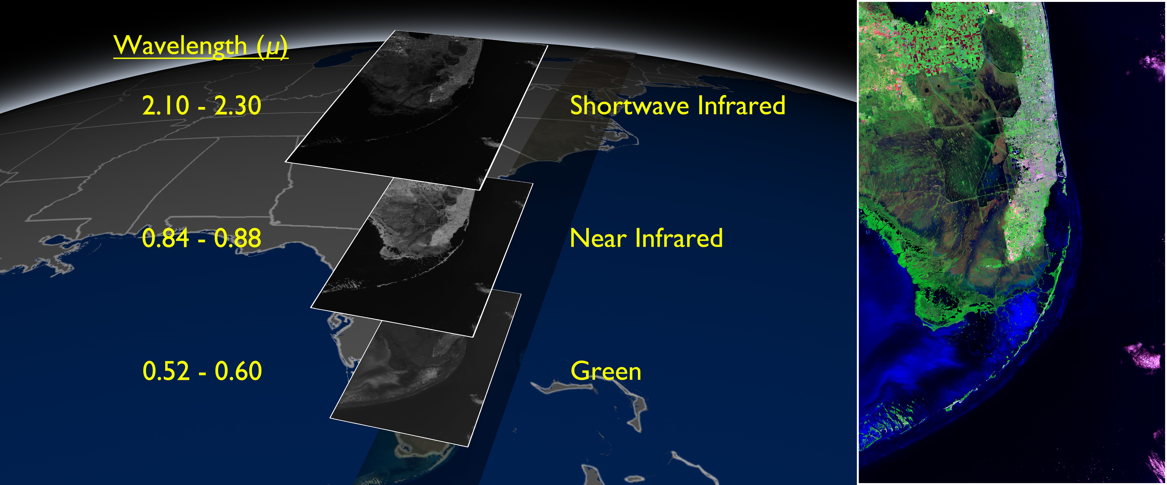
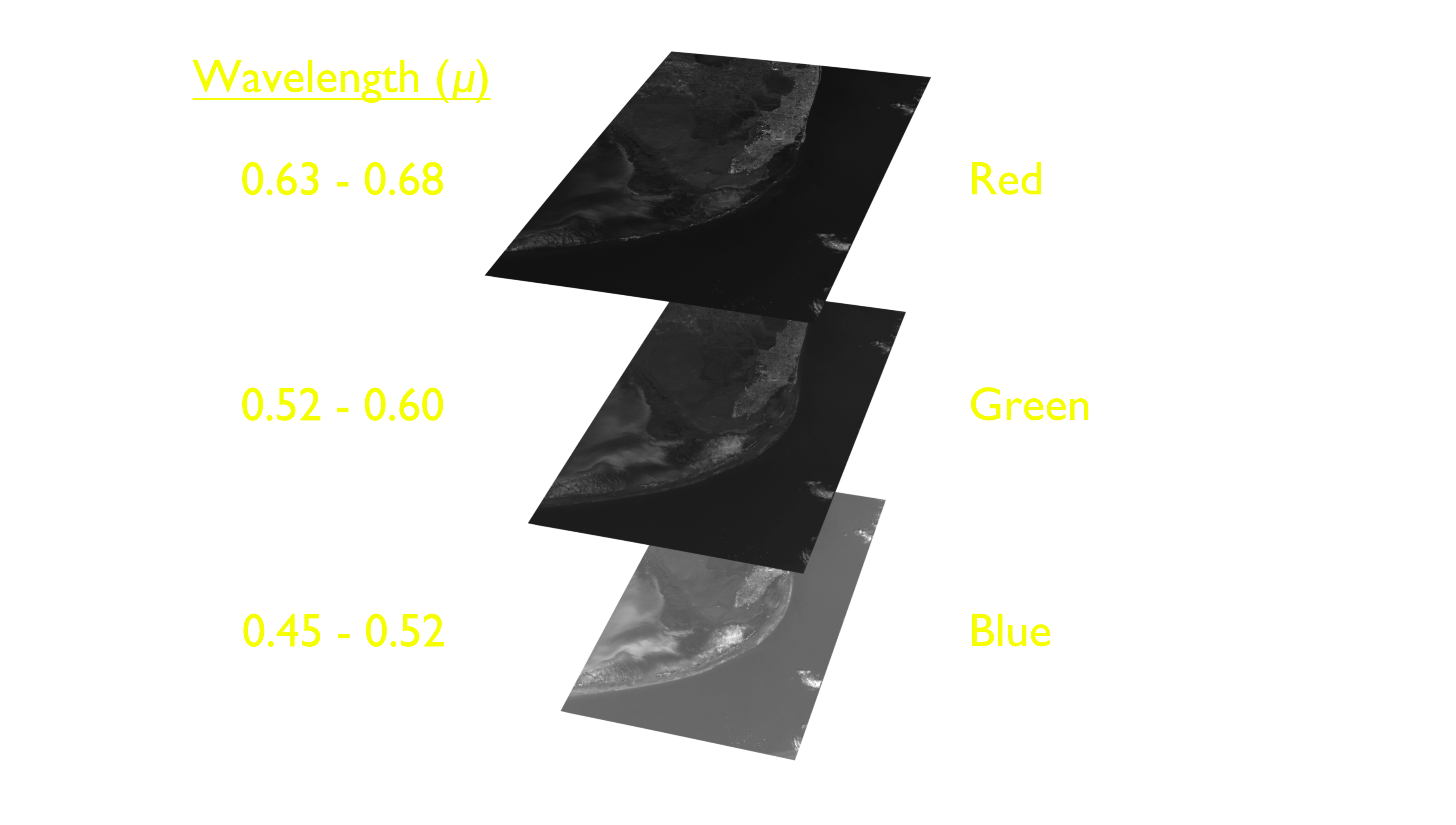
Landsat satellites view the Earth through a number of different bands. Each band captures imagery in different spectral wavelengths. Scientists can then combine these bands a number of ways to obtain information about the satellite imagery. These still images show several different band combinations alongside the resulting imagery over the Florida Everglades.


Florida Everglades Onion Skin Stills
These still images were produced for use on NASA travelling exhibits.
Visualization Credits
Alex Kekesi (Global Science and Technology, Inc.): Lead Animator
Holli Riebeek (Sigma Space Corporation): Producer
James R. Irons (NASA/GSFC): Scientist
Tassia Owen (Sigma Space Corporation): Project Support
Holli Riebeek (Sigma Space Corporation): Producer
James R. Irons (NASA/GSFC): Scientist
Tassia Owen (Sigma Space Corporation): Project Support
Please give credit for this item to:
NASA's Goddard Space Flight Center Scientific Visualization Studio
NASA's Goddard Space Flight Center Scientific Visualization Studio
Short URL to share this page:
https://svs.gsfc.nasa.gov/4025
Mission:
Landsat
Data Used:
Note: While we identify the data sets used in these visualizations, we do not store any further details nor the data sets themselves on our site.
This item is part of this series:
LDCM
Keywords:
SVS >> Everglades
SVS >> Landsat
SVS >> Spectrum
GCMD >> Location >> Florida
SVS >> Wavelengths
NASA Science >> Earth
GCMD keywords can be found on the Internet with the following citation: Olsen, L.M., G. Major, K. Shein, J. Scialdone, S. Ritz, T. Stevens, M. Morahan, A. Aleman, R. Vogel, S. Leicester, H. Weir, M. Meaux, S. Grebas, C.Solomon, M. Holland, T. Northcutt, R. A. Restrepo, R. Bilodeau, 2013. NASA/Global Change Master Directory (GCMD) Earth Science Keywords. Version 8.0.0.0.0
https://svs.gsfc.nasa.gov/4025
Mission:
Landsat
Data Used:
Landsat-5/TM/Band Combination 4, 3, 2
11/10/2011Landsat-5/TM/Band Combination 7,4,2
11/10/2011Landsat-5/TM/Band Combination 3-2-1
11/10/2011This item is part of this series:
LDCM
Keywords:
SVS >> Everglades
SVS >> Landsat
SVS >> Spectrum
GCMD >> Location >> Florida
SVS >> Wavelengths
NASA Science >> Earth
GCMD keywords can be found on the Internet with the following citation: Olsen, L.M., G. Major, K. Shein, J. Scialdone, S. Ritz, T. Stevens, M. Morahan, A. Aleman, R. Vogel, S. Leicester, H. Weir, M. Meaux, S. Grebas, C.Solomon, M. Holland, T. Northcutt, R. A. Restrepo, R. Bilodeau, 2013. NASA/Global Change Master Directory (GCMD) Earth Science Keywords. Version 8.0.0.0.0


