Earth
ID: 13734
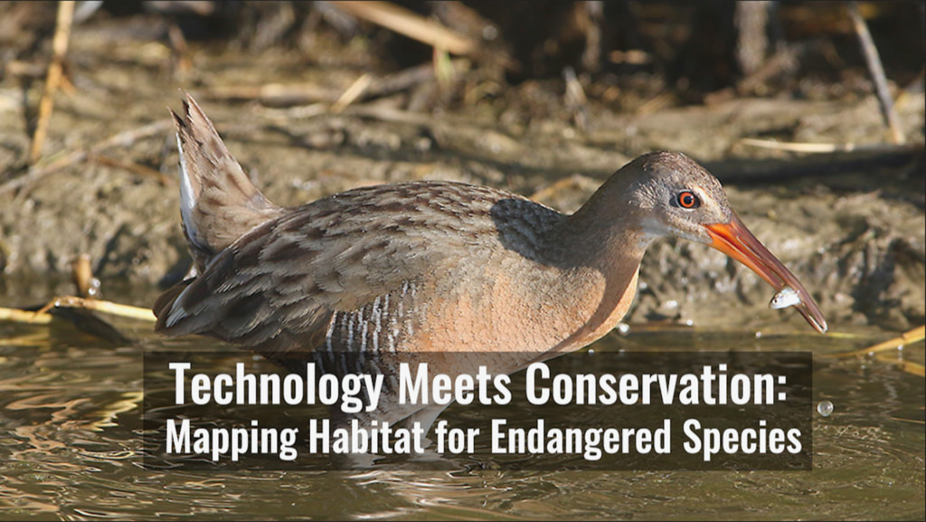
In a constantly changing world, the protection of our planet’s endangered species and ecosystems is a priority for ecologists. Recently, a group of researchers at the University of Idaho have worked to combine their extensive on-the-ground research of the endangered Yuma Ridgway’s rail with Landsat’s vast archive, to create a habitat suitability model that can be used by land managers. By using this model, it gives land managers the tools and data to make decisions of how to best carry out conservation for the Yuma Ridgway’s rail on a year to year basis. With the success of this initial model, it’s hypothesized that this tool will be able to help additional species in the area and others down the road.
Technology Meets Conservation
To view the map, click https://sites.google.com/view/habitatsuitability-yrr/home
The Landsat Program is a series of Earth-observing satellite missions jointly managed by NASA and the U.S. Geological Survey (USGS). Landsat satellites have been consistently gathering data about our planet since 1972. They continue to improve and expand this unparalleled record of Earth's changing landscapes for the benefit of all.
For More Information
Credits
Matthew R. Radcliff (USRA): Lead Producer
Aaron E. Lepsch (ADNET Systems, Inc.): Technical Support
Harrison Bach (Intern): Producer
Kate Ramsayer (Telophase): Writer
Harrison Bach (Intern): Editor
Aaron E. Lepsch (ADNET Systems, Inc.): Technical Support
Harrison Bach (Intern): Producer
Kate Ramsayer (Telophase): Writer
Harrison Bach (Intern): Editor
Please give credit for this item to:
NASA's Goddard Space Flight Center
NASA's Goddard Space Flight Center
Short URL to share this page:
https://svs.gsfc.nasa.gov/13734
Missions:
Landsat
Landsat 7
This item is part of these series:
Narrated Movies
Landsat
Keywords:
DLESE >> Biology
SVS >> HDTV
SVS >> Habitat
SVS >> Landsat
SVS >> Marsh
SVS >> Marshland
GCMD >> Earth Science >> Biosphere >> Animal Taxonomy >> Birds
GCMD >> Earth Science >> Biosphere >> Wetlands >> Marshes
GCMD >> Earth Science >> Human Dimensions >> Environmental Impacts >> Conservation
NASA Science >> Earth
GCMD keywords can be found on the Internet with the following citation: Olsen, L.M., G. Major, K. Shein, J. Scialdone, S. Ritz, T. Stevens, M. Morahan, A. Aleman, R. Vogel, S. Leicester, H. Weir, M. Meaux, S. Grebas, C.Solomon, M. Holland, T. Northcutt, R. A. Restrepo, R. Bilodeau, 2013. NASA/Global Change Master Directory (GCMD) Earth Science Keywords. Version 8.0.0.0.0


