Earth
ID: 12164
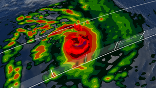
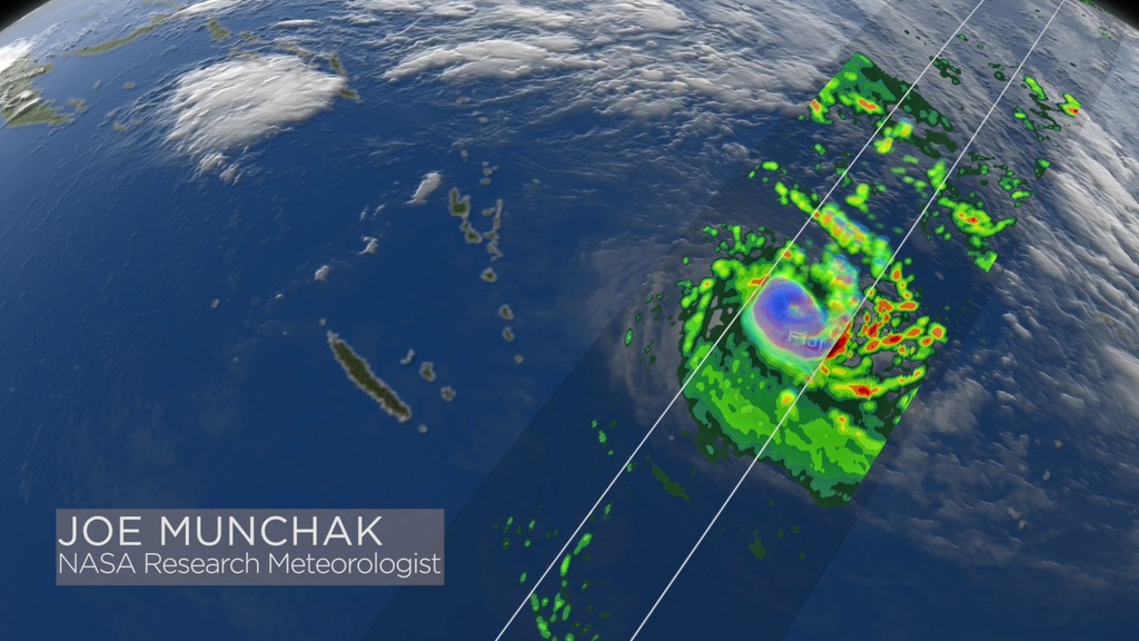
The NASA GPM satellite passed directly over Tropical Cyclone Winston just after it made landfall on the north coast of Viti Levu Island, which is the largest and most populated island in the nation of Fiji. At the time, Winston was one of the most intense tropical cyclones observed in the South Pacific Ocean, and took an unusual track on the way to Fiji, completing a large counter-clockwise loop during the preceding week.
NASA's GPM satellite is designed to measure rainfall using both passive microwave (GMI) and radar (DPR) instruments. GMI measuremensts are sensitive to the column-integrated rain and ice water, and cover a wide swath, whereas the DPR can observe 3D structures of radar signals reflected by rain and snow in a narrower swath. In this animation, the GMI rainfall estimates are shown at the earth's surface below the 3D storm structure revealed by DPR.
Winston Over Fiji
NASA's GPM satellite is designed to measure rainfall using both passive microwave (GMI) and radar (DPR) instruments. GMI measuremensts are sensitive to the column-integrated rain and ice water, and cover a wide swath, whereas the DPR can observe 3D structures of radar signals reflected by rain and snow in a narrower swath. In this animation, the GMI rainfall estimates are shown at the earth's surface below the 3D storm structure revealed by DPR.
Related
Credits
Ryan Fitzgibbons (USRA): Lead Producer
Alex Kekesi (Global Science and Technology, Inc.): Lead Visualizer
Stephen J. Munchak (University of Maryland): Lead Scientist
George Huffman (NASA/GSFC): Lead Scientist
Chris Kidd (University of Maryland): Scientist
Stephen J. Munchak (University of Maryland): Lead Narrator
Alex Kekesi (Global Science and Technology, Inc.): Lead Visualizer
Stephen J. Munchak (University of Maryland): Lead Scientist
George Huffman (NASA/GSFC): Lead Scientist
Chris Kidd (University of Maryland): Scientist
Stephen J. Munchak (University of Maryland): Lead Narrator
Please give credit for this item to:
NASA's Goddard Space Flight Center
NASA's Goddard Space Flight Center
Short URL to share this page:
https://svs.gsfc.nasa.gov/12164
Mission:
Global Precipitation Measurement (GPM)
Keywords:
SVS >> HDTV
NASA Science >> Earth
https://svs.gsfc.nasa.gov/12164
Mission:
Global Precipitation Measurement (GPM)
Keywords:
SVS >> HDTV
NASA Science >> Earth


