Earth
ID: 11324

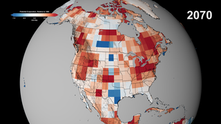
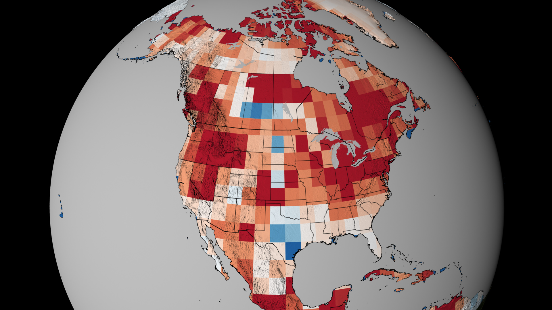
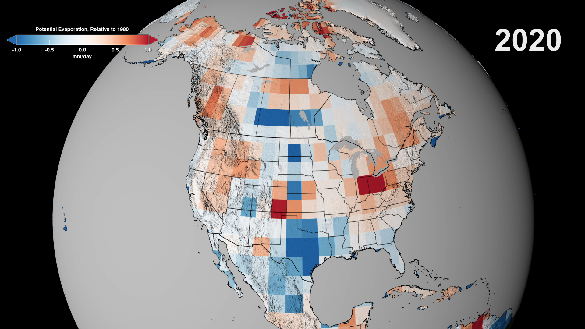
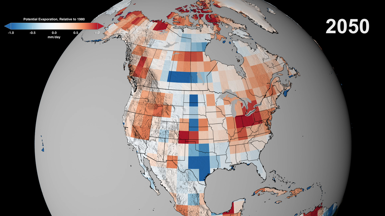
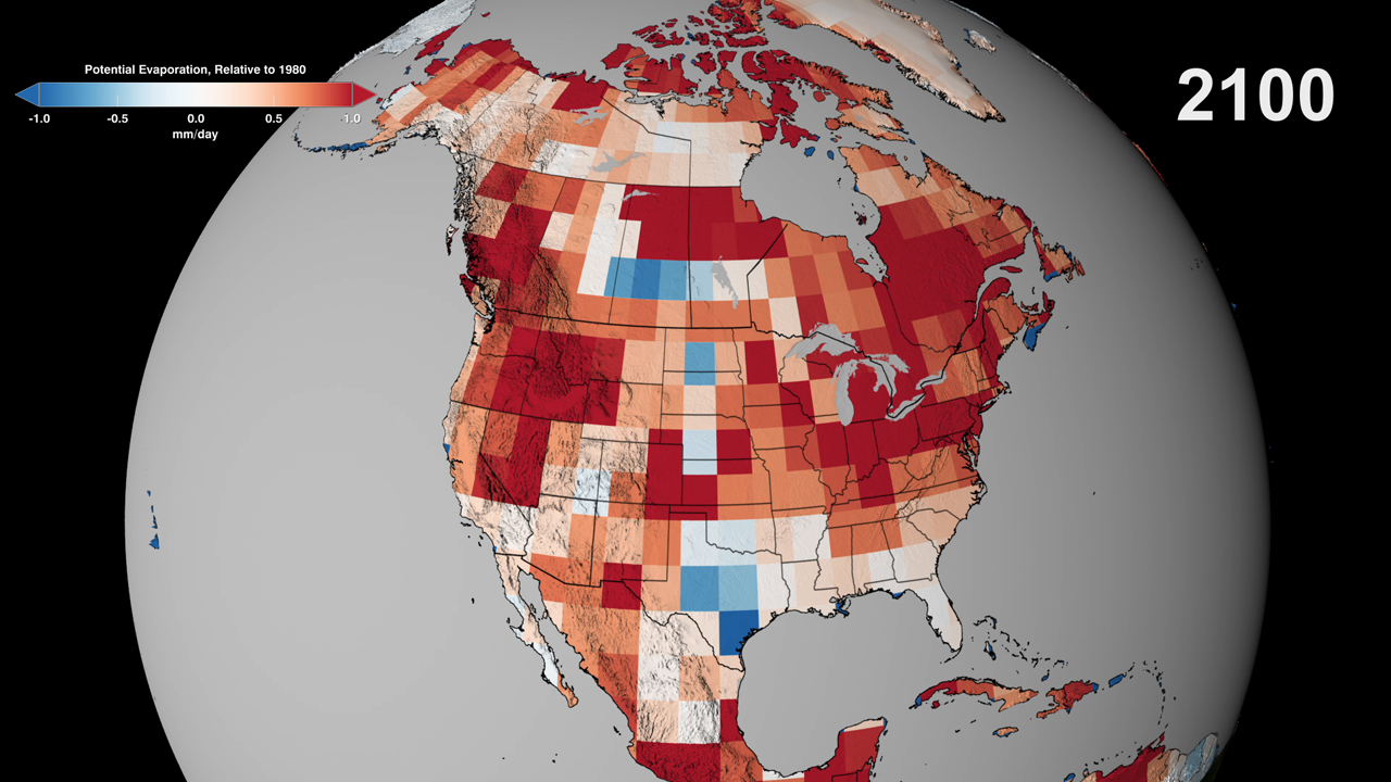
Hot and dry conditions lead to more fires. Those were the findings presented in 2012 by a team of researchers that used NASA satellite data and climate models to predict fire activity in the United States. Now, a new animation shows how dry conditions will cause different parts of the U.S., Canada and Mexico to experience an increased risk of fire by the end of the century. By mapping projected values for a measure of dryness known as the potential evaporation—a calculation that’s based on temperature, rainfall and wind speed estimates—scientists are able to interpret how fire activity will be influenced by future climates. Changes in dryness relative to 1980 levels are shown in the animation using color, where reds represent an increase in dryness and blues represent a decrease. Watch the video to see how dry conditions are expected to spread across North America by the year 2100.


Burn Notice
Related Story
For More Information
Story Credits
Visualizer/Animator:
Trent L. Schindler (USRA)
Producers:
Alison Schuyler Ogden (NASA/GSFC)
Michelle Handleman (USRA)
Lead Scientist:
Doug C. Morton (NASA/GSFC)
Lead Writer:
Kayvon Sharghi (USRA)
Trent L. Schindler (USRA)
Producers:
Alison Schuyler Ogden (NASA/GSFC)
Michelle Handleman (USRA)
Lead Scientist:
Doug C. Morton (NASA/GSFC)
Lead Writer:
Kayvon Sharghi (USRA)
Please give credit for this item to:
NASA's Goddard Space Flight Center
NASA's Goddard Space Flight Center
Short URL to share this page:
https://svs.gsfc.nasa.gov/11324
Keywords:
SVS >> App
NASA Science >> Earth
https://svs.gsfc.nasa.gov/11324
Keywords:
SVS >> App
NASA Science >> Earth


