Earth
ID: 11202
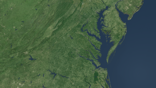
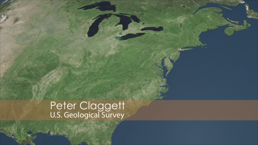
Landsat is a critical and invaluable tool for characterizing the landscape and mapping it over time. Landsat data provides a baseline of observations for science about how human activities on the land affect water quality, affect wildlife habitat, affect air quality. The satellite imagery covers the entire 64,000 square miles of the Chesapeake Bay watershed (spanning six states and the District of Columbia). Without it we wouldn't be able to really understand how sources of nutrients and sediment have changed and where they are in the Chesapeake Bay.
Monitoring Changes in the Chesapeake Bay Watershed
The Landsat Program is a series of Earth-observing satellite missions jointly managed by NASA and the U.S. Geological Survey.
The narration in this video is by Peter Claggett, a research geographer with the U.S. Geological Survey's Eastern Geographic Science Center. He has worked at the Chesapeake Bay Program Office since 2002, where he leads the Land Data Team that conducts research on land change characterization, analysis, and modeling in the Chesapeake Bay Watershed.
The audio was adapted from a radio interview with EarthSky.org.
Related

For More Information
Credits
Helen-Nicole Kostis (USRA): Lead Animator
Cindy Starr (Global Science and Technology, Inc.): Animator
Jeff de La Beaujardiere (NASA): Animator
Greg Shirah (NASA/GSFC): Animator
Matthew R. Radcliff (USRA): Video Editor
Matthew R. Radcliff (USRA): Producer
Peter Claggett (USGS): Scientist
Cindy Starr (Global Science and Technology, Inc.): Animator
Jeff de La Beaujardiere (NASA): Animator
Greg Shirah (NASA/GSFC): Animator
Matthew R. Radcliff (USRA): Video Editor
Matthew R. Radcliff (USRA): Producer
Peter Claggett (USGS): Scientist
Please give credit for this item to:
NASA's Goddard Space Flight Center
Audio adapted from EarthSky.org
NASA's Goddard Space Flight Center
Audio adapted from EarthSky.org
Short URL to share this page:
https://svs.gsfc.nasa.gov/11202
Mission:
Landsat
This item is part of these series:
Narrated Movies
Chesapeake Bay
Landsat
Goddard TV Tape:
G2013-020 -- Chesapeake Flyover
Keywords:
SVS >> HDTV
DLESE >> Hydrology
SVS >> Impervious
SVS >> Landsat
GCMD >> Earth Science >> Oceans >> Water Quality
GCMD >> Earth Science >> Hydrosphere >> Surface Water >> Runoff
GCMD >> Earth Science >> Land Surface >> Landscape >> Landscape Ecology
SVS >> Hyperwall
NASA Science >> Earth
GCMD keywords can be found on the Internet with the following citation: Olsen, L.M., G. Major, K. Shein, J. Scialdone, S. Ritz, T. Stevens, M. Morahan, A. Aleman, R. Vogel, S. Leicester, H. Weir, M. Meaux, S. Grebas, C.Solomon, M. Holland, T. Northcutt, R. A. Restrepo, R. Bilodeau, 2013. NASA/Global Change Master Directory (GCMD) Earth Science Keywords. Version 8.0.0.0.0


