Biggest and Brightest Moon of 2020 Live Shots
- Produced by:
- Teresa Johnson
- View full credits

Click here for canned interview with Dr. Noah Petro
Click here for canned interview in Spanish with Dr. Geronimo Villanueva
Click here for B-ROLL for these interviews.
You can learn more about Apollo 13 as we near the 50th anniversary here:
NASA Commemorates 50th Anniversary of Apollo 13, ‘A Successful Failure’
NASA scientists are available virtually for live or taped interviews using programs including Skype or FaceTime on Tuesday, April 7th, from 6:00 a.m. – 1:00 p.m. EDT to tell your viewers when they can see this unique phenomenon and talk about the Moon’s past, present and future.
To Schedule an interview: https://forms.gle/W8T6JEVqTj2TbADz7
The Moon has an elliptical orbit, and it goes through periods of orbiting more closely to Earth. Tuesday’s supermoon will be the closest this year!
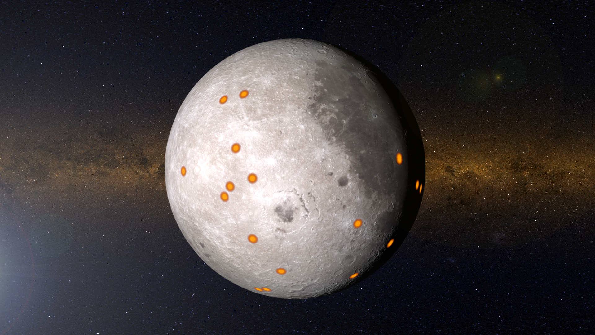
The Moon is a familiar sight in the night sky. Humans have been staring at it since the dawn of time. But even now we’re still learning new things about our closest neighbor. NASA’s Lunar Reconnaissance Orbiter (LRO) has been giving us an unprecedented close-up view of our Moon for over a decade. It’s showing us where meteorites are hitting the surface and changing the landscape even now, and where there are minerals in the lunar soil that could be resources for future explorers. The spacecraft is showing us every day that our Moon is dynamic and a fascinating place to explore.
As we mark the 50th anniversary of the Apollo 13 mission to the Moon later this month, NASA is looking to send the first woman and next man to the Moon with the Artemis program. This time to stay.
SUGGESTED ANCHOR INTRO: DID YOU KNOW THAT SOMETIMES THE MOON APPEARS SLIGHTLY LARGER IN THE SKY?... WELL, TONIGHT MAKE SURE TO CHECK OUT THE BIGGEST AND MOST DAZZLING MOON OF THE YEAR… WE HAVE NASA SCIENTIST…. TO TELL US MORE ABOUT THIS AMAZING PHENOMENON….
Scientists:
Noah Petro / NASA Scientist
Kelsey Young / NASA Scientist
Barbara Cohen / NASA Scientist
Michelle Thaller / NASA Scientist
Andrea Jones / Public Engagement Lead, Planetary Science at NASA Goddard
Geronimo Villanueva / NASA Scientist [can do interviews in Spanish]
Suggested Questions
What is a supermoon and why is it special?
NASA has been studying the Moon for 10 years with the Lunar Reconnaissance Orbiter, what are some surprising things we’ve learned about the Moon?
The 50th anniversary of Apollo 13th is coming up. Although the Apollo 13 astronauts didn’t land on the Moon, what did we learn from this mission?
NASA is planning an exciting new mission to the Moon with the Artemis program. What do we still want to know about the Moon?
How can our viewers see the supermoon and learn more?
Canned interview with NASA Scientist Dr. Noah Petro. TRT 7:24
B-roll for Supermoon Live Shot
Canned interview in Spanish with NASA Scientist Dr. Geronimo Villanueva. TRT 4:27
Credits
Please give credit for this item to:
NASA's Goddard Space Flight Center
Producers
- Teresa Johnson (NASA/GSFC) [Lead]
- Courtney A. Lee (ADNET)
- Mariah Cox (NASA)
- Michelle Handleman (KBRwyle)
Related pages
Apollo 13 Moon View Using LRO Data
Feb. 24th, 2020
Read morePath 75:02:00 − 80:01:50. The path of the Apollo 13 spacecraft near the Moon. The one-minute animation covers five hours of real time, at 10 seconds per frame. The view is centered on the lunar north pole, with the center of the near side facing the top of the frame. Versions both with and without the annotations in the bottom right are available, as are the separate components (Moon and path with alpha, starry background). Perilune 75:02:00 − 80:01:50. A nadir view of the Moon from the position of the Apollo 13 spacecraft. This covers the same time span as the Path animation and is available both with and without the annotations in the bottom right. LOS 77:04:00 − 77:09:00. The Earth appears to set behind the Moon, which is illuminated solely by earthshine (sunlight reflected from Earth). Loss of signal (LOS) occurs when the Moon blocks the Earth from the point of view of the spacecraft. Radio communication between the crew and Mission Control in Houston is cut off until the spacecraft emerges from behind the Moon about 25 minutes later. The separate elements (Earth and Moon, starfield) are also available. Sunrise 77:16:00 − 77:26:00. Apollo 13 emerges from the lunar night and begins to see sunlit terrain up close for the first time. Chaplygin 77:26:00 − 77:31:00. Looking south, the astronauts can see the craters Keeler, Chaplygin, Marconi, and near the horizon, Gagarin and Isaev. Tsiolkovskiy 77:31:00 − 77:36:00. To the south is the large Tsiolkovskiy crater, one of the few areas of dark mare basalt on the far side. The bright central peak creates a stark contrast. Earthrise 77:32:40 − 77:37:40. The Earth emerges above the lunar horizon, and the crew can once again communicate with Mission Control. The West Coast of North America is visible in daylight, while the Sun has set in Houston. Moscoviense 77:36:00 − 77:41:00. Mare Moscoviense (Sea of Moscow) lies to the north of the Apollo 13 trajectory. Crisium 77:39:00 − 77:44:00. Minutes after AOS (acquisition of signal), the astronauts point out several lunar features to each other that are visible in this animation, including Mare Smythii and Mare Crisium. AS13-60-8606. The eastern limb of the Moon not long after Apollo 13 experienced sunrise. AS13-62-8912. This photograph of Chaplygin crater (center-left) was taken through one of the Lunar Module windows using a camera intended for surface photography (note the plus-shaped Réseau markings). Blurry, dark, vertical stripes are out-of-focus scale marks on the LM window, used to judge angles and distances. The hatch on the Command Module is prominent in the foreground. AS13-60-8626. Tsiolkovskiy crater photographed with the 250mm telephoto lens. AS13-60-8648. Mare Moscoviense taken with the 250mm telephoto lens. AS13-61-8740. Mare Smythii is near the center of the image. To its right (north) are Neper crater (lighter in the center) and Mare Marginis (partly obscured by the spacecraft). Mare Crisium is on the horizon, with the splotchy Mare Undarum to its left (south). Using color and elevation maps from the Lunar Reconnaissance Orbiter (LRO) mission, these visualizations recreate with unprecedented fidelity what the crew of Apollo 13 could see as they flew around the far side of the Moon. Several Apollo 13 photographs are at the bottom of the page for comparison. These visualizations have been incorporated into the multimedia recreation of the entire Apollo 13 mission in real time at apolloinrealtime.org.Apollo 13 would have been the third lunar landing mission in the Apollo program. But 56 hours into the flight, an explosion in the Service Module changed the flight into a rescue mission. The crew was forced to use the Lunar Module as a lifeboat, and rather than landing on the Moon, they were limited to observing and photographing it from hundreds of kilometers above the surface.Recreating what they saw requires not only excellent maps but also knowledge of the spacecraft's flight path — all of the animations on this page are views from the position of the spacecraft at specific times during their flight behind the Moon, using the same focal lengths as the lenses on board.The trajectory used for these visualizations was derived from the position and speed at pericynthion (closest point to the Moon) listed in Table 4-III of the Apollo 13 Mission Report. The inclination and nodes were found using a second point on the path from Table 4-II — the center of the Moon and two points on the path are sufficient to define the orbit plane. The resulting orbital elements are:Perifocal Distance 1988.8 kmEccentricity 1.4462Inclination 173.7°Longitude of the Ascending Node -150.74°Argument of Periapsis 28.7°Mean Anomaly at Epoch 0°Epoch April 15, 1970 00:33:57 UTGravitational Parameter 4904.87 km3/s2See also a slightly different and more complete reconstruction by Daniel Adamo in the Journal of Guidance, Control, and Dynamics (Adamo 2008).The time ranges shown in the captions refer to Ground Elapsed Time (GET), the number of hours and minutes since liftoff, which occurred on April 11, 1970 at 1:13 p.m. Houston time. The Path and Perilune animations cover five hours of flight in a single minute of running time, but the rest of the animations cover five or ten minutes of flight in one or two minutes, speeding up time by a factor of only 5. When played back at 6 fps, the animations run at real-time speed. PhotographsThese are a few of the hundreds of photographs taken by Apollo 13. Compare them to the visualizations. Every Apollo 13 photo can be found in the Apollo Image Atlas maintained by the Lunar and Planetary Institute. Related pages
Apollo 13 Views of the Moon in 4K
Feb. 24th, 2020
Read moreThis video uses data gathered from the Lunar Reconnaissance Orbiter spacecraft to recreate some of the stunning views of the Moon that the Apollo 13 astronauts saw on their journey in 1970.Music provided by Universal Production Music: "Visions of Grandeur" - Frederick WiedmannWatch this video on the NASA Goddard YouTube channel. Spanish Version/Versión en españolVistas de la Luna en 4K del Apolo 13Este video utiliza datos recopilados por la nave espacial Orbitador de Reconocimiento Lunar para recrear algunas de las impresionantes vistas de la Luna que los astronautas del Apolo 13 observaron en su viaje en 1970. Música proporcionada por Universal Production Music: "Visions of Grandeur" - Frederick Wiedmann. Data from the Lunar Reconnaissance Orbiter spacecraft now makes it possible to show what the Apollo 13 astronauts saw as they flew around the far side of the Moon. This video showcases visualizations in 4K resolution of many of those lunar surface views, starting with earthset and sunrise, and concluding with the time Apollo 13 reestablished radio contact with Mission Control. Also depicted is the path of the free return trajectory around the Moon, and a continuous view of the Moon throughout that path. All views have been sped up for timing purposes - they are not shown in "real-time." For more information, or to obtain the original individual assets that comprise this video, please visit: http://svs.gsfc.nasa.gov/4791 Related pages
Moon Phase and Libration, 2020
Dec. 12th, 2019
Read moreThe phase and libration of the Moon for 2020, at hourly intervals. Includes supplemental graphics that display the Moon's orbit, subsolar and sub-Earth points, and the Moon's distance from Earth at true scale. Craters near the terminator are labeled, as are Apollo landing sites and maria and other albedo features in sunlight. The phase and libration of the Moon for 2020, at hourly intervals. Includes music, supplemental graphics that display the Moon's orbit, subsolar and sub-Earth points, and the Moon's distance from Earth at true scale. Craters near the terminator are labeled, as are Apollo landing sites and maria and other albedo features in sunlight.Music: "Calling It a Night" - Written by Matt Cusson. Vocal and Piano by Matt Cusson. 23 Jump Shots ASCAP. ©2017Watch this video on the NASA Goddard YouTube channel. The phase and libration of the Moon for 2020, at hourly intervals. The higher resolution frames include an alpha channel. The orbit of the Moon in 2020, viewed from the north pole of the ecliptic, with the vernal equinox to the right. The sizes of the Earth and Moon are exaggerated by a factor of 15, 20, or 25, depending on the frame size. The frames include an alpha channel. An animated diagram of the subsolar and sub-Earth points for 2020. The Moon's north pole, equator, and meridian are indicated. The frames include an alpha channel. An animated diagram of the Moon's distance from the Earth for 2020. The sizes and distances are true to scale, and the lighting and Earth tilt are correct. The frames include an alpha channel. Feature labels. Crater labels appear when the center of the crater is within 20 degrees of the terminator (the day-night line). They are on the western edge of the crater during waxing phases (before Full Moon) and to the east during waning phases. Mare, sinus, and lacus features are labeled when in sunlight. Apollo landing site labels are always visible. The frames include an alpha channel. Waxing crescent. Visible toward the southwest in early evening. First quarter. Visible high in the southern sky in early evening. Waxing gibbous. Visible to the southeast in early evening, up for most of the night. Full Moon. Rises at sunset, high in the sky around midnight. Visible all night. Waning gibbous. Rises after sunset, high in the sky after midnight, visible to the southwest after sunrise. Third quarter. Rises around midnight, visible to the south after sunrise. Waning crescent. Low to the east before sunrise. New Moon. By the modern definition, New Moon occurs when the Moon and Sun are at the same geocentric ecliptic longitude. The part of the Moon facing us is completely in shadow then. Pictured here is the traditional New Moon, the earliest visible waxing crescent, which signals the start of a new month in many lunar and lunisolar calendars. Dial-A-Moon Click on the image to download a high-resolution version with feature labels and additional graphics. Hover over the image to reveal the animation frame number, which can be used to locate and download the corresponding frame from any of the animations on this page, including unlabeled high-resolution Moon images. The data in the table for the entire year can be downloaded as a JSON file or as a text file.The animation archived on this page shows the geocentric phase, libration, position angle of the axis, and apparent diameter of the Moon throughout the year 2020, at hourly intervals. Until the end of 2020, the initial Dial-A-Moon image will be the frame from this animation for the current hour.More in this series:Moon Phase and Libration GalleryLunar Reconnaissance Orbiter (LRO) has been in orbit around the Moon since the summer of 2009. Its laser altimeter (LOLA) and camera (LROC) are recording the rugged, airless lunar terrain in exceptional detail, making it possible to visualize the Moon with unprecedented fidelity. This is especially evident in the long shadows cast near the terminator, or day-night line. The pummeled, craggy landscape thrown into high relief at the terminator would be impossible to recreate in the computer without global terrain maps like those from LRO.The Moon always keeps the same face to us, but not exactly the same face. Because of the tilt and shape of its orbit, we see the Moon from slightly different angles over the course of a month. When a month is compressed into 24 seconds, as it is in this animation, our changing view of the Moon makes it look like it's wobbling. This wobble is called libration.The word comes from the Latin for "balance scale" (as does the name of the zodiac constellation Libra) and refers to the way such a scale tips up and down on alternating sides. The sub-Earth point gives the amount of libration in longitude and latitude. The sub-Earth point is also the apparent center of the Moon's disk and the location on the Moon where the Earth is directly overhead.The Moon is subject to other motions as well. It appears to roll back and forth around the sub-Earth point. The roll angle is given by the position angle of the axis, which is the angle of the Moon's north pole relative to celestial north. The Moon also approaches and recedes from us, appearing to grow and shrink. The two extremes, called perigee (near) and apogee (far), differ by about 14%.The most noticed monthly variation in the Moon's appearance is the cycle of phases, caused by the changing angle of the Sun as the Moon orbits the Earth. The cycle begins with the waxing (growing) crescent Moon visible in the west just after sunset. By first quarter, the Moon is high in the sky at sunset and sets around midnight. The full Moon rises at sunset and is high in the sky at midnight. The third quarter Moon is often surprisingly conspicuous in the daylit western sky long after sunrise.Celestial north is up in these images, corresponding to the view from the northern hemisphere. The descriptions of the print resolution stills also assume a northern hemisphere orientation. (There is also a south-up version of this page.) The Moon's Orbit From this birdseye view, it's somewhat easier to see that the phases of the Moon are an effect of the changing angles of the Sun, Moon and Earth. The Moon is full when its orbit places it in the middle of the night side of the Earth. First and Third Quarter Moon occur when the Moon is along the day-night line on the Earth.The First Point of Aries is at the 3 o'clock position in the image. The Sun is in this direction at the March equinox. You can check this by freezing the animation at around the 1:03 mark, or by freezing the full animation with the time stamp near March 20. This direction serves as the zero point for both ecliptic longitude and right ascension.The north pole of the Earth is tilted 23.5 degrees toward the 12 o'clock position at the top of the image. The tilt of the Earth is important for understanding why the north pole of the Moon seems to swing back and forth. In the full animation, watch both the orbit and the "gyroscope" Moon in the lower left. The widest swings happen when the Moon is at the 3 o'clock and 9 o'clock positions. When the Moon is at the 3 o'clock position, the ground we're standing on is tilted to the left when we look at the Moon. At the 9 o'clock position, it's tilted to the right. The tilt itself doesn't change. We're just turned around, looking in the opposite direction. The subsolar and sub-Earth points are the locations on the Moon's surface where the Sun or the Earth are directly overhead, at the zenith. A line pointing straight up at one of these points will be pointing toward the Sun or the Earth. The sub-Earth point is also the apparent center of the Moon's disk as observed from the Earth.In the animation, the blue dot is the sub-Earth point, and the yellow dot is the subsolar point. The lunar latitude and longitude of the sub-Earth point is a measure of the Moon's libration. For example, when the blue dot moves to the left of the meridian (the line at 0 degrees longitude), an extra bit of the Moon's western limb is rotating into view, and when it moves above the equator, a bit of the far side beyond the north pole becomes visible.At any given time, half of the Moon is in sunlight, and the subsolar point is in the center of the lit half. Full Moon occurs when the subsolar point is near the center of the Moon's disk. When the subsolar point is somewhere on the far side of the Moon, observers on Earth see a crescent phase. The Moon's orbit around the Earth isn't a perfect circle. The orbit is slightly elliptical, and because of that, the Moon's distance from the Earth varies between 28 and 32 Earth diameters, or about 356,400 and 406,700 kilometers. In each orbit, the smallest distance is called perigee, from Greek words meaning "near earth," while the greatest distance is called apogee. The Moon looks largest at perigee because that's when it's closest to us.The animation follows the imaginary line connecting the Earth and the Moon as it sweeps around the Moon's orbit. From this vantage point, it's easy to see the variation in the Moon's distance. Both the distance and the sizes of the Earth and Moon are to scale in this view. In the HD-resolution frames, the Earth is 50 pixels wide, the Moon is 14 pixels wide, and the distance between them is about 1500 pixels, on average.Note too that the Earth appears to go through phases just like the Moon does. For someone standing on the surface of the Moon, the Sun and the stars rise and set, but the Earth doesn't move in the sky. It goes through a monthly sequence of phases as the Sun angle changes. The phases are the opposite of the Moon's. During New Moon here, the Earth is full as viewed from the Moon. The Named PhasesThe following is a gallery containing examples of each of the Moon phases that have names. New, full, and quarter phases occur on specific days, while crescent and gibbous phases are the transitions between these points and span multiple days. The quarters are so named because they occur when the Moon is one fourth or three fourths of the way through its cycle of phases. Many people find this confusing, though, since visually they are half moons. It might be helpful to remember that the visible half of the Moon's disk is really only one quarter of its spherical surface. Related pages
10 Years at the Moon
June 18th, 2019
Read moreThis video celebrates the Lunar Reconnaissance Orbiter mission's 10th anniversary at the Moon, highlighting some notable accomplishments.Music Provided by Killer Tracks: "New Way Forward" - Mark PetrieWatch this video on the NASA Goddard YouTube channel. NASA’s Lunar Reconnaissance Orbiter mission now celebrates its 10-year anniversary of being at the Moon. After launching on June 18, 2009 and entering lunar orbit on June 23rd, the spacecraft continues to collect vast amounts of data vital to our understanding of the lunar landscape and environment, our solar system, and to our future exploration goals for the Moon and Mars. This video highlights some notable facts and accomplishments of the LRO mission over the past decade, all of which are paving the way forward for reestablishing a human presence on the Moon with the newly-announced Artemis program.For more information on the Lunar Reconnaissance Orbiter, visit: LRO WebsiteAll of LRO’s data is archived and can be viewed at: LRO Planetary Data SystemTo see images from the Lunar Reconnaissance Orbiter Camera, visit: LROC Website Related pages
Tour of the Moon 4K Redux
April 9th, 2018
Read moreThe camera flies over the lunar terrain, coming in for close looks at a variety of interesting sites and some of the LRO data associated with them. Includes narration, music, feature titles, research sources, and the location and scale of the image center. Music Provided By Killer Tracks: "Never Looking Back" - Frederick Wiedmann. "Flying over Turmoil" - Benjamin Krause & Scott Goodman.Watch this video on the NASA Goddard YouTube channel.This video is also available on the SVS YouTube channel. The camera flies over the lunar terrain, coming in for close looks at a variety of interesting sites and some of the LRO data associated with them. Includes feature titles, research sources, and the location and scale of the image center. Comparisons of certain frames from the original 2011 tour (bottom) and the 2018 version (top). The data gathered by LRO in the intervening years is reflected in the improved quality of the newer images. The tour as rendered, without titles. The frames contain an alpha channel. The background stars visible in the first 14 seconds of the tour. The animated location and scale display. The title slides, including keys (color bars) for the gravity, elevation, and Christiansen feature data overlays. In the fall of 2011, the Lunar Reconnaissance Orbiter (LRO) mission released its original Tour of the Moon, a five-minute animation that takes the viewer on a virtual tour of our nearest neighbor in space. Six years later, the tour has been recreated in eye-popping 4K resolution, using the same camera path and drawing from the vastly expanded data trove collected by LRO in the intervening years.The tour visits a number of interesting sites chosen to illustrate a variety of lunar terrain features. Some are on the near side and are familiar to both professional and amateur observers on Earth, while others can only be seen clearly from space. Some are large and old (Orientale, South Pole-Aitken), others are smaller and younger (Tycho, Aristarchus). Constantly shadowed areas near the poles are hard to photograph but easier to measure with altimetry, while several of the Apollo landing sites, all relatively near the equator, have been imaged at resolutions as high as 25 centimeters (10 inches) per pixel.The new tour highlights the mineral composition of the Aristarchus plateau, evidence for surface water ice in certain spots near the south pole, and the mapping of gravity in and around the Orientale basin. Related pages
Record-breaking Supermoon Live Shots (Nov. 11, 2016)
Nov. 2nd, 2016
Read moreB-roll for supermoon live shots on Nov. 11, 2016. Dr. Alex Young interview about upcoming Supermoon on November 14, 2016. Nayessda Castro, NASA Engineer, interview about upcoming Supermoon on November 14, 2016. [On camera canned interview] Planetary scientist Dr. Noah Petro answers questions about the Nov. 14, 2016, supermoon. [Off camera canned interview] Planetary scientist Dr. Noah Petro answers questions about the Nov. 14, 2016, supermoon. [Canned interview in Spanish] NASA engineer Nayessda Castro answers questions about the Nov. 14, 2016, supermoon in Spanish. [Short social media video about the Nov. 14, 2016, supermoon]The moon is a familiar sight, but the days leading up to Monday, Nov. 14, promise a spectacular supermoon show. When a full moon makes its closest pass to Earth in its orbit it appears up to 14 percent bigger and 30 percent brighter, making it a supermoon. This month’s is especially ‘super’ for two reasons: it is the only supermoon this year to be completely full, and it is the closest moon to Earth since 1948. The moon won’t be this super again until 2034!Share your supermoon photos using #NASAsupermoon on social media. Showstopper Nov. 14 Supermoon is the Closest Moon to Earth since 1948Bigger and Brighter, the Moon will Dazzle in the Night Sky all WeekendThe moon is a familiar sight, but the days leading up to Monday, Nov. 14, promise a spectacular supermoon show. When a full moon makes its closest pass to Earth in its orbit it appears up to 14 percent bigger and 30 percent brighter, making it a supermoon. This month’s is especially ‘super’ for two reasons: it is the only supermoon this year to be completely full, and it is the closest moon to Earth since 1948 – when a gallon of gas cost just 16 cents. The moon won’t be this super again until 2034!Join NASA scientists on Friday, Nov. 11, from 6:00 a.m. to 11:30 a.m. EST to tell your viewers when they can see the supermoon, what’s so special about this one and how studying our nearest neighbor helps us uncover mysteries of the outer solar system.The moon is the Rosetta Stone by which we understand the rest of the solar system. NASA’s Lunar Reconnaissance Orbiter – or LRO – has been mapping the moon’s surface and capturing high-resolution images for more than seven years. New observations from LRO show a surprising number of small meteoroids are transforming the moon’s surface much faster than previously thought. Extensive mapping of the moon aids scientists in understanding our planet’s history as well as planetary objects beyond the Earth-moon system.Share supermoon images using #NASAsupermoon. Find a collection of these images on NASA Goddard's Flickr.*** To Book a Window ***Contact Clare Skelly – clare.a.skelly@nasa.gov / 301-286-4994 (office) HD Satellite Digital Coordinates:AMC-9 Ku-band Xp 23 Slot AB| 83.0 ° W Longitude | DL 12151.0 MHz | Horizontal Polarity | QPSK/DVB-S | FEC 3/4 | SR 13.235 Mbps | DR 18.2954 MHz | HD 720p | Format MPEG2 | Chroma Level 4:2:0 | Audio EmbeddedSuggested Questions:1. What is a supermoon and what makes this one so super?2. When is the best time to see the supermoon and will it look different from other full moons?3. Many of our viewers will be amazed to hear that NASA has had a spacecraft orbiting the moon for over seven years. What is the most surprising thing you’ve seen?4. What can our moon teach us about other mysterious places deeper in the solar system?5. Where can we learn more?Location: NASA’s Goddard Space Flight Center / Greenbelt, MarylandScientists:Dr. Noah Petro / NASA Scientist—or— Dr. Alex Young / NASA Scientist—or— Nayessda Castro / NASA Engineer & LRO Mission Operations Team Member [en Español] For More InformationSee [nasa.gov/lro](nasa.gov/lro) Related pages
New Craters on the Moon
March 17th, 2015
Read moreThe Lunar Reconnaissance Orbiter's powerful cameras are enabling scientists to find present-day impact craters on the Moon.Watch this video on the NASAexplorer YouTube channel.For complete transcript, click here. VISUALIZATION - Artist's concept of the bright lunar impact in Mare Imbrium on March 17, 2013. VIDEO RECORDING - Bright flash in Mare Imbrium on March 17, 2013. Video captured by NASA's Marshall Space Flight Center. IMAGE - Close up of the March 17 impact crater. Available in before and after versions. IMAGE - Close up of the March 17 crater with image processing. The outline indicates soil ejected during impact. IMAGE - LROC mosaic showing the location of the March 17 crater and the pattern of ejected material. Available in labeled and clean versions. VISUALIZATION - Map of present-day lunar impact craters Planetary scientists believe that small impacts regularly bombard the Moon, but until recently, they’ve had no way to distinguish new craters from the already pockmarked lunar surface. In 2009, NASA’s Lunar Reconnaissance Orbiter (LRO) arrived at the Moon and began taking high-resolution photographs. By comparing pictures taken early in the mission with more recent images, the LRO camera team has discovered more than two-dozen new impact craters – including an 18-meter-wide crater caused by a bright flash on March 17, 2013.Learn more about this finding. For More InformationSee [http://lroc.sese.asu.edu/posts/770](http://lroc.sese.asu.edu/posts/770) Related pages