State of Arctic Sea Ice

This year’s Arctic sea ice maximum annual extent is the lowest on record.
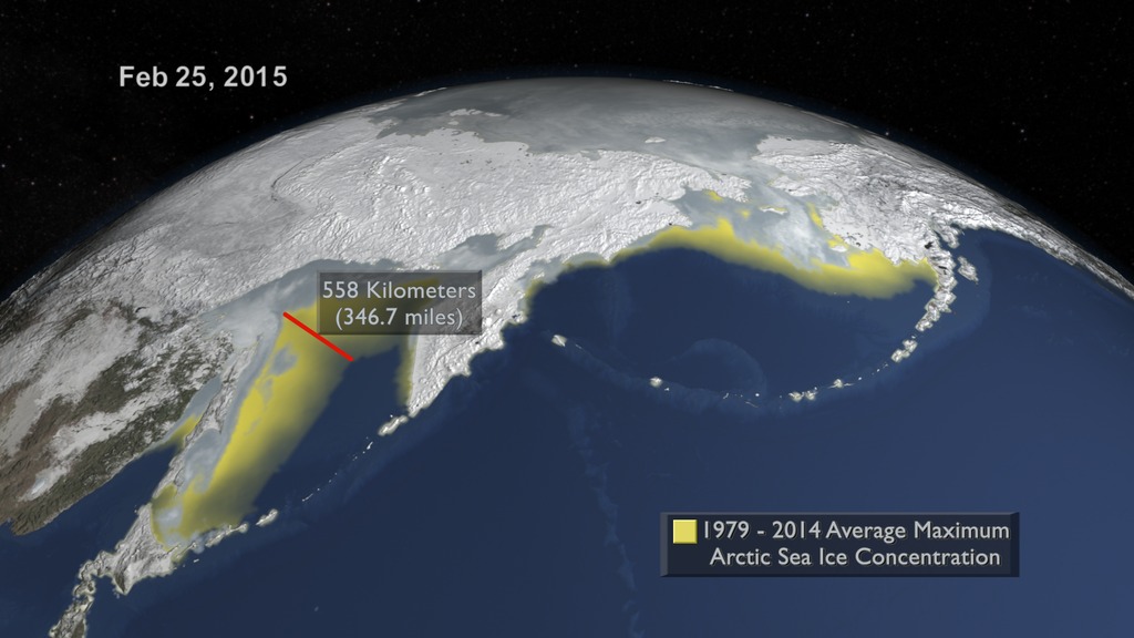
On February 25, 2015, the sea ice cap of the Arctic reached its annual maximum winter extent. At 5.61 million square miles, this year’s maximum extent was the smallest on the satellite record. Arctic sea ice, frozen seawater floating on top of the Arctic Ocean and its neighboring seas, is in constant change: it grows in the fall and winter, reaching its annual maximum between late February and early April, and then it shrinks in the spring and summer until it hits its annual minimum extent in September. The past decades have seen a downward trend in Arctic sea ice extent during both the growing and melting season, though the decline is steeper in the latter. Watch the video to see changes in Arctic sea ice observed from space leading up to this year’s record maximum.
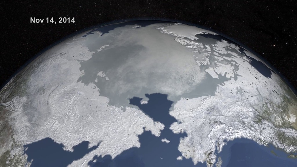
This visualization shows the bulk of the Arctic sea ice freeze cycle from Oct. 1, 2014, up to this year’s winter maximum on Feb. 25, 2015.
At 5.61 million square miles, this year's maximum is about 50,000 square miles below the previous lowest peak wintertime extent, reached in 2011.
The main player in the wintertime maximum extent is the seasonal ice at the edges of the ice pack, which is prone to shifting and heating by winds.
Areas colored yellow above show the difference in this year's sea ice pack to the average maximum coverage observed from 1979-2014.
For More Information
See NASA.gov
Credits
Please give credit for this item to:
NASA's Scientific Visualization Studio
-
Animator
-
Cindy Starr
(Global Science and Technology, Inc.)

-
Cindy Starr
(Global Science and Technology, Inc.)
-
Producers
- Jefferson Beck (USRA)
- Joy Ng (USRA)
-
Scientists
- Josefino Comiso (NASA/GSFC)
- Walt Meier (NASA/GSFC)
-
Writer
- Maria-Jose Vinas Garcia (Telophase)
Related
- ID: 4281
 Visualization
 - ID: 11816
 Produced Video
Release date
This page was originally published on Thursday, April 16, 2015.
This page was last updated on Wednesday, May 3, 2023 at 1:49 PM EDT.