GPM Looks Inside a Snow Storm
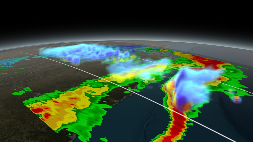
On March 17, 2014 the Global Precipitation Measurement (GPM) mission's Core Observatory flew over the East coast's last snow storm of the 2013-2014 winter season. This was also one of the first major snow storms observed by GPM shortly after it was launched on February 27, 2014.
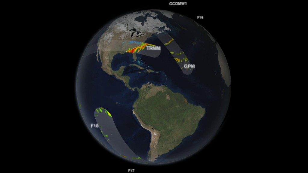
The GPM Core Observatory carries two instruments that show the location and intensity of rain and snow, which defines a crucial part of the storm structure – and how it will behave. The GPM Microwave Imager sees through the tops of clouds to observe how much and where precipitation occurs, and the Dual-frequency Precipitation Radar observes precise details of precipitation in 3-dimensions.
For forecasters, GPM's microwave and radar data are part of the toolbox of satellite data, including other low Earth orbit and geostationary satellites, that they use to monitor tropical cyclones and hurricanes.
Credits
Please give credit for this item to:
NASA's Goddard Space Flight Center
-
Animator
-
Alex Kekesi
(Global Science and Technology, Inc.)

-
Alex Kekesi
(Global Science and Technology, Inc.)
-
Video editor
- Ryan Fitzgibbons (USRA)
-
Narrator
- Rob Gutro (NASA/GSFC)
-
Producer
- Ryan Fitzgibbons (USRA)
-
Scientists
- Gail Skofronick Jackson (NASA/GSFC)
-
George Huffman
(NASA/GSFC)
-
Project support
- Aaron E. Lepsch (ADNET Systems, Inc.)
-
Writer
- Ellen T. Gray (ADNET Systems, Inc.)
Missions
This page is related to the following missions:Series
This page can be found in the following series:Tapes
The media on this page originally appeared on the following tapes:-
GPM Sees Snowstorm
(ID: 2014082)
Thursday, September 4, 2014 at 4:00AM
Related
- ID: 4173
 Visualization
 - ID: 4203
 Visualization
Release date
This page was originally published on Thursday, September 4, 2014.
This page was last updated on Wednesday, May 3, 2023 at 1:50 PM EDT.