Earth
ID: 4103
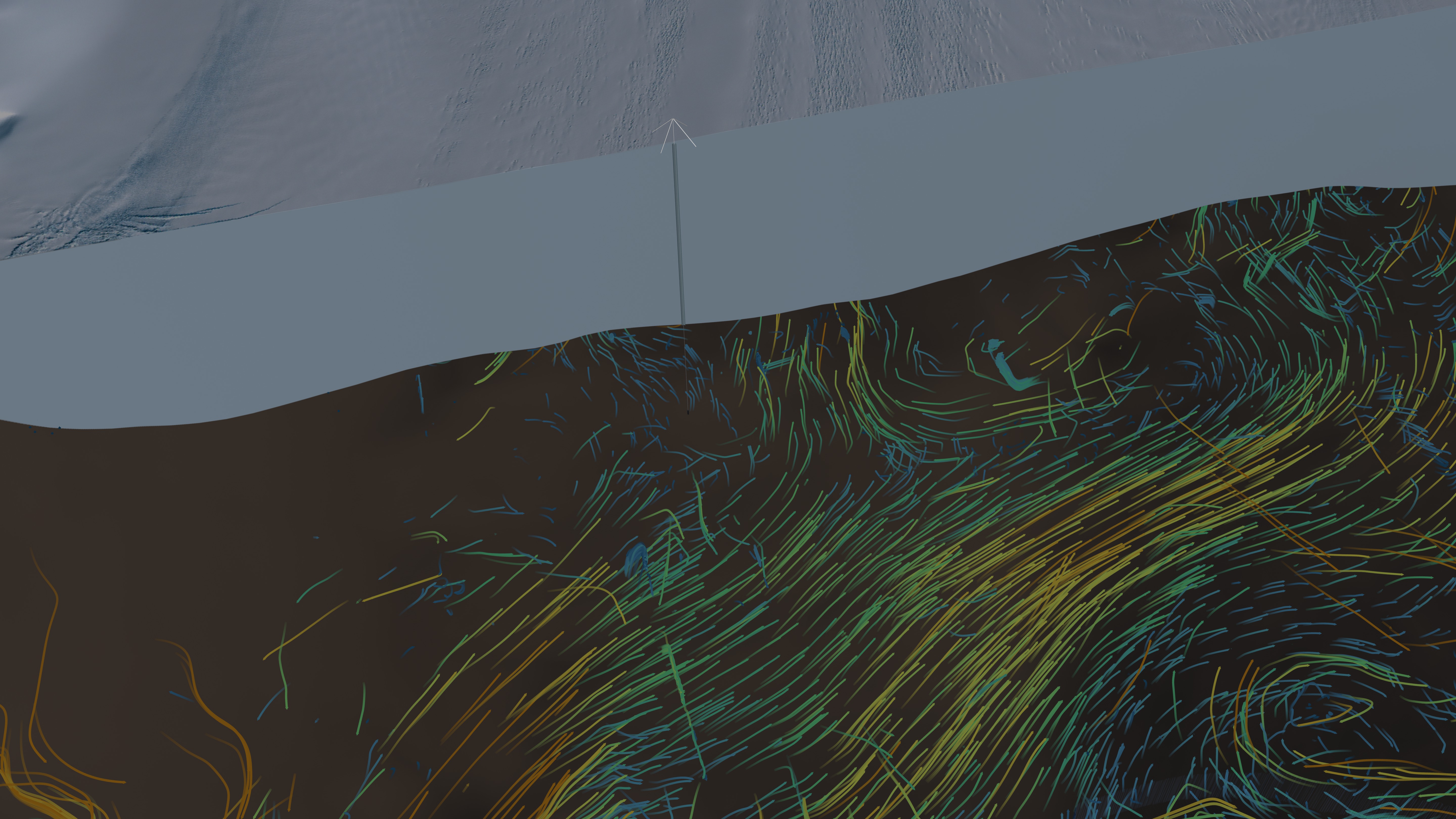
On the margins of Antarctica, an ice shelve acts as a dam slowing the movement of outlet glaciers flowing toward the sea. However, the ice shelves are exposed to the underlying ocean and may weaken as a result of warm ocean currents. Scientists recently completed an expedition to the ice shelf buffering the Pine Island glacier, a major outlet of the West Antarctic Ice Sheet that has rapidly thinned and accelerated in recent decades. Drilling a shaft through the ice shelf, they submerged instruments beneath the ice to measure ocean velocity, temperature, and salinity. Their observations revealed a 600-m-wide 80-m-deep channel cut into the underside of the ice-shelf that incurs melting beneath the ice shelf of 0.06 m per day. See the paper here for details.


Measuring beneath the Pine Island Ice Shelf
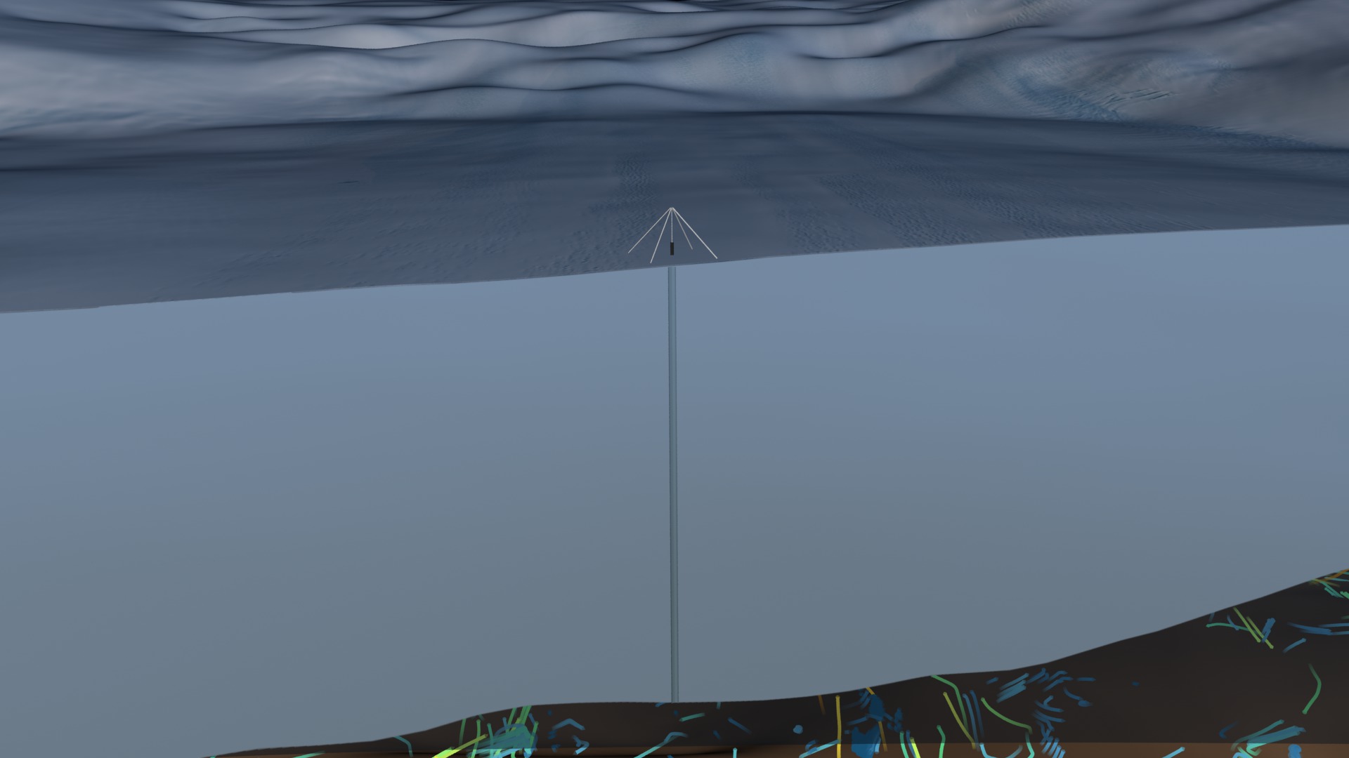
This animation shows the ocean currents colored by their velocity circulating around and under the Pine Island ice shelf. Orange and yellow indicate faster currents while green and blue depict slower. A small red marker indicates the location of the drill site. In this animation, the Pine Island ice shelf is temporarily sliced away to reveal the ocean flows under the ice and subsequently restored up to the location of the drill site. A shaft penetrates through the ice sheet and the instrument is lowered through the shaft into the water that flows beneath the ice shelf.
In this animation, the topography and ice shelf thickness is exaggerated by 15 times.
Visualization Credits
Cindy Starr (Global Science and Technology, Inc.): Lead Visualizer
Horace Mitchell (NASA/GSFC): Animator
Greg Shirah (NASA/GSFC): Animator
Jefferson Beck (USRA): Producer
T. P. Stanton (Naval Postgraduate School): Scientist
W. J. Shaw (Naval Postgraduate School): Scientist
Martin Truffer (University of Alaska): Scientist
H. F. J. Corr (British Antarctic Survey): Scientist
L. E. Peters (The Pennsylvania State University): Scientist
K. L. Riverman (The Pennsylvania State University): Scientist
Bob Bindschadler (NASA/GSFC): Scientist
D. M. Holland (New York University): Scientist
S. Anandakrishnan (The Pennsylvania State University): Scientist
Laurence Schuler (ADNET Systems, Inc.): Project Support
Ian Jones (ADNET Systems, Inc.): Project Support
Please give credit for this item to:
NASA's Goddard Space Flight Center Scientific Visualization Studio
NASA's Goddard Space Flight Center Scientific Visualization Studio
Science Paper:
T. P. Stanton1, W. J. Shaw1, M. Truffer2, H. F. J. Corr3, L. E. Peters4, K. L. Riverman4, R. Bindschadler5, D. M. Holland6, S. Anandakrishnan4, "Channelized Ice Melting in the Ocean Boundary Layer Beneath Pine Island Glacier, Antarctica", Science 13 September 2013: Vol. 341 no. 6151 pp. 1236-1239.
Short URL to share this page:
https://svs.gsfc.nasa.gov/4103
Mission:
Landsat
Data Used:
Note: While we identify the data sets used in these visualizations, we do not store any further details nor the data sets themselves on our site.
Keywords:
SVS >> HDTV
DLESE >> Physical oceanography
GCMD >> Earth Science >> Cryosphere >> Glaciers/Ice Sheets
GCMD >> Earth Science >> Hydrosphere >> Glaciers/Ice Sheets
GCMD >> Earth Science >> Oceans >> Ocean Circulation
GCMD >> Earth Science >> Cryosphere >> Glaciers/Ice Sheets >> Glacier Thickness/Ice Sheet Thickness
GCMD >> Earth Science >> Hydrosphere >> Glaciers/Ice Sheets >> Glacier Thickness/Ice Sheet Thickness
GCMD >> Earth Science >> Hydrosphere >> Glaciers/Ice Sheets >> Glaciers
GCMD >> Earth Science >> Oceans >> Ocean Circulation >> Ocean Currents
SVS >> Glaciers
NASA Science >> Earth
GCMD keywords can be found on the Internet with the following citation: Olsen, L.M., G. Major, K. Shein, J. Scialdone, S. Ritz, T. Stevens, M. Morahan, A. Aleman, R. Vogel, S. Leicester, H. Weir, M. Meaux, S. Grebas, C.Solomon, M. Holland, T. Northcutt, R. A. Restrepo, R. Bilodeau, 2013. NASA/Global Change Master Directory (GCMD) Earth Science Keywords. Version 8.0.0.0.0
T. P. Stanton1, W. J. Shaw1, M. Truffer2, H. F. J. Corr3, L. E. Peters4, K. L. Riverman4, R. Bindschadler5, D. M. Holland6, S. Anandakrishnan4, "Channelized Ice Melting in the Ocean Boundary Layer Beneath Pine Island Glacier, Antarctica", Science 13 September 2013: Vol. 341 no. 6151 pp. 1236-1239.
Short URL to share this page:
https://svs.gsfc.nasa.gov/4103
Mission:
Landsat
Data Used:
Landsat-7/ETM+/Landsat Image Mosaic of Antarctica also referred to as: LIMA
Mosaic - NASA/GSFC, British Antarctic Survey, USGS EROS Data Center
Mosaicing to avoid clouds produced a high quality, nearly cloud-free benchmark data set of Antarctica for the International Polar Year from images collected primarily during 1999-2003.
ECCO3 High Resolution Ocean and Sea Ice Model
Model - NASA/JPLKeywords:
SVS >> HDTV
DLESE >> Physical oceanography
GCMD >> Earth Science >> Cryosphere >> Glaciers/Ice Sheets
GCMD >> Earth Science >> Hydrosphere >> Glaciers/Ice Sheets
GCMD >> Earth Science >> Oceans >> Ocean Circulation
GCMD >> Earth Science >> Cryosphere >> Glaciers/Ice Sheets >> Glacier Thickness/Ice Sheet Thickness
GCMD >> Earth Science >> Hydrosphere >> Glaciers/Ice Sheets >> Glacier Thickness/Ice Sheet Thickness
GCMD >> Earth Science >> Hydrosphere >> Glaciers/Ice Sheets >> Glaciers
GCMD >> Earth Science >> Oceans >> Ocean Circulation >> Ocean Currents
SVS >> Glaciers
NASA Science >> Earth
GCMD keywords can be found on the Internet with the following citation: Olsen, L.M., G. Major, K. Shein, J. Scialdone, S. Ritz, T. Stevens, M. Morahan, A. Aleman, R. Vogel, S. Leicester, H. Weir, M. Meaux, S. Grebas, C.Solomon, M. Holland, T. Northcutt, R. A. Restrepo, R. Bilodeau, 2013. NASA/Global Change Master Directory (GCMD) Earth Science Keywords. Version 8.0.0.0.0


