Planets and Moons
ID: 3582
An updated version of this animation is available here.
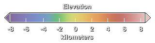
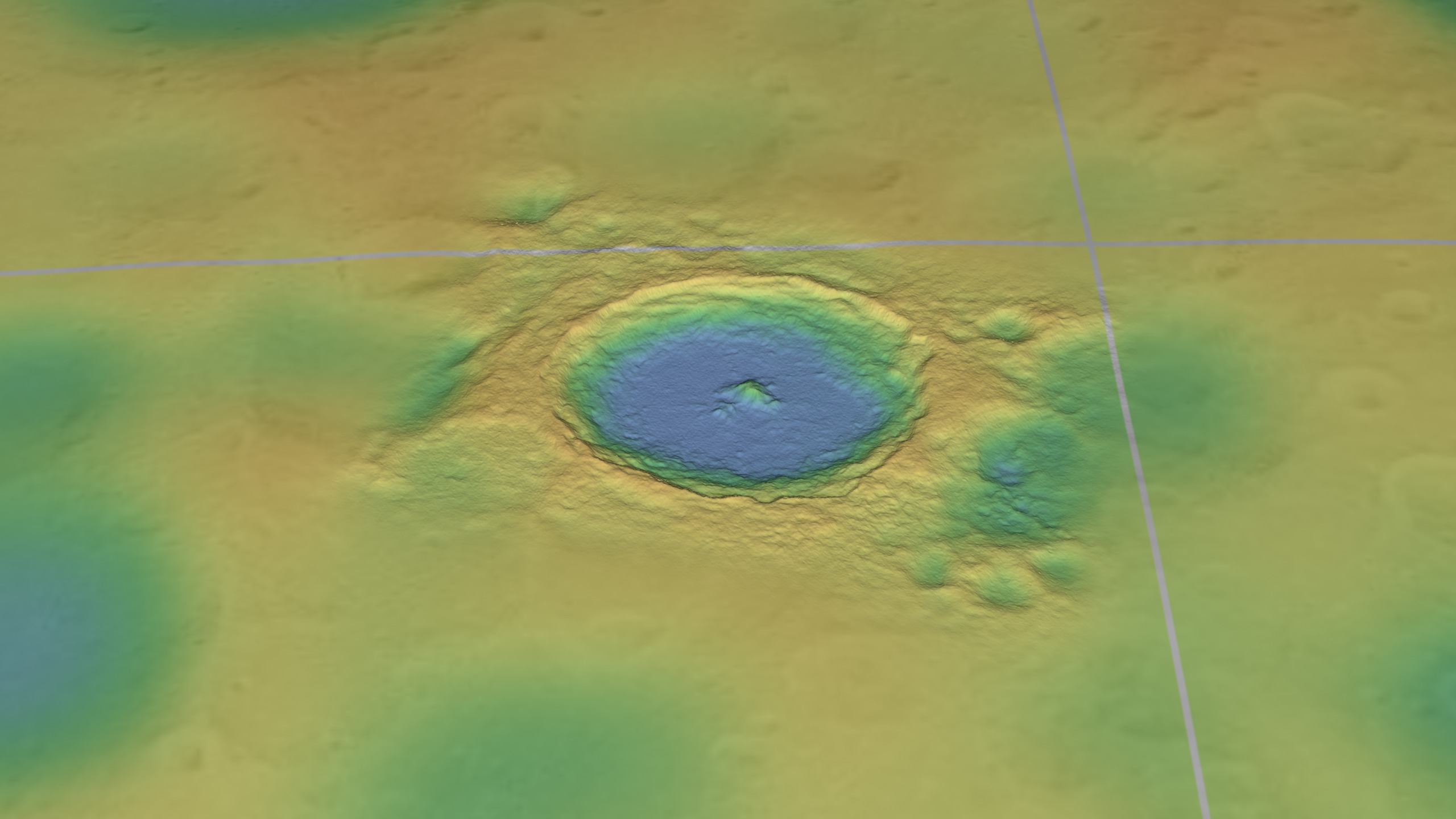
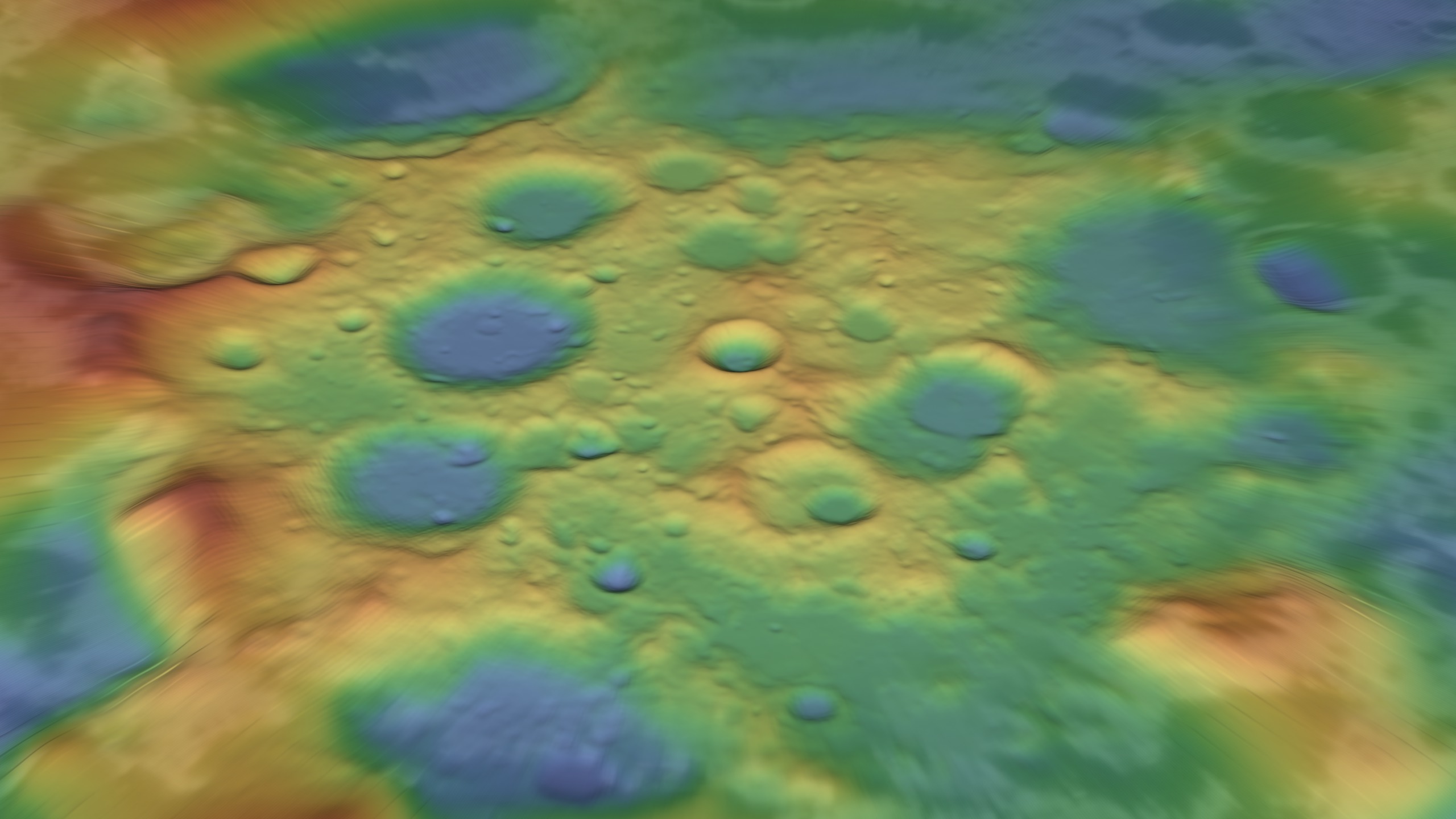
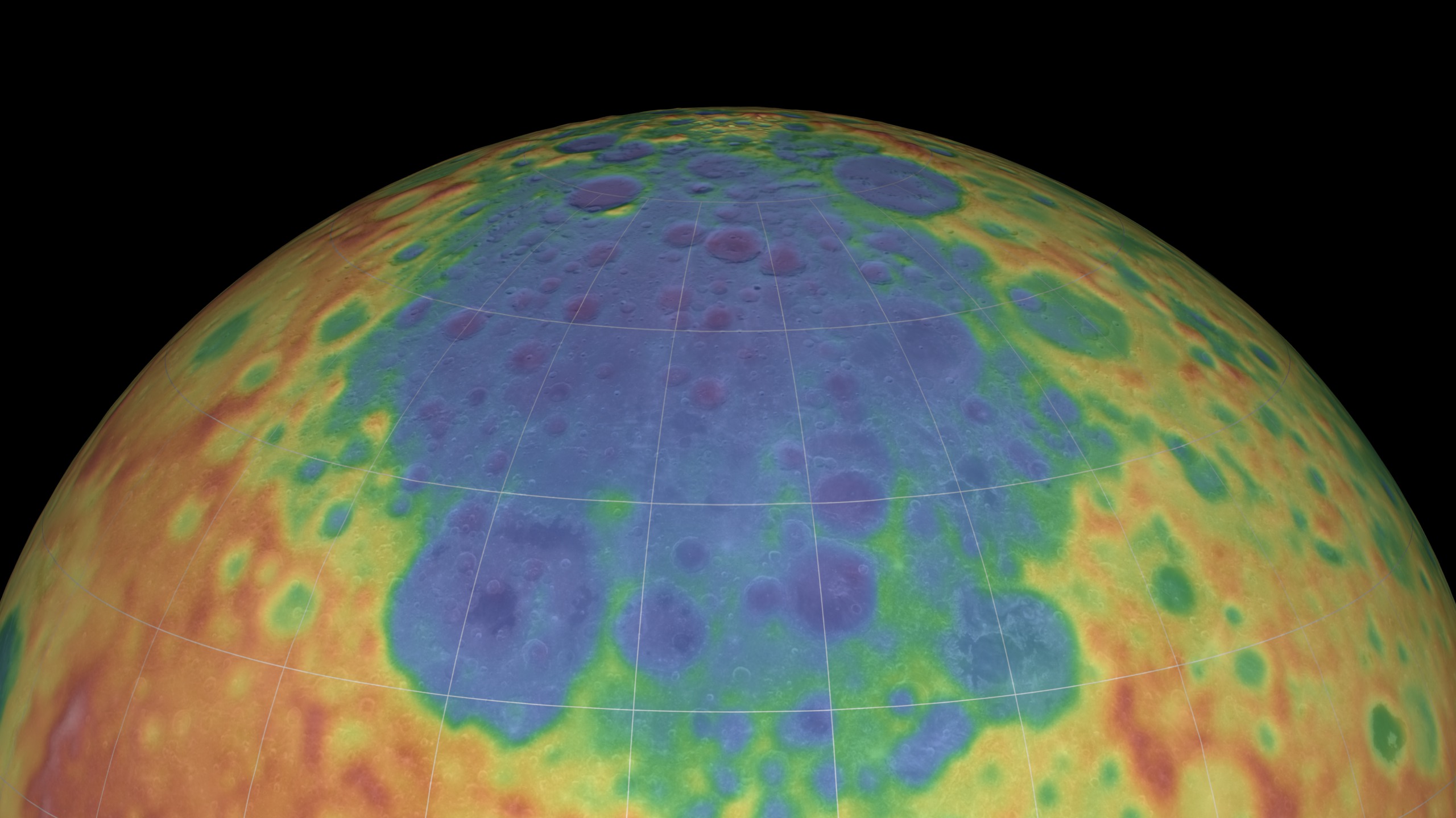
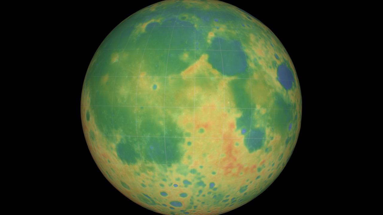
Lunar Topography in False Color
This animation is a brief tour of several prominent features of the Moon's terrain: Tycho crater, the south pole, and the South Pole-Aitken basin. The height of the terrain is color-coded, with blues and greens representing low altitudes and reds representing high altitudes. The view is match-moved to a companion piece showing the Moon in natural colors.
The elevation map comprises low-resolution data from a number of sources, including the Clementine and JAXA/SELENE spacecraft, combined with high-resolution insets for Tycho and the region near the south pole. One of the goals of the Lunar Reconnaissance Orbiter mission is the creation of a high-resolution elevation map of the entire surface of the Moon.
For More Information
Visualization Credits
Ernie Wright (UMBC): Lead Animator
Marte Newcombe (GST): Animator
Andrew Freeberg (NASA/GSFC): Producer
James Garvin (NASA/GSFC): Scientist
Marte Newcombe (GST): Animator
Andrew Freeberg (NASA/GSFC): Producer
James Garvin (NASA/GSFC): Scientist
Please give credit for this item to:
NASA/Goddard Space Flight Center Scientific Visualization Studio. Some elevation data provided by JAXA/SELENE.
NASA/Goddard Space Flight Center Scientific Visualization Studio. Some elevation data provided by JAXA/SELENE.
Short URL to share this page:
https://svs.gsfc.nasa.gov/3582
Data Used:
Note: While we identify the data sets used in these visualizations, we do not store any further details nor the data sets themselves on our site.
This item is part of these series:
The Moon
LRO Pre-launch
Goddard TV Tape:
G2009-030 -- LRO Pre-Launch Resource Tape
Keywords:
SVS >> Elevation data
SVS >> False Color
SVS >> HDTV
SVS >> Moon
SVS >> South Pole
SVS >> Lunar Reconnaissance Orbiter
SVS >> For Educators
SVS >> Lunar Surface
SVS >> Lunar Topography
SVS >> Lunar Elevation Map
SVS >> Tycho Crater
SVS >> Aitken Basin
NASA Science >> Planets and Moons
https://svs.gsfc.nasa.gov/3582
Data Used:
KAGUYA/Laser Altimeter (LALT)/DEM
JAXA - 2007-12-30 to 2008-03-31
Formerly known as "SELENE".
Tycho DEM
1998Unified Lunar Control Network 2005 also referred to as: ULCN 2005
Data Compilation - USGS - 1970 to 2005
The ULCN 2005 (Unified Lunar Control Network 2005) is a lunar control point network that precisely measured 272,931 pieces of data produced by the USGS using existing lunar imagery or data from the Clementine and other observations.
This item is part of these series:
The Moon
LRO Pre-launch
Goddard TV Tape:
G2009-030 -- LRO Pre-Launch Resource Tape
Keywords:
SVS >> Elevation data
SVS >> False Color
SVS >> HDTV
SVS >> Moon
SVS >> South Pole
SVS >> Lunar Reconnaissance Orbiter
SVS >> For Educators
SVS >> Lunar Surface
SVS >> Lunar Topography
SVS >> Lunar Elevation Map
SVS >> Tycho Crater
SVS >> Aitken Basin
NASA Science >> Planets and Moons


