Earth
ID: 906
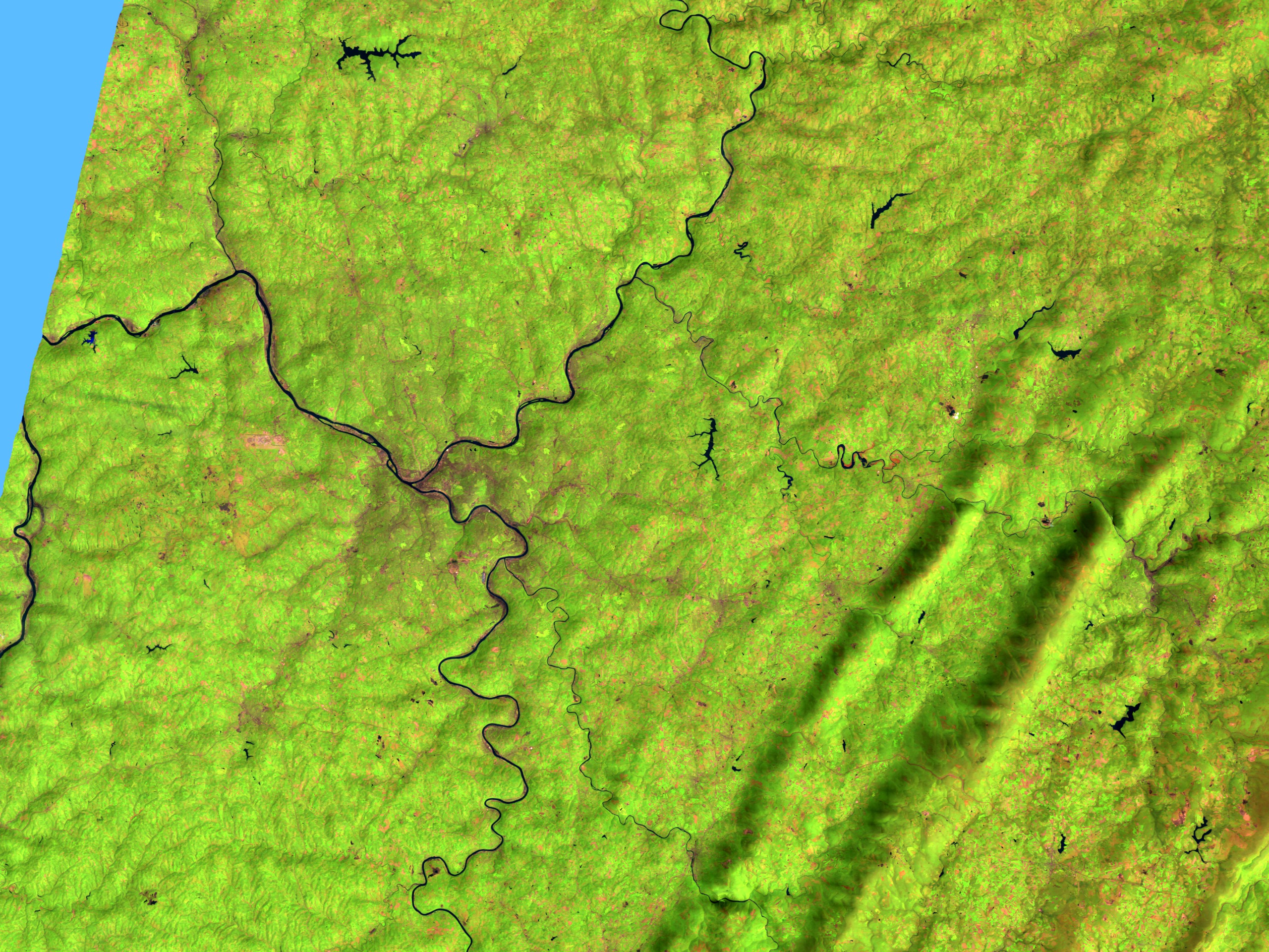
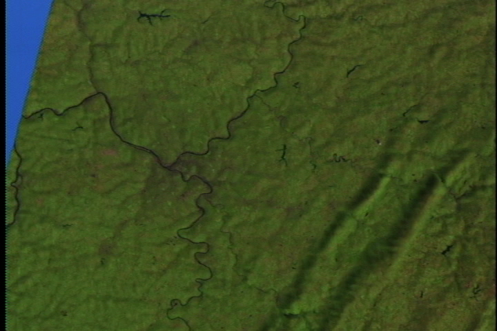
These scenes show Pittsburgh and the countryside around it as seen by the Landsat Thematic Mapper (TM) instrument. Pittsburgh is built around the confluence of the Monongahela and Allegheny Rivers which join in the city to form the Ohio River. The terrain of the area is also shown exaggerated by a factor of three to emphasis terrain features such as the Appalachian Mountains and the river valleys. In the countryside image, north is up, the Monongahela River runs in from the south into the city while the Allegheny comes in from the north and the Ohio runs westward (to the left) out to the scene's edge. The image of the city appears from the perspective of a viewer above the Allegheny River looking southwards towards the city.

Pittsburgh (542) With Terrain Data, x 3 Exaggeration
The shortwave infrared (TM band 5), infrared (TM band 4), and visible green (TM band 2) channels are displayed in the images as red, green, and blue respectively. In this combination, barren and/or recently cultivated land appears red to pink, vegetation appears green, water is dark blue, and artificial structures of concrete and asphalt appear dark gray or black.
For More Information
Visualization Credits
Please give credit for this item to:
NASA/Goddard Space Flight Center Scientific Visualization Studio
NASA/Goddard Space Flight Center Scientific Visualization Studio
Short URL to share this page:
https://svs.gsfc.nasa.gov/906
Mission:
Landsat
Data Used:
Note: While we identify the data sets used in these visualizations, we do not store any further details nor the data sets themselves on our site.
This item is part of this series:
USCities
Goddard TV Tape:
G1999-021
Keywords:
DLESE >> Human geography
DLESE >> Physical geography
GCMD >> Location >> Pennsylvania
NASA Science >> Earth
GCMD keywords can be found on the Internet with the following citation: Olsen, L.M., G. Major, K. Shein, J. Scialdone, S. Ritz, T. Stevens, M. Morahan, A. Aleman, R. Vogel, S. Leicester, H. Weir, M. Meaux, S. Grebas, C.Solomon, M. Holland, T. Northcutt, R. A. Restrepo, R. Bilodeau, 2013. NASA/Global Change Master Directory (GCMD) Earth Science Keywords. Version 8.0.0.0.0
https://svs.gsfc.nasa.gov/906
Mission:
Landsat
Data Used:
Landsat-5/TM
1993/05/14DTED Level 1 (3 arc second)
Model - USGSThis item is part of this series:
USCities
Goddard TV Tape:
G1999-021
Keywords:
DLESE >> Human geography
DLESE >> Physical geography
GCMD >> Location >> Pennsylvania
NASA Science >> Earth
GCMD keywords can be found on the Internet with the following citation: Olsen, L.M., G. Major, K. Shein, J. Scialdone, S. Ritz, T. Stevens, M. Morahan, A. Aleman, R. Vogel, S. Leicester, H. Weir, M. Meaux, S. Grebas, C.Solomon, M. Holland, T. Northcutt, R. A. Restrepo, R. Bilodeau, 2013. NASA/Global Change Master Directory (GCMD) Earth Science Keywords. Version 8.0.0.0.0


