Earth
ID: 4984
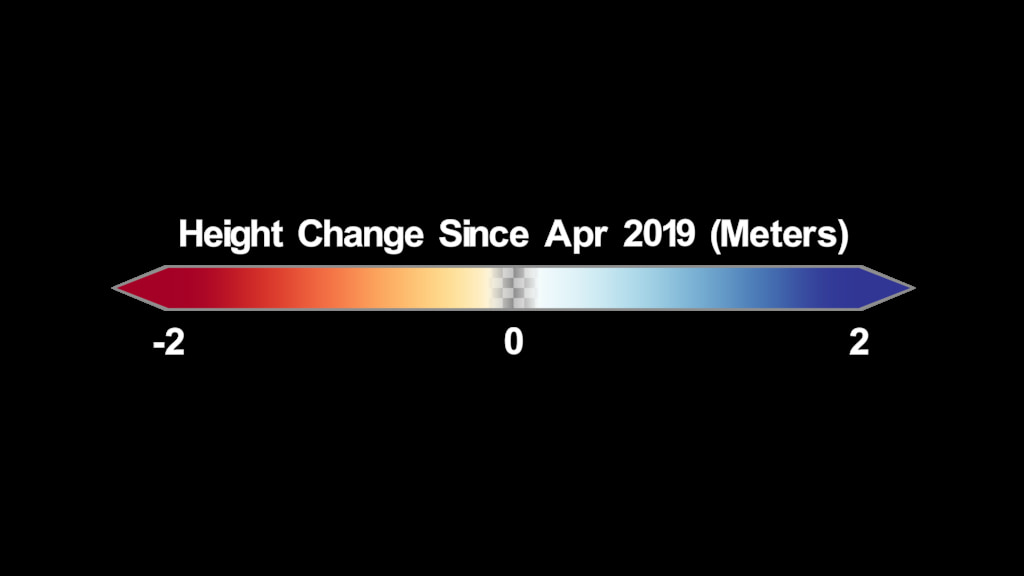
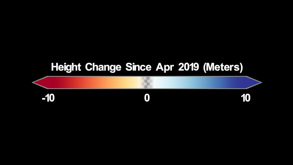
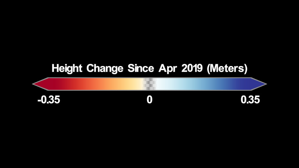
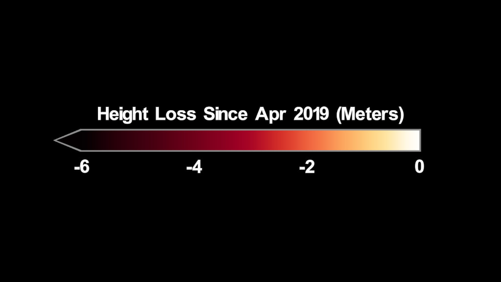
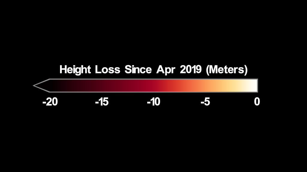
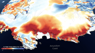
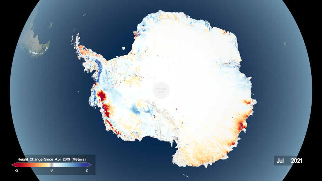
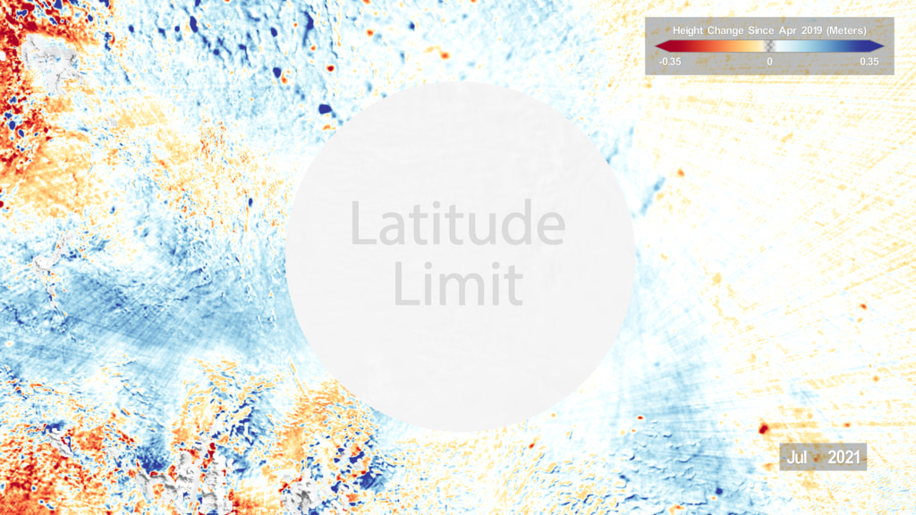
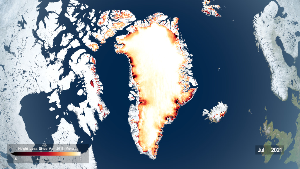
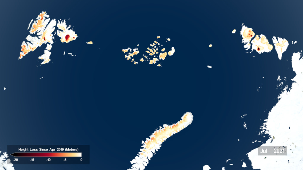
NASA’s ICESat-2 satellite measures the elevation of Earth’s surfaces – and two data products from the mission map the height of Antarctic and Greenland ice sheets, as well as how those ice sheets change over time. The ICESat-2 ATL14 data product provides a reference ice sheet surface corresponding to the ice sheet elevation in April 2019, while ATL15 provides elevation changes to that surface through time. These products are re-generated every 91 days, which is how long it takes ICESat-2 to complete its 1,387 unique orbits and collect a complete grid of measurements. Every time ATL14 and 15 are regenerated, all of the data over the life of the mission is used to improve the April 2019 standard, and best represent how the ice sheets are changing. ATL14 is posted at 100m resolution, and ATL15 is posted at 1 km resolution at one month time resolution.
ICESat-2 Land Ice Height Change
Related
Visualization Credits
Kel Elkins (USRA): Lead Visualizer
Ryan Fitzgibbons (KBR Wyle Services, LLC): Lead Producer
Benjamin E. Smith (University of Washington Applied Physics Lab Polar Science Center): Scientist
Thomas A. Neumann (NASA/GSFC): Scientist
Kate Ramsayer (Telophase): Writer
Ian Jones (ADNET Systems, Inc.): Technical Support
Laurence Schuler (ADNET Systems, Inc.): Technical Support
Please give credit for this item to:
NASA's Scientific Visualization Studio
NASA's Scientific Visualization Studio
Short URL to share this page:
https://svs.gsfc.nasa.gov/4984
Data Used:
Note: While we identify the data sets used in these visualizations, we do not store any further details nor the data sets themselves on our site.
Keywords:
SVS >> Hyperwall
NASA Science >> Earth
SVS >> ICESat-2
https://svs.gsfc.nasa.gov/4984
Data Used:
ICESat-2/Advanced Topographic Laser Altimeter System (ATLAS)
4/2019-7/2021Keywords:
SVS >> Hyperwall
NASA Science >> Earth
SVS >> ICESat-2


