NASA Mission Maps 16 Years of Ice Loss
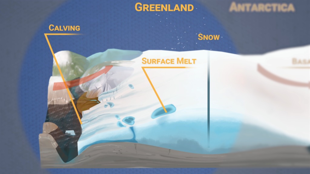
Using the most advanced Earth-observing laser instrument NASA has ever flown in space, scientists have made precise, detailed measurements of how the elevation of the Greenland and Antarctic ice sheets have changed over 16 years.
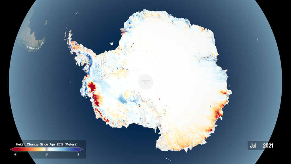
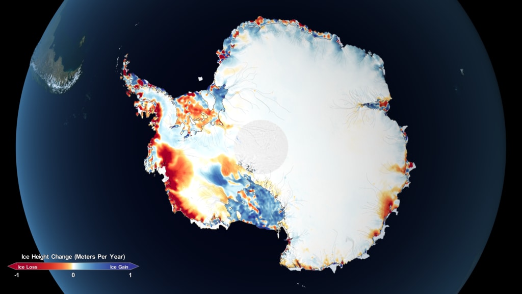
The results provide insights into how the polar ice sheets are changing, demonstrating definitively that small gains of ice in East Antarctica are dwarfed by massive losses in West Antarctica. The scientists found the net loss of ice from Antarctica, along with Greenland’s shrinking ice sheet, has been responsible for 0.55 inches (14 millimeters) of sea level rise between 2003 and 2019 – slightly less than a third of the total amount of sea level rise observed in the world’s oceans.
Credits
Please give credit for this item to:
NASA's Goddard Space Flight Center
-
Producer
- Ryan Fitzgibbons (USRA)
-
Writer
- Kate Ramsayer (Telophase)
-
Scientists
- Thomas A. Neumann (NASA/GSFC)
- Benjamin E. Smith (University of Washington Applied Physics Lab Polar Science Center)
- Helen Amanda Fricker (Scripps Institution of Oceanography, University of California, San Diego)
- Alex S. Gardner (NASA/JPL CalTech)
-
Visualizer
- Kel Elkins (USRA)
-
Editor
- Ryan Fitzgibbons (USRA)
-
Narrator
- LK Ward (USRA)
-
Animator
- Adriana Manrique Gutierrez (USRA)
-
Videographer
- Jefferson Beck (USRA)
Release date
This page was originally published on Thursday, April 30, 2020.
This page was last updated on Wednesday, May 3, 2023 at 1:44 PM EDT.
Series
This visualization can be found in the following series:Related
- ID: 4984
 Visualization
Sources
- ID: 4796
 Visualization
 - ID: 12977
 Produced Video
 - ID: 3849
 Visualization