Normalized Differential Vegetation Index critical to Agricultural Monitoring in the United States
New satellite technologies offer enhanced capabilities for early forecasting of food production at national, regional, and global scales. The Group on Earth Observations (GEO) Global Agricultural Monitoring (GEOGLAM) program aims to strengthen national capacity in all countries from freely available data.
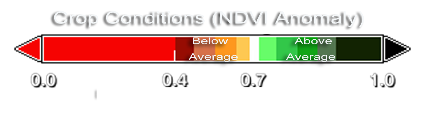
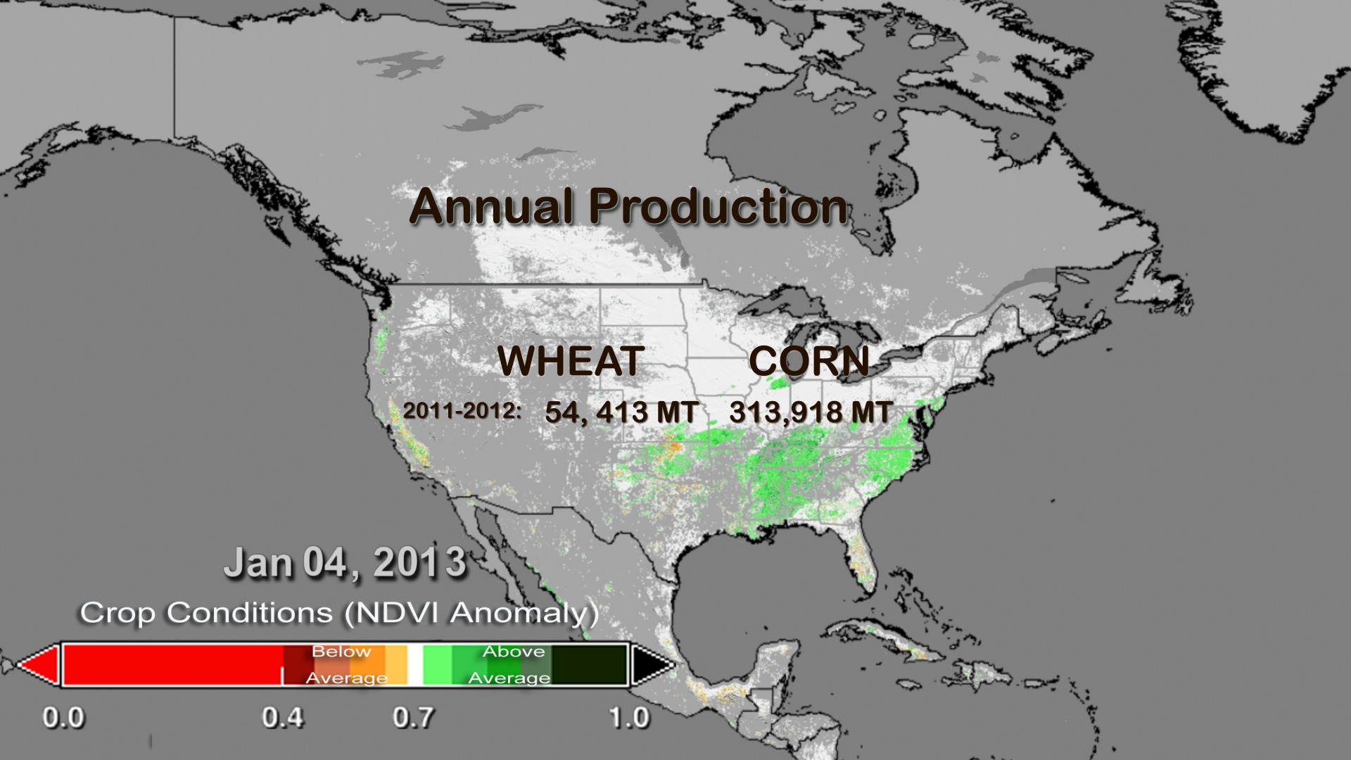
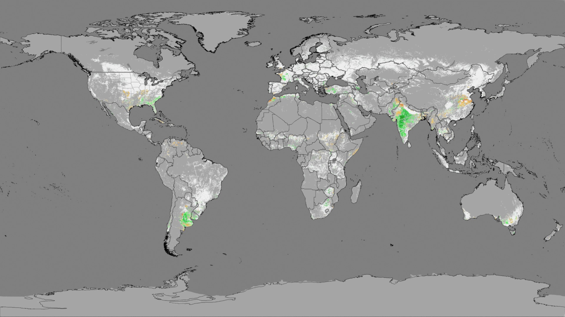
These visuals show MODIS' satellite-derived crop NDVI Anomaly relative to average (2000-2011). Orange and brown indicate crop with below average conditions. Green indicates crop with above averate conditions. The visual compares the crop conditions or NDVI anomaly from year 2011-2012 to year 2012-2013. In the 2012-2013 year 7,342 more metric tons (MT) of wheat were produced then in the previous year, but 40,086 fewer metric tons of corn were produced.
Related Documentation
Visualization Credits
Jefferson Beck (USRA): Producer
Chris Justice (University of Maryland): Scientist
Inbal Becker Reshef (University of Maryland): Scientist
Eric Vermote (NASA/GSFC): Scientist
NASA/Goddard Space Flight Center Scientific Visualization Studio
https://svs.gsfc.nasa.gov/4072
Data Used:
Terra and Aqua/MODIS/Normalized Difference Vegetation Index (NDVI) also referred to as: NDVI
NASA - 2000 - 2011This item is part of this series:
Agriculture Campaign: Land Use Change, Climate Change, Agriculture Monitoring, and Food Security
Keywords:
DLESE >> Forestry
DLESE >> Natural hazards
DLESE >> Soil science
GCMD >> Earth Science >> Agriculture
GCMD >> Earth Science >> Agriculture >> Agricultural Aquatic Sciences
GCMD >> Earth Science >> Agriculture >> Agricultural Engineering
GCMD >> Earth Science >> Agriculture >> Agricultural Plant Science
GCMD >> Earth Science >> Agriculture >> Forest Science
GCMD >> Earth Science >> Agriculture >> Soils
GCMD >> Earth Science >> Agriculture >> Agricultural Aquatic Sciences >> Aquaculture
GCMD >> Earth Science >> Agriculture >> Agricultural Engineering >> Farm Structures
GCMD >> Earth Science >> Agriculture >> Agricultural Plant Science >> Crop/Plant Yields
GCMD >> Earth Science >> Agriculture >> Agricultural Plant Science >> Irrigation
GCMD >> Earth Science >> Agriculture >> Agricultural Plant Science >> Reclamation/Revegetation/Restoration
GCMD >> Earth Science >> Agriculture >> Forest Science >> Reforestation
GCMD >> Earth Science >> Agriculture >> Soils >> Soil Moisture/Water Content
SVS >> Hyperwall
NASA Science >> Earth
GCMD keywords can be found on the Internet with the following citation: Olsen, L.M., G. Major, K. Shein, J. Scialdone, S. Ritz, T. Stevens, M. Morahan, A. Aleman, R. Vogel, S. Leicester, H. Weir, M. Meaux, S. Grebas, C.Solomon, M. Holland, T. Northcutt, R. A. Restrepo, R. Bilodeau, 2013. NASA/Global Change Master Directory (GCMD) Earth Science Keywords. Version 8.0.0.0.0


