Deforestation in Rondonia, Brazil
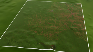
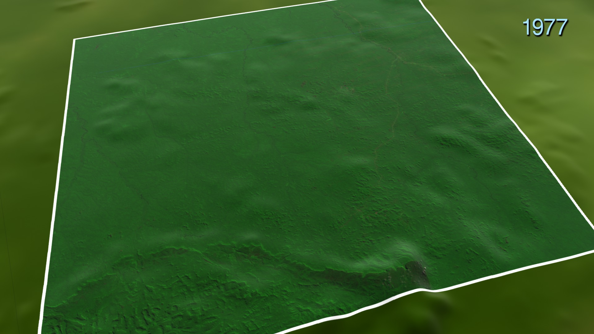
Deforestation in Rondonia in the 1970s until the 1990s had a distinctive "fishbone" pattern. Access to this remote region began with a major road cutting through the dense tropical forest, opening up new territory for small farms and ranches. Then, other roads developed at right angles to the initial road. In this visualization, these roads shoot off a stretch of the main "backbone" road for about 31 miles (~50 kilometers) long, each secondary road branching off about every 2.5 (~4 kilometers). This creates the "fishbone" pattern.
Even with the deforestation, Brazil is still home to more than a quarter of Earth's tropical forests. In addition to their astounding biodiversity, these forests act as a major carbon "sink." These are places where carbon dioxide in the atmosphere is absorbed by living things, like trees and plants, and thus the carbon is said to be trapped or sequestered. With increasing carbon dioxide levels around the world, the ability of these forests to hold onto carbon has beneficial implications for stabilizing the world's climate.
NASA and the U.S. Department of the Interior through the U.S. Geological Survey (USGS) jointly manage Landsat, and the USGS preserves a 40-year archive of Landsat images that is freely available over the Internet. The next Landsat satellite, now known as the Landsat Data Continuity Mission (LDCM) and later to be called Landsat 8, is scheduled for launch in 2013.
Related
Visualization Credits
Alex Kekesi (Global Science and Technology, Inc.): Animator
Horace Mitchell (NASA/GSFC): Animator
Matthew R. Radcliff (USRA): Producer
Aries Keck (ADNET Systems, Inc.): Writer
NASA/Goddard Space Flight Center Scientific Visualization Studio
https://svs.gsfc.nasa.gov/3967
Missions:
Landsat
Terra
Data Used:
Terra and Aqua/MODIS/Blue Marble Land Cover
The Blue Marble data is courtesy of Reto Stockli (NASA/GSFC).
Keywords:
SVS >> HDTV
SVS >> Landsat
GCMD >> Earth Science >> Human Dimensions >> Habitat Conversion/Fragmentation >> Deforestation
GCMD >> Location >> Brazil
SVS >> Hyperwall
SVS >> Rainforest
NASA Science >> Earth
GCMD keywords can be found on the Internet with the following citation: Olsen, L.M., G. Major, K. Shein, J. Scialdone, S. Ritz, T. Stevens, M. Morahan, A. Aleman, R. Vogel, S. Leicester, H. Weir, M. Meaux, S. Grebas, C.Solomon, M. Holland, T. Northcutt, R. A. Restrepo, R. Bilodeau, 2013. NASA/Global Change Master Directory (GCMD) Earth Science Keywords. Version 8.0.0.0.0


