Earth
ID: 3552
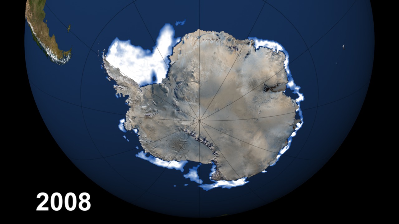
This visualization shows Antarctic sea ice minima from 1979 through 2008. Near the end of each southern hemisphere summer (usually in February), the Antarctic sea ice cover reaches its minimum extent and what is left is called the perennial ice cover which consists mainly of thick multi-year ice floes.
Yearly Antarctic Sea Ice Minima from 1979 through 2008
Visualization Credits
Please give credit for this item to:
NASA/Goddard Space Flight Center Scientific Visualization Studio Thanks to Rob Gerston (GSFC) for providing the data.
NASA/Goddard Space Flight Center Scientific Visualization Studio Thanks to Rob Gerston (GSFC) for providing the data.
Short URL to share this page:
https://svs.gsfc.nasa.gov/3552
Data Used:
Note: While we identify the data sets used in these visualizations, we do not store any further details nor the data sets themselves on our site.
Keywords:
DLESE >> Cryology
SVS >> HDTV
GCMD >> Earth Science >> Cryosphere >> Sea Ice
GCMD >> Earth Science >> Cryosphere >> Sea Ice >> Sea Ice Concentration
SVS >> iPod
NASA Science >> Earth
GCMD keywords can be found on the Internet with the following citation: Olsen, L.M., G. Major, K. Shein, J. Scialdone, S. Ritz, T. Stevens, M. Morahan, A. Aleman, R. Vogel, S. Leicester, H. Weir, M. Meaux, S. Grebas, C.Solomon, M. Holland, T. Northcutt, R. A. Restrepo, R. Bilodeau, 2013. NASA/Global Change Master Directory (GCMD) Earth Science Keywords. Version 8.0.0.0.0
https://svs.gsfc.nasa.gov/3552
Data Used:
DMSP/SSM/I
SSMI sea ice data: 1979/02/17, 1980/03/01, 1981/02/18, 1982/02/21, 1983/02/24, 1984/02/19, 1985/02/19, 1986/02/28, 1987/02/21, 1988/02/24, 1989/02/16, 1990/02/21, 1991/02/28, 1992/02/21, 1993/02/14, 1994/02/11, 1995/02/14, 1996/02/20, 1997/02/19, 1998/02/17, 1999/02/21, 2000/02/16, 2001/02/19, 2002/02/16, 2003/02/16, 2004/02/20, 2005/02/14, 2006/02/19, 2007/02/19, 2008/02/16
Defense Meteorological Satellite Program Special Sensor Microwave Imager
Comiso's Daily Sea Ice Concentration
Data Compilation - NASA/GSFCKeywords:
DLESE >> Cryology
SVS >> HDTV
GCMD >> Earth Science >> Cryosphere >> Sea Ice
GCMD >> Earth Science >> Cryosphere >> Sea Ice >> Sea Ice Concentration
SVS >> iPod
NASA Science >> Earth
GCMD keywords can be found on the Internet with the following citation: Olsen, L.M., G. Major, K. Shein, J. Scialdone, S. Ritz, T. Stevens, M. Morahan, A. Aleman, R. Vogel, S. Leicester, H. Weir, M. Meaux, S. Grebas, C.Solomon, M. Holland, T. Northcutt, R. A. Restrepo, R. Bilodeau, 2013. NASA/Global Change Master Directory (GCMD) Earth Science Keywords. Version 8.0.0.0.0


