Earth
ID: 3537
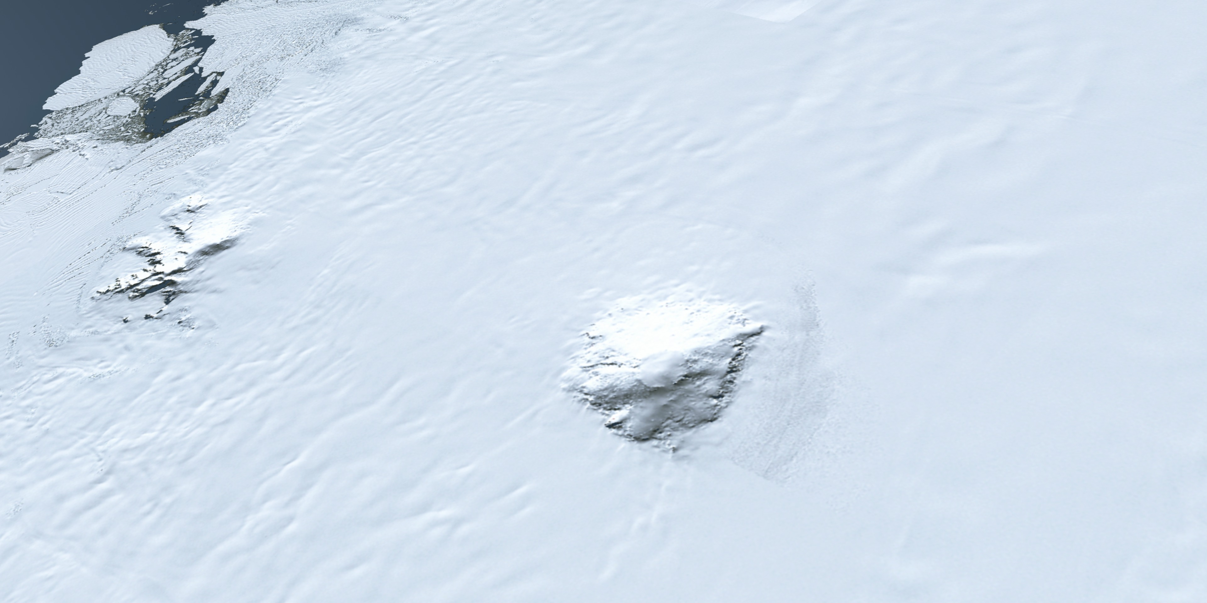
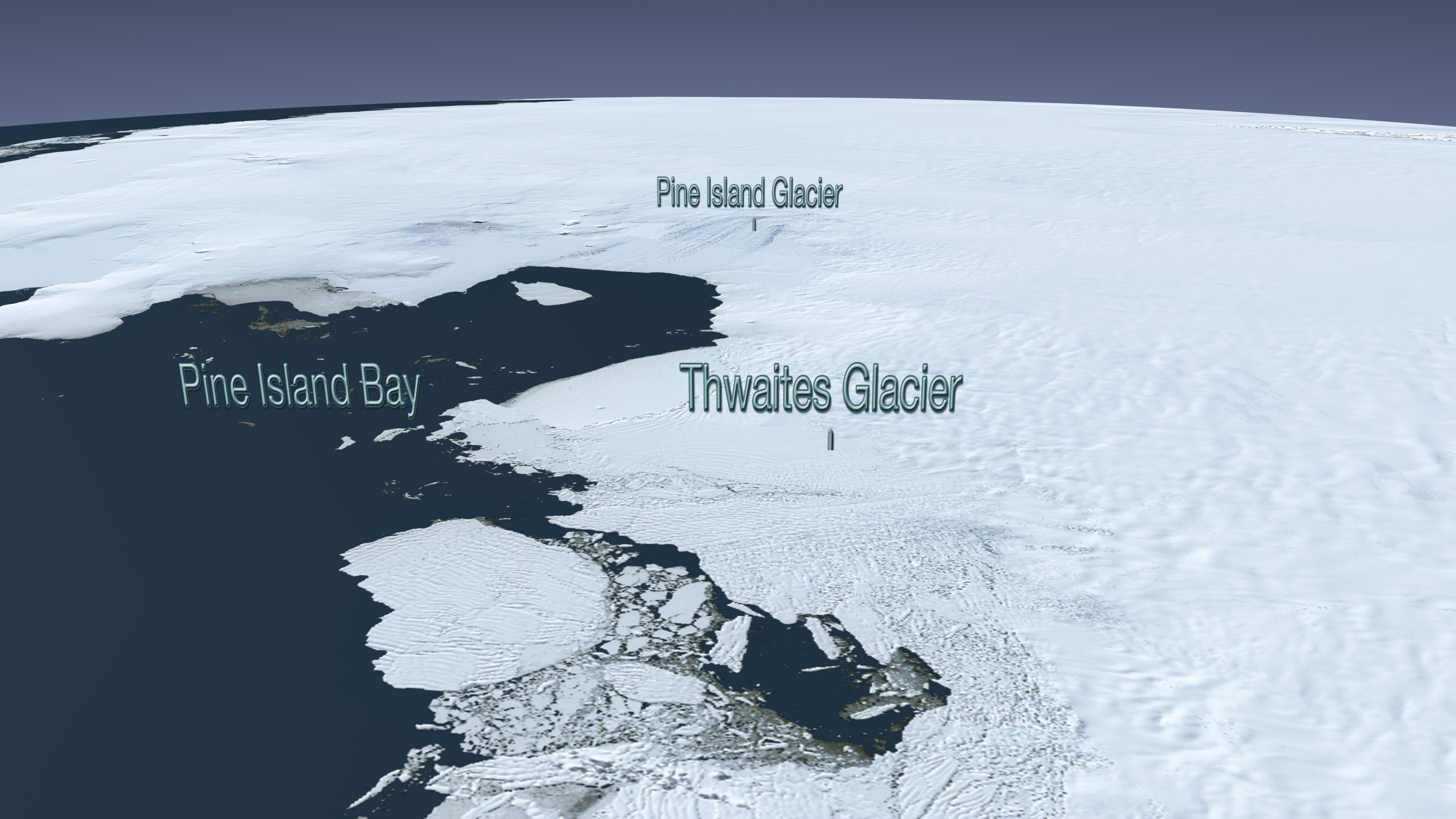
The Landsat Image Mosaic of Antarctica (LIMA) is a data product funded by the National Science Foundation (NSF) and jointly produced by the U.S. Geological Survey (USGS), the British Antarctic Survey (BAS), and the National Aeronautics and Space Administration (NASA). The LIMA data shown here uses the pan-chromatic band and has a resolution of 15 meters per pixel. The 13 swaths used to generate this sample mosaic where acquired between December 25, 1999 and December 31, 2001. The elevation data shown has no vertical exaggeration (1x) and is courtesy of the Radarsat Antarctic Mapping Project (RAMP) Digital Elevation Model (DEM).
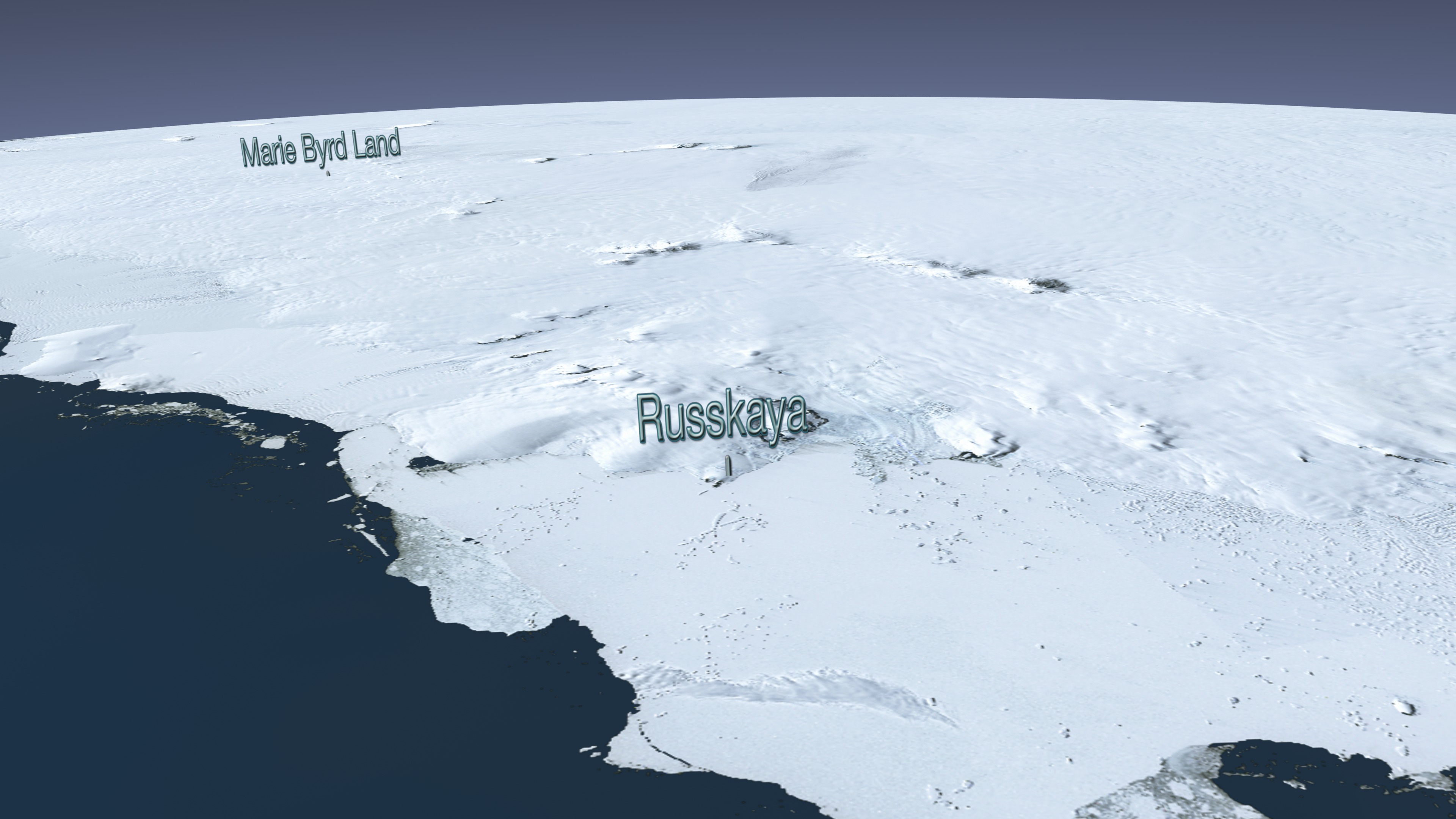
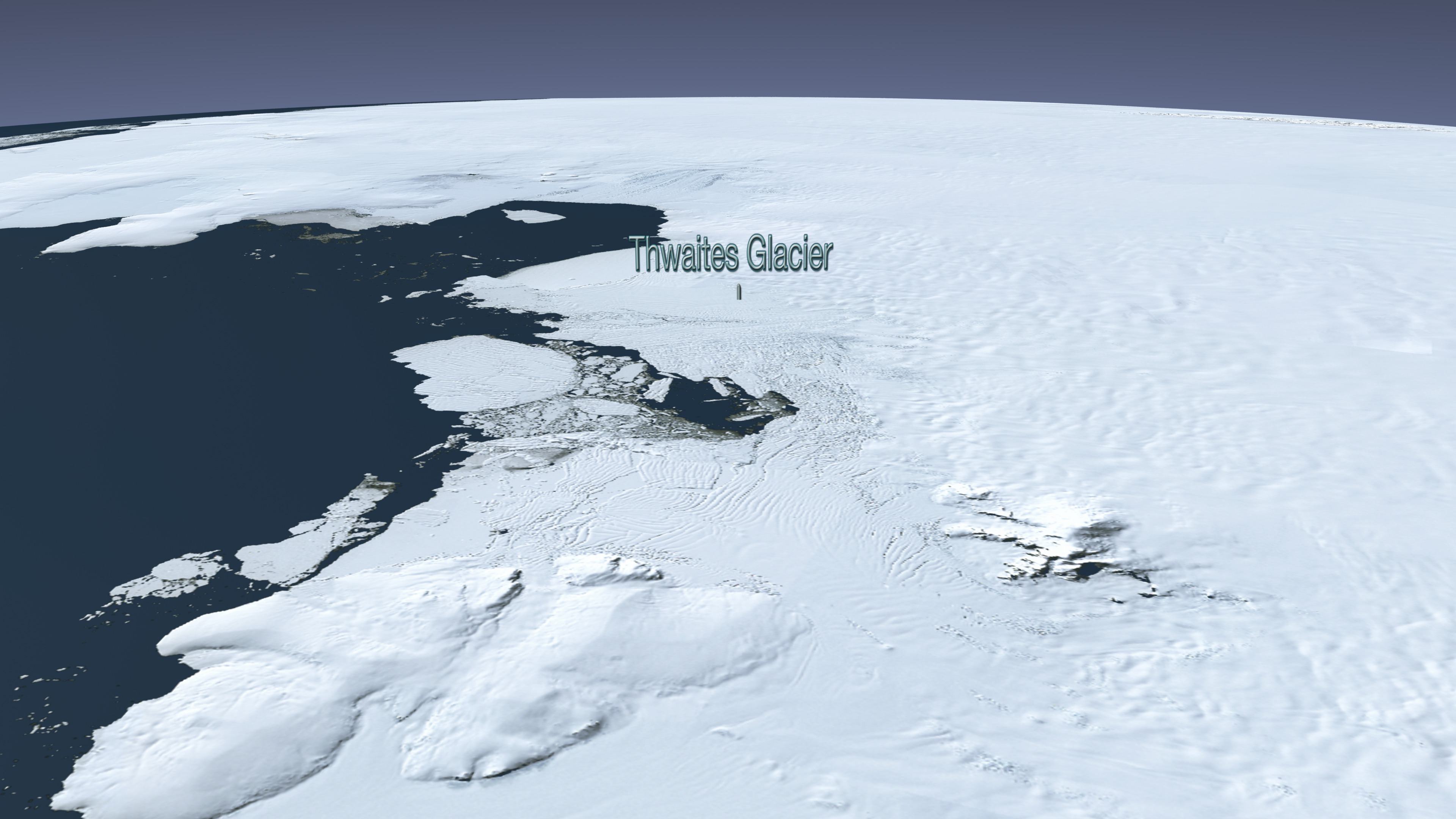
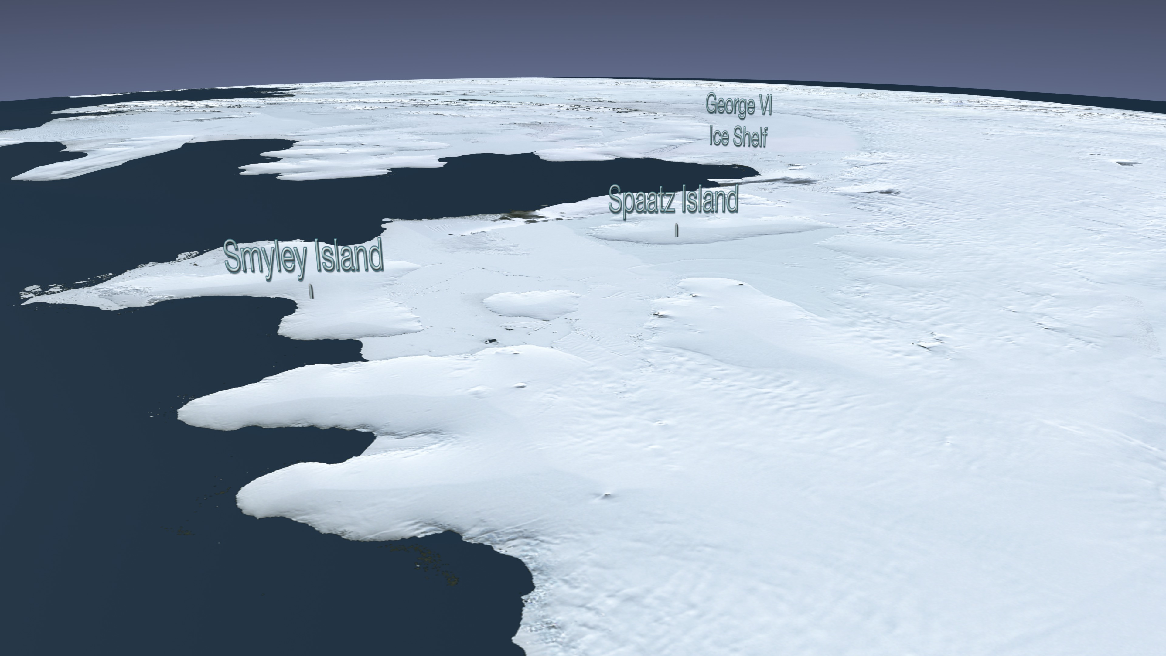
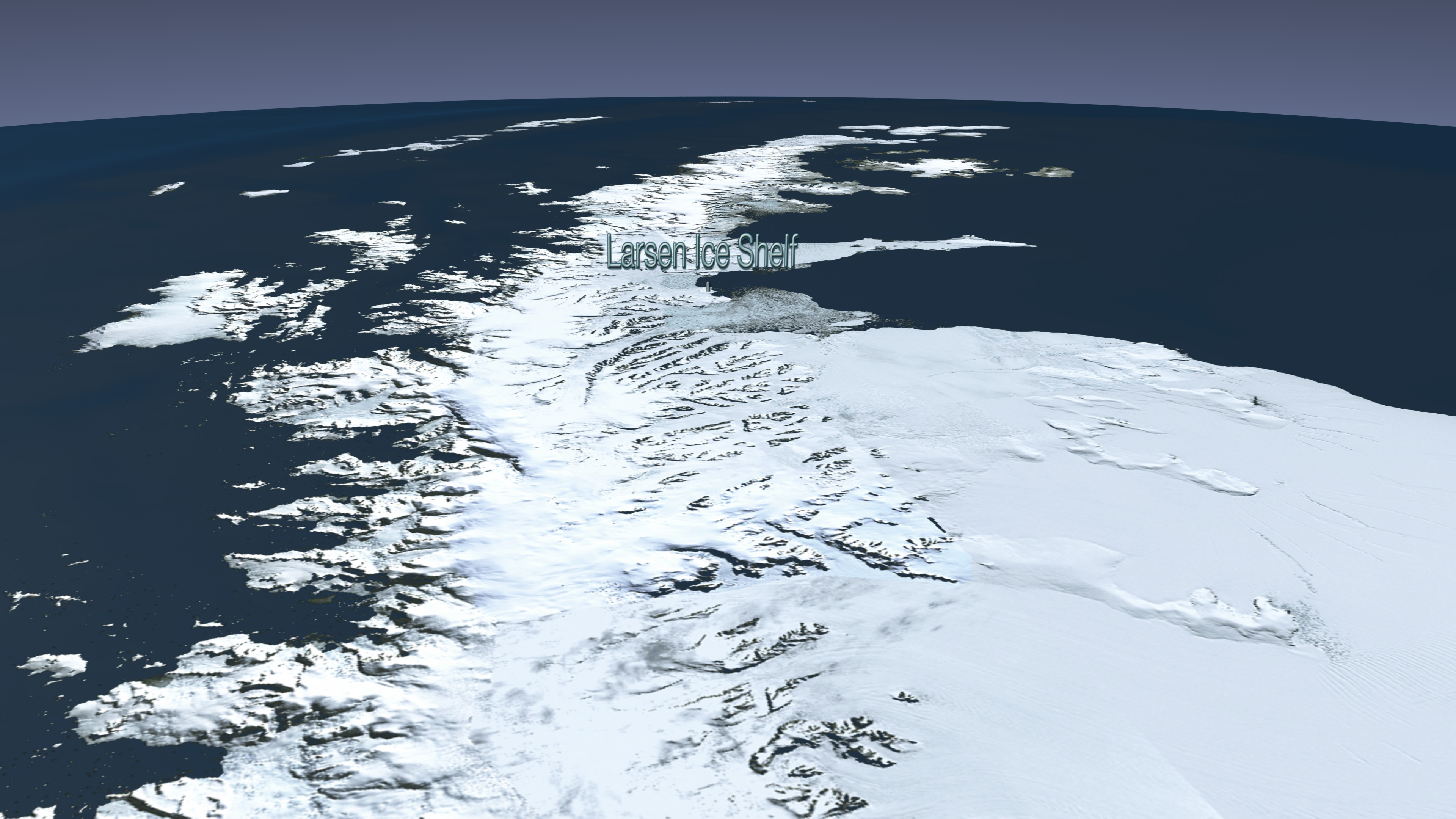
Landsat Image Mosaic of Antarctica Flyover of Western Antarctica
Visualization Credits
Lori Perkins (NASA/GSFC): Lead Animator
Greg Shirah (NASA/GSFC): Animator
Andrew Freeberg (NASA/GSFC): Producer
Bob Bindschadler (NASA/GSFC): Scientist
Greg Shirah (NASA/GSFC): Animator
Andrew Freeberg (NASA/GSFC): Producer
Bob Bindschadler (NASA/GSFC): Scientist
Please give credit for this item to:
NASA/Goddard Space Flight Center Scientific Visualization Studio LIMA Data provided by: Patricia Vornberger (SAIC) LIMA data produced by U.S. Geological Survey (USGS), the British Antarctic Survey (BAS) and NASA
NASA/Goddard Space Flight Center Scientific Visualization Studio LIMA Data provided by: Patricia Vornberger (SAIC) LIMA data produced by U.S. Geological Survey (USGS), the British Antarctic Survey (BAS) and NASA
Short URL to share this page:
https://svs.gsfc.nasa.gov/3537
Mission:
Landsat
Data Used:
Note: While we identify the data sets used in these visualizations, we do not store any further details nor the data sets themselves on our site.
This item is part of this series:
Landsat Image Mosaic of Antarctica
Keywords:
SVS >> HDTV
GCMD >> Earth Science >> Cryosphere >> Glaciers/Ice Sheets
GCMD >> Earth Science >> Cryosphere >> Glaciers/Ice Sheets >> Glacier Elevation/Ice Sheet Elevation
GCMD >> Earth Science >> Cryosphere >> Glaciers/Ice Sheets >> Glacier Topography/Ice Sheet Topography
GCMD >> Location >> Antarctica
NASA Science >> Earth
GCMD keywords can be found on the Internet with the following citation: Olsen, L.M., G. Major, K. Shein, J. Scialdone, S. Ritz, T. Stevens, M. Morahan, A. Aleman, R. Vogel, S. Leicester, H. Weir, M. Meaux, S. Grebas, C.Solomon, M. Holland, T. Northcutt, R. A. Restrepo, R. Bilodeau, 2013. NASA/Global Change Master Directory (GCMD) Earth Science Keywords. Version 8.0.0.0.0
https://svs.gsfc.nasa.gov/3537
Mission:
Landsat
Data Used:
Radarsat Antarctic Mapping Project (RAMP) Digital Elevation Model (DEM) also referred to as: RAMP DEM
Data Compilation - NSIDCLandsat-7/ETM+/Landsat Image Mosaic of Antarctica also referred to as: LIMA
Mosaic - NASA/GSFC, British Antarctic Survey, USGS EROS Data Center - 12/25/1999 - 12/31/2001
Mosaicing to avoid clouds produced a high quality, nearly cloud-free benchmark data set of Antarctica for the International Polar Year from images collected primarily during 1999-2003.
Landsat-7/ETM+/Band Combination 3, 2, 1
This item is part of this series:
Landsat Image Mosaic of Antarctica
Keywords:
SVS >> HDTV
GCMD >> Earth Science >> Cryosphere >> Glaciers/Ice Sheets
GCMD >> Earth Science >> Cryosphere >> Glaciers/Ice Sheets >> Glacier Elevation/Ice Sheet Elevation
GCMD >> Earth Science >> Cryosphere >> Glaciers/Ice Sheets >> Glacier Topography/Ice Sheet Topography
GCMD >> Location >> Antarctica
NASA Science >> Earth
GCMD keywords can be found on the Internet with the following citation: Olsen, L.M., G. Major, K. Shein, J. Scialdone, S. Ritz, T. Stevens, M. Morahan, A. Aleman, R. Vogel, S. Leicester, H. Weir, M. Meaux, S. Grebas, C.Solomon, M. Holland, T. Northcutt, R. A. Restrepo, R. Bilodeau, 2013. NASA/Global Change Master Directory (GCMD) Earth Science Keywords. Version 8.0.0.0.0


