Earth
ID: 3487
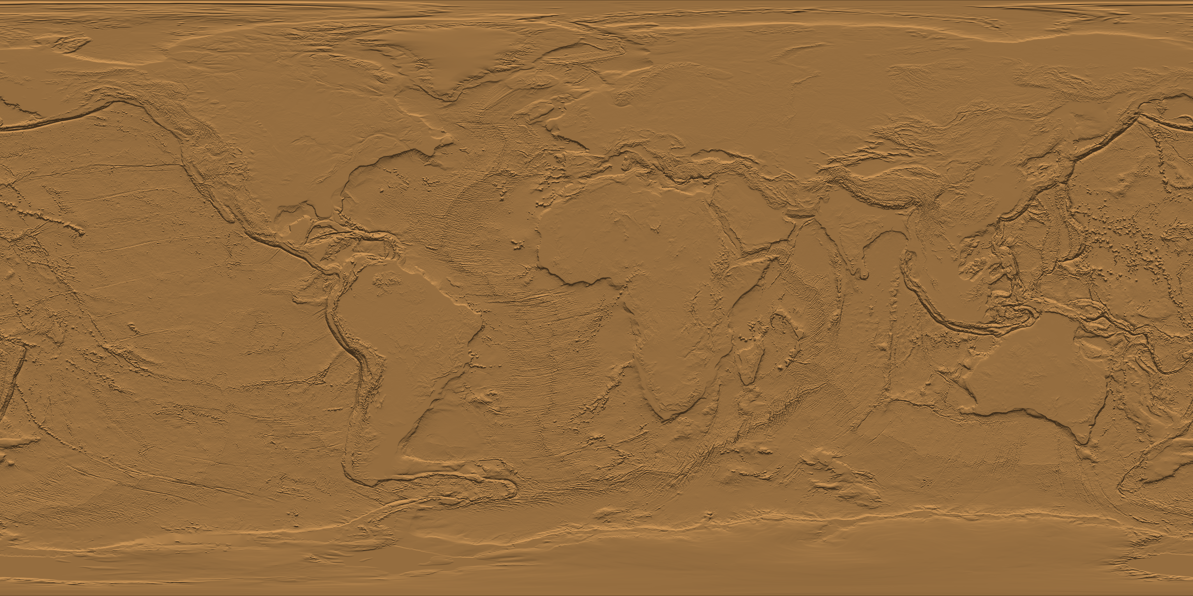
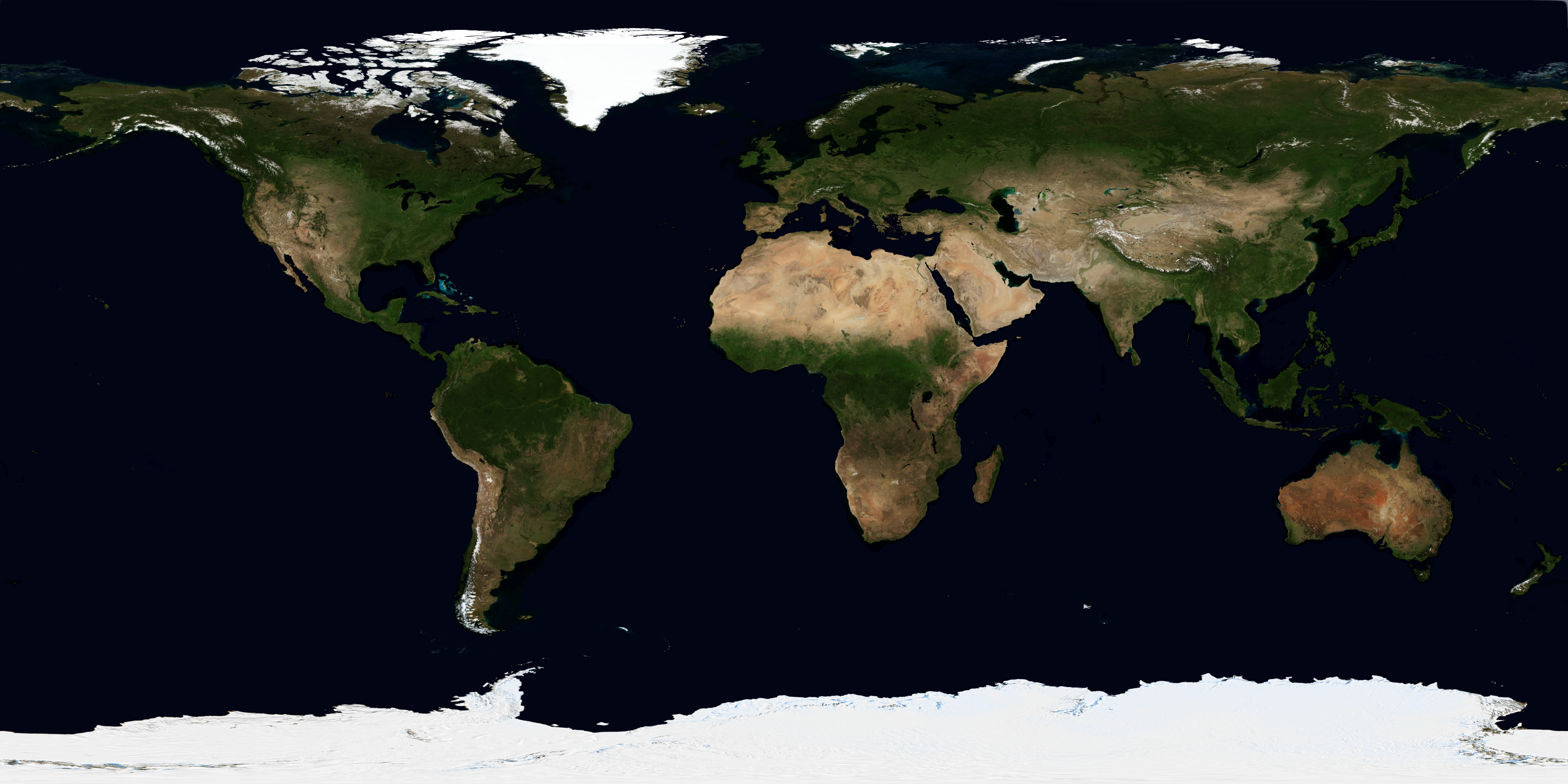
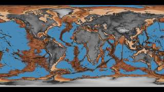
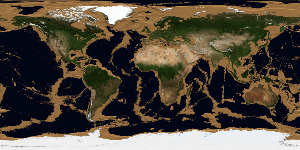
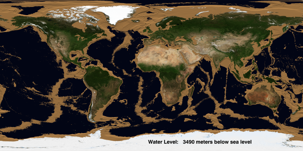
Three fifths of the Earth's surface is under the ocean, and the ocean floor is as rich in detail as the land surface with which we are familiar. This animation simulates a drop in sea level that gradually reveals this detail. As the sea level drops, the continental shelves appear immediately. They are mostly visible by a depth of 140 meters, except for the Arctic and Antarctic regions, where the shelves are deeper. The mid-ocean ridges start to appear at a depth of 2000 to 3000 meters. By 6000 meters, most of the ocean is drained except for the deep ocean trenches, the deepest of which is the Marianas Trench at a depth of 10,911 meters.

Draining the Oceans
There is a newer version of this story located here: https://svs.gsfc.nasa.gov/4823
Newer Version
Visualization Credits
Horace Mitchell (NASA/GSFC): Lead Animator
Please give credit for this item to:
NASA/Goddard Space Flight Center Scientific Visualization Studio U.S. Department of Commerce, National Oceanic and Atmospheric Administration, National Geophysical Data Center, 2006, 2-minute Gridded Global Relief Data (ETOPO2v2) - http://www.ngdc.noaa.gov/mgg/fliers/06mgg01.html The Blue Marble Next Generation data is courtesy of Reto Stockli (NASA/GSFC) and NASA's Earth Observatory.
NASA/Goddard Space Flight Center Scientific Visualization Studio U.S. Department of Commerce, National Oceanic and Atmospheric Administration, National Geophysical Data Center, 2006, 2-minute Gridded Global Relief Data (ETOPO2v2) - http://www.ngdc.noaa.gov/mgg/fliers/06mgg01.html The Blue Marble Next Generation data is courtesy of Reto Stockli (NASA/GSFC) and NASA's Earth Observatory.
Short URL to share this page:
https://svs.gsfc.nasa.gov/3487
Mission:
Terra
Data Used:
Note: While we identify the data sets used in these visualizations, we do not store any further details nor the data sets themselves on our site.
Keywords:
DLESE >> Physical geography
DLESE >> Physical oceanography
GCMD >> Earth Science >> Hydrosphere >> Snow/Ice >> Ice Growth/Melt
GCMD >> Earth Science >> Oceans >> Bathymetry/Seafloor Topography >> Bathymetry
GCMD >> Earth Science >> Oceans >> Bathymetry/Seafloor Topography >> Continental Margins
GCMD >> Earth Science >> Oceans >> Bathymetry/Seafloor Topography >> Seafloor Topography
GCMD >> Earth Science >> Oceans >> Bathymetry/Seafloor Topography >> Trenches
SVS >> Sea Level
SVS >> For Educators
SVS >> Continents
SVS >> Lithosphere
SVS >> Ocean Ridges
SVS >> Hydrosphere >> Ice
NASA Science >> Earth
GCMD keywords can be found on the Internet with the following citation: Olsen, L.M., G. Major, K. Shein, J. Scialdone, S. Ritz, T. Stevens, M. Morahan, A. Aleman, R. Vogel, S. Leicester, H. Weir, M. Meaux, S. Grebas, C.Solomon, M. Holland, T. Northcutt, R. A. Restrepo, R. Bilodeau, 2013. NASA/Global Change Master Directory (GCMD) Earth Science Keywords. Version 8.0.0.0.0
https://svs.gsfc.nasa.gov/3487
Mission:
Terra
Data Used:
Terra and Aqua/MODIS/Blue Marble: Next Generation also referred to as: BMNG
1/1/2004 - 12/31/2004
Credit:
The Blue Marble data is courtesy of Reto Stockli (NASA/GSFC).
The Blue Marble data is courtesy of Reto Stockli (NASA/GSFC).
2-minute Gridded Global Relief Data also referred to as: ETOPO2
Data Compilation - NOAA NGDCKeywords:
DLESE >> Physical geography
DLESE >> Physical oceanography
GCMD >> Earth Science >> Hydrosphere >> Snow/Ice >> Ice Growth/Melt
GCMD >> Earth Science >> Oceans >> Bathymetry/Seafloor Topography >> Bathymetry
GCMD >> Earth Science >> Oceans >> Bathymetry/Seafloor Topography >> Continental Margins
GCMD >> Earth Science >> Oceans >> Bathymetry/Seafloor Topography >> Seafloor Topography
GCMD >> Earth Science >> Oceans >> Bathymetry/Seafloor Topography >> Trenches
SVS >> Sea Level
SVS >> For Educators
SVS >> Continents
SVS >> Lithosphere
SVS >> Ocean Ridges
SVS >> Hydrosphere >> Ice
NASA Science >> Earth
GCMD keywords can be found on the Internet with the following citation: Olsen, L.M., G. Major, K. Shein, J. Scialdone, S. Ritz, T. Stevens, M. Morahan, A. Aleman, R. Vogel, S. Leicester, H. Weir, M. Meaux, S. Grebas, C.Solomon, M. Holland, T. Northcutt, R. A. Restrepo, R. Bilodeau, 2013. NASA/Global Change Master Directory (GCMD) Earth Science Keywords. Version 8.0.0.0.0


