Earth
ID: 3462
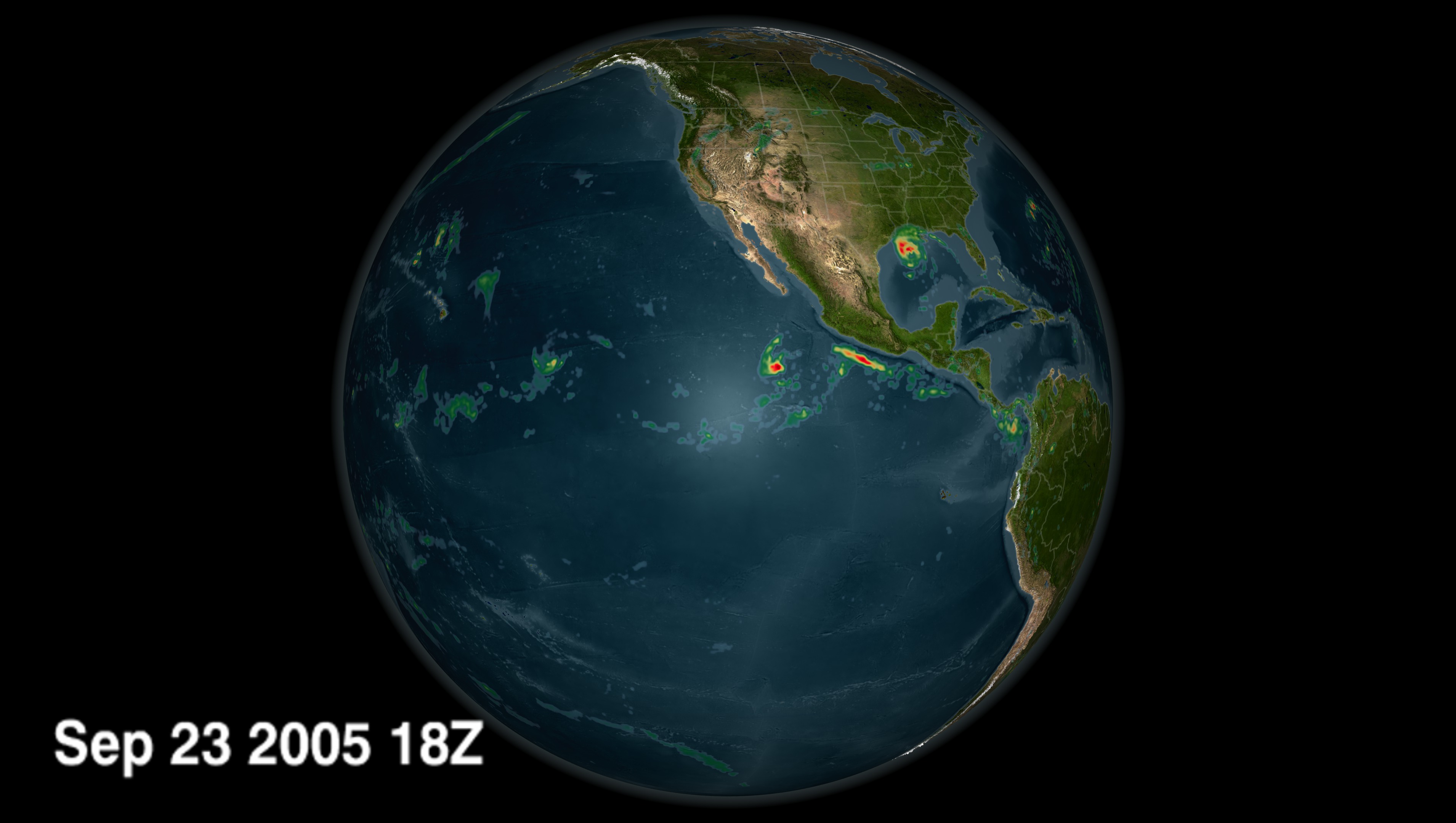
This is a three-hour global rainmap from January 1, 2005 through December 31, 2005, as compiled by the TRMM satellite's Multi-satellite Precipation Analysis. The TRMM Multi-satellite Precipitation Analysis produces three hourly rain rates at 0.250 latitude by 0.250 longitude grid covering 500S to 500N. The input data for this merged product include a merged intercalibrated microwave-only product (3B40RT) and an Infrared rain product that is calibrated using microwave rain rates (3B41RT). Currently, 3B40RT is generated using rain rate estimates from microwave measurements from the TRMM sensors and the Special Sensor Microwave Imagers on board the DMSP satellites using the Goddard Profiling Algorithm (GPROF). 3B41RT is based on infrared measurements from geostationary satellites that are calibrated using microwave rain estimates. The 3B42RT estimate consists of the merged microwave estimate within the 3 hourly 0.25 degree space/time grid when available, and the calibrated IR rain rates otherwise.

Global TRMM Rainmap 2005
Visualization Credits
Please give credit for this item to:
NASA/Goddard Space Flight Center Scientific Visualization Studio Hal Pierce (SSAI/NASA GSFC)
NASA/Goddard Space Flight Center Scientific Visualization Studio Hal Pierce (SSAI/NASA GSFC)
Short URL to share this page:
https://svs.gsfc.nasa.gov/3462
Mission:
Tropical Rainfall Measuring Mission - TRMM
Data Used:
Note: While we identify the data sets used in these visualizations, we do not store any further details nor the data sets themselves on our site.
Dates of Data Used:
2005/01/01 - 2005/12/31
This item is part of this series:
Rainfall
Keywords:
DLESE >> Atmospheric science
SVS >> HDTV
GCMD >> Earth Science >> Atmosphere >> Precipitation >> Precipitation Amount
GCMD >> Earth Science >> Atmosphere >> Precipitation >> Rain
NASA Science >> Earth
GCMD keywords can be found on the Internet with the following citation: Olsen, L.M., G. Major, K. Shein, J. Scialdone, S. Ritz, T. Stevens, M. Morahan, A. Aleman, R. Vogel, S. Leicester, H. Weir, M. Meaux, S. Grebas, C.Solomon, M. Holland, T. Northcutt, R. A. Restrepo, R. Bilodeau, 2013. NASA/Global Change Master Directory (GCMD) Earth Science Keywords. Version 8.0.0.0.0
https://svs.gsfc.nasa.gov/3462
Mission:
Tropical Rainfall Measuring Mission - TRMM
Data Used:
TRMM and DMSP/SSM/I and TMI/3B4XRT also referred to as: 3-hour Rainmap
2005/01/01 - 2005/12/31Dates of Data Used:
2005/01/01 - 2005/12/31
This item is part of this series:
Rainfall
Keywords:
DLESE >> Atmospheric science
SVS >> HDTV
GCMD >> Earth Science >> Atmosphere >> Precipitation >> Precipitation Amount
GCMD >> Earth Science >> Atmosphere >> Precipitation >> Rain
NASA Science >> Earth
GCMD keywords can be found on the Internet with the following citation: Olsen, L.M., G. Major, K. Shein, J. Scialdone, S. Ritz, T. Stevens, M. Morahan, A. Aleman, R. Vogel, S. Leicester, H. Weir, M. Meaux, S. Grebas, C.Solomon, M. Holland, T. Northcutt, R. A. Restrepo, R. Bilodeau, 2013. NASA/Global Change Master Directory (GCMD) Earth Science Keywords. Version 8.0.0.0.0


