Earth
ID: 2683
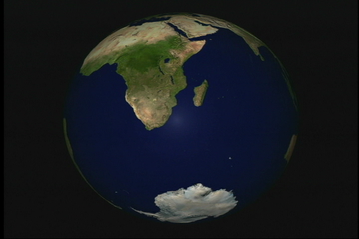
In conjunction with the 30th Anniversary Apollo 17 mission, NASA put together a special release highlighting one of the most popular photos taken during this mission. The photo (#AS17-148-22727) was taken on Dec. 7, 1972 from the Apollo 17 command module. It was the first full Earth photograph revealing the Antarctic continent. Over the years, many other satellites have taken imagery of Earth, including Terra/MODIS. This animation uses a global mosaic derived from Terra/MODIS. As a tribute to its predecessor, this Blue Marble data set has been aligned to the same angle and pitch that the famous Apollo 17 photograph was taken.

Apollo 17 30th Anniversary: Blue Marble Drift-in
Visualization Credits
Alex Kekesi (Global Science and Technology, Inc.): Lead Animator
Please give credit for this item to:
NASA/Goddard Space Flight Center Scientific Visualization Studio The Blue Marble Next Generation data is courtesy of Reto Stockli (NASA/GSFC) and NASA's Earth Observatory.
NASA/Goddard Space Flight Center Scientific Visualization Studio The Blue Marble Next Generation data is courtesy of Reto Stockli (NASA/GSFC) and NASA's Earth Observatory.
Short URL to share this page:
https://svs.gsfc.nasa.gov/2683
Mission:
Terra
Data Used:
Note: While we identify the data sets used in these visualizations, we do not store any further details nor the data sets themselves on our site.
This item is part of this series:
Apollo 17 30th Anniversary
Goddard TV Tape:
G2002-089
Keywords:
SVS >> Photography
SVS >> Picture
SVS >> Wonderglobe
NASA Science >> Earth
https://svs.gsfc.nasa.gov/2683
Mission:
Terra
Data Used:
Terra and Aqua/MODIS/Blue Marble: Next Generation also referred to as: BMNG
1/1/2004 - 12/31/2004
Credit:
The Blue Marble data is courtesy of Reto Stockli (NASA/GSFC).
The Blue Marble data is courtesy of Reto Stockli (NASA/GSFC).
This item is part of this series:
Apollo 17 30th Anniversary
Goddard TV Tape:
G2002-089
Keywords:
SVS >> Photography
SVS >> Picture
SVS >> Wonderglobe
NASA Science >> Earth


