Earth
ID: 2285
Rotating globe showing global grassland coverage. Data obtained from Terra/MODIS land cover isolating grasslands, woody savannas, savannas, and wetlands (all seen in green). This data represents 4 parts of a 17 part global classification product all of which have been taken at 1km. resolution.
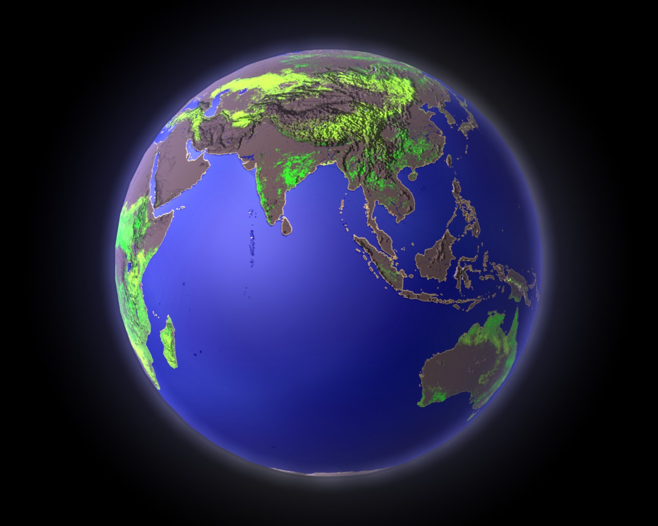
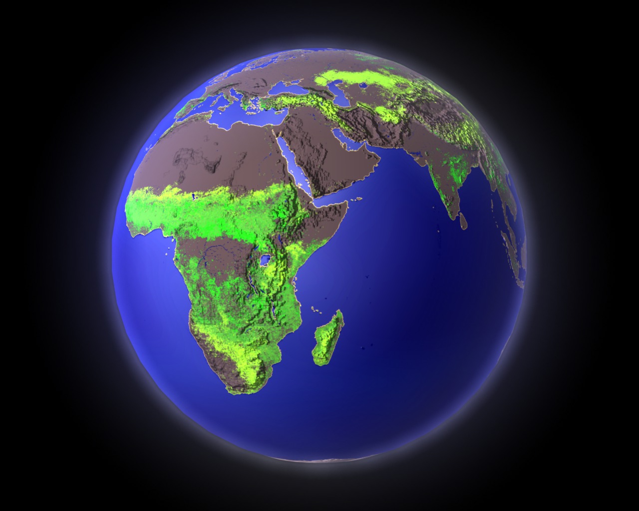
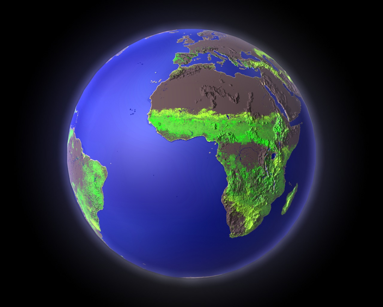

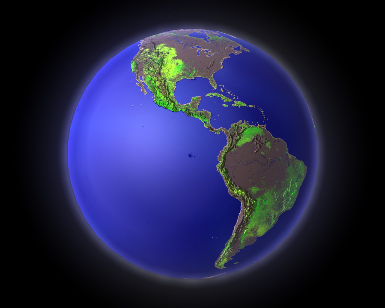
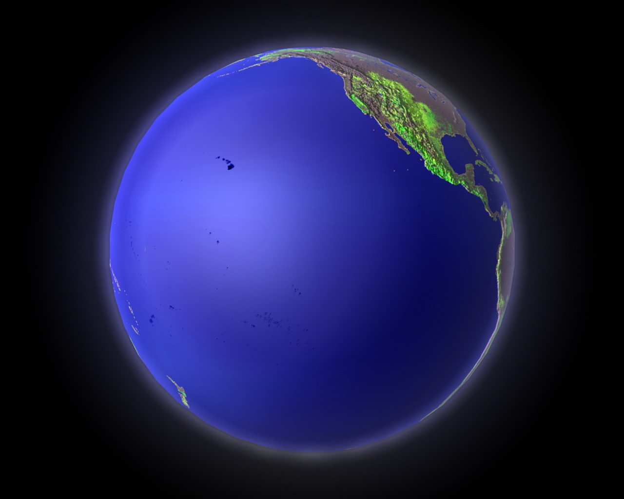
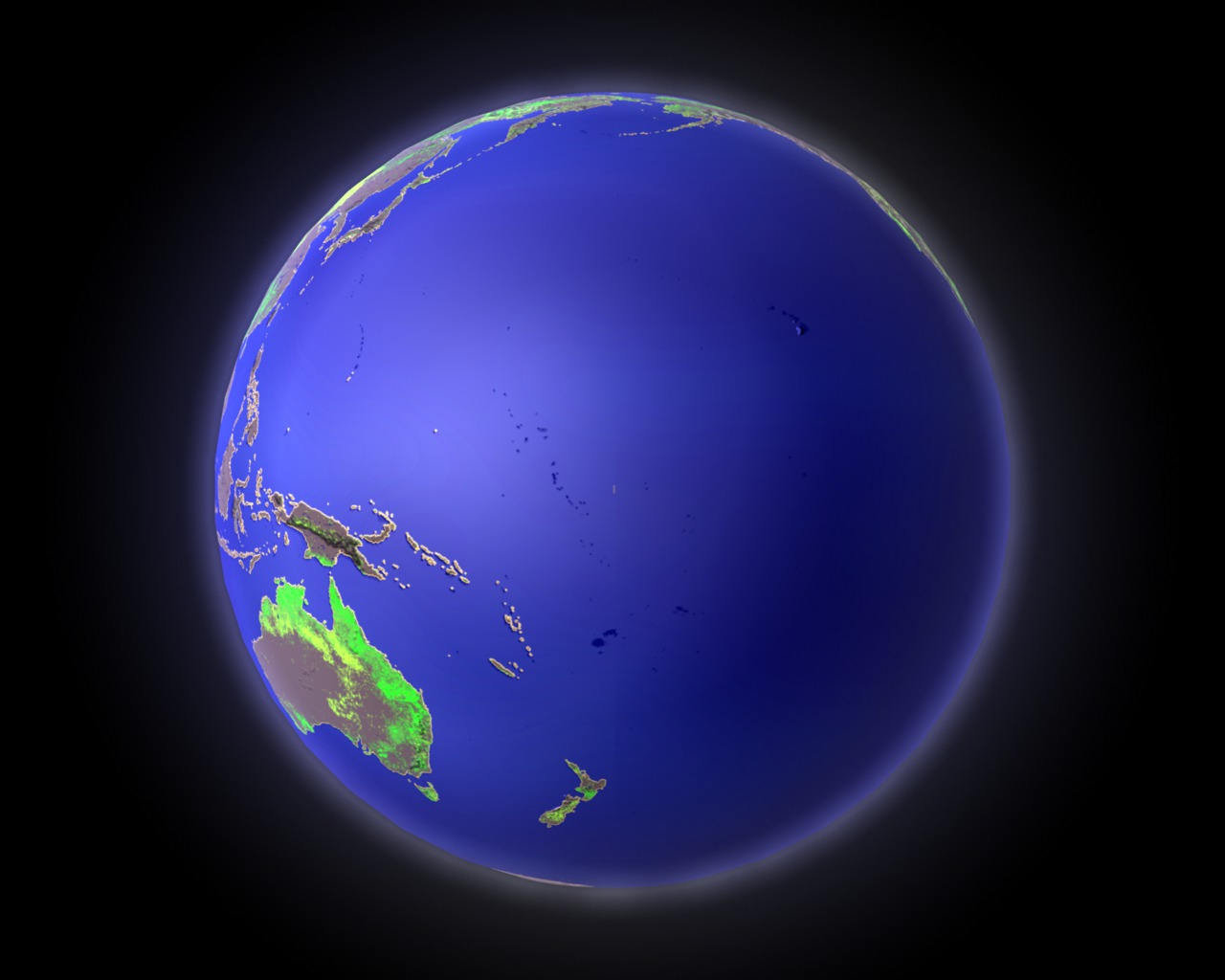
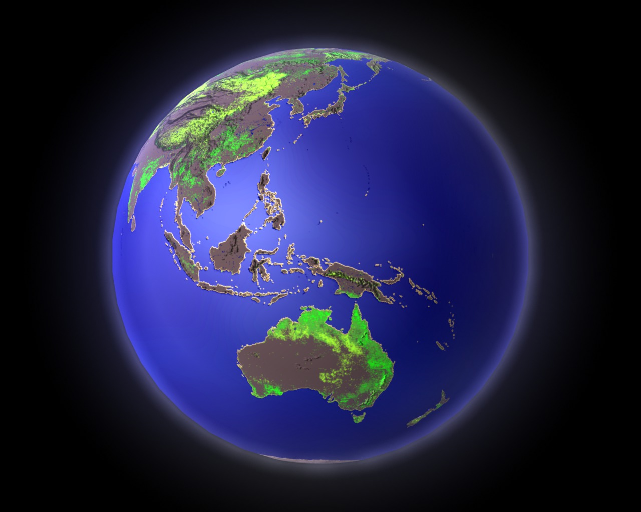
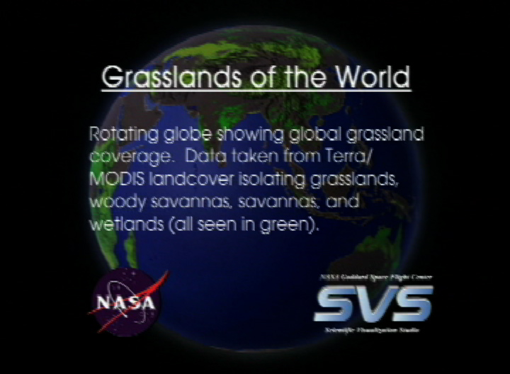
Grasslands of the World
Visualization Credits
Alex Kekesi (Global Science and Technology, Inc.): Lead Animator
Lori Perkins (NASA/GSFC): Animator
Mark Friedl (Boston University): Scientist
John Hodges (Boston University): Scientist
Lori Perkins (NASA/GSFC): Animator
Mark Friedl (Boston University): Scientist
John Hodges (Boston University): Scientist
Please give credit for this item to:
NASA/Goddard Space Flight Center Scientific Visualization Studio
NASA/Goddard Space Flight Center Scientific Visualization Studio
Short URL to share this page:
https://svs.gsfc.nasa.gov/2285
Mission:
Terra
Data Used:
Note: While we identify the data sets used in these visualizations, we do not store any further details nor the data sets themselves on our site.
Dates of Data Used:
2001/1/1-2001/7/1
This item is part of this series:
Journey to Planet Earth
Goddard TV Tape:
G2003-046
Keywords:
SVS >> Grasslands
SVS >> Permanent Wetlands
GCMD >> Earth Science >> Biosphere >> Terrestrial Ecosystems >> Savannas
NASA Science >> Earth
GCMD keywords can be found on the Internet with the following citation: Olsen, L.M., G. Major, K. Shein, J. Scialdone, S. Ritz, T. Stevens, M. Morahan, A. Aleman, R. Vogel, S. Leicester, H. Weir, M. Meaux, S. Grebas, C.Solomon, M. Holland, T. Northcutt, R. A. Restrepo, R. Bilodeau, 2013. NASA/Global Change Master Directory (GCMD) Earth Science Keywords. Version 8.0.0.0.0
https://svs.gsfc.nasa.gov/2285
Mission:
Terra
Data Used:
Terra/MODIS/Land Cover also referred to as: Grasslands, Woody Savannas, Savannas, and Wetlands
2001/1/1-2001/7/1Dates of Data Used:
2001/1/1-2001/7/1
This item is part of this series:
Journey to Planet Earth
Goddard TV Tape:
G2003-046
Keywords:
SVS >> Grasslands
SVS >> Permanent Wetlands
GCMD >> Earth Science >> Biosphere >> Terrestrial Ecosystems >> Savannas
NASA Science >> Earth
GCMD keywords can be found on the Internet with the following citation: Olsen, L.M., G. Major, K. Shein, J. Scialdone, S. Ritz, T. Stevens, M. Morahan, A. Aleman, R. Vogel, S. Leicester, H. Weir, M. Meaux, S. Grebas, C.Solomon, M. Holland, T. Northcutt, R. A. Restrepo, R. Bilodeau, 2013. NASA/Global Change Master Directory (GCMD) Earth Science Keywords. Version 8.0.0.0.0


