Planets and Moons
ID: 2060
Views of the asteroid Eros generated by data from the laser rangefinder. This false color image shows the 'gravity slope' at various regions on the object. The gravity slope is the angle between the local gravitation field (computed assuming a constant density for the asteroid) and the normal to the surface. Blue is low slope, red is high slope.
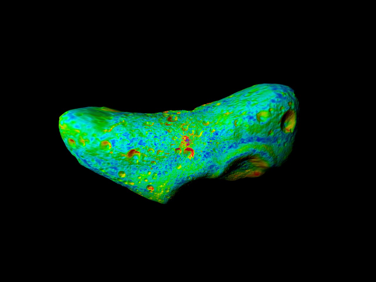
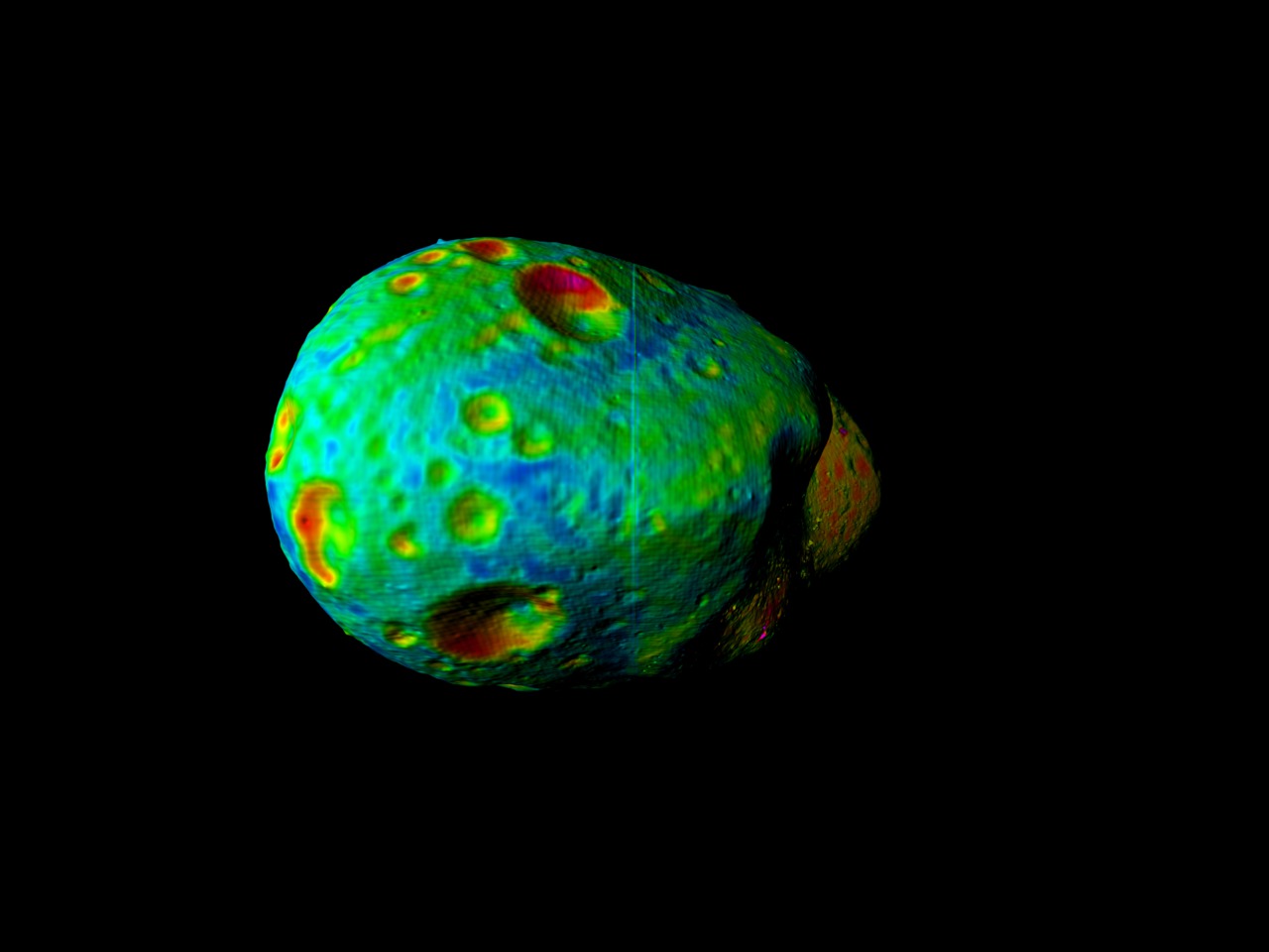
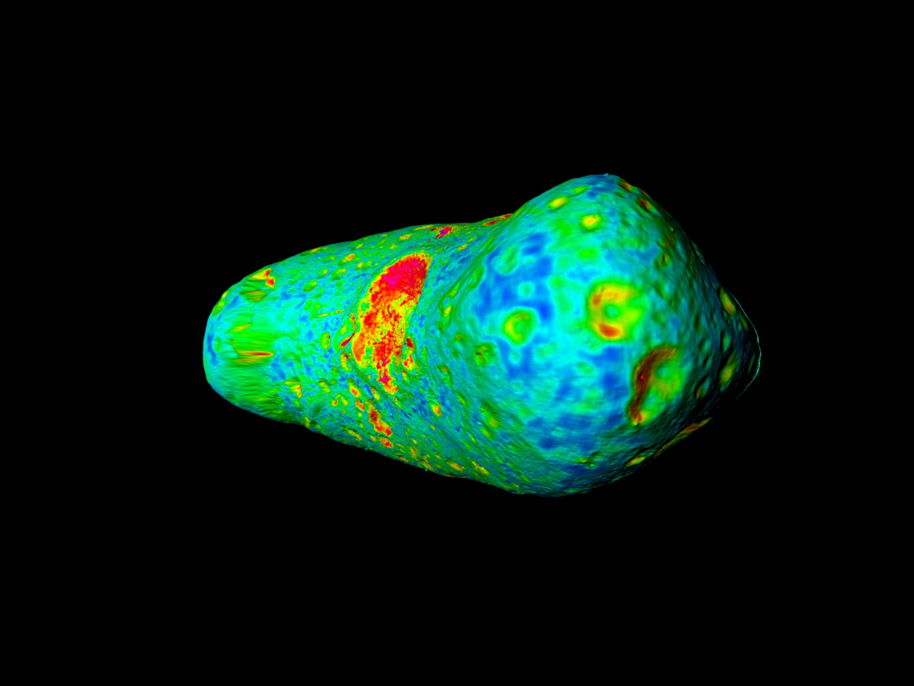
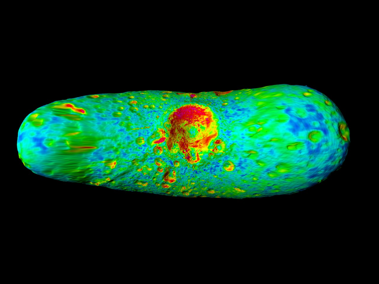
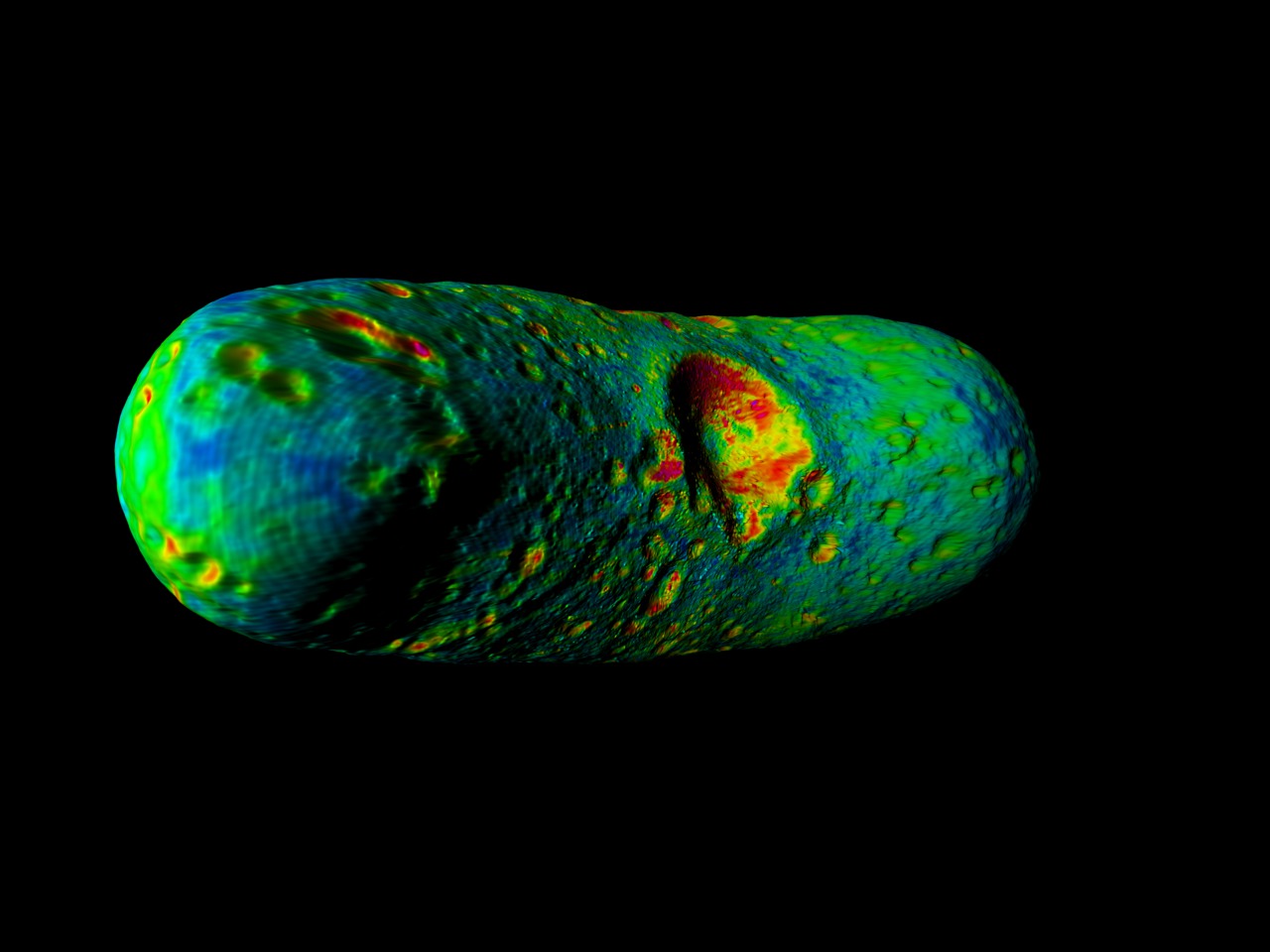

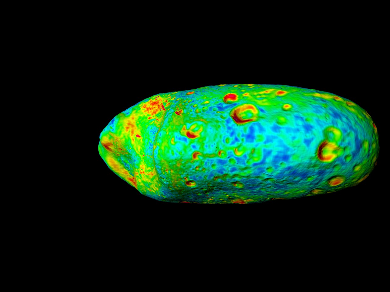

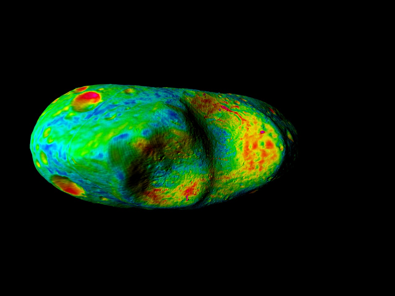
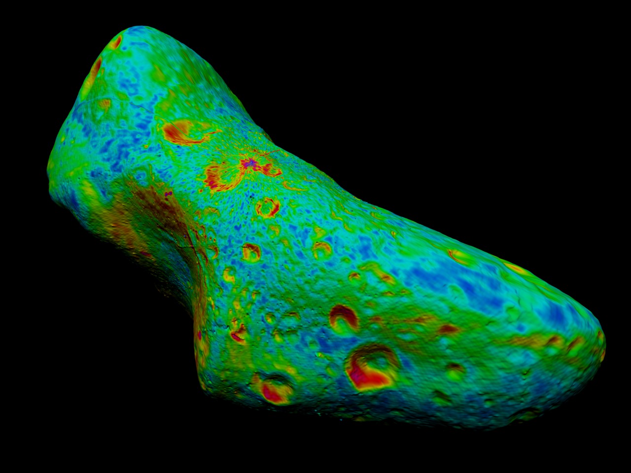
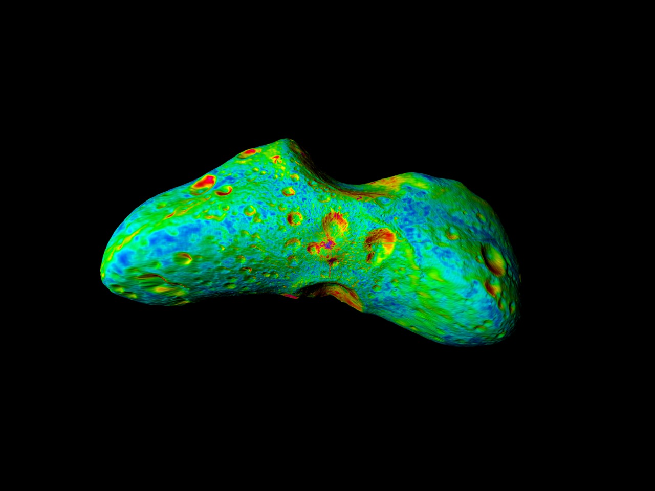

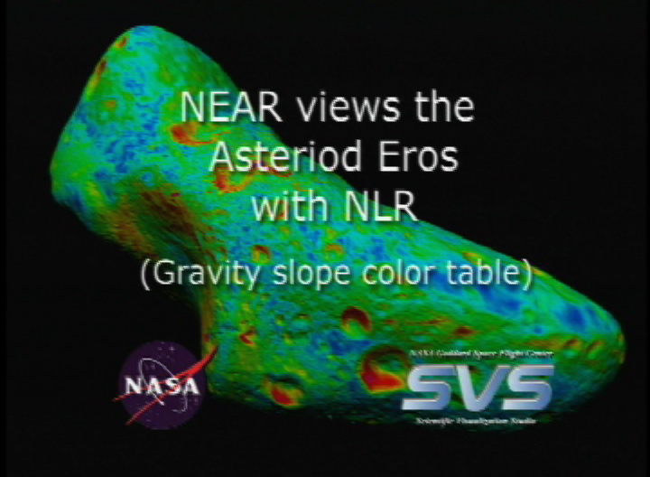
NEAR Views the Asteroid Eros (Gravity Slope)
For More Information
Visualization Credits
Greg Shirah (NASA/GSFC): Lead Animator
Tom Bridgman (Global Science and Technology, Inc.): Animator
Marte Newcombe (GST): Animator
David Smith (NASA/GSFC): Scientist
Maria Zuber (Massachusetts Institute of Technology): Scientist
Tom Bridgman (Global Science and Technology, Inc.): Animator
Marte Newcombe (GST): Animator
David Smith (NASA/GSFC): Scientist
Maria Zuber (Massachusetts Institute of Technology): Scientist
Please give credit for this item to:
NASA/Goddard Space Flight Center Scientific Visualization Studio
NASA/Goddard Space Flight Center Scientific Visualization Studio
Science Paper:
Science 289, pp 2097-2101 (22 Sept 2000)
Short URL to share this page:
https://svs.gsfc.nasa.gov/2060
Data Used:
Note: While we identify the data sets used in these visualizations, we do not store any further details nor the data sets themselves on our site.
This item is part of this series:
Eros
Keywords:
SVS >> Asteroid
SVS >> Eros
SVS >> HDTV
SVS >> Laser Rangefinder
DLESE >> Space science
NASA Science >> Planets and Moons
Places you might have seen this:
Computer Graphics World April 2001 pp. 76
Science 289, pp 2097-2101 (22 Sept 2000)
Short URL to share this page:
https://svs.gsfc.nasa.gov/2060
Data Used:
NEAR/NLR
2000/02-2001/02This item is part of this series:
Eros
Keywords:
SVS >> Asteroid
SVS >> Eros
SVS >> HDTV
SVS >> Laser Rangefinder
DLESE >> Space science
NASA Science >> Planets and Moons
Places you might have seen this:
Computer Graphics World April 2001 pp. 76


