Earth
ID: 11194
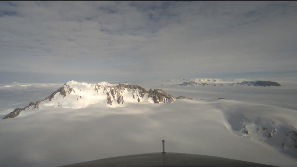
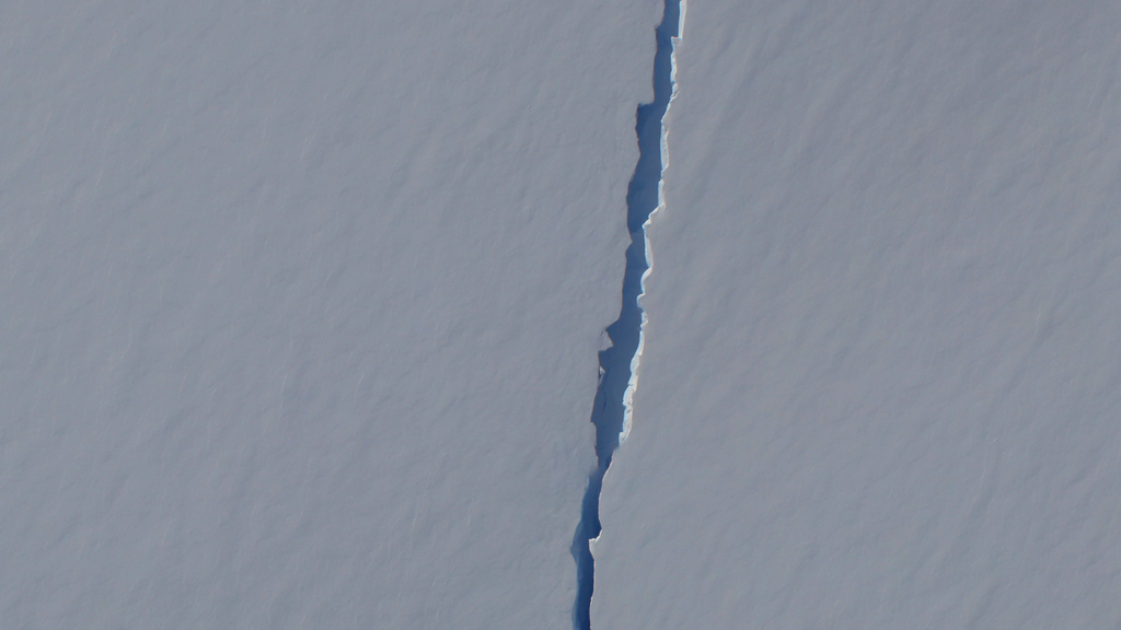
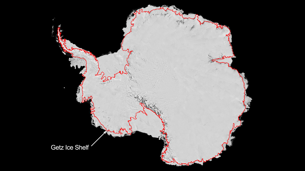
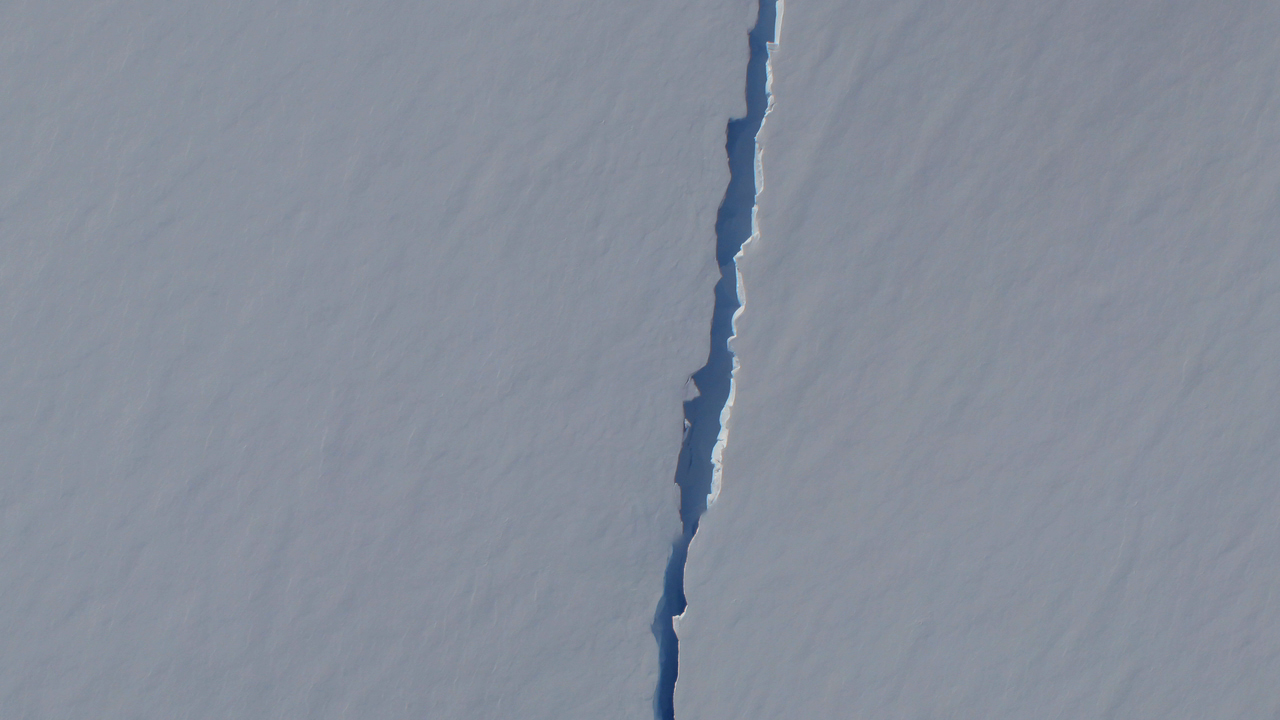
In certain parts of Antarctica, the ice is disappearing—fast. To better understand how and why this is happening, NASA's Operation IceBridge mission uses a suite of advanced instruments aboard its DC-8 aircraft to survey the continent's layered ice deposits and underlying bedrock. One place scientists are looking at closely is the Getz Ice Shelf. The underside of this 300-mile-long floating tongue of ice hanging off West Antarctica is being eaten away by warm ocean currents. And a thin crack on its surface threatens to calve a large piece of it into the sea. In 2012, researchers mapped regions near the ice shelf's grounding line, the point where the ice leaves the support of land and begins to float on water, to determine how much ice is being lost to the ocean, and at what rate. Watch the video to learn more.

Mapping Polar Ice
Related Story
Story Credits
Visualizers/Animators:
Lori Perkins (NASA/GSFC)
Trent L. Schindler (USRA)
Horace Mitchell (NASA/GSFC)
Greg Shirah (NASA/GSFC)
Narrator:
Jefferson Beck (USRA)
Producer:
Jefferson Beck (USRA)
Lead Scientist:
Michael Studinger (UMD)
Lead Writer:
Jefferson Beck (USRA)
Lori Perkins (NASA/GSFC)
Trent L. Schindler (USRA)
Horace Mitchell (NASA/GSFC)
Greg Shirah (NASA/GSFC)
Narrator:
Jefferson Beck (USRA)
Producer:
Jefferson Beck (USRA)
Lead Scientist:
Michael Studinger (UMD)
Lead Writer:
Jefferson Beck (USRA)
Please give credit for this item to:
NASA's Goddard Space Flight Center
NASA's Goddard Space Flight Center
Short URL to share this page:
https://svs.gsfc.nasa.gov/11194
Keywords:
DLESE >> Narrated
SVS >> App
NASA Science >> Earth
https://svs.gsfc.nasa.gov/11194
Keywords:
DLESE >> Narrated
SVS >> App
NASA Science >> Earth


