Operation IceBridge 2012 Antarctic Campaign video series
This year Operation IceBridge completed 16 science flights over Antarctica and nearby sea ice, flying once again out of Punta Arenas, Chile. This video series contains a diverse set of products reflecting the science and adventure of the mission.
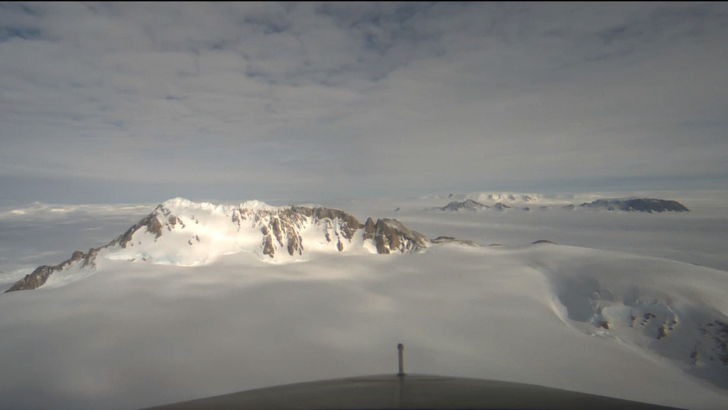
NASA's Operation IceBridge has launched its Antarctic 2012 campaign, flying high-priority missions measuring polar ice from a base of operations at the tip of Patagonia on the Strait of Magellan. They have even made a return visit to the Pine Island Glacier, the site of last year's discovery of a massive rift in the ice.
For complete transcript, click here.
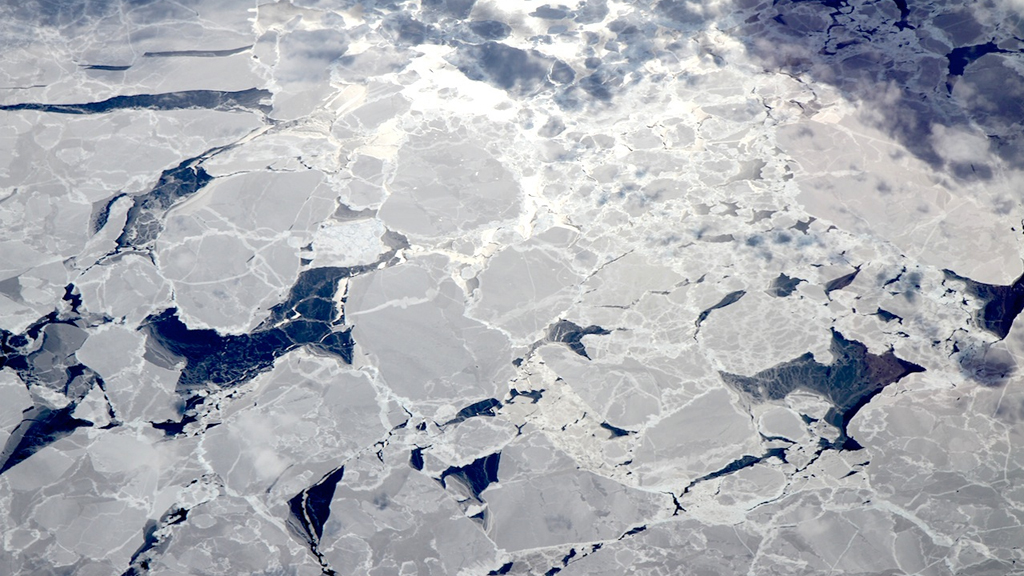
Sea ice doesn't always hold the allure of a massive ice sheet, or a crevassed blue glacier spilling between mountains, but it comes in array of shapes and sizes and has its own ephemeral beauty. Operation IceBridge studies sea ice at both poles, and also runs across interesting formations on route to other targets.
For complete transcript, click here.
Operation IceBridge returned to the Pine Island Glacier twice in 2012, and NASA glaciologist Kelly Brunt discusses the implications of the glacier's impending calving event.
For complete transcript, click here.
On Nov. 4, 2012, Operation IceBridge flew an 11-hour mission over the Recovery Glacier and Filchner Ice Shelf in eastern Antarctica. On the transit back home, NASA scientist John Sonntag gave a two-minute breakdown of the mission over the aircraft headset, including the purpose of the day's flight, the challenges of working with Antarctic weather forecasts, and what the team found when they arrived on site.
For complete transcript, click here.
Can you stuff all the sights and science of a 12-hour mission into just three minutes? Maybe not, but here's our first try, chronicling NASA's recent flight to Antarctica's remote Getz Ice Shelf, where Operation IceBridge measured everything from the ice surface to the bedrock below, flew low over giant icebergs, and even scanned a lengthy new crack in the ice.
For complete transcript, click here.
Operaci
Credits
Please give credit for this item to:
NASA's Goddard Space Flight Center
-
Narrator
- Jefferson Beck (USRA)
-
Producer
- Jefferson Beck (USRA)
-
Scientist
- Michael Studinger (UMD)
Series
This page can be found in the following series:Tapes
The media on this page originally appeared on the following tapes:-
Operation IceBridge 2012 Antarctic video series
(ID: 2012122)
Friday, November 16, 2012 at 5:00AM
Produced by - James Collier (NASA)
Datasets used
-
[Airborne Topographic Mapper]
ID: 139 -
DMS Photogrammetry [Digital Mapping System]
ID: 729
Note: While we identify the data sets used on this page, we do not store any further details, nor the data sets themselves on our site.
Related
- ID: 11194
 Produced Video
 - ID: 11143
 Produced Video
Release date
This page was originally published on Friday, November 16, 2012.
This page was last updated on Wednesday, May 3, 2023 at 1:52 PM EDT.