Earth
ID: 10855

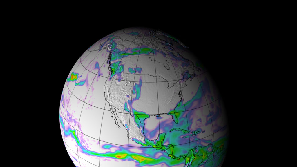
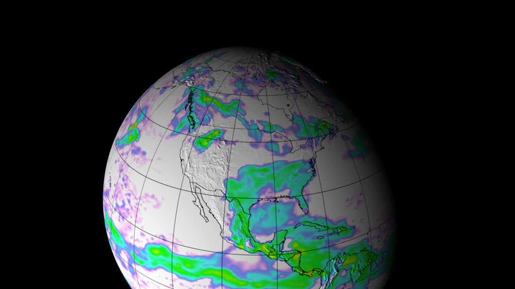
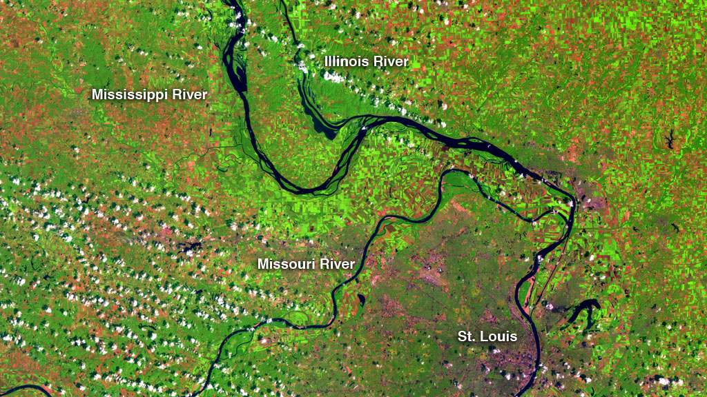
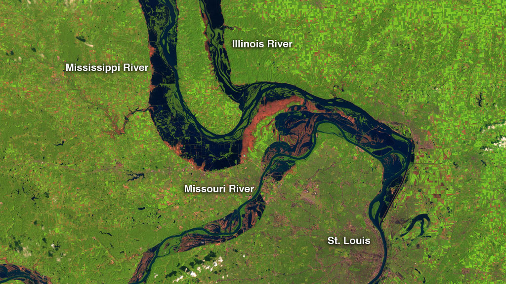
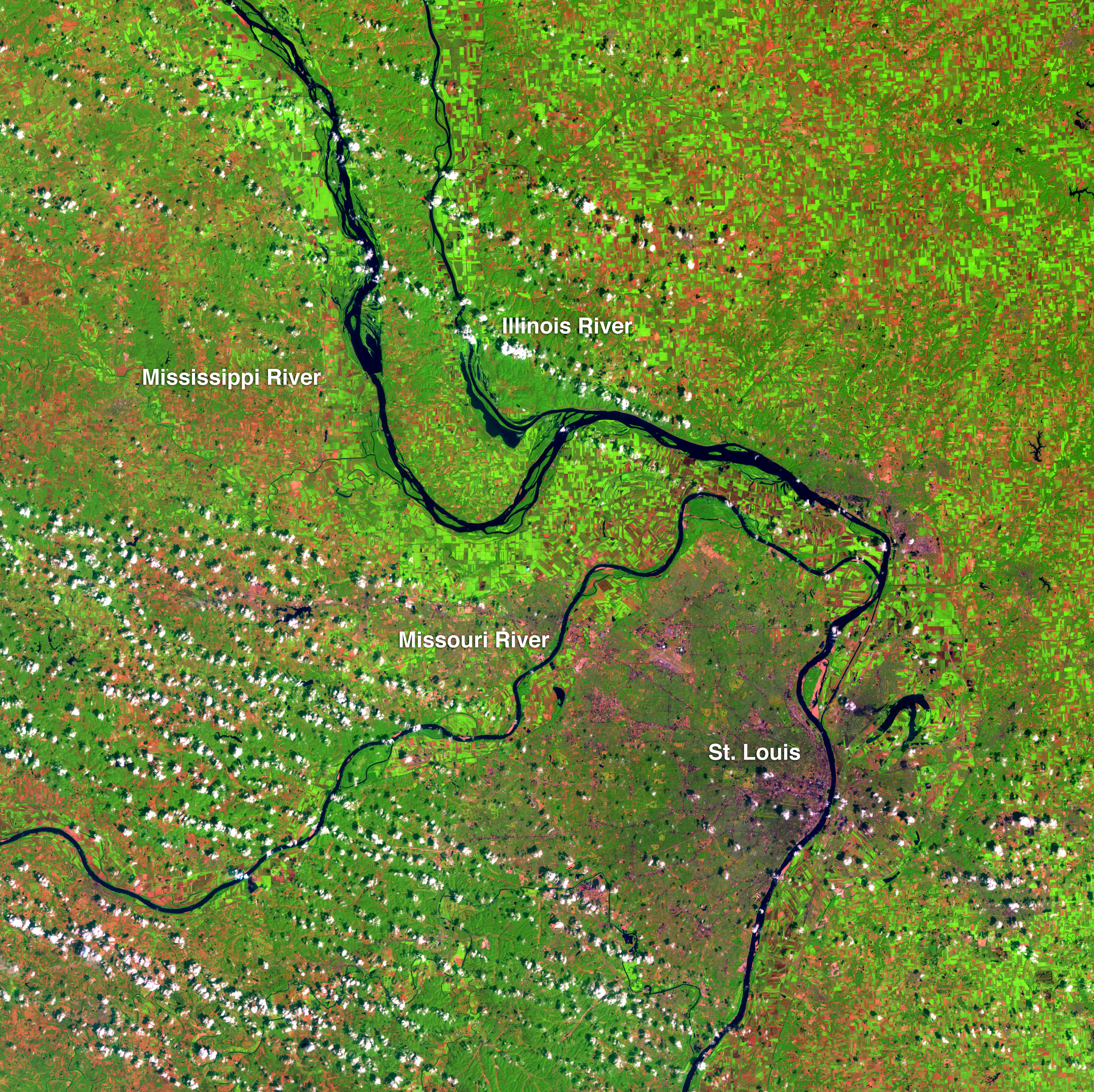
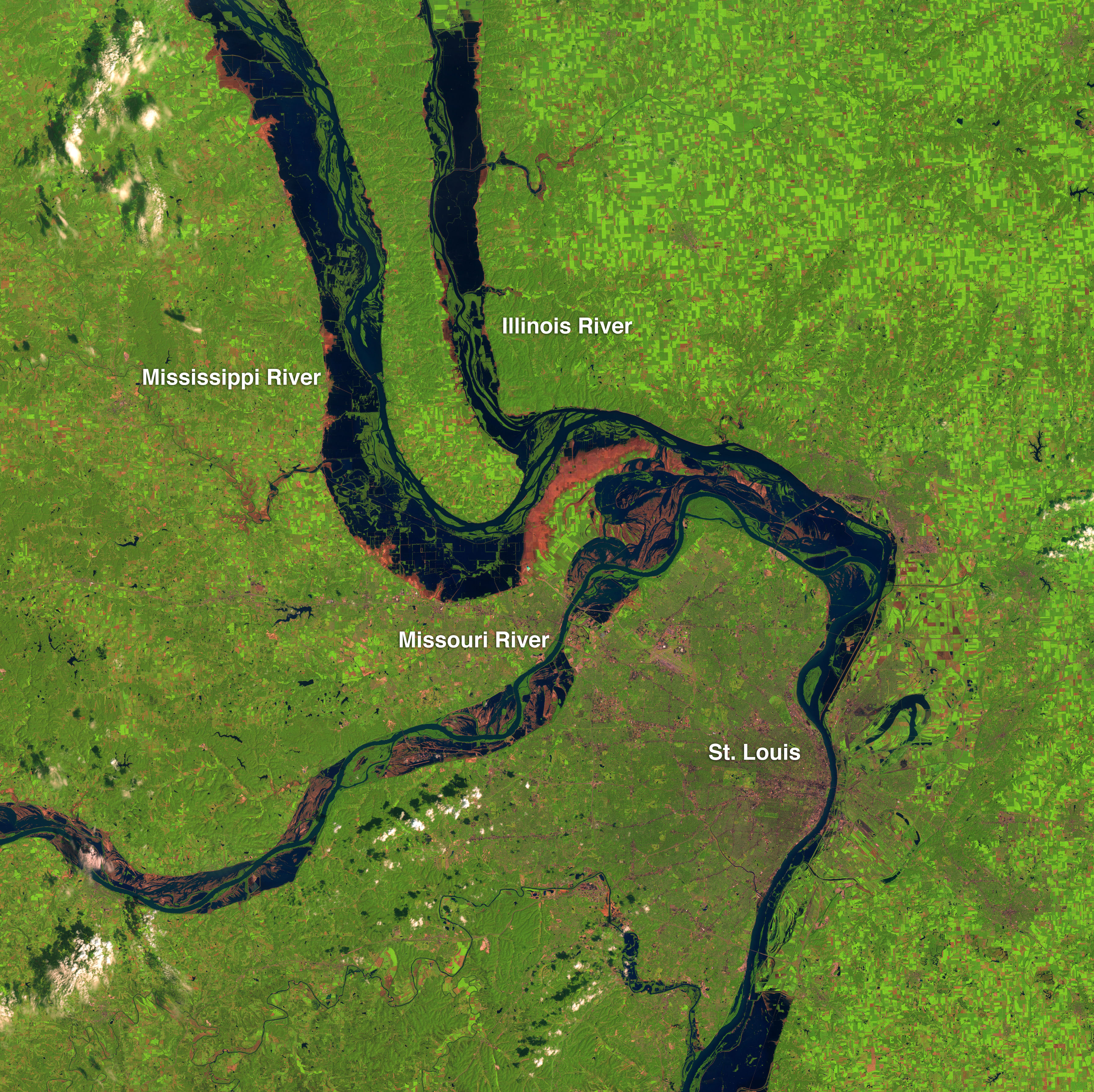
An extreme lack of rainfall over much of the United States in 1988 caused greater crop losses than any disaster in U.S. history, killed livestock and led to massive fires in Yellowstone National Park. Five years later, excessive rainfall in the summer of 1993 left rivers swollen, farm fields flooded and towns from the Dakotas to Missouri underwater. Like they did with wind patterns over the United States in these same two devastating years (see previous story, "Recreating The Wind"), NASA scientists used a comprehensive dataset called MERRA to compare the extreme precipitation differences in 1988 and 1993. In 1988, a region of high pressure sat over the middle of the country for much of the summer and blocked the usual arrival of moisture from the Gulf of Mexico. In contrast, the typical transport of moisture to the U.S. from the Gulf of Mexico intensified greatly five years later, among other factors. Some cities in 1988 did not see rain for close to two months. Others in 1993 remained flooded for five months or more. In these visualizations of total rainfall from each year, watch as drastic differences between the two seasons unfold from May 1 to July 31 in each year.
Too Little, Too Much
For More Information
Story Credits
Lead Visualizer/Animator:
Trent L. Schindler (USRA)
Lead Scientists:
Siegfried D. Schubert (NASA/GSFC)
Michael Bosilovich (NASA/GSFC)
Michele Rienecker (NASA/GSFC)
Lead Writer:
Patrick Lynch (Wyle Information Systems)
Trent L. Schindler (USRA)
Lead Scientists:
Siegfried D. Schubert (NASA/GSFC)
Michael Bosilovich (NASA/GSFC)
Michele Rienecker (NASA/GSFC)
Lead Writer:
Patrick Lynch (Wyle Information Systems)
Please give credit for this item to:
NASA's Goddard Space Flight Center
NASA's Goddard Space Flight Center
Short URL to share this page:
https://svs.gsfc.nasa.gov/10855
Keywords:
SVS >> App
NASA Science >> Earth
https://svs.gsfc.nasa.gov/10855
Keywords:
SVS >> App
NASA Science >> Earth


