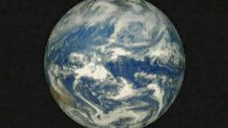
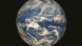
Earth
ID: 1013
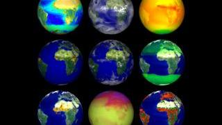
Six Annotated Datasets Pull Away from a Single Globe
Alternate Versions
Visualization Credits
Yoram Kaufman (NASA/GSFC): Scientist
Please give credit for this item to:
NASA/Goddard Space Flight Center, The SeaWiFS Project and GeoEye, Scientific Visualization Studio. NOTE: All SeaWiFS images and data presented on this web site are for research and educational use only. All commercial use of SeaWiFS data must be coordinated with GeoEye (NOTE: In January 2013, DigitalGlobe and GeoEye combined to become DigitalGlobe).
NASA/Goddard Space Flight Center, The SeaWiFS Project and GeoEye, Scientific Visualization Studio. NOTE: All SeaWiFS images and data presented on this web site are for research and educational use only. All commercial use of SeaWiFS data must be coordinated with GeoEye (NOTE: In January 2013, DigitalGlobe and GeoEye combined to become DigitalGlobe).
Short URL to share this page:
https://svs.gsfc.nasa.gov/1013
Missions:
Galileo
Upper Atmosphere Radiation Satellite (UARS)
Data Used:
Note: While we identify the data sets used in these visualizations, we do not store any further details nor the data sets themselves on our site.
This item is part of this series:
Terra Pre-launch
Keywords:
DLESE >> Atmospheric science
DLESE >> Biological oceanography
DLESE >> Physical geography
SVS >> GOES
NASA Science >> Earth
https://svs.gsfc.nasa.gov/1013
Missions:
Galileo
Upper Atmosphere Radiation Satellite (UARS)
Data Used:
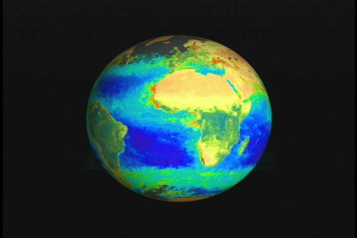
Earth Probe/TOMS
Galileo/Solid-State Imaging Camera
NASA/JPL - 1990/12/11-1990/12/12SeaStar/SeaWiFS
NOTE: All SeaWiFS images and data presented on this web site are for research and educational use only. All commercial use of SeaWiFS data must be coordinated with GeoEye
Credit:
NASA/Goddard Space Flight Center, The SeaWiFS Project and GeoEye, Scientific Visualization Studio. NOTE: All SeaWiFS images and data presented on this web site are for research and educational use only. All commercial use of SeaWiFS data must be coordinated with GeoEye (NOTE: In January 2013, DigitalGlobe and GeoEye combined to become one DigitalGlobe.).
NASA/Goddard Space Flight Center, The SeaWiFS Project and GeoEye, Scientific Visualization Studio. NOTE: All SeaWiFS images and data presented on this web site are for research and educational use only. All commercial use of SeaWiFS data must be coordinated with GeoEye (NOTE: In January 2013, DigitalGlobe and GeoEye combined to become one DigitalGlobe.).
This item is part of this series:
Terra Pre-launch
Keywords:
DLESE >> Atmospheric science
DLESE >> Biological oceanography
DLESE >> Physical geography
SVS >> GOES
NASA Science >> Earth


