SnowEx Field Campaigns
Overview
NASA uses the vantage point of space to study all aspects of the Earth as an interconnected system. But there remain significant obstacles to measuring accurately how much water is stored across the planet's snow-covered regions. The amount of water in snow plays a major role in water availability for drinking water, agriculture and hydropower.
Enter SnowEx, a NASA led multi-year research campaign to improve remote-sensing measurements of how much snow is on the ground at any given time and how much water that will turn into when that snow melts. SnowEx is sponsored by the Terrestrial Hydrology Program at NASA Headquarters in Washington, D.C., and managed by Goddard Space Flight Center.
For more information: nasa.gov/earthexpeditions
Edited Features
- ID: 14302 Produced Video
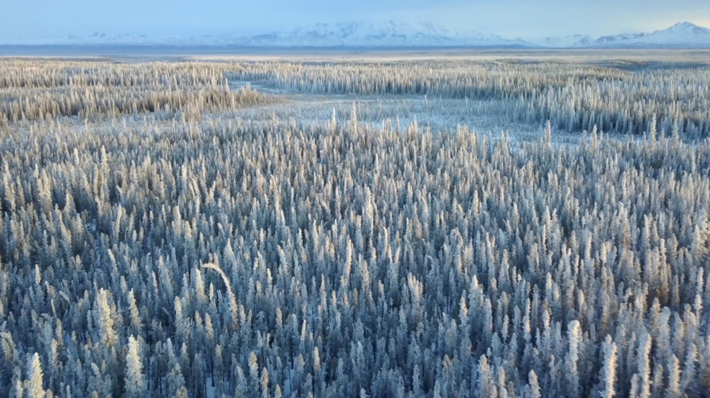
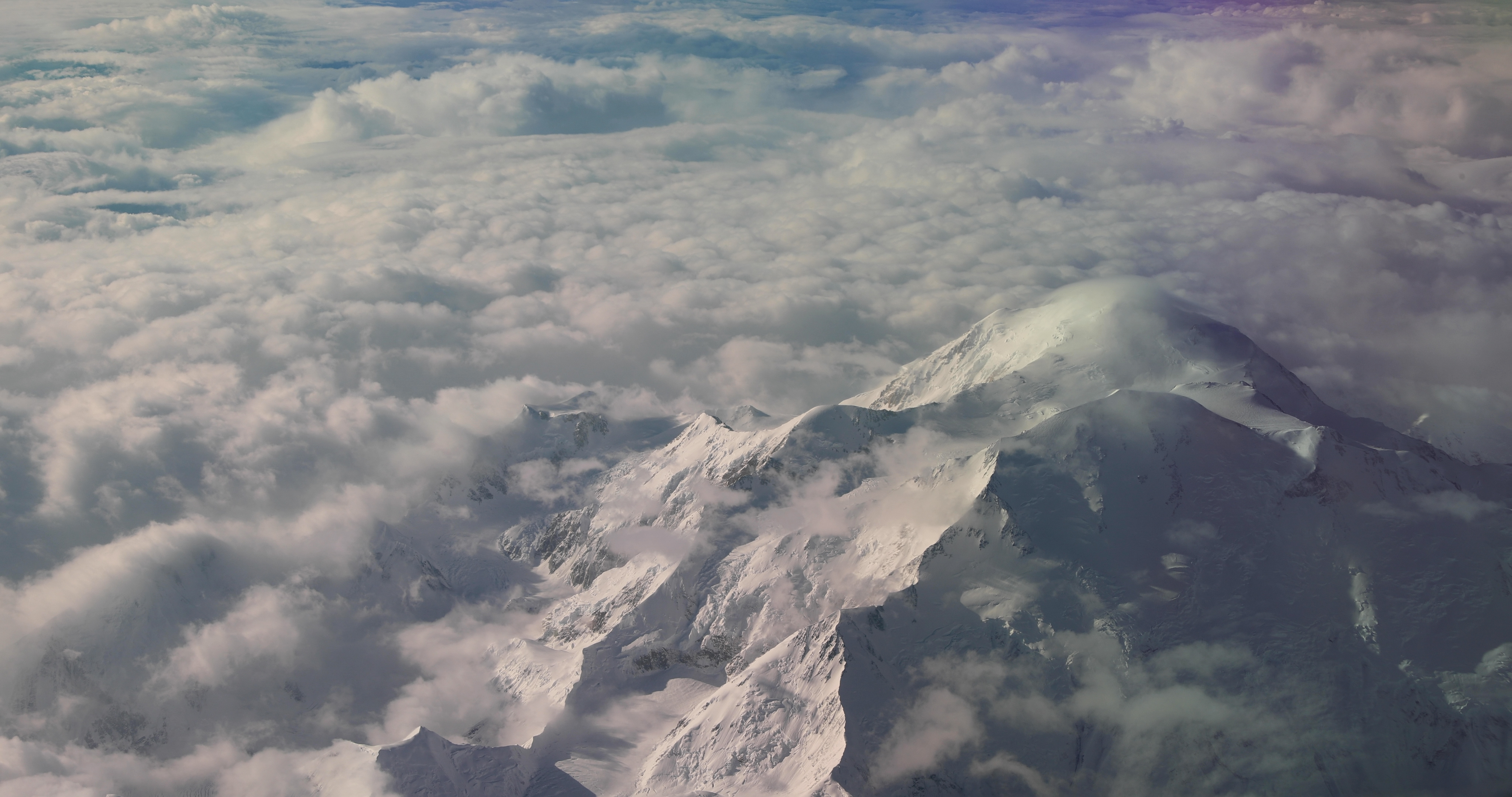
SnowEx Sets Sights on Alaska
Go to this pageMusic: "World Citizens," "Geothermical Power," Universal Production MusicThis video can be freely shared and downloaded. While the video in its entirety can be shared without permission, some individual imagery provided by pond5.com, Boise State University, Matt Crook and Harrison Bach and is obtained through permission and may not be excised or remixed in other products. For more information on NASA’s media guidelines, visit https://www.nasa.gov/multimedia/guidelines/index.html.Complete transcript available.Video Descriptive Text available. || SnowEx23_Thumb_print.jpg (1024x574) [226.9 KB] || SnowEx23_Thumb.png (2602x1460) [6.9 MB] || SnowEx23_Thumb_searchweb.png (320x180) [130.3 KB] || SnowEx23_Thumb_thm.png (80x40) [11.3 KB] || SnowEx_2023_Kickoff_Prores.mov (1920x1080) [2.0 GB] || SnowEx_2023_Kickoff_Prores.webm (1920x1080) [16.5 MB] || SnowEx_2023_Kickoff_v3.mp4 (1920x1080) [303.9 MB] || SnowEx23.en_US.srt [3.2 KB] || SnowEx23.en_US.vtt [3.0 KB] ||
- ID: 13851 Produced Video
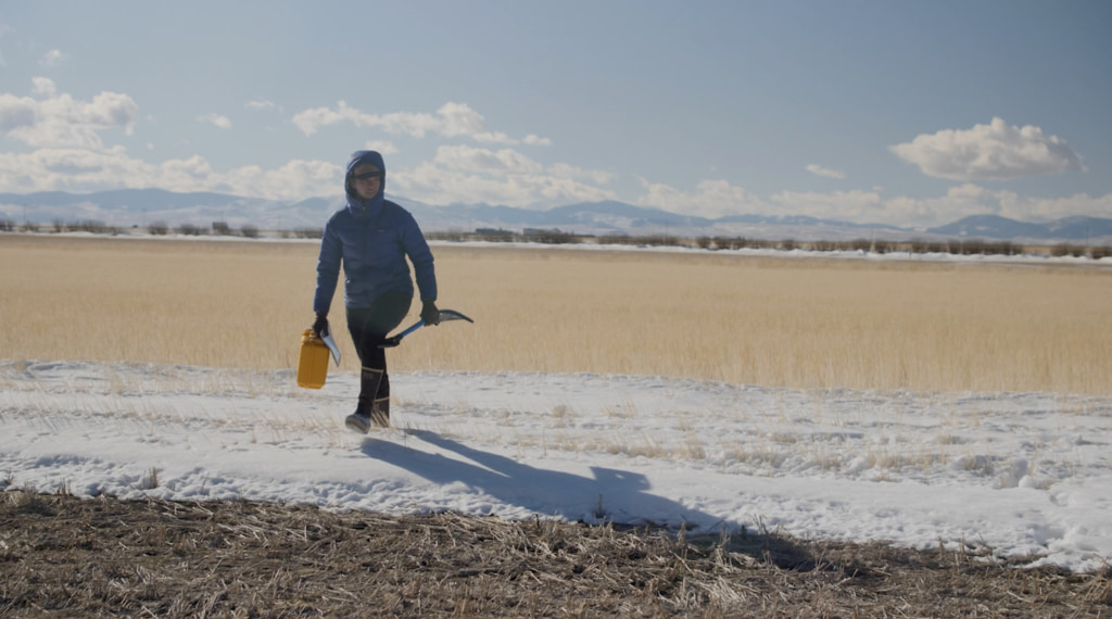
Snow Scientists in the Windswept Montana Prairie
Go to this pageMusic: "Timelapse," "A New Dawn," Universal Production MusicComplete transcript available.Footage provided by Harrison Bach. For licensing information, contact hbach21@gmail.com || montana-snowex-thumb_print.jpg (1024x570) [131.2 KB] || montana-snowex-thumb.png (3272x1824) [6.0 MB] || montana-snowex-thumb_searchweb.png (320x180) [92.5 KB] || montana-snowex-thumb_thm.png (80x40) [9.5 KB] || MontanaSnowExFIXED.mp4 (1920x1080) [539.0 MB] || MontanaSnowExFIXEDprores.mov (1920x1080) [4.3 GB] || MontanaSnowEx_prores_1.mov (1920x1080) [30.6 MB] || MontanaSnowExFIXEDprores.webm (1920x1080) [22.2 MB] || MontanaSnowEx.en_US.srt [6.4 KB] || MontanaSnowEx.en_US.vtt [6.4 KB] ||
- ID: 13820 Produced Video
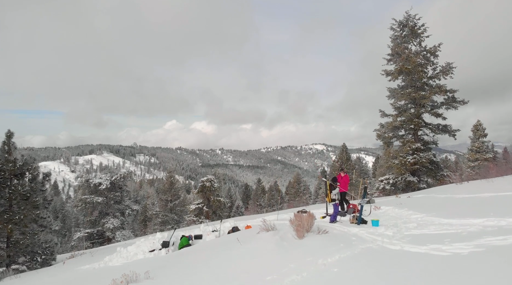
NASA and Partners Get Back into Snow Business
Go to this pageMusic: "Beautiful Serenity," "Frozen Waves," Universal Production Music.This video can be freely shared and downloaded. While the video in its entirety can be shared without permission, some individual imagery provided by pond5.com and Boise State University and is obtained through permission and may not be excised or remixed in other products. Specific details on stock footage may be found here. For more information on NASA’s media guidelines, visit https://www.nasa.gov/multimedia/guidelines/index.html.Complete transcript available.Notes on footage:0:31 - 3:28 provided by Matt Crook/Boise State University3:28 - 3:36 provided by pond5.com || snowex2021-thumb.png (1643x916) [1.4 MB] || snowex2021-thumb_print.jpg (1024x570) [102.3 KB] || snowex2021-thumb_searchweb.png (320x180) [81.0 KB] || snowex2021-thumb_thm.png (80x40) [9.3 KB] || SnowEx2021kickoffBoise.mp4 (1920x1080) [282.7 MB] || SnowEx2021kickoffBoise.webm (1920x1080) [30.2 MB] || SnowEx2021kickoff.en_US.srt [4.9 KB] || SnowEx2021kickoff.en_US.vtt [4.9 KB] ||
- ID: 13610 Produced Video
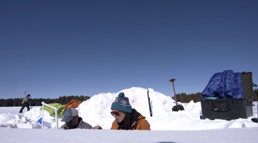
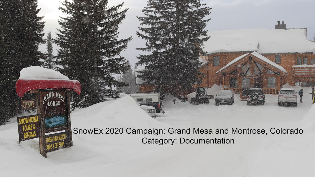
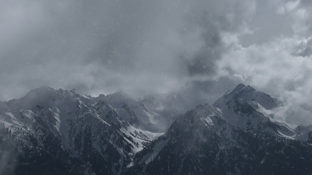
Snow Scientists Dig Deep in Grand Mesa
Go to this pageMusic: "Storm Chasers," "Black Coffee," "From Small Beginnings," Universal Production MusicComplete transcript available. || SnowEx2020_thumb_print.jpg (1024x569) [77.1 KB] || SnowEx2020_thumb.png (2970x1652) [3.2 MB] || SnowEx2020_thumb_searchweb.png (320x180) [67.2 KB] || SnowEx2020_thumb_thm.png (80x40) [7.9 KB] || SnowEx2020_prores.mov (1920x1080) [4.3 GB] || SnowEx_Wrap_v2.mp4 (1920x1080) [322.6 MB] || SnowEx_Wrap_v2.webm (1920x1080) [34.2 MB] || SnowEx2020_YouTube.mp4 (1920x1080) [509.7 MB] || SnowEx2020.en_US.srt [6.2 KB] || SnowEx2020.en_US.vtt [6.3 KB] ||
- ID: 12511 Produced Video
![Complete transcript available.Music credit: "Detective Analysis" by Laurent Dury [SACEM] from Killer Tracks Music](/vis/a010000/a012500/a012511/ERNSnowEx_YouTube.00083_print.jpg)
NASA Investigates Water Supply in Snow
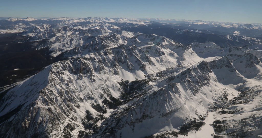
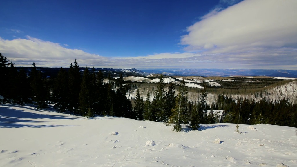
Go to this pageThis February, a NASA-led research campaign called SnowEx kicked off in Colorado. The 5-year study will advance global measurements of how much snow is on the ground at any given time and how much liquid water is contained in that snow. The amount of water in snow plays a huge role in water availability for drinking water, agriculture, and hydropower.Teams of 50 researchers are stationed at Grand Mesa and Senator Beck Basin over a three-week period to measure snow using a variety of snow-sensing instruments and techniques. Ground measurements will allow the team to validate the remotely sensed measurements acquired by multiple sensors on the various aircraft.Data acquired from the SnowEx campaign will be stored at the National Snow and Ice Data Center in Boulder, Colorado, and will be available to anyone to order at no cost, as is the case with all NASA data. For more information: https://www.nasa.gov/earthexpeditions/ ||
Broadcast-quality Media
- Section
SnowEx 2020 B-roll
Go to this sectionNASA’s SnowEx ground and airborne campaign is a multiyear effort using a variety of techniques to study snow characteristics, and the team concluded their second year in March 2020. Not only is SnowEx learning valuable information about how snow properties change by terrain and season, but they are also testing the tools NASA will need to sample snow from space.
- ID: 12496 B-Roll
SnowEx Field Campaign: 4K B-roll From The P-3 Orion Aircraft
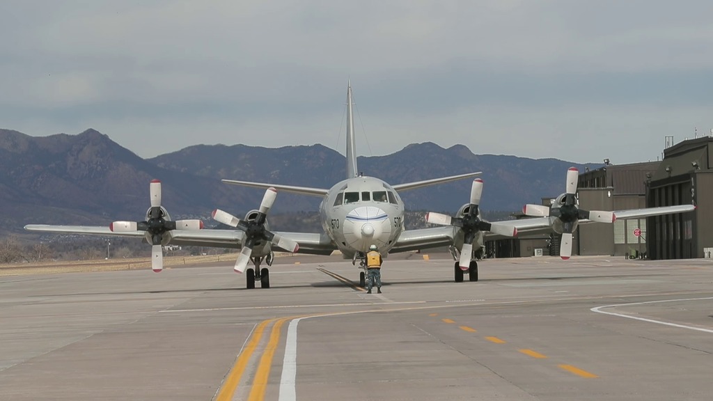
Go to this pageSnowEx is a NASA led multi-year research campaign to improve measurements of how much snow is on the ground at any given time and how much liquid water is contained in that snow.Five aircraft with a total of ten different sensors will participate in the SnowEx campaign. From a base of operations at Peterson Air Force Base, Colorado Springs, SnowEx will deploy a P-3 Orion aircraft operated by the Scientific Development Squadron ONE (VXS-1), based at Naval Air Station Patuxent River, Maryland. A King Air plane will fly out of Grand Junction, Colorado, while high-altitude NASA jets will fly from Johnson Space Center in Houston.The planes will carry passive and active microwave sensors that are good at measuring snow-water equivalent in dry snow, but are less optimal for measuring snow forests or light snow cover. The campaign will also deploy an airborne laser instrument to measure snow depth, and airborne sensors to measure surface temperature and reflected light from snow.Data acquired from the SnowEx campaign will be stored at the National Snow and Ice Data Center in Boulder, Colorado, and will be available to anyone to order at no cost, as is the case with all NASA data.For more information: https://www.nasa.gov/earthexpeditions ||
- ID: 12489 B-Roll
SnowEx Field Campaign: B-roll From The P-3 Orion Aircraft
Go to this pageSnowEx is a NASA led multi-year research campaign to improve measurements of how much snow is on the ground at any given time and how much liquid water is contained in that snow.Five aircraft with a total of ten different sensors will participate in the SnowEx campaign. From a base of operations at Peterson Air Force Base, Colorado Springs, SnowEx will deploy a P-3 Orion aircraft operated by the Scientific Development Squadron ONE (VXS-1), based at Naval Air Station Patuxent River, Maryland. A King Air plane will fly out of Grand Junction, Colorado, while high-altitude NASA jets will fly from Johnson Space Center in Houston. The planes will carry passive and active microwave sensors that are good at measuring snow-water equivalent in dry snow, but are less optimal for measuring snow forests or light snow cover. The campaign will also deploy an airborne laser instrument to measure snow depth, and airborne sensors to measure surface temperature and reflected light from snow.Data acquired from the SnowEx campaign will be stored at the National Snow and Ice Data Center in Boulder, Colorado, and will be available to anyone to order at no cost, as is the case with all NASA data.For more information: https://www.nasa.gov/earthexpeditions ||
- ID: 12490 B-Roll
SnowEx Field Campaign: B-roll From Grand Mesa
Go to this pageSnowEx is a NASA led multi-year research campaign to improve measurements of how much snow is on the ground at any given time and how much liquid water is contained in that snow.Starting in February, teams of 50 researchers are stationed at Grand Mesa and Senator Beck Basin over a three-week period to measure snow using a variety of snow-sensing instruments and techniques.Ground measurements will allow the team to validate the remotely-sensed measurements acquired by the multiple sensors on the various aircraft.Data acquired from the SnowEx campaign will be stored at the National Snow and Ice Data Center in Boulder, Colorado, and will be available to anyone to order at no cost, as is the case with all NASA data. For more information: https://www.nasa.gov/earthexpeditions/ ||
Snow Data Visualizations
- ID: 4995 Visualization
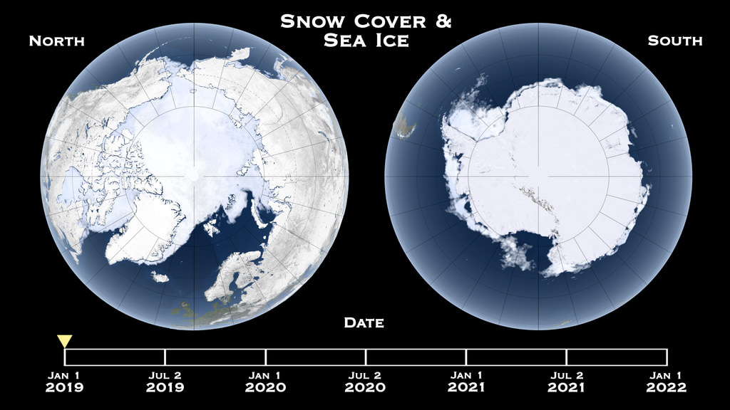
Global Snow Cover and Sea Ice Cycle at Both Poles
Go to this pageVisualization showing the changes in snow cover and sea ice with the seasons, for the years 2019-2021. || sea_ice_sidexside.0001_print.jpg (1024x576) [121.9 KB] || sea_ice_sidexside.0001_searchweb.png (320x180) [64.0 KB] || sea_ice_sidexside.0001_thm.png (80x40) [6.5 KB] || sea_ice_sidexside.0001_web.png (320x180) [64.0 KB] || sea_ice_sidexside_1080p30.mp4 (1920x1080) [25.6 MB] || sea_ice_sidexside_1080p30.webm (1920x1080) [7.1 MB] || frames/3840x2160_16x9_30p/full_video/ (3840x2160) [128.0 KB] || sea_ice_sidexside_2160p30.mp4 (3840x2160) [65.8 MB] ||
- ID: 3899 Visualization
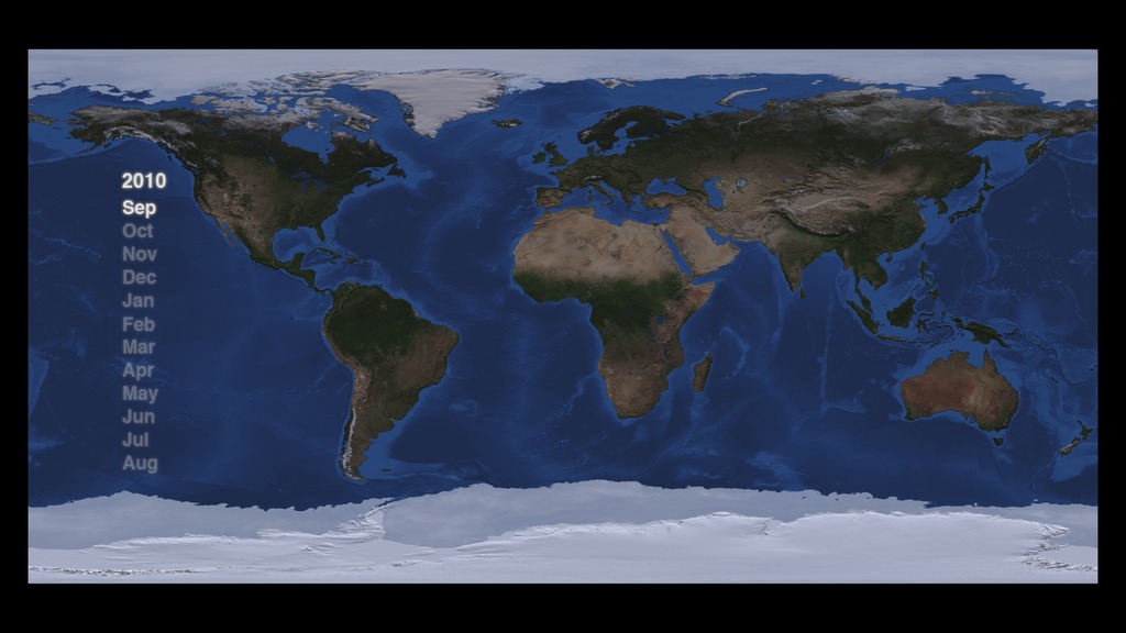
Seasonal sea ice and snow cover visualizations
Go to this pageSeasonal snow cover and sea ice across the globe from September 2010 to August 2011 || FlatMap_1920x108060fps_0000_print.jpg (1024x576) [99.4 KB] || FlatMap_1920x108060fps_0000_searchweb.png (320x180) [65.9 KB] || FlatMap_1920x108060fps_0000_web.png (320x180) [65.9 KB] || FlatMap_1920x108060fps_0000_thm.png (80x40) [5.8 KB] || frames/1920x1080_16x9_60p/Global/ (1920x1080) [256.0 KB] || frames/1920x1080_16x9_30p/Global/ (1920x1080) [128.0 KB] || frames/1280x720_16x9_30p/Global/ (1280x720) [128.0 KB] || FlatMap_1920x1080_p30.mp4 (1920x1080) [13.3 MB] || FlatMap_1280x720_p30.mp4 (1280x720) [8.2 MB] || FlatMap_1280x720_p30.webm (1280x720) [3.6 MB] ||
- ID: 12564 Produced Video
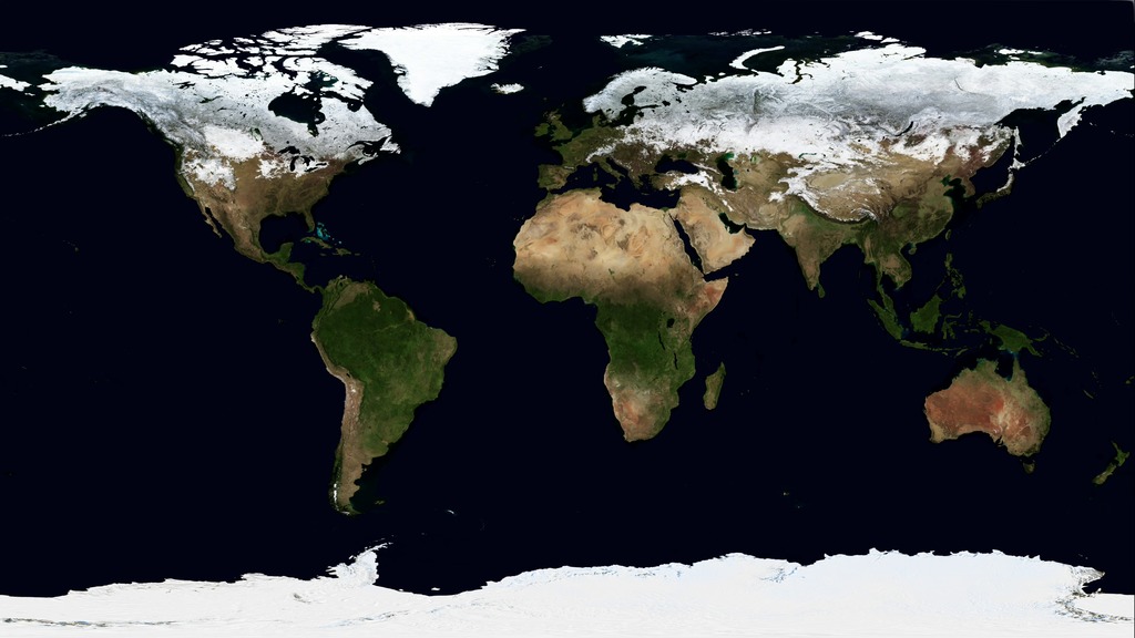
Blue Marble Next Generation
Go to this pageBlue Marble: Next Generation is a years worth of monthly composites at a spatial resolution of 500 meters. These monthly images, from january through December, reveal seasonal changes to the land surface: the green-up and dying-back of vegetation in temperate regions such as North America and Europe, dry and wet seasons in the tropics, and advancing and retreating Northern Hemisphere snow cover. || 12564_Blue_Marble_UHD_large.00001_print.jpg (1024x576) [112.1 KB] || 12564_Blue_Marble_UHD_large.00001_searchweb.png (320x180) [59.3 KB] || 12564_Blue_Marble_UHD_large.00001_thm.png (80x40) [5.5 KB] || 12564_Blue_Marble_appletv.m4v (1280x720) [5.9 MB] || 12564_Blue_Marble_prores_1280.mov (1280x720) [184.0 MB] || 12564_Blue_Marble_UHD.webm (960x540) [2.6 MB] || 12564_Blue_Marble_UHD_prores.mov (3840x2160) [1.4 GB] || 12564_Blue_Marble_UHD_youtube_hq.mov (3840x2160) [40.4 MB] || 12564_Blue_Marble_UHD_large.mp4 (3840x2160) [12.6 MB] || GSFC_20170403_Blue_m12564_Marble.en_US.vtt [64 bytes] || frames/5400x2700_2x1_60p/ (5400x2700) [4.0 KB] ||
- ID: 31113 Hyperwall Visual
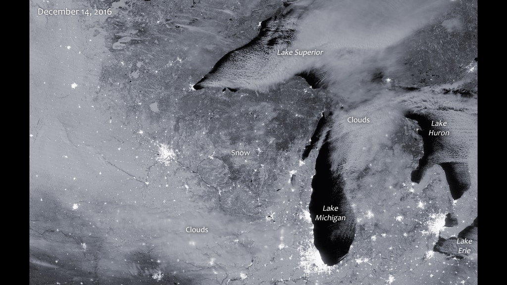
Snow Cover in the Great Lakes Region, United States
Go to this pagesnow cover in the Great Lakes region with Night Lights || snow-cover-great-lakes_print.jpg (1024x576) [144.8 KB] || snow-cover-great-lakes.png (3840x2160) [8.3 MB] || snow-cover-great-lakes_searchweb.png (320x180) [90.6 KB] || snow-cover-great-lakes_thm.png (80x40) [6.4 KB] ||
- ID: 4690 Visualization
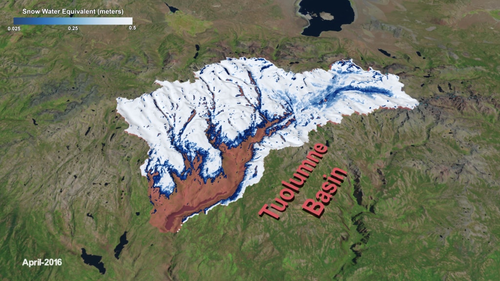
Tracking Snow Water Equivalent in the Tuolumne Basin
Go to this pageThis visualization focuses on the Tuolumne Basin, located within the boundaries of Yosemite National Park, which supplies water via the Hetch Hetchy aqueduct to the San Francisco Bay Area. Snow Water Equivalent (SWE) data collected by the Airborne Snow Observatory (ASO) between 2014 and 2017 is depicted in blues and whites, showing how the snowpack changes over time. This version includes a colorbar. || aso_wColorbar_1500_print.jpg (1024x576) [175.2 KB] || aso_wColorbar_1500_searchweb.png (320x180) [127.9 KB] || aso_wColorbar_1500_thm.png (80x40) [8.0 KB] || frames/1920x1080_16x9_30p/aso_tuolumne_wColorbar/ (1920x1080) [128.0 KB] || aso_wColorbar_1080p30.mp4 (1920x1080) [60.8 MB] || aso_wColorbar_1080p30.webm (1920x1080) [7.6 MB] ||
- ID: 4307 Visualization
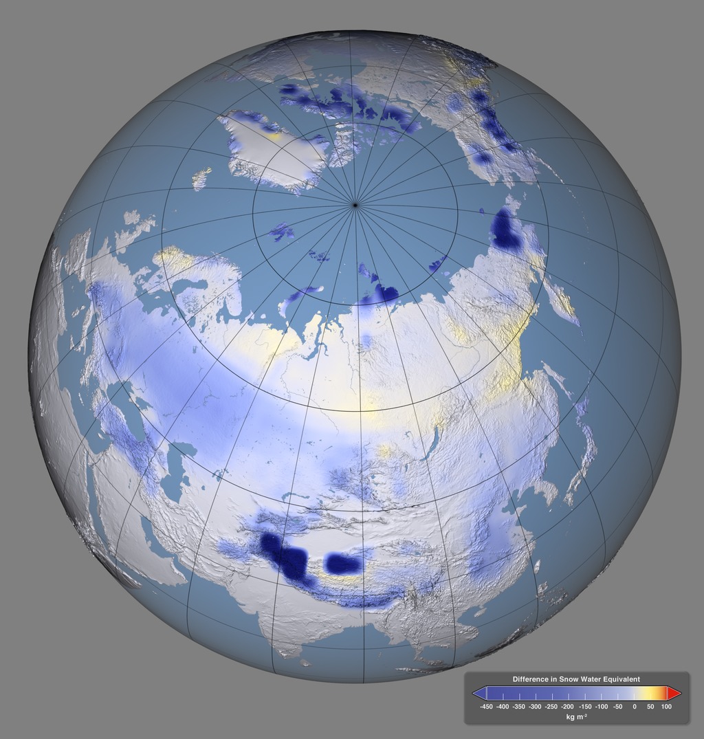
Impact of Snow Darkening on Boreal Spring Climate
Go to this pageFigure 1b: This image shows how the reduced albedo of the snow from dust, black carbon and organic carbon (the "snow darkening effect") alters difference in snow water equivalent through increased springtime melt. A colorbar reflects the quantities of the difference. || Figure_1_B_disk_20_medium_layers_with_Legend_print.jpg (1024x1075) [252.0 KB] || Figure_1_B_disk_20_medium_layers_with_Legend_searchweb.png (320x180) [5.9 MB] || Figure_1_B_disk_20_medium_layers_with_Legend_thm.png (80x40) [5.8 MB] || Figure_1_B_disk_20_medium_layers_with_Legend.tif (2000x2100) [11.2 MB] || Figure_1_B_disk_30_large_layers_with_Legend.tif (3000x3150) [24.5 MB] || Figure_1_B_disk_30_large_layers_with_Legend.psd (3000x3150) [30.5 MB] || Figure_1_B_disk_40_extra_large_layers_with_Legend.tif (4000x4200) [43.0 MB] || Figure_1_B_disk_40_extra_large_layers_with_Legend.psd (4000x4200) [53.6 MB] ||
Related Features
- ID: 12511 Produced Video
NASA Investigates Water Supply in Snow
Go to this pageThis February, a NASA-led research campaign called SnowEx kicked off in Colorado. The 5-year study will advance global measurements of how much snow is on the ground at any given time and how much liquid water is contained in that snow. The amount of water in snow plays a huge role in water availability for drinking water, agriculture, and hydropower.Teams of 50 researchers are stationed at Grand Mesa and Senator Beck Basin over a three-week period to measure snow using a variety of snow-sensing instruments and techniques. Ground measurements will allow the team to validate the remotely sensed measurements acquired by multiple sensors on the various aircraft.Data acquired from the SnowEx campaign will be stored at the National Snow and Ice Data Center in Boulder, Colorado, and will be available to anyone to order at no cost, as is the case with all NASA data. For more information: https://www.nasa.gov/earthexpeditions/ ||
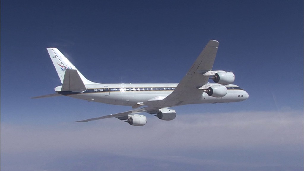
- ID: 12549 Produced Video
![Complete transcript available.Music credit: “Time Shift Equalibrium” by Ben Niblett [PRS] and Jon Cotton [PRS] from Killer Tracks MusicWatch this video on the NASA Goddard YouTube channel.](/vis/a010000/a012500/a012549/LARGE_MP4-12549_SnowExPlane_large.00378_print.jpg)
How a NASA Science Flight is No Ordinary Journey
Go to this pageA group of scientists and pilots conducted a series of science flights over Western Colorado for a new five-year NASA-led airborne mission called SnowEx.SnowEx is exploring better ways to measuring how much water is stored in snow-covered regions with the goal of eventually creating a future snow satellite mission. More accurate snow measurements will help scientists and decisions-makers better understand our world’s water supply and better predict floods and droughts. Data acquired from the SnowEx campaign will be stored at the National Snow and Ice Data Center in Boulder, Colorado, and will be available to anyone to order at no cost, as is the case with all NASA data.For more information:NASA's SnowEx Challenges the Sensing Techniques...'Until They Break'NASA: Snow Science in Support of Our Nation's Water Supply ||
- ID: 12507 Produced Video
GPM Gets Flake-y
Go to this pageThe Global Precipitation Measurement can help improve numerical weather predictions of snowfall by measuring the size and shape distribution of snow particles, layer by layer, in a storm. ||
- ID: 12497 Produced Video
Snow Live Shots (Feb. 17, 2017)
Go to this pageB-roll for NASA interviews on Friday, February 17, 2017. || B-Roll.00001_print.jpg (1024x576) [182.9 KB] || B-Roll.00001_searchweb.png (320x180) [86.4 KB] || B-Roll.00001_web.png (320x180) [86.4 KB] || B-Roll.00001_thm.png (80x40) [6.6 KB] || B-Roll.mov (1280x720) [6.2 GB] || B-Roll.webm (1280x720) [47.7 MB] ||
- ID: 40333 Gallery
ABoVE
Go to this pageThe Arctic Boreal Vulnerability Experiment, or ABoVE, is a NASA-led, 10-year field experiment designed to better understand the ecological and social consequences of environmental change in one of the most rapidly changing regions on Earth. Satellite, airborne, and ground observations across Alaska and Canada will help us better understand the local and regional effects of changing forests, permafrost, and ecosystems – and how these changes could ultimately affect people and places beyond the Arctic.
Previous Field Campaigns
- ID: 12050 Produced Video
Researchers Gear Up For OLYMPEX
Go to this pageFrom November 10 through December 21, NASA and university scientists are taking to the field to study wet winter weather near Seattle, Washington. With weather radars, weather balloons, specialized ground instruments, and NASA's DC-8 flying laboratory, the science team will be verifying rain and snowfall observations made by the Global Precipitation Measurement (GPM) satellite mission on a NASA-led field campaign, The Olympic Mountain Experiment, or OLYMPEX.For more information: http://www.nasa.gov/feature/goddard/nasa-heads-to-pacific-northwest-for-field-campaign-to-measure-rain-and-snowfall ||
- ID: 10938 Produced Video
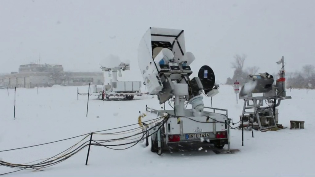
NASA Wraps Up Cold Season Campaign for GPM
Go to this pageFor six weeks in Ontario, Canada, scientists and engineers lead a field campaign to study the science and mechanics of falling snow. The datasets retrieved will be used to generate algorithms which translate what the GPM Core satellite "sees" into precipitation rates, including that of falling snow. Ground validation science manager Walt Petersen gives a summary of the GCPEx field campaign. Field campaigns are critical in improving satellite observations and precipitation measurements. ||
- ID: 3907 Visualization
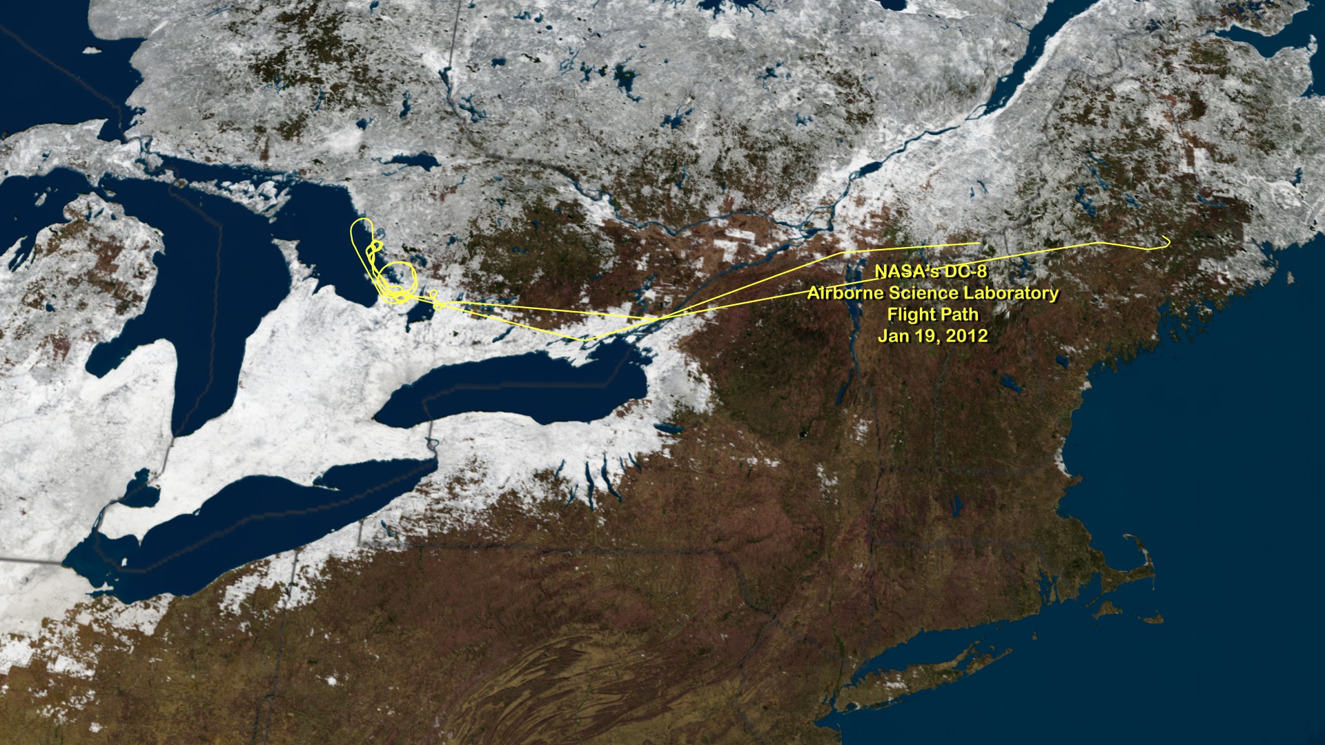
NASA's DC-8 Airborne Science Laboratory Flight Path Jan 19, 2012
Go to this pageNASA is flying an airborne science laboratory through Canadian snowstorms for six weeks in support of a difficult task of the upcoming Global Precipitation Measurement (GPM) mission: measuring snowfall from space. GPM is an international satellite mission scheduled for launch in 2014 that will provide next-generation observations of worldwide rain and snow every three hours. It is the first precipitation mission designed to detect falling snow from space. NASA's DC-8 flying laboratory flew this flight path on Jan 19, 2012 in support of NASA's Global Precipitation Measurement Cold-season Precipitation Experiment (GCPEx) snow study. The GCPEx field campaign will help scientists match measurements of snow in the air and on the ground. ||
- ID: 10890 Produced Video
NASA Airborne Cold Weather Experiment Measures Falling Snow
Go to this pageNASA is flying an airborne science laboratory through Canadian snowstorms for six weeks in support of a difficult task of the upcoming Global Precipitation Measurement (GPM) mission: measuring snowfall from space. GPM is an international satellite mission scheduled for launch in 2014 that will provide next-generation observations of worldwide rain and snow every three hours. It is the first precipitation mission designed to detect falling snow from space. ||