Flying Around The Eclipse Shadow
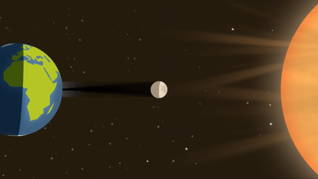
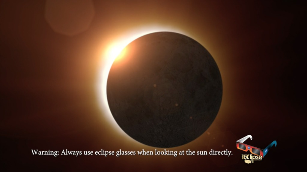
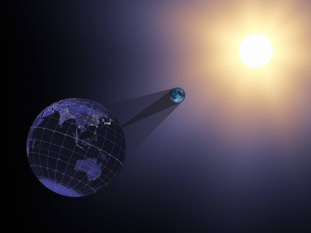
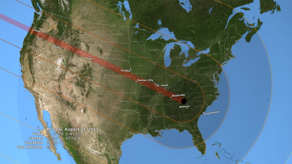
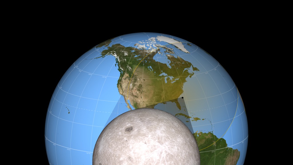
A view of the Moon's shadow during the August 21, 2017 eclipse from both the night and day sides of the Earth.
This visualization combines the views from several previous visualizations (#4390, #4321, and #4314) to create a continuous camera flight from the night side of the Earth to the day side, showing the relationship of the Earth, Moon, and Sun during the August 21, 2017 eclipse. It shows the direction of the Moon's motion and the Earth's rotation, the complete path of the umbra from the moment it touches down on the Earth until the moment it departs, and the true scale of the Earth-Moon system.
For More Information
Credits
Please give credit for this item to:
NASA's Scientific Visualization Studio
-
Visualizer
- Ernie Wright (USRA)
-
Scientist
- C. Alex Young (NASA/GSFC)
Release date
This page was originally published on Wednesday, June 21, 2017.
This page was last updated on Monday, July 15, 2024 at 12:05 AM EDT.
Missions
This visualization is related to the following missions:Series
This visualization can be found in the following series:Datasets used in this visualization
-
BMNG (Blue Marble: Next Generation) [Terra and Aqua: MODIS]
ID: 508Credit: The Blue Marble data is courtesy of Reto Stockli (NASA/GSFC).
This dataset can be found at: http://earthobservatory.nasa.gov/Newsroom/BlueMarble/
See all pages that use this dataset -
DEM (Digital Elevation Map) [LRO: LOLA]
ID: 653 -
DE421 (JPL DE421)
ID: 752Planetary ephemerides
This dataset can be found at: http://ssd.jpl.nasa.gov/?ephemerides#planets
See all pages that use this dataset -
WAC 643nm High Sun Global Mosaic [LRO: LROC]
ID: 803
Note: While we identify the data sets used in these visualizations, we do not store any further details, nor the data sets themselves on our site.
Related
- ID: 12648
 Produced Video
 - ID: 12664
- ID: 12625
- ID: 4390
 Visualization
 - ID: 4314
 Visualization
 - ID: 4321
 Visualization
Used as a Source In
- ID: 12179
 Produced Video
 - ID: 12669
![Music: Dawn Drone by Juan Jose Alba Gomez [SGAE]Complete transcript available.](/vis/a010000/a012600/a012669/LARGE_MP4-EPICEclipse_Rescript_large.00696_print.jpg) Produced Video
Produced Video