A newer version of this visualization is available.
Urban Growth in Las Vegas
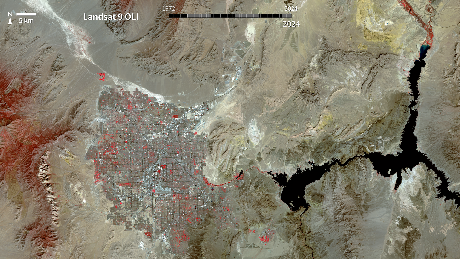
The city of Las Vegas—meaning the meadows—was established in 1905. Its grassy meadows and artesian springs attracted settlers traveling across the arid Desert Southwest in the early 1800s. In the 1930s, gambling became legalized and construction of the Hoover Dam began, resulting in the city's first growth spurt. Since then, Las Vegas has not stopped growing. Population has reached nearly two million over the past decade, becoming one of the fastest growing metropolitan areas in the world. These false-color images show the rapid urbanization of Las Vegas between 1972 and 2018. The city streets and other impervious surfaces appear gray, while irrigated vegetation appears red. Over the years, the expansion of irrigated vegetation (e.g., lawns and golf courses) has stretched the city’s desert bounds.
Animation of timeseries of Landsat data of Las Vegas

9 images from the Las Vegas Landsat time series
Plots of lake levels and population along with 6 images from the time series
For More Information
Credits
Please give credit for this item to:
NASA/Goddard Space Flight Center
-
Producer
- Marit Jentoft-Nilsen (Global Science and Technology, Inc.)
-
Visualizer
- Marit Jentoft-Nilsen (Global Science and Technology, Inc.)
-
Writer
- Heather Hanson (Global Science and Technology, Inc.)
-
Project support
- Mark Malanoski (Global Science and Technology, Inc.)
Missions
This page is related to the following missions:Datasets used
-
[Landsat]
ID: 47 -
[Landsat-1: MSS]
ID: 48 -
[Landsat-2: MSS]
ID: 49 -
[Landsat-3: MSS]
ID: 50 -
[Landsat-4: MSS]
ID: 51 -
[Landsat-5: TM]
ID: 53 -
[Landsat-7: ETM+]
ID: 55This dataset can be found at: http://landsat.gsfc.nasa.gov/about/wrs.html
See all pages that use this dataset -
Band Combination 5, 4, 3 [Landsat-8: OLI]
ID: 862
Note: While we identify the data sets used on this page, we do not store any further details, nor the data sets themselves on our site.
Newer Versions
- ID: 31195
 Hyperwall Visual
Release date
This page was originally published on Friday, March 15, 2019.
This page was last updated on Thursday, October 10, 2024 at 12:19 AM EDT.