Landsat 9 Teaser Promo
Video promoting the technological advances of Landsat 9, continuing the legacy of global land imaging begun in 1972. The video highlights the origin of the Landsat program and some of the many benefits we receive from its data.
Music: Marble Place by Matias Suescun [SACEM], published by KTSA Publishing [SACEM], available from Universal Production Music
Complete transcript available.
Watch this video on the NASA Goddard YouTube channel.
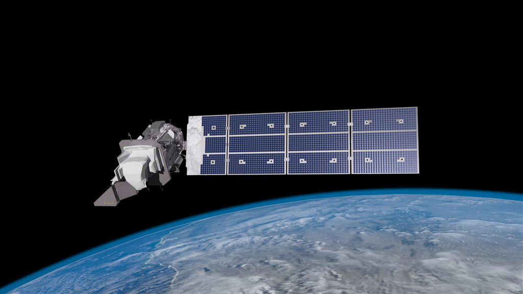
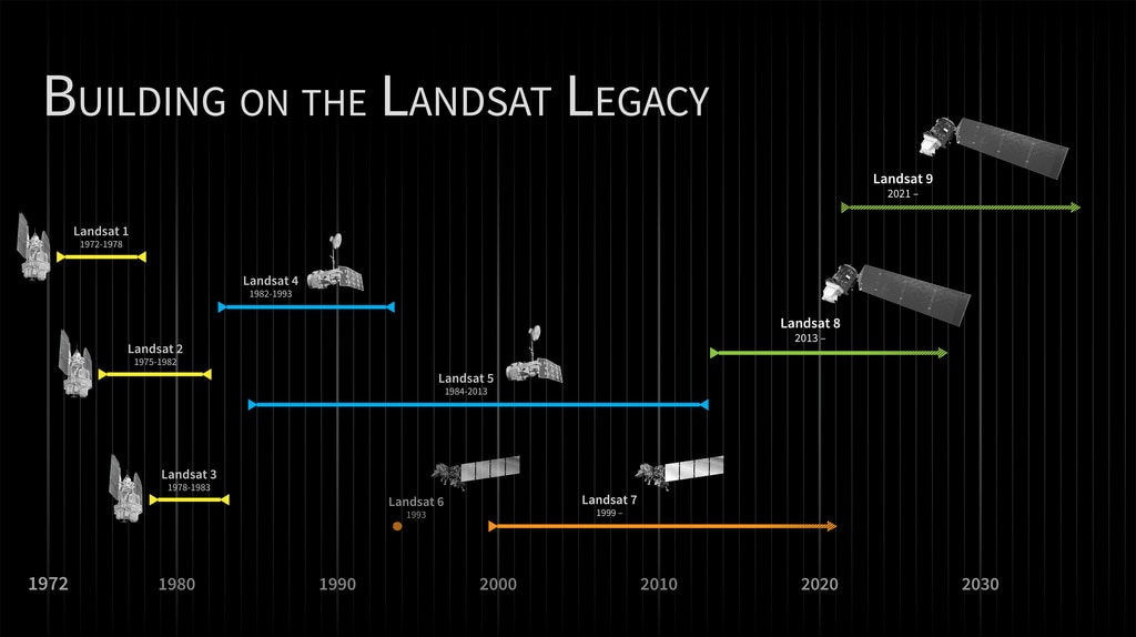
Landsat 9 is the latest satellite to continue the legacy of global observations of Earth’s land surface. With unmatched longevity, accuracy, and coverage, the Landsat program has been the cornerstone of global land imaging since 1972. Landsat 9 continues this tradition, and will carry us into the next fifty years of Earth observations. The two instruments on-board will make the most advanced measurements of any Landsat satellite.
Design and construction of the spacecraft and its instruments is managed by NASA’s Goddard Space Flight Center, and operation and archiving of the data is managaed by the US Geological Survey. Goddard and Ball Aerospace each built one of the instruments, and the spacecraft was built by Northrop Grumman.
The Landsat Program is a series of Earth-observing satellite missions jointly managed by NASA and the U.S. Geological Survey (USGS). Landsat satellites have been consistently gathering data about our planet since 1972. They continue to improve and expand this unparalleled record of Earth's changing landscapes for the benefit of all.
Credits
Please give credit for this item to:
NASA's Goddard Space Flight Center
-
Producer
- Matthew R. Radcliff (USRA)
-
Technical support
- Aaron E. Lepsch (ADNET Systems, Inc.)
-
Writer
- Kate Ramsayer (Telophase)
-
Editor
- Matthew R. Radcliff (USRA)
-
Narrator
- Matthew R. Radcliff (USRA)
-
Scientist
- Jeffrey Masek (NASA/GSFC)
Missions
This page is related to the following missions:Series
This page can be found in the following series:Related
- ID: 13920

Sources
- ID: 13259
 Produced Video
 - ID: 11433
 Produced Video
 - ID: 3939
 Visualization
Release date
This page was originally published on Thursday, July 23, 2020.
This page was last updated on Wednesday, May 3, 2023 at 1:44 PM EDT.