A newer version of this visualization is available.
NASA's Earth Observing Fleet: March 2017
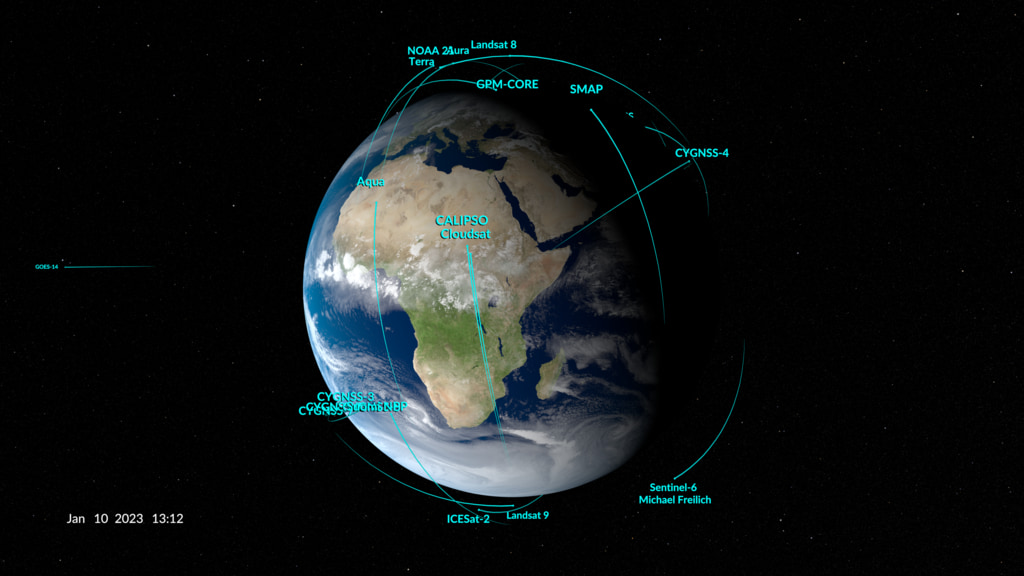
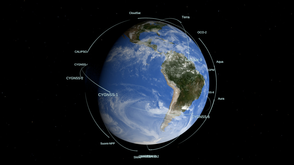
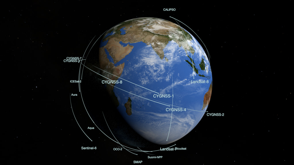
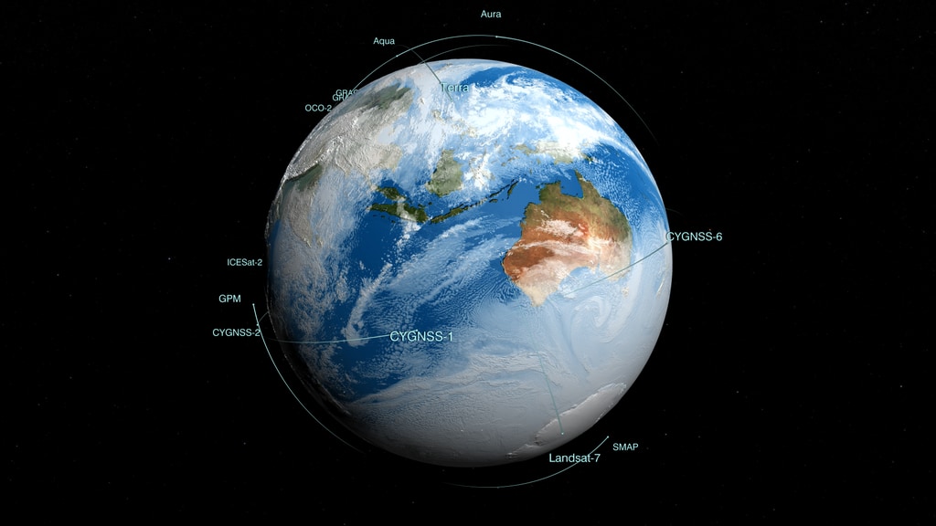
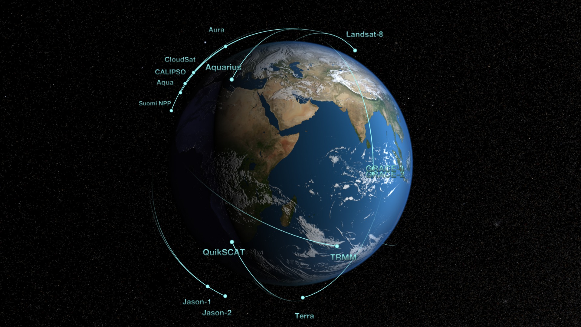
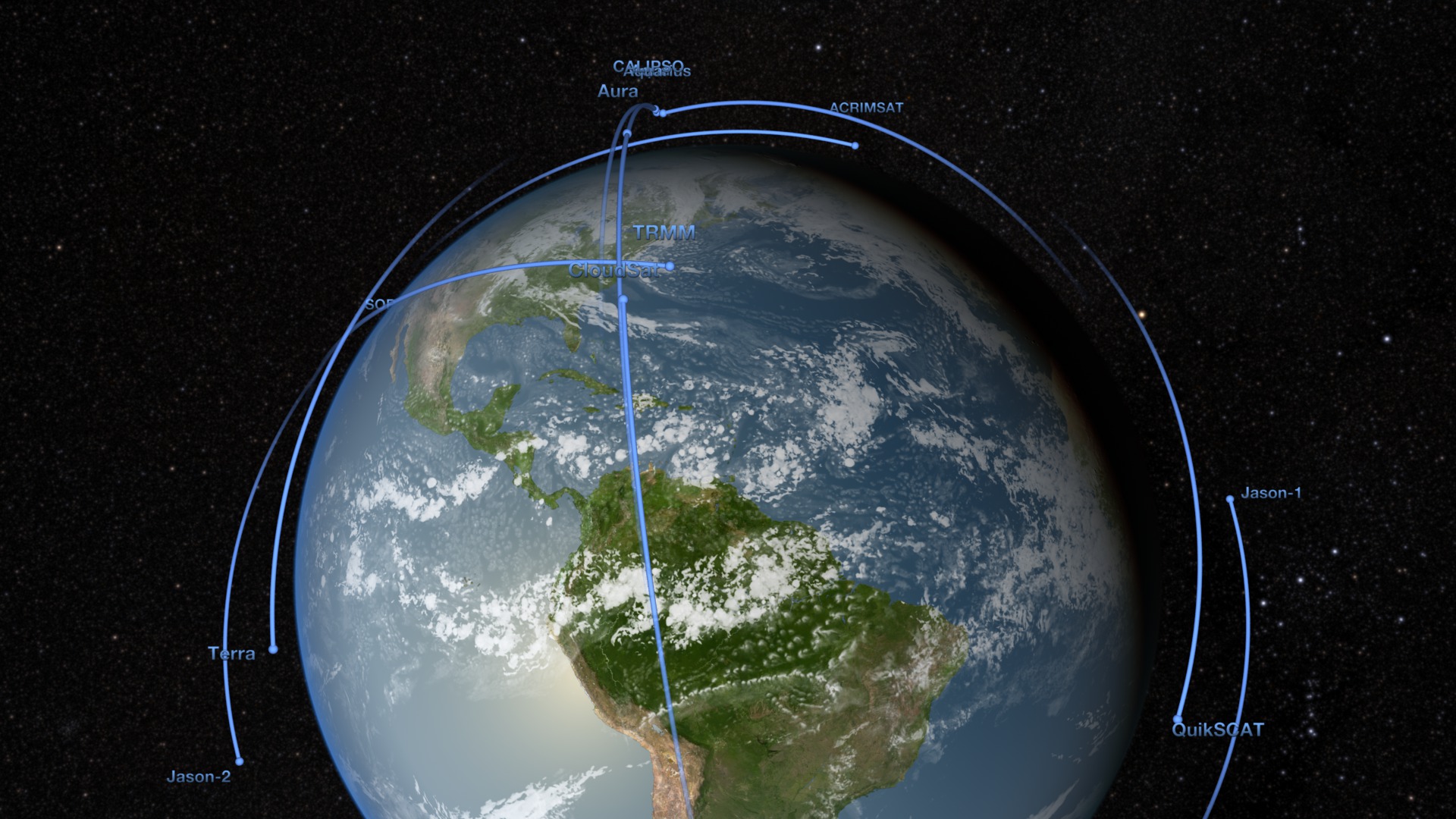
NASA's Earth observing fleet as of March 2017
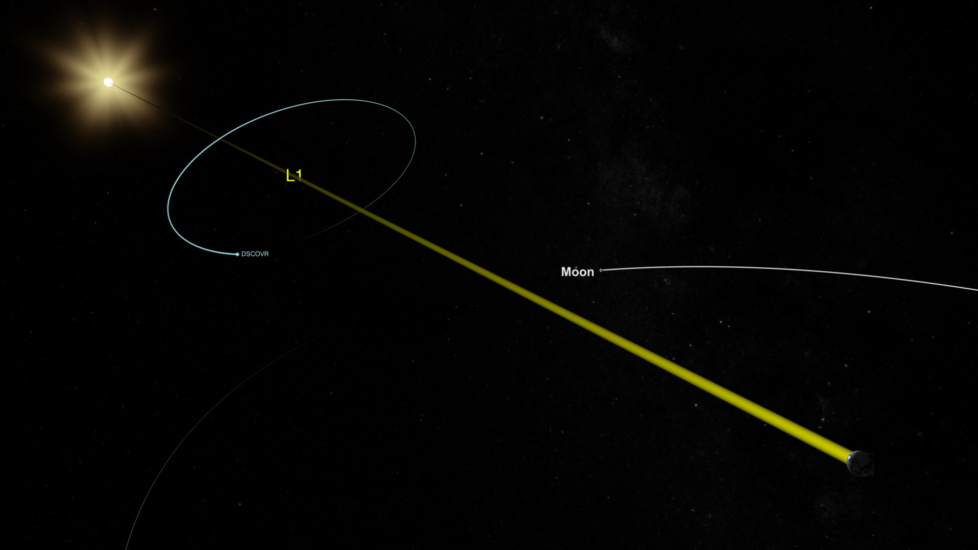
This animation shows the orbits of NASA's fleet of Earth observing spacecraft that are considered operational as of March 2017. New elements in this version include the CYGNSS constellation and DSCOVR at L1. The clouds used in this version are from a high resolution GEOS model run at 10 minute time steps interpolated down to the per-frame level.
The following spacecraft are included:
- Aqua
- Aura
- CALIPSO: Cloud-Aerosol Lidar and Infrared Pathfinder Satellite Observation
- CYGNSS-1: Cyclone Global Navigation Satellite System 1
- CYGNSS-2: Cyclone Global Navigation Satellite System 2
- CYGNSS-3: Cyclone Global Navigation Satellite System 3
- CYGNSS-4: Cyclone Global Navigation Satellite System 4
- CYNGSS-5: Cyclone Global Navigation Satellite System 5
- CYGNSS-6: Cyclone Global Navigation Satellite System 6
- CYGNSS-7: Cyclone Global Navigation Satellite System 7
- CYGNSS-8: Cyclone Global Navigation Satellite System 8
- Cloudsat
- DSCOVR: Deep Space Climate Observatory
- GPM: Global Precipitation Measurement
- GRACE-1: Gravity Recovery and Climate Experiment-1
- GRACE-2: Gravity Recovery and Climate Experiment-2
- ISS: International Space Station
- Jason 2
- Jason 3
- Landsat 7
- Landsat 8
- OCO-2: Orbiting Carbon Observatory-2
- SMAP: Soil Moisture Passive Active
- SORCE: Solar Radiation and Climate Experiment
- Suomi NPP: Suomi National Polar-orbiting Partnership
- Terra
- QuikSCAT
Also included:
- Stars
- Moon
- Sun
- Earth
- L1: Sun-Earth Lagrange Point
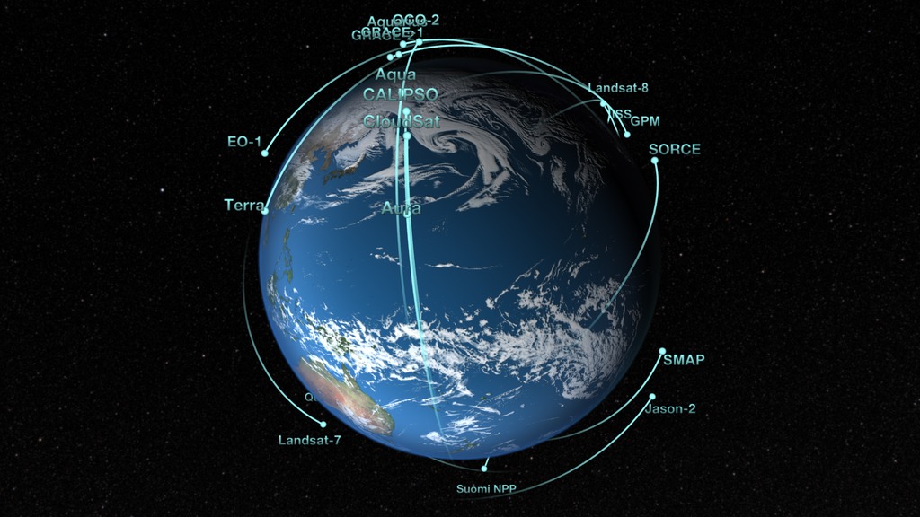
NASA's Earth observing fleet as of March 2017 with the A-train in highlighted in green
Credits
Please give credit for this item to:
NASA's Scientific Visualization Studio
-
Visualizers
-
Greg Shirah
(NASA/GSFC)

-
Ernie Wright
(USRA)
-
Greg Shirah
(NASA/GSFC)
-
Technical support
- Laurence Schuler (ADNET Systems, Inc.)
- Ian Jones (ADNET Systems, Inc.)
-
Project support
- Eric Sokolowsky (Global Science and Technology, Inc.)
Datasets used
-
GTOPO30 Topography and Bathymetry
ID: 274 -
CelesTrak Spacecraft Orbit Ephemeris
ID: 454This dataset can be found at: http://celestrak.com
See all pages that use this dataset -
Tycho Catalogue (Tycho 2 Catalogue) [Hipparcos: Telescope]
ID: 550This dataset can be found at: http://archive.eso.org/ASTROM/
See all pages that use this dataset -
JPL/Horizon Orbital Ephemerides
ID: 597Planetary ephemerides
This dataset can be found at: http://ssd.jpl.nasa.gov/?horizons
See all pages that use this dataset -
GEOS Atmospheric Model
ID: 665 -
Space-Track TLE (Space-Track Two-Line Elements)
ID: 753Satellite ephemerides
This dataset can be found at: http://Space-Track.org
See all pages that use this dataset
Note: While we identify the data sets used on this page, we do not store any further details, nor the data sets themselves on our site.
Related
- ID: 12824
- ID: 12595

- ID: 12592
 Produced Video
Newer Versions
- ID: 5061
 Visualization
 - ID: 4928
 Visualization
 - ID: 4931
 Visualization
 - ID: 4772
 Visualization
Older Versions
- ID: 4274
 Visualization
 - ID: 3996
 Visualization
 - ID: 4070
 Visualization
 - ID: 3892
- ID: 3725
Used as a Source In
- ID: 12579
 Produced Video
 - ID: 12586
![NASA's fleet of Earth science satellites, along with Earth science instruments on the International Space Station, surveys the whole globe, even the most remote parts that are difficult if not impossible to visit. With instruments in space, scientists can get data for the whole globe in detail that they can't get anywhere else. This visualization shows the NASA fleet in 2017, from low Earth orbit all the way out to the DSCOVR satellite taking in the million-mile view.Music: The Glide, by Zubin Thakkar [SOCAN]Watch this video on the NASA Goddard YouTube channel.](/vis/a010000/a012500/a012586/12586_Earth_Fleet_2017_large.00330_print.jpg) Produced Video
Produced Video
Release date
This page was originally published on Wednesday, April 19, 2017.
This page was last updated on Monday, March 10, 2025 at 12:06 AM EDT.