Planets and Moons
ID: 3808
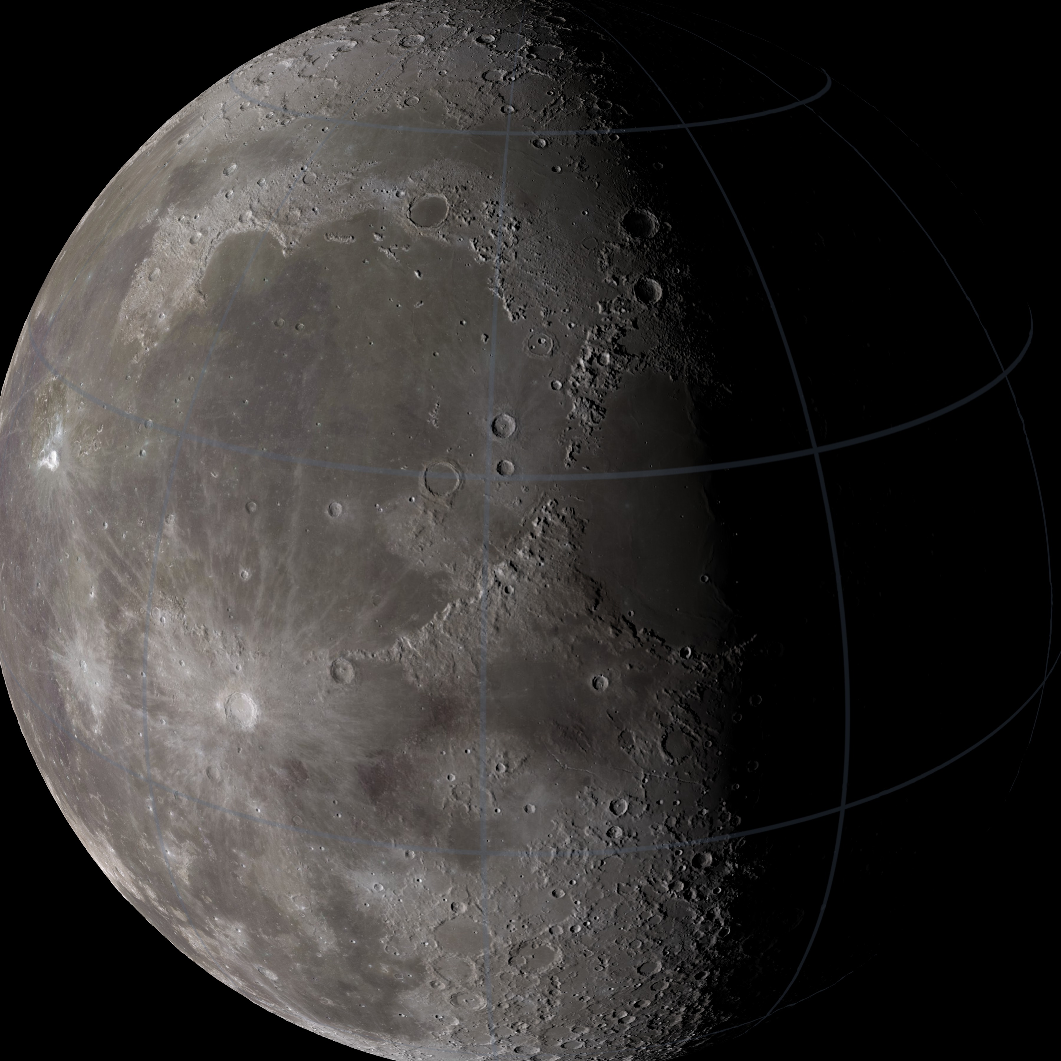
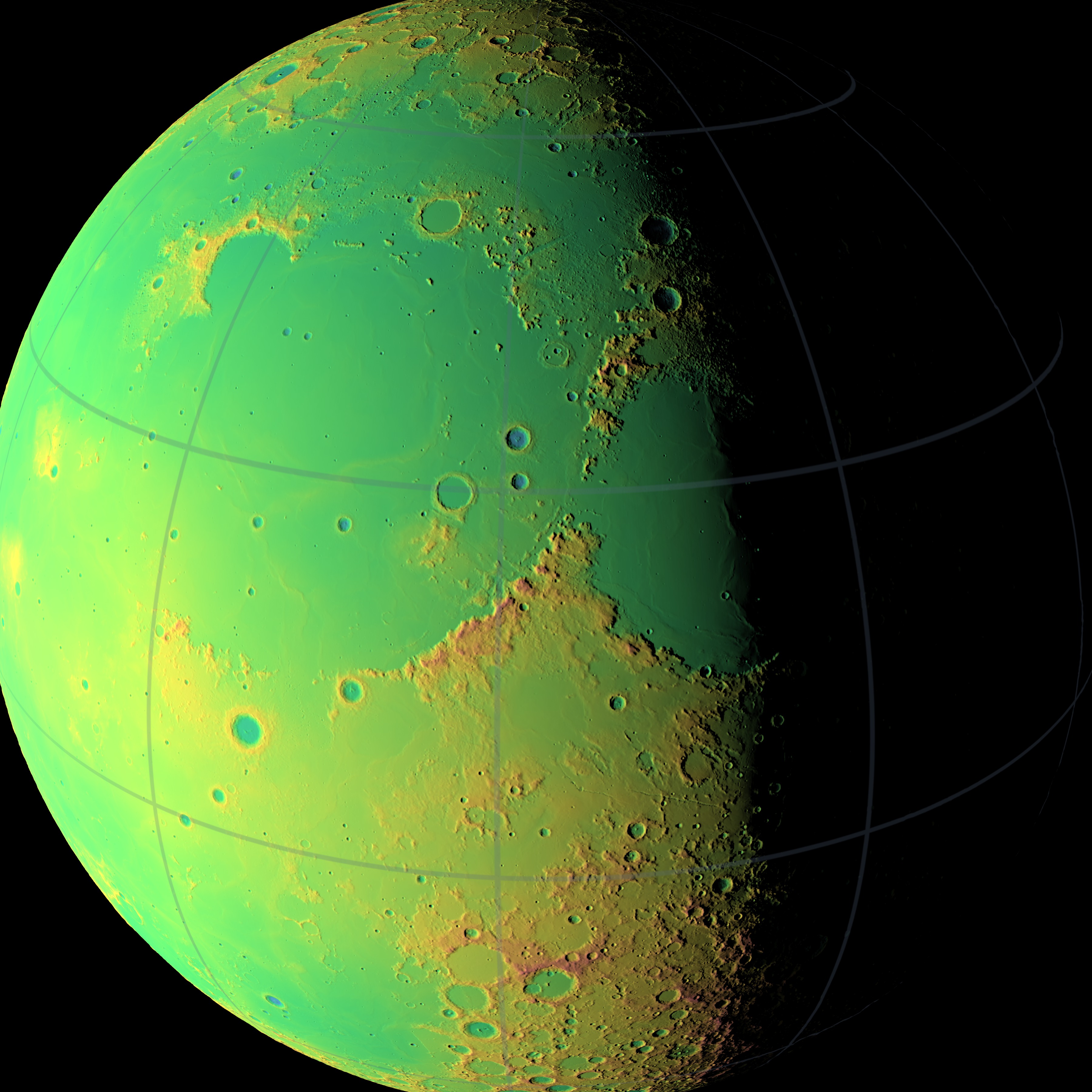
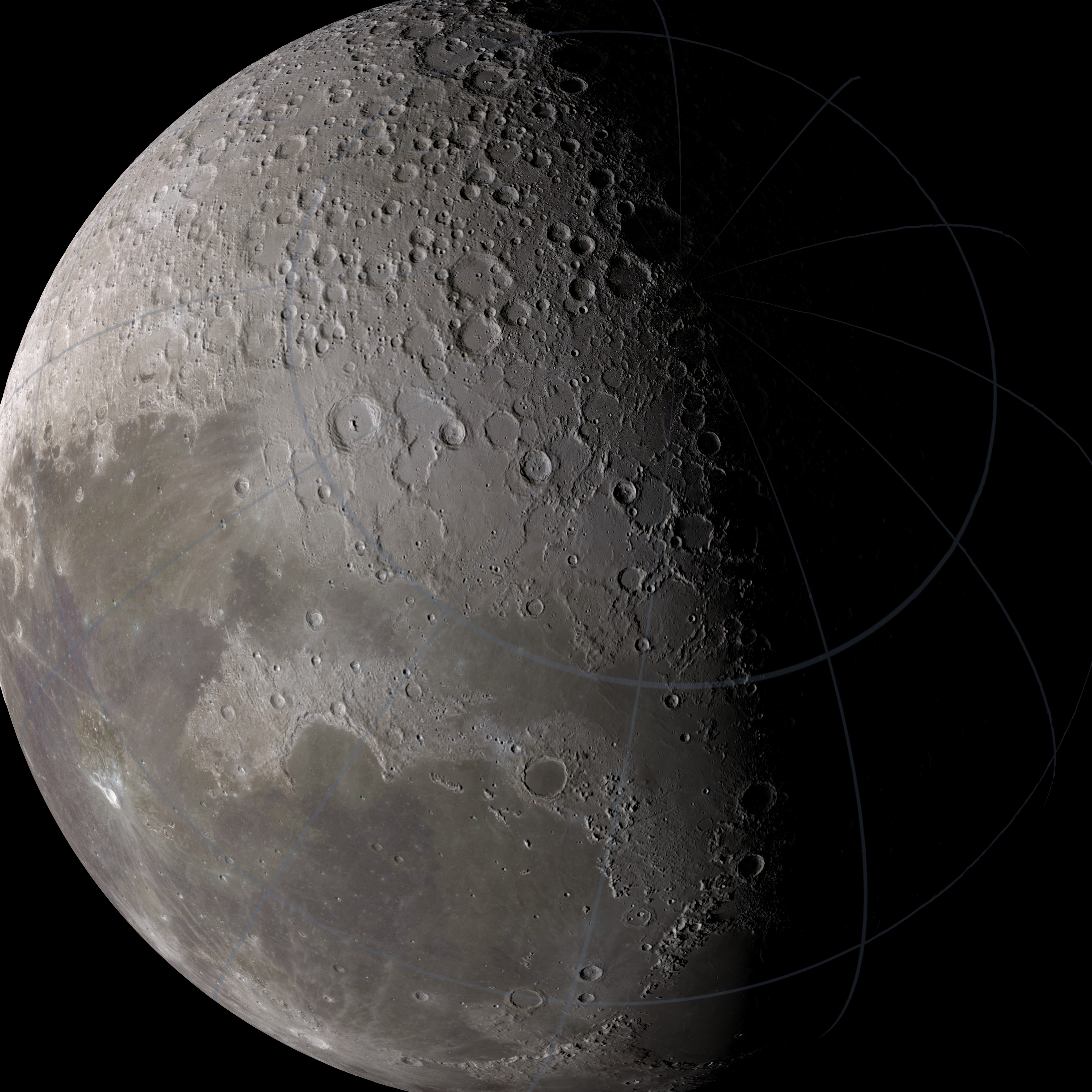
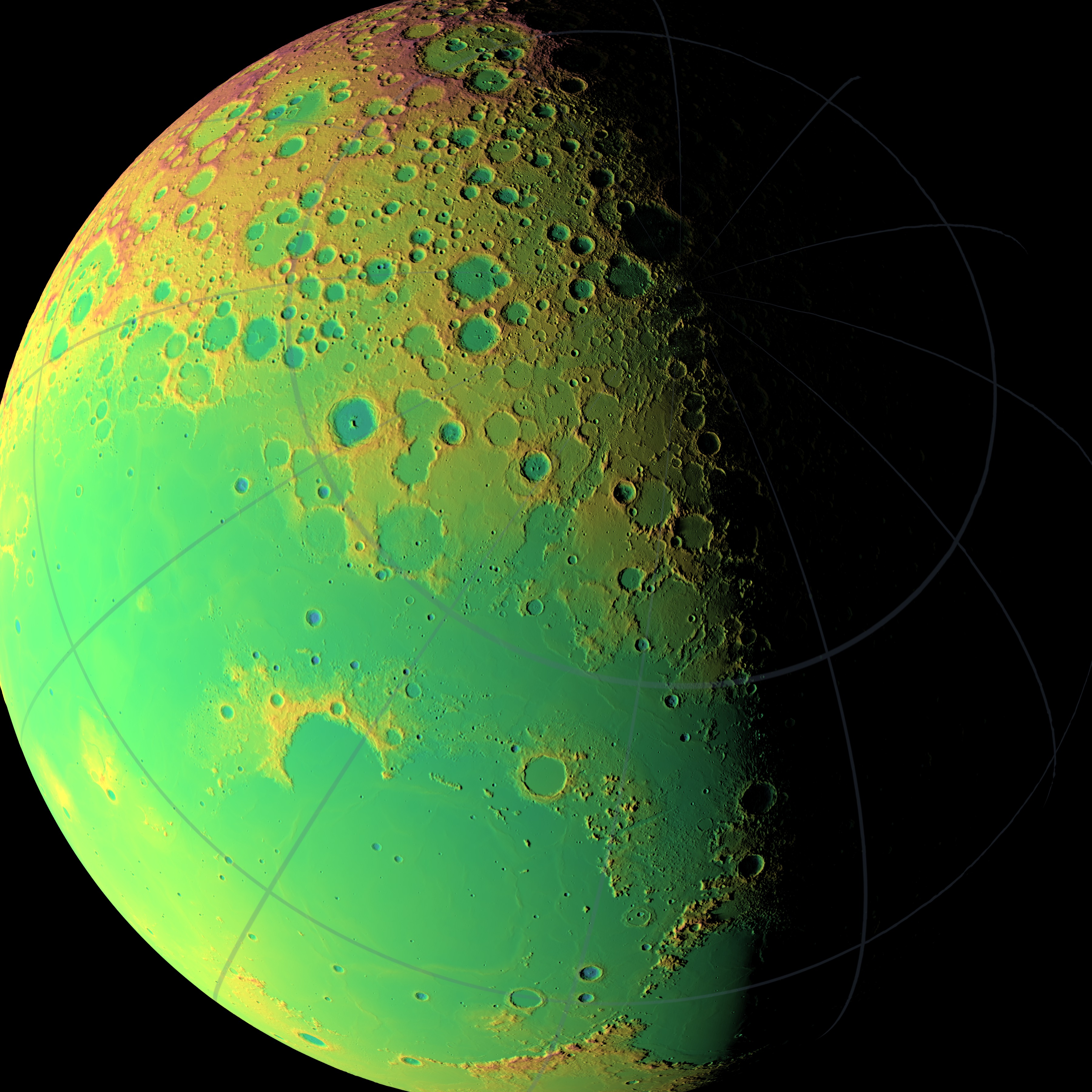
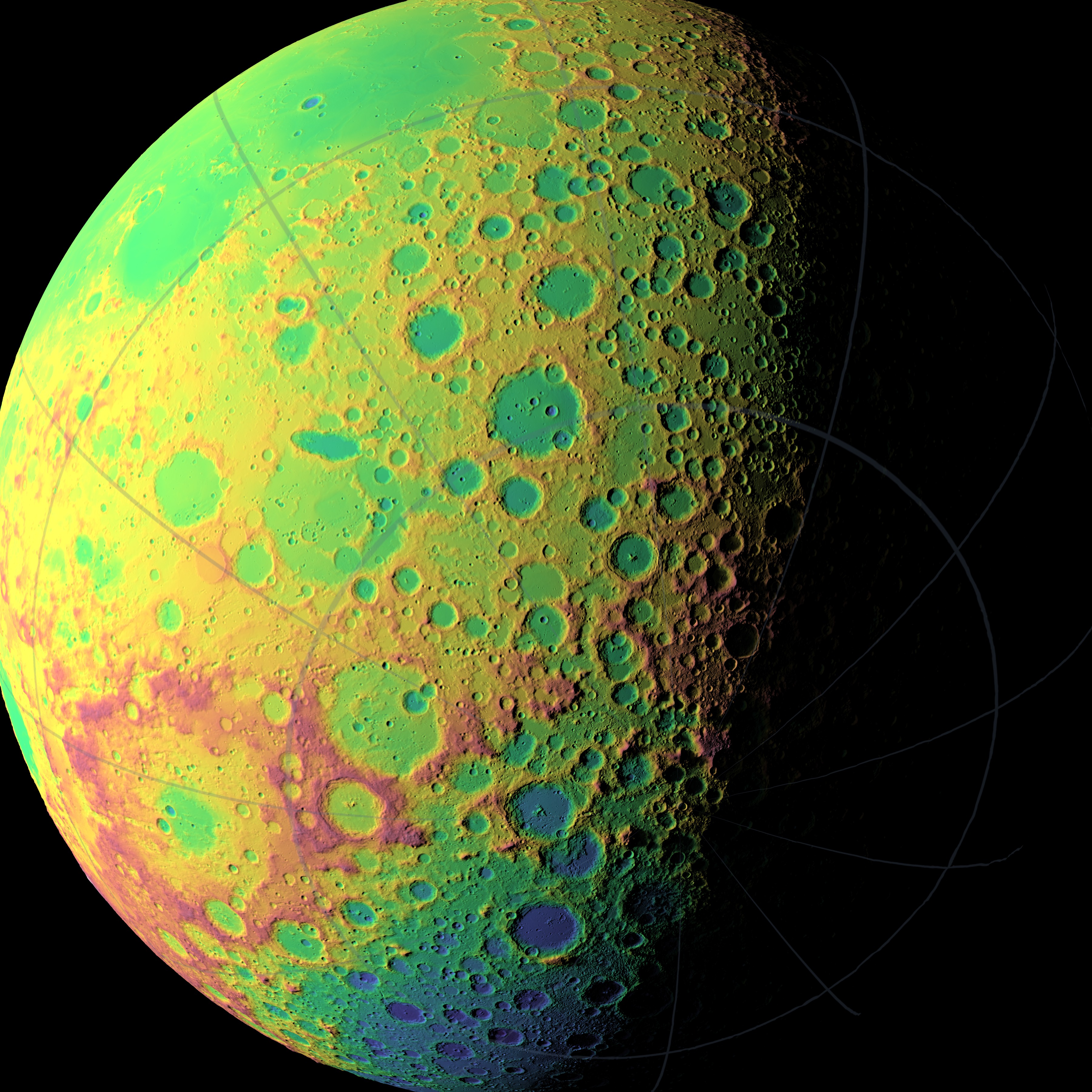
These high resolution still images illustrate the global elevation map of the Moon being developed by the laser altimeter (LOLA) on Lunar Reconnaissance Orbiter. To date, LOLA has measured the elevation of over two billion points on the surface of the Moon. These measurements make it possible to render shaded relief maps of the Moon with unprecedented accuracy and detail. See also this comparison of LOLA with past maps.

LOLA Stills for AGU 2010
The waning gibbous Moon is rendered from three points of view. For each view, a natural color image is paired with a false color version in which low elevations are blue to green and high elevations are yellow to red. The terrain is in highest relief near the terminator, or shadow line, where the Sun is setting on a month-long lunar day. Amateur astronomers pay particular attention to features near the terminator, since the high relief brings out details that are normally washed out in the glare of reflected sunlight.
Visualization Credits
Ernie Wright (UMBC): Lead Animator
Chris Smith (HTSI): Producer
Gregory A. Neumann (NASA/GSFC): Scientist
Chris Smith (HTSI): Producer
Gregory A. Neumann (NASA/GSFC): Scientist
Please give credit for this item to:
NASA/Goddard Space Flight Center Scientific Visualization Studio
NASA/Goddard Space Flight Center Scientific Visualization Studio
Short URL to share this page:
https://svs.gsfc.nasa.gov/3808
Mission:
LRO (Lunar Reconnaissance Orbiter)
Data Used:
Note: While we identify the data sets used in these visualizations, we do not store any further details nor the data sets themselves on our site.
This item is part of these series:
The Moon
LRO - Still Images
Keywords:
SVS >> Laser
SVS >> Laser Altimeter
SVS >> Laser Rangefinder
SVS >> Lidar
SVS >> Lunar
SVS >> Moon
SVS >> Hyperwall
SVS >> LRO
SVS >> Lunar Reconnaissance Orbiter
SVS >> LOLA
SVS >> Laser Ranging
NASA Science >> Planets and Moons
https://svs.gsfc.nasa.gov/3808
Mission:
LRO (Lunar Reconnaissance Orbiter)
Data Used:
LRO/LOLA/Digital Elevation Map also referred to as: DEM
August 2009 - September 2010This item is part of these series:
The Moon
LRO - Still Images
Keywords:
SVS >> Laser
SVS >> Laser Altimeter
SVS >> Laser Rangefinder
SVS >> Lidar
SVS >> Lunar
SVS >> Moon
SVS >> Hyperwall
SVS >> LRO
SVS >> Lunar Reconnaissance Orbiter
SVS >> LOLA
SVS >> Laser Ranging
NASA Science >> Planets and Moons


