The Upper Atmosphere Research Satellite (UARS)
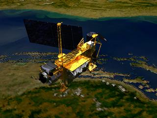
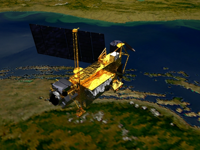
The Upper Atmosphere Research Satellite (UARS) is shown here flying over the Earth (SeaWiFS true color data of Europe). The satellite was launched in 1991 by the Space Shuttle Discovery. It is 35 feet long, 15 feet in diameter, weighs 13,000 pounds, and carries 10 instruments. UARS orbits at an altitude of 375 miles with an orbital inclination of 57 degrees. Designed to operate for two years, eight of its ten instruments are still functioning as of late 1998. UARS' primary mission is to measure ozone and chemical compounds found in the ozone layer which affect ozone chemistry and processes. UARS also measures winds and temperatures in the stratosphere as well as the energy input from the Sun. NOTE: All SeaWiFS images and data presented on this web site are for research and educational use only. All commercial use of SeaWiFS data must be coordinated with ORBIMAGE.
Technical notes:
|