Planets and Moons
ID: 4716
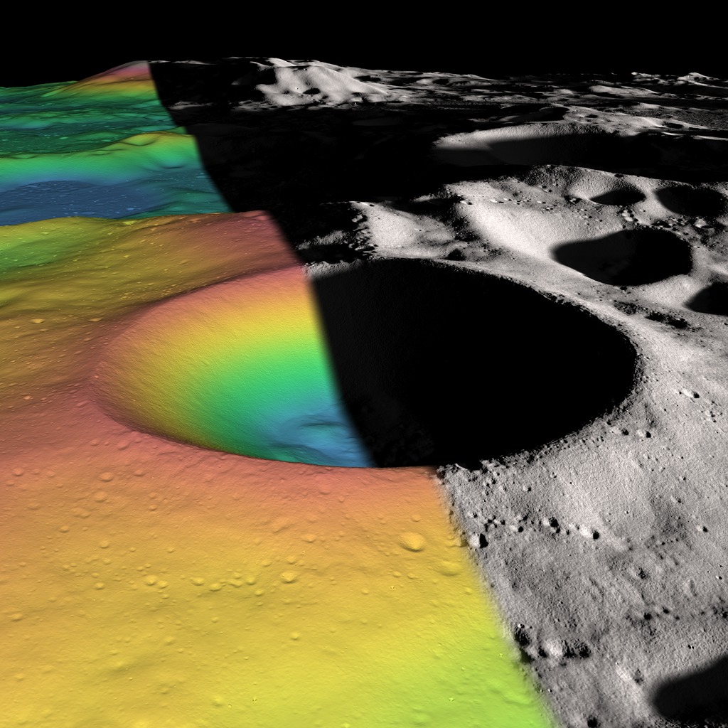
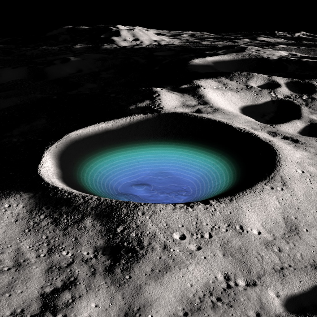
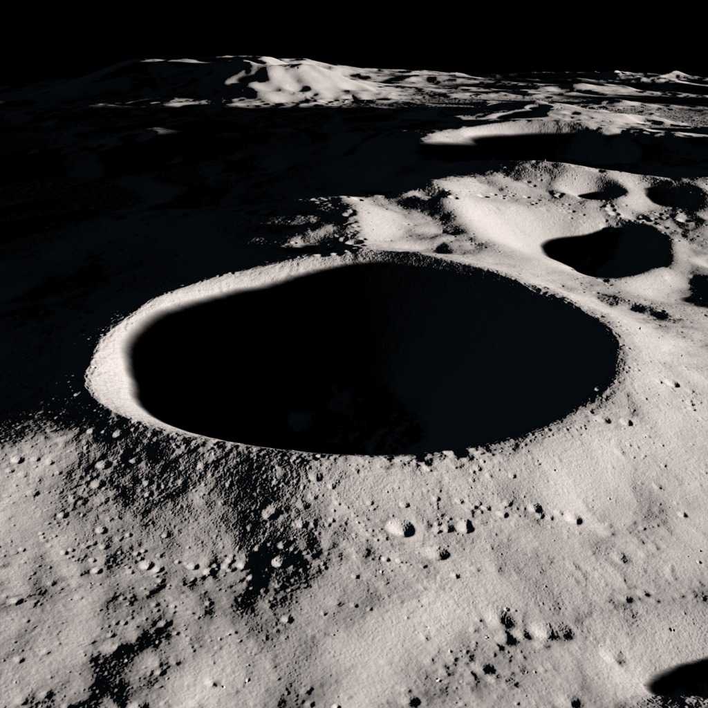
These computer-generated images are centered on Shackleton, a well-preserved, bowl-shaped crater, 21 kilometers wide and 4 km deep, at the Moon's south pole. Shackleton's floor is in perpetual shadow, but LOLA, the laser altimeter on Lunar Reconnaissance Orbiter, reveals boulders and low hills, or hummocks, formed by material slumping from the crater's sides. Shackleton's cold interior may harbor water ice and other volatiles that would evaporate rapidly if exposed to the Sun. In contrast, some points on the rim of the crater are in persistent sunshine and may be ideal places for solar panels. The ridge on the far side of the crater in this view connects Shackleton's rim to the rim of the adjacent crater Slater. Another ridge, just out of frame on the left, connects to de Gerlache crater. Certain points on these ridges are also in persistent sunshine.
Visualizing Shackleton Crater
For More Information
Visualization Credits
Ernie Wright (USRA): Lead Visualizer
Erwan M. Mazarico (NASA/GSFC): Scientist
Maria Zuber (Massachusetts Institute of Technology): Scientist
Gregory A. Neumann (NASA/GSFC): Scientist
David Smith (NASA/GSFC): Scientist
Erwan M. Mazarico (NASA/GSFC): Scientist
Maria Zuber (Massachusetts Institute of Technology): Scientist
Gregory A. Neumann (NASA/GSFC): Scientist
David Smith (NASA/GSFC): Scientist
Please give credit for this item to:
NASA's Scientific Visualization Studio
NASA's Scientific Visualization Studio
Science Paper:
Zuber et al., Constraints on the volatile distribution within Shackleton crater at the lunar south pole, Nature 486, 378-381 (21 June 2012)
Short URL to share this page:
https://svs.gsfc.nasa.gov/4716
Mission:
LRO (Lunar Reconnaissance Orbiter)
Data Used:
Note: While we identify the data sets used in these visualizations, we do not store any further details nor the data sets themselves on our site.
This item is part of this series:
The Moon
Keywords:
SVS >> Moon
SVS >> LRO
SVS >> Lunar Reconnaissance Orbiter
SVS >> Lunar Poles
SVS >> Solar System >> Moon >> Craters
NASA Science >> Planets and Moons
Zuber et al., Constraints on the volatile distribution within Shackleton crater at the lunar south pole, Nature 486, 378-381 (21 June 2012)
Short URL to share this page:
https://svs.gsfc.nasa.gov/4716
Mission:
LRO (Lunar Reconnaissance Orbiter)
Data Used:
LRO/LOLA/Digital Elevation Map also referred to as: DEM
This item is part of this series:
The Moon
Keywords:
SVS >> Moon
SVS >> LRO
SVS >> Lunar Reconnaissance Orbiter
SVS >> Lunar Poles
SVS >> Solar System >> Moon >> Craters
NASA Science >> Planets and Moons


