Earth
ID: 13987
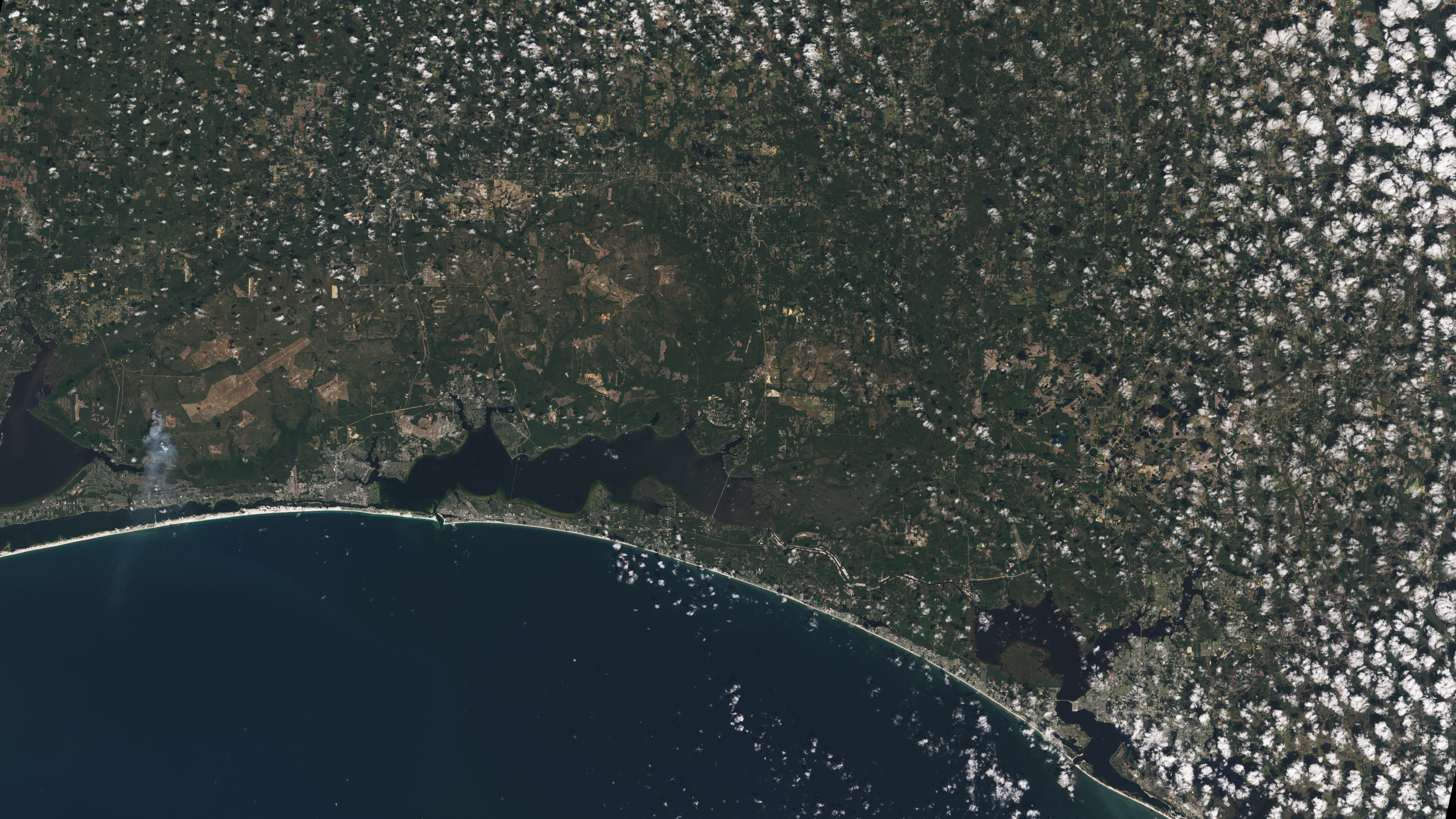
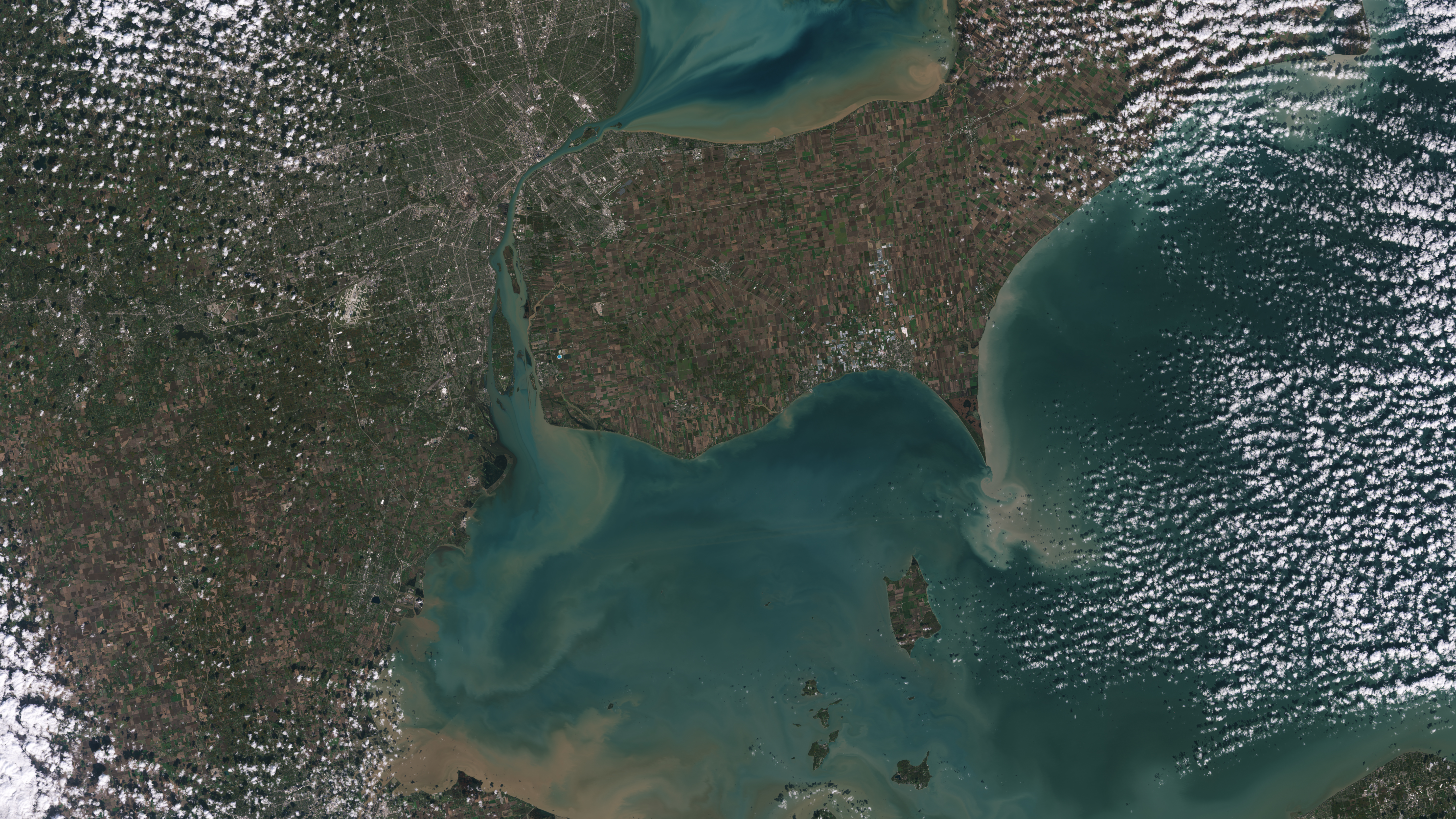
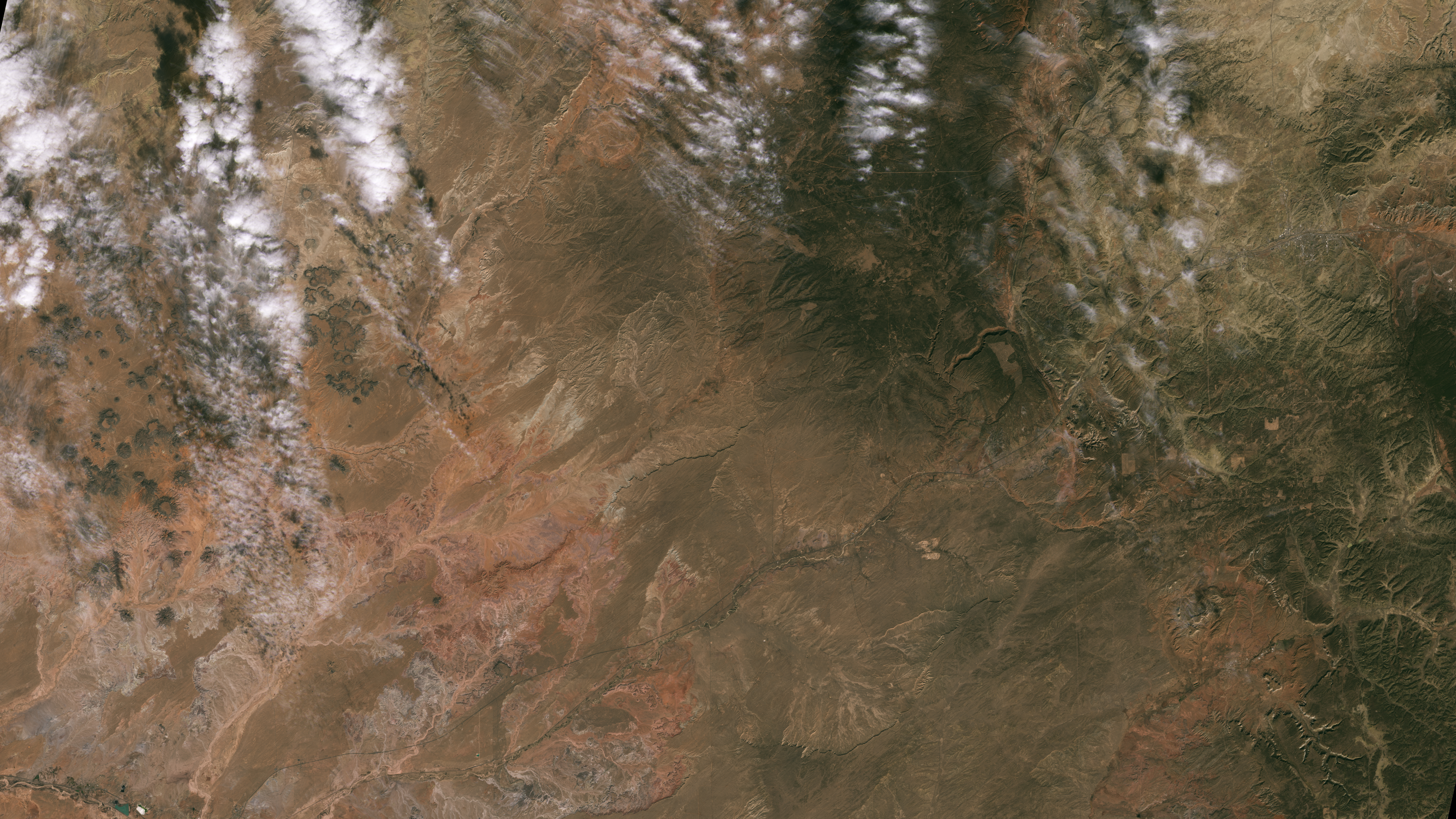
Landsat 9, a joint mission from NASA and the U.S. Geological Survey, launched Sept. 27, 2021, and has now collected its first images of Earth. These images, all acquired Oct. 31, 2021, provide a preview of how the mission will help people manage vital natural resources and track the impacts of climate change, adding to Landsat’s unparalleled data record that spans nearly 50 years of space-based Earth observation.
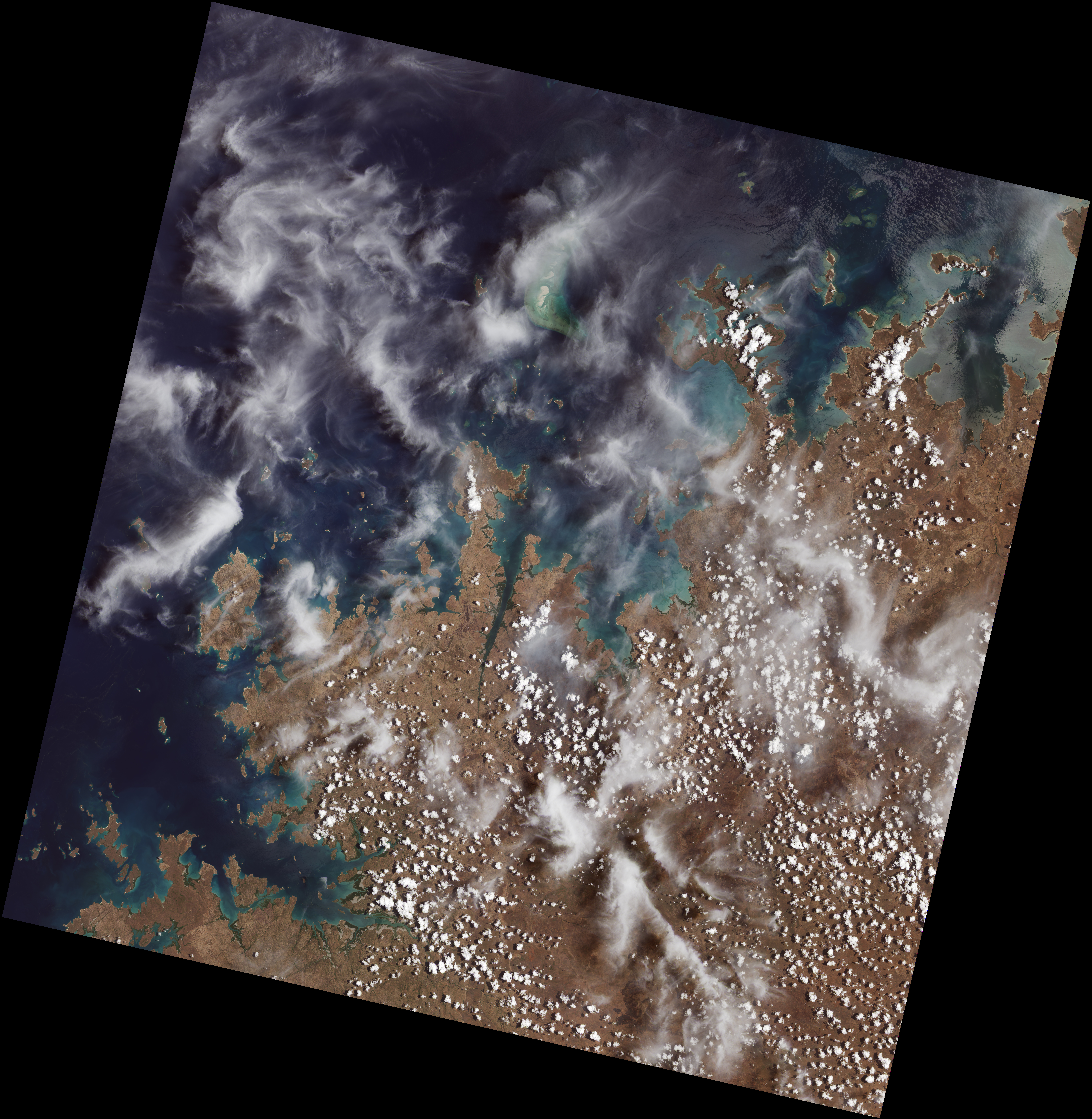
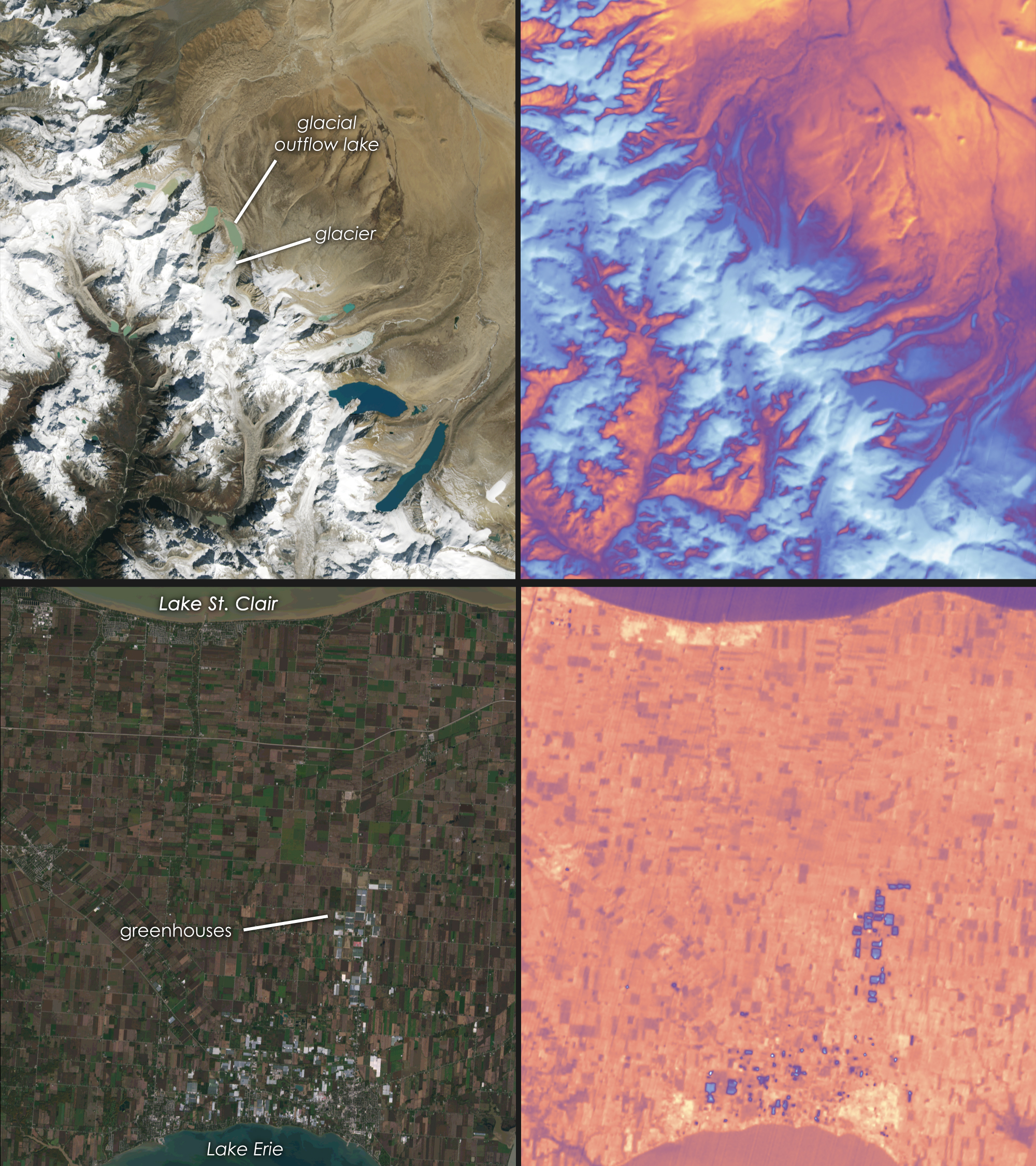
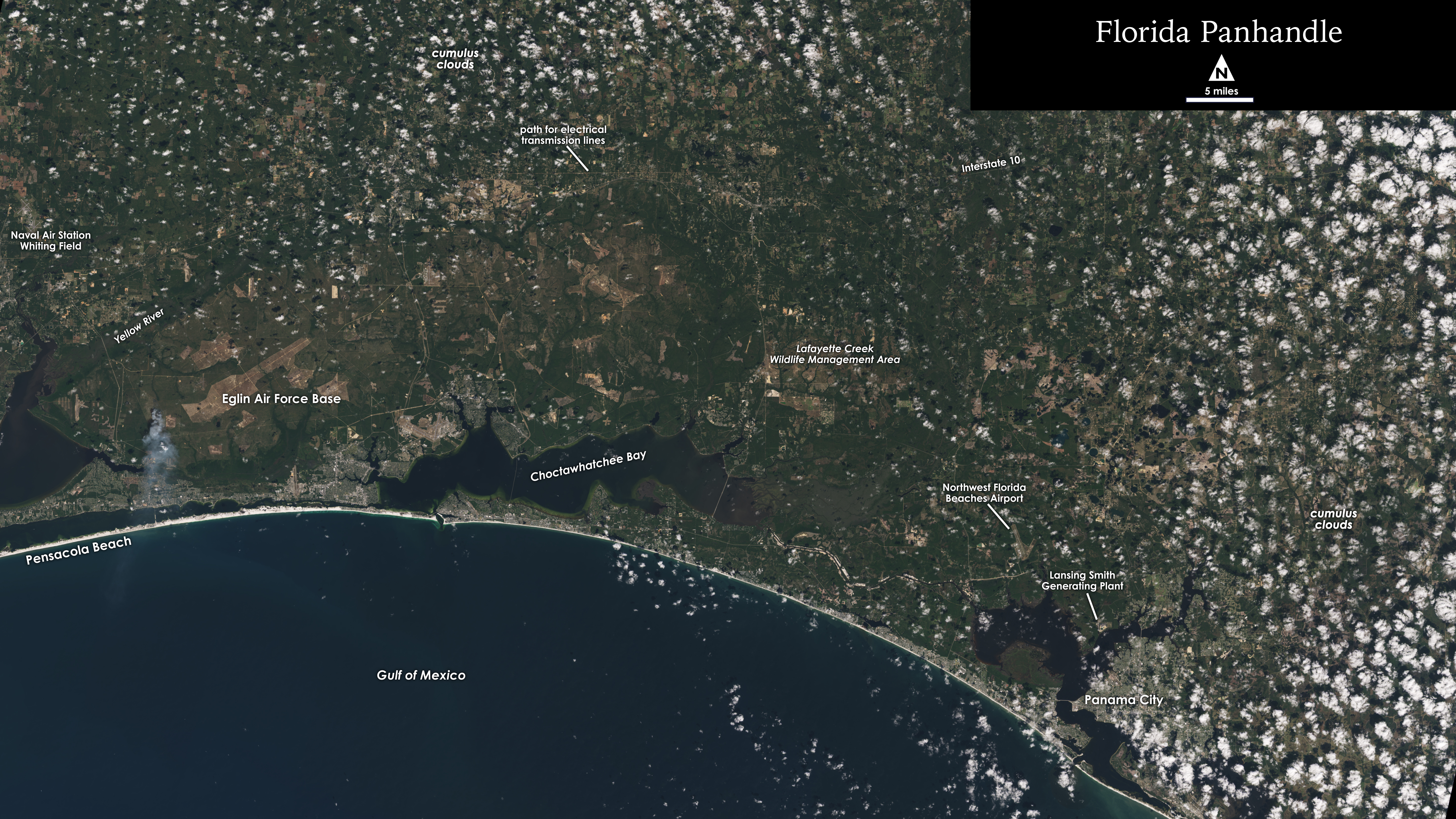
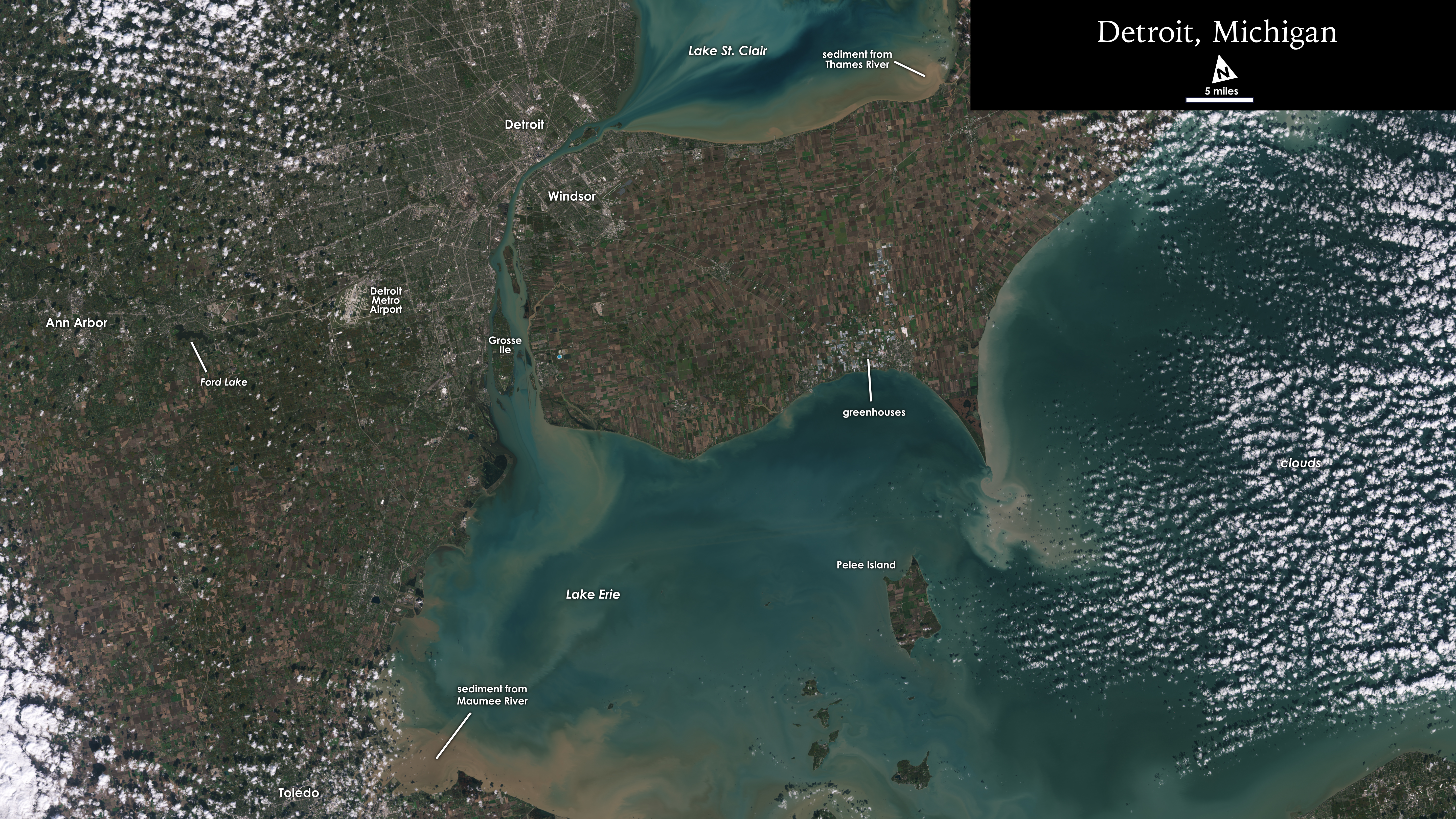
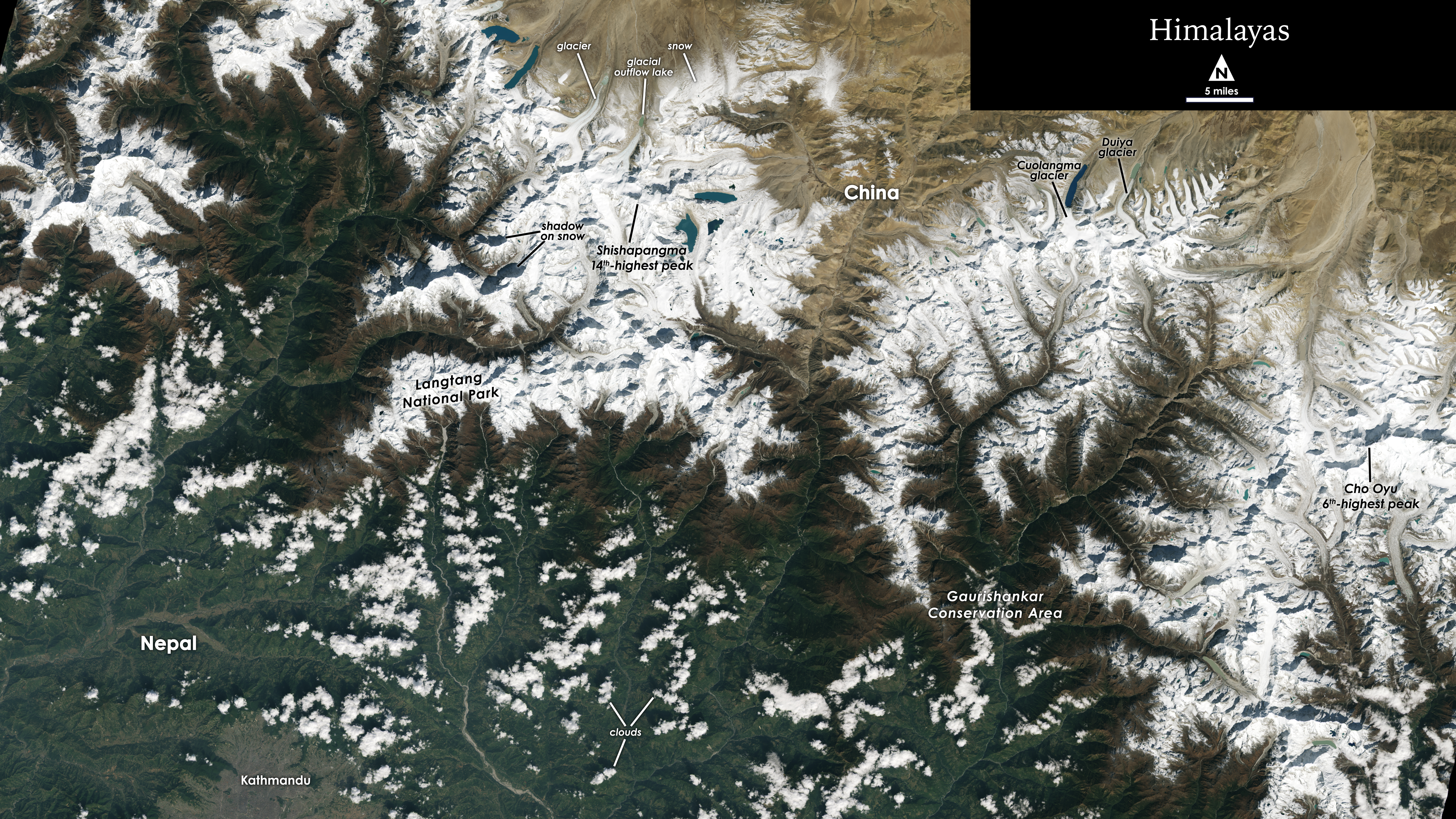
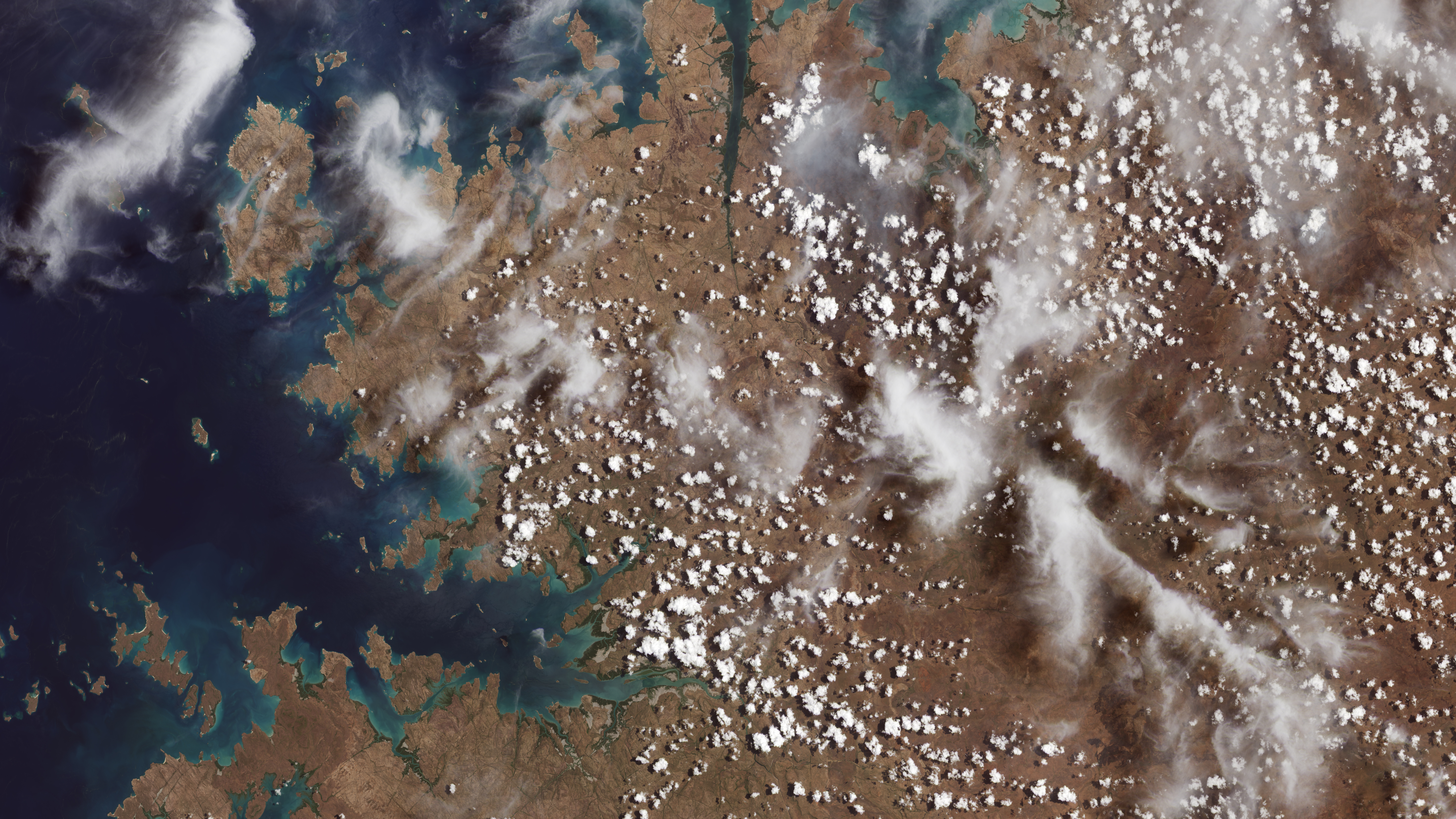
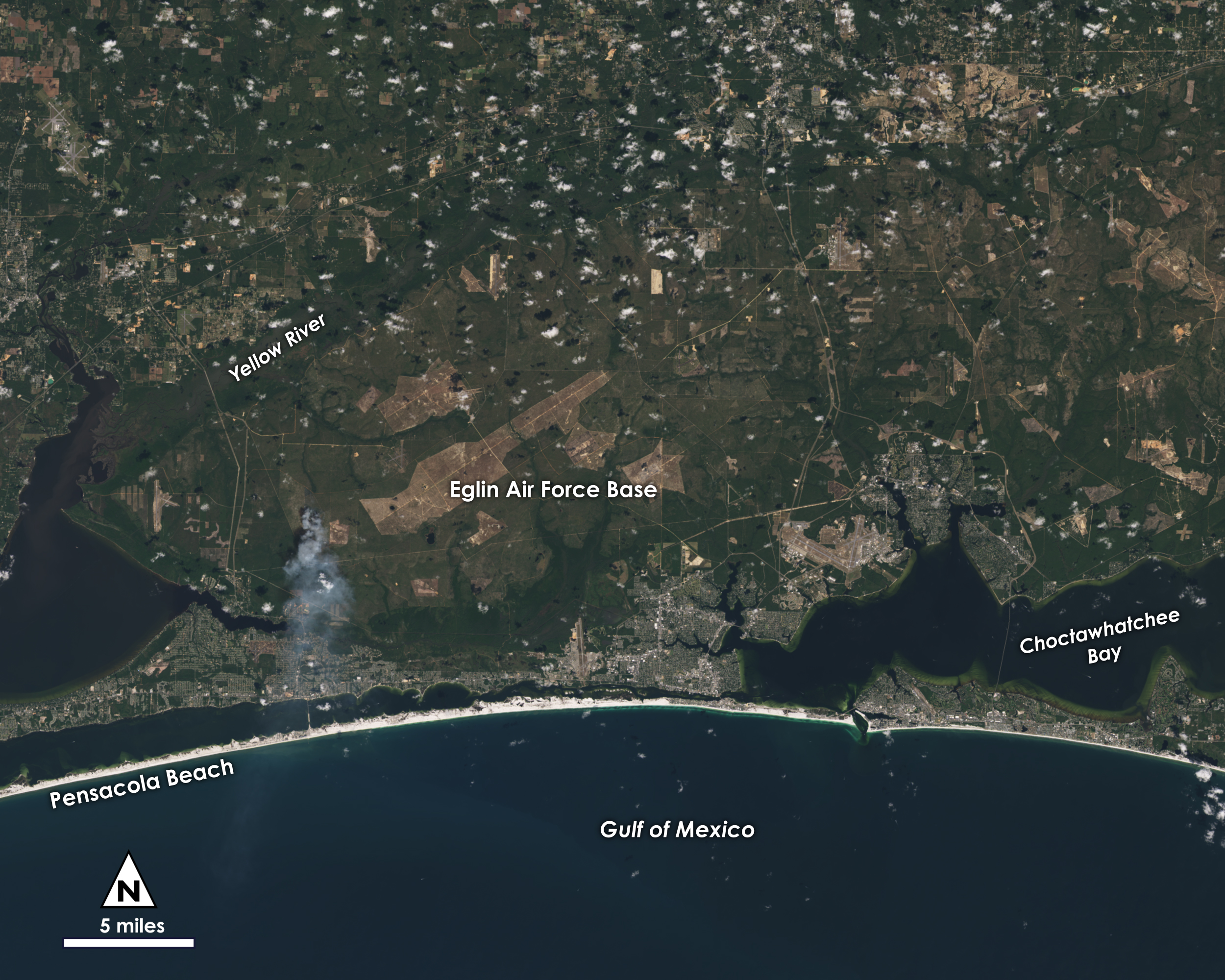
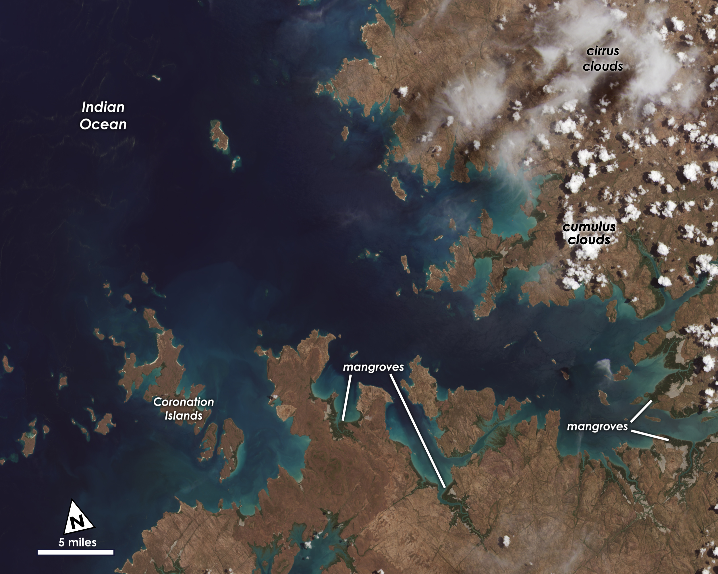
Shown in the images are coastal ecosystems in Australia; the intersection of cities and coastlines in the Florida Panhandle; glaciers in High Mountain Asia; and farm fields surrounding Lake Erie.
Landsat 9 carries two instruments that capture imagery: the Operational Land Imager 2, or OLI-2, which detects nine different wavelengths of visible, near-infrared and shortwave-infrared light; and the Thermal Infrared Sensor 2, or TIRS-2, which detects two wavelengths of thermal radiation to measure slight changes in temperature. These instruments will provide Landsat 9 users essential information about crop health, irrigation use, water quality, wildfire severity, deforestation, glacial retreat, urban expansion and more. OLI-2 was built by Ball Aerospace and TIRS-2 was built by NASA's Goddard Space Flight Center. Northrop Grumman built the Landsat 9 spacecraft, integrated it with the instruments, and tested the observatory.
NASA’s Landsat 9 team is in the midst of a 100-day check-out period, which involves testing the satellite’s different systems and subsystems and calibrating the instruments in preparation for handing the mission over to the USGS in January. The USGS will operate Landsat 9 along with Landsat 8, and together the two satellites will collect approximately 1,500 images of Earth’s surface every day, covering the globe every eight days. Landsat 9 data will be available to the public, for free, from USGS’s website, as soon as the satellite begins normal operations.

Landsat 9 First Light Images
Shown in the images are coastal ecosystems in Australia; the intersection of cities and coastlines in the Florida Panhandle; glaciers in High Mountain Asia; and farm fields surrounding Lake Erie.
Landsat 9 carries two instruments that capture imagery: the Operational Land Imager 2, or OLI-2, which detects nine different wavelengths of visible, near-infrared and shortwave-infrared light; and the Thermal Infrared Sensor 2, or TIRS-2, which detects two wavelengths of thermal radiation to measure slight changes in temperature. These instruments will provide Landsat 9 users essential information about crop health, irrigation use, water quality, wildfire severity, deforestation, glacial retreat, urban expansion and more. OLI-2 was built by Ball Aerospace and TIRS-2 was built by NASA's Goddard Space Flight Center. Northrop Grumman built the Landsat 9 spacecraft, integrated it with the instruments, and tested the observatory.
NASA’s Landsat 9 team is in the midst of a 100-day check-out period, which involves testing the satellite’s different systems and subsystems and calibrating the instruments in preparation for handing the mission over to the USGS in January. The USGS will operate Landsat 9 along with Landsat 8, and together the two satellites will collect approximately 1,500 images of Earth’s surface every day, covering the globe every eight days. Landsat 9 data will be available to the public, for free, from USGS’s website, as soon as the satellite begins normal operations.
Credits
Jeffrey Masek (NASA/GSFC): Scientist
Matthew Radcliff (KBRwyle): Lead Producer
Kate Ramsayer (Telophase): Lead Writer
Matthew Radcliff (KBRwyle): Visualizer
Chris J Crawford (USGS): Scientist
Matthew Radcliff (KBRwyle): Lead Producer
Kate Ramsayer (Telophase): Lead Writer
Matthew Radcliff (KBRwyle): Visualizer
Chris J Crawford (USGS): Scientist
Please give credit for this item to:
NASA's Goddard Space Flight Center, using data from the U.S. Geological Survey
NASA's Goddard Space Flight Center, using data from the U.S. Geological Survey
Short URL to share this page:
https://svs.gsfc.nasa.gov/13987
Missions:
Landsat
Landsat 9
This item is part of these series:
Images of Earth and Space
Landsat
Keywords:
SVS >> First Light
SVS >> Landsat
SVS >> Remote Sensing
SVS >> Water
SVS >> Hyperwall
NASA Science >> Earth
https://svs.gsfc.nasa.gov/13987
Missions:
Landsat
Landsat 9
This item is part of these series:
Images of Earth and Space
Landsat
Keywords:
SVS >> First Light
SVS >> Landsat
SVS >> Remote Sensing
SVS >> Water
SVS >> Hyperwall
NASA Science >> Earth


