Earth
ID: 10773
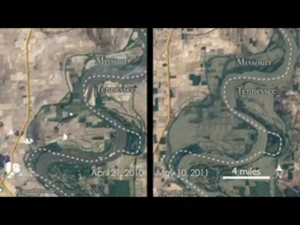
Heavy spring rains and snowmelt led to devastating floods along the Mississippi River in May 2011. Landsat 5 flew over the Mississippi River on May 10, 2011, giving a distinct view of the extraordinary extent of the flooding. This was only eight days after the Army Corps of Engineers began blasting holes in earthen levees near Cairo, Illinois, when the river reached a depth of 61 feet.


Mississippi Flooding 2011
The extent of the 2011 flooding is compared with the same locations in April 2010.
Credits
Please give credit for this item to:
NASA/Goddard Space Flight Center Individual Landsat scenes were combined by Jesse Allen of the NASA Earth Observatory. The Landsat Program is a series of Earth-observing satellite missions jointly managed by NASA and the U.S. Geological Survey.
NASA/Goddard Space Flight Center Individual Landsat scenes were combined by Jesse Allen of the NASA Earth Observatory. The Landsat Program is a series of Earth-observing satellite missions jointly managed by NASA and the U.S. Geological Survey.
Short URL to share this page:
https://svs.gsfc.nasa.gov/10773
Mission:
Landsat
Goddard TV Tape:
G2011-062 -- Mississippi River 2011 Flooding
Keywords:
SVS >> HDTV
DLESE >> Hydrology
SVS >> Landsat
SVS >> Mississippi River
GCMD >> Earth Science >> Hydrosphere >> Surface Water >> Rivers/Streams
NASA Science >> Earth
GCMD >> Earth Science >> Human Dimensions >> Natural Hazards >> Floods
GCMD keywords can be found on the Internet with the following citation: Olsen, L.M., G. Major, K. Shein, J. Scialdone, S. Ritz, T. Stevens, M. Morahan, A. Aleman, R. Vogel, S. Leicester, H. Weir, M. Meaux, S. Grebas, C.Solomon, M. Holland, T. Northcutt, R. A. Restrepo, R. Bilodeau, 2013. NASA/Global Change Master Directory (GCMD) Earth Science Keywords. Version 8.0.0.0.0


