Sea Level Rise
Overview
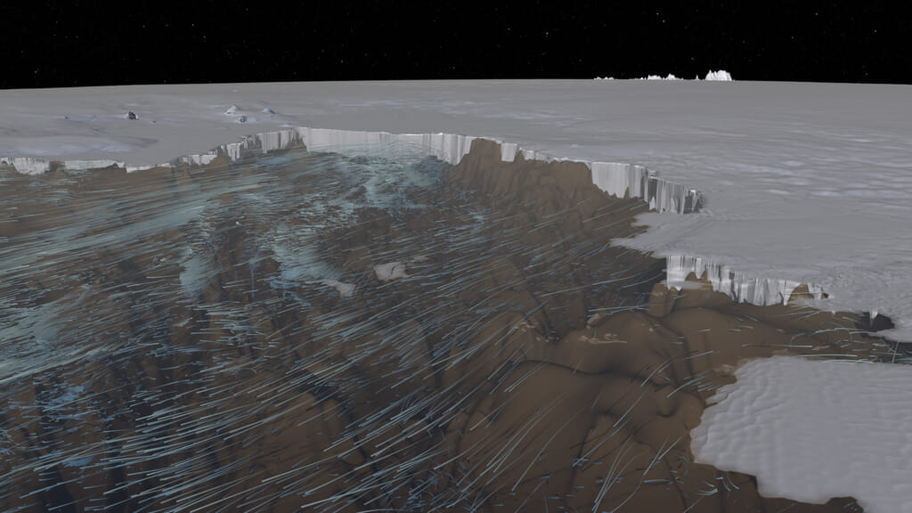
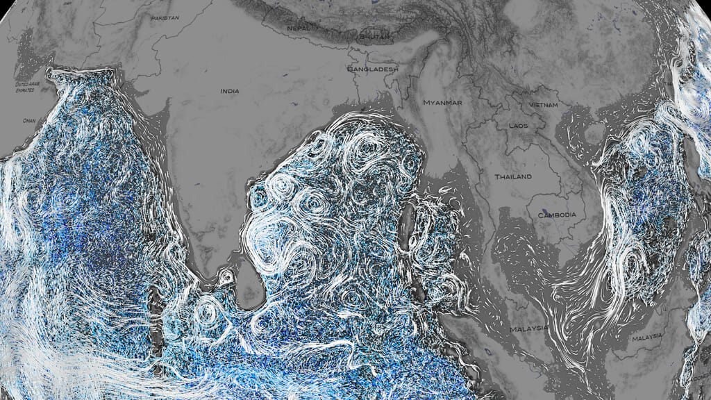
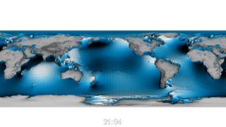
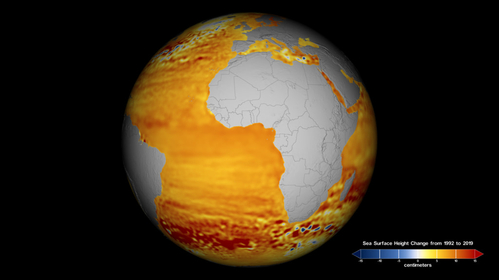
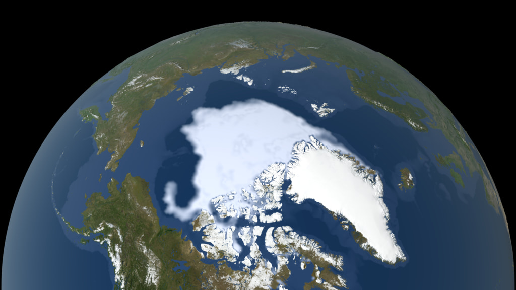
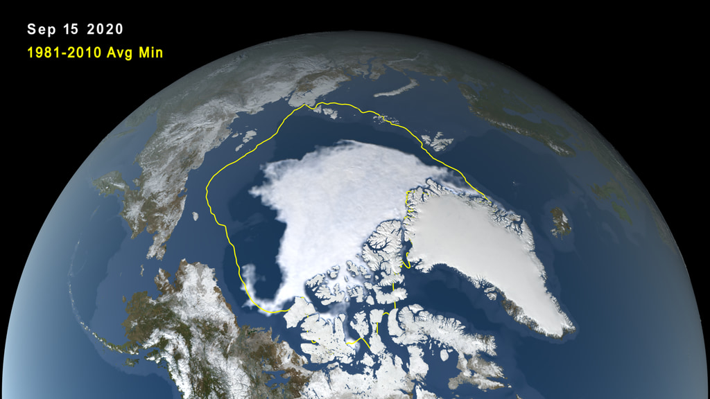
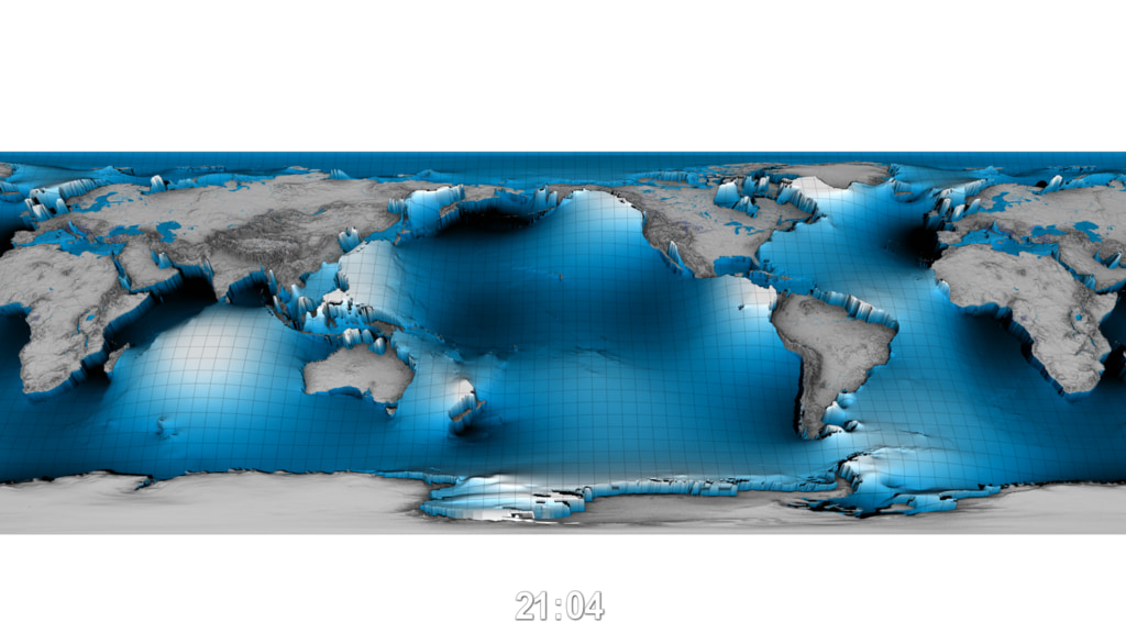
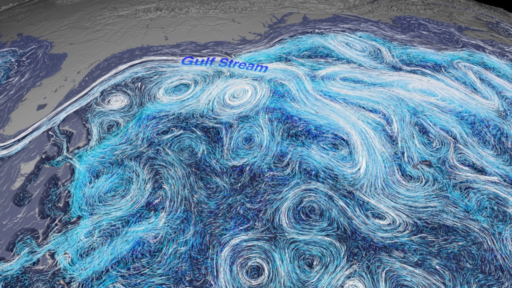
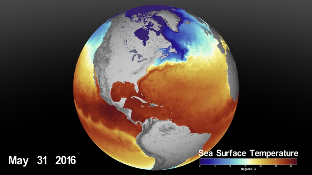
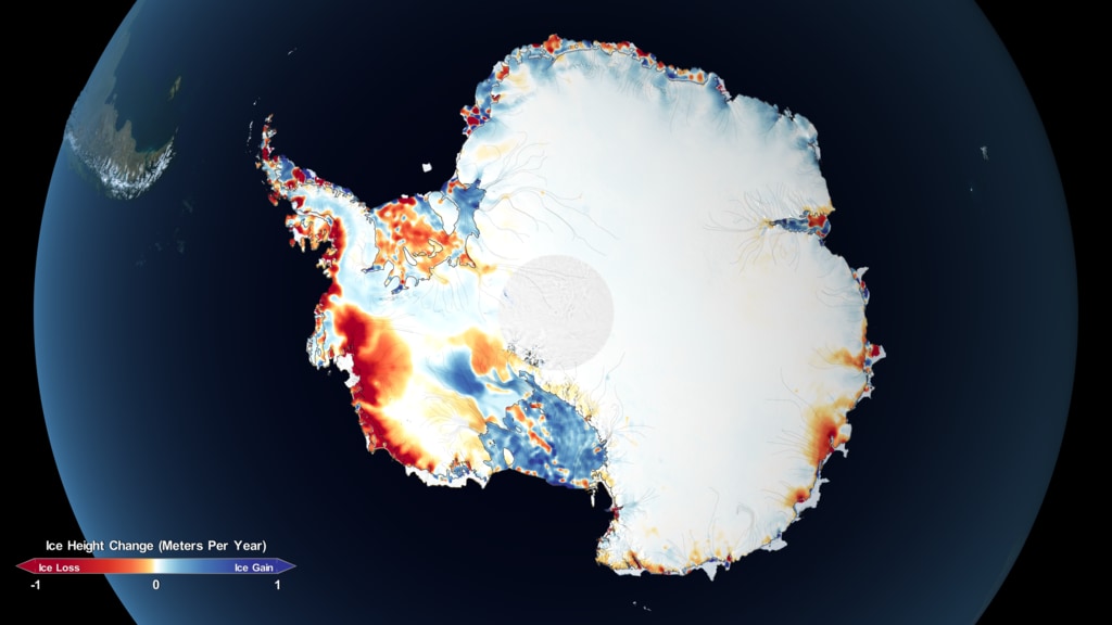
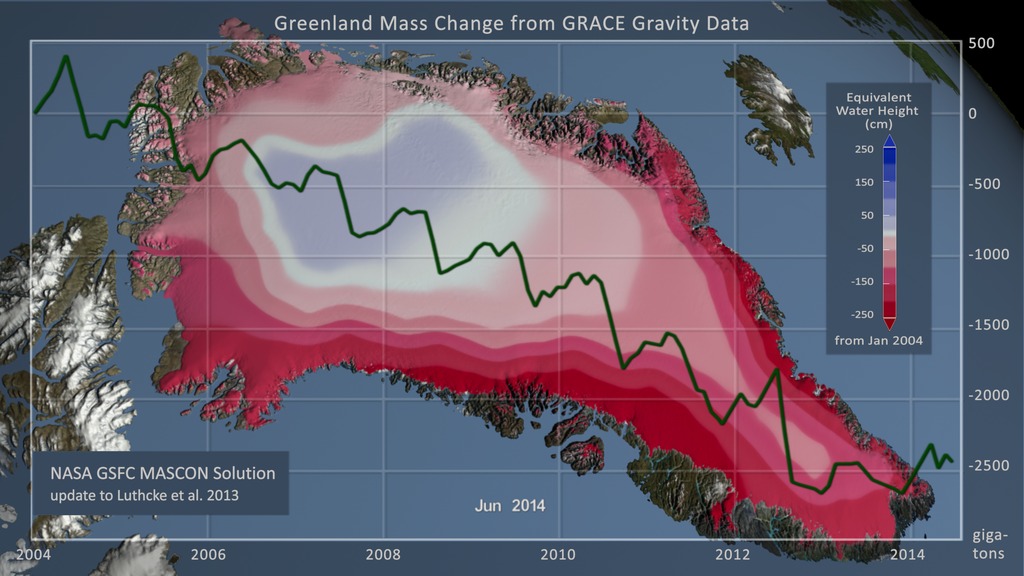
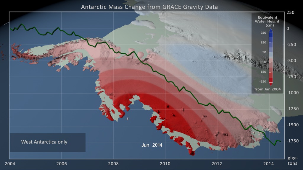
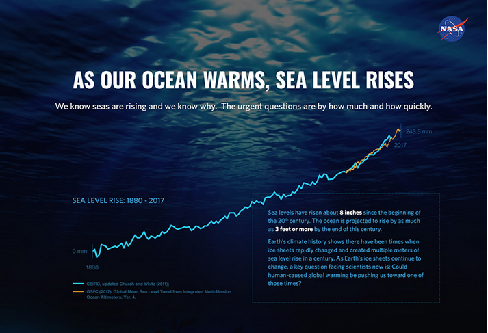
Earth’s seas are rising, a direct result of a changing climate. Ocean temperatures are increasing, leading to ocean expansion. And as ice sheets and glaciers melt, they add more water. A fleet of increasingly sophisticated instruments deployed by NASA across the oceans, on polar ice and in orbit, reveals significant changes among globally interlocking factors that are driving sea levels higher.
Visualizations
- ID: 4871
 Visualization
 - ID: 4858
 Visualization
 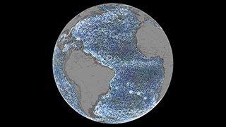 Section
 Section
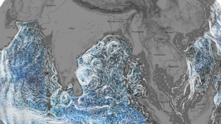
 Section
- ID: 4853
 Visualization
 - ID: 4867
 Visualization
 - ID: 4860
 Visualization
 - ID: 4804
 Visualization
 - ID: 4841
 Visualization
- ID: 13577
![VIDEO: "Witness the Breathtaking Beauty of Earth’s Polar Regions"
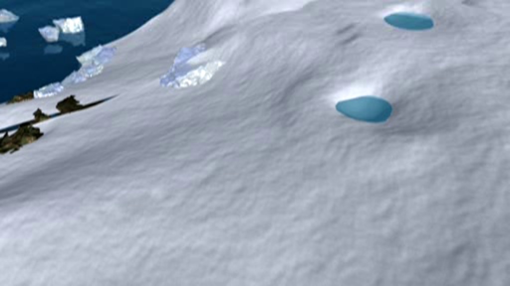
Operation IceBridge recorded the diversity and fragility of our rapidly changing polar regions. These areas are some of the most inhospitable, but breathtaking places on Earth. Sit back and witness the polar regions, from western Greenland to Antarctica. Notable features include the Pine Island Glacier, Larsen C ice shelf, and rapid summer melt on the western Greenland Ice Sheet.
Learn more: Operation IceBridge
Music Provided by Universal Production Music: "Arabesque No.1" by Claude Debussy [PD]
This video is also available on our YouTube channel.](/vis/a010000/a013500/a013577/13577_Cryosphere_Beauty_Classic.00018_print.jpg)
- ID: 4821
 Visualization
 - ID: 4802
- ID: 4818
 Visualization
 - ID: 4809
- ID: 4796
 Visualization
 - ID: 4566
- ID: 4596
 Visualization
 - ID: 4328
 Visualization
 - ID: 4249
 Visualization
 - ID: 4325
- ID: 4347
- ID: 20111
 Animation
Additional Resources


NASA Field Research 2015
- ID: 11994 Produced Video

Rising Seas: NASA on the Greenland Ice Sheet
Go to this pageGreenland_SLR_Final_Condensed_appletv_print.jpg (1024x576) [88.1 KB] || Greenland_SLR_Final_Condensed_youtube_hq_searchweb.png (180x320) [74.6 KB] || Greenland_SLR_Final_Condensed_youtube_hq_thm.png (80x40) [6.1 KB] || Greenland_SLR_Final_Condensed_appletv.m4v (1280x720) [1.6 GB] || Greenland_SLR_Live_Final_Condensed.mov (1280x720) [42.4 GB] || Greenland_SLR_Final_Condensed_HD.wmv (1280x720) [580.1 MB] || Greenland_SLR_Final_Condensed_youtube_hq.mov (1280x720) [4.8 GB] || Greenland_SLR_Final_Condensed_HD.webm (1280x720) [346.3 MB] || Greenland_SLR_Final_Condensed_youtube_hq.webm (1280x720) [349.8 MB] || Greenland_SLR_Final_Condensed_appletv_subtitles.m4v (1280x720) [1.6 GB] || Greenland_SLR_Final_Condensed.en_US.srt [85.1 KB] || Greenland_SLR_Final_Condensed.en_US.vtt [84.9 KB] || Greenland_SLR_Final_Condensed_ipod_sm.mp4 (320x240) [590.0 MB] ||
- ID: 11982 Produced Video
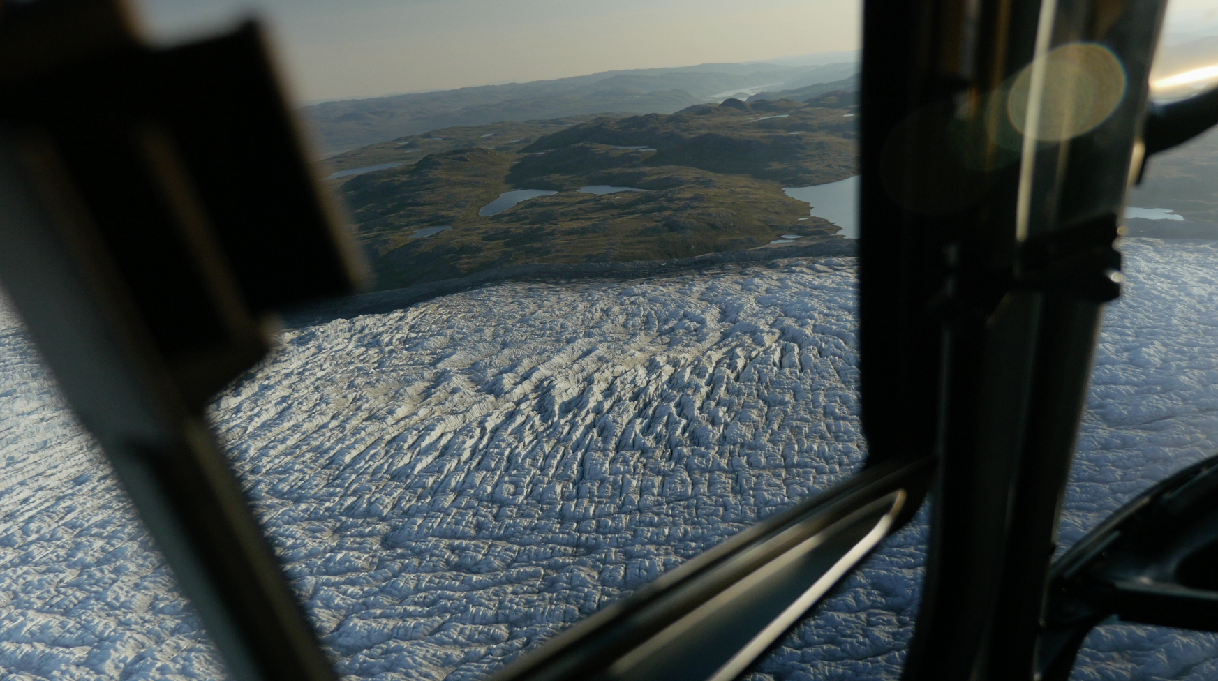
Aerials over Greenland
Go to this pageA reel of helicopter footage taken in July of 2015 over Greenland including a transit from Kangerlussuaq, Greenland to a field camp on the ice sheet, operated by UCLA's Larry Smith footage over the Ilulissat IceFjord and nearby glaciers. ||
- ID: 11983 Produced Video
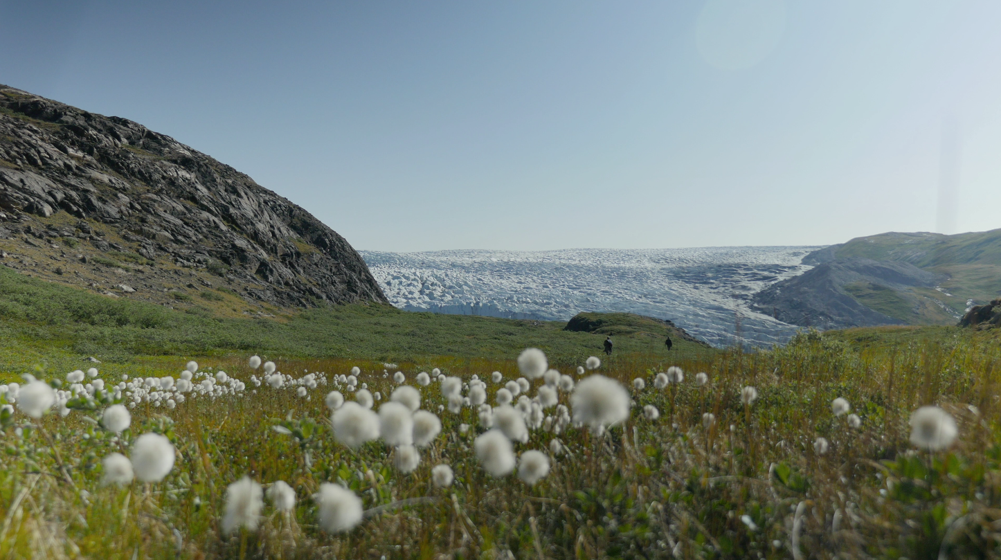
Greenland Beauty Shots
Go to this pageViews of Greenlandic scenery from Kangerlussuaq, the terminous of the Russell Glacier, and the Ilulissat region. ||
- ID: 11984 Produced Video
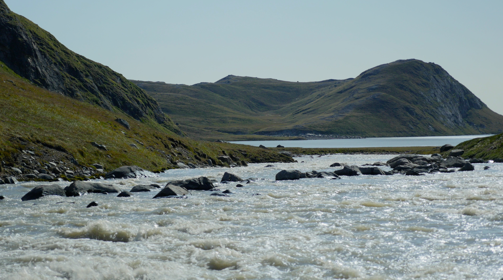
Greenland Melt Water
Go to this pageVarious scenes of water melting from the Greenland Ice Sheet on its way to the sea. ||
- ID: 11985 Produced Video
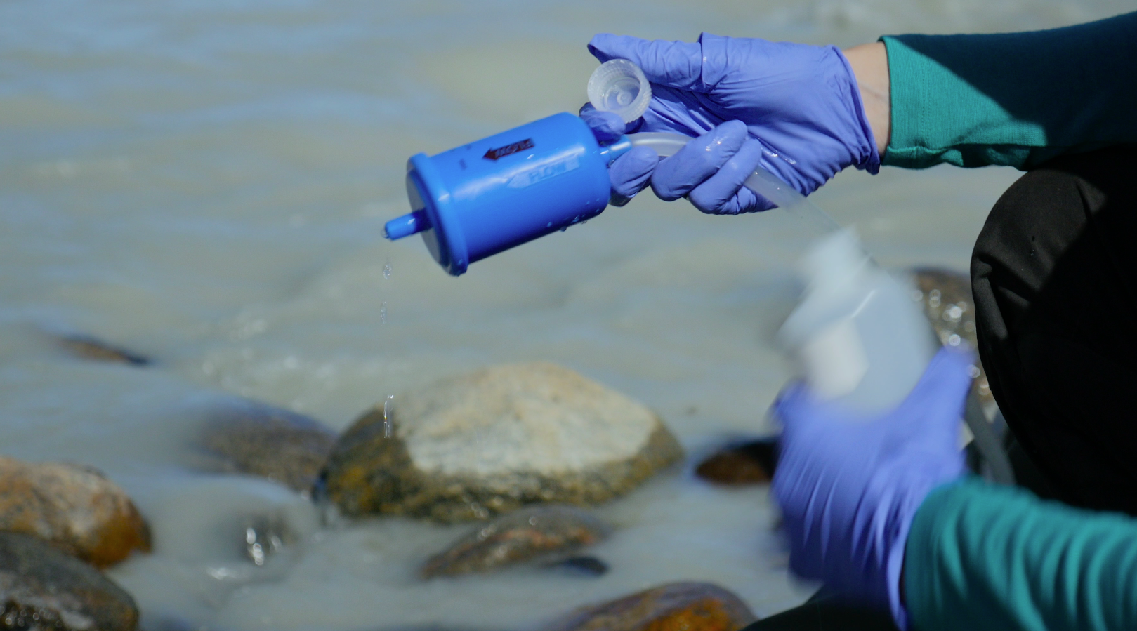
Researchers in the Field
Go to this pageNASA, the National Science Foundation, and universities support a variety of field research in Greenland. ||
- ID: 11987 Produced Video
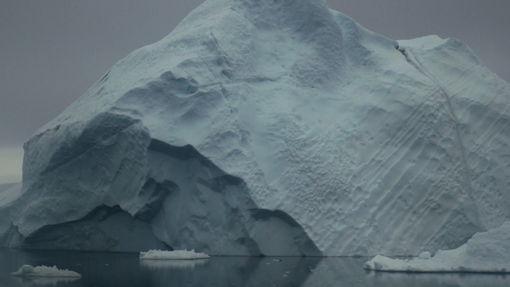
Greenland Icebergs
Go to this pageGreenlandReel_Icebergs_720H264_print.jpg (1024x576) [90.9 KB] || GreenlandReel_Icebergs_720H264_searchweb.png (320x180) [85.7 KB] || GreenlandReel_Icebergs_720H264_web.png (180x320) [85.7 KB] || GreenlandReel_Icebergs_720H264_thm.png (80x40) [5.7 KB] || GreenlandReel_Icebergs_720H264.mp4 (1280x720) [466.5 MB] || GreenlandReel_Icebergs_1080H264.mp4 (1920x1080) [467.9 MB] || GreenlandReel_Icebergs_720H264.webm (1280x720) [29.8 MB] || GreenlandReel_Icebergs_2160H264.mp4 (3840x2160) [1.1 GB] || GreenlandReel_Icebergs_2160APR.mov (3840x2160) [30.8 GB] ||
- ID: 11862 Produced Video
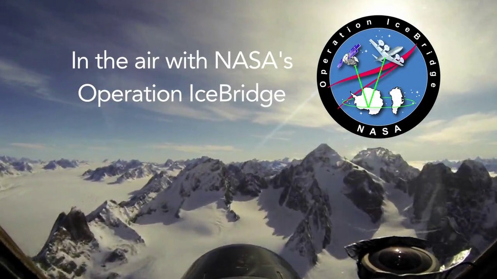
Operation IceBridge Arctic 2015 video series
Go to this pageFor more IceBridge videos NASA’s Operation IceBridge has wrapped up its 2015 Arctic field campaign after covering a vast expanse of science targets during 33 different flights over land ice, sea ice, and glaciers. The airborne campaign flies over the Arctic and Antarctic every year measuring changes in the ice with instruments like radar and lasers. For more on IceBridge, visit NASA's IceBridge webpage. ||