Earth
ID: 934
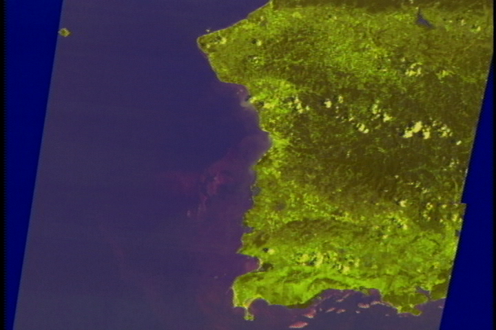
This scene shows the southwestern corner of the island of Puerto Rico as seen by the three Landsat Thematic Mapper (TM) visible light sensors. The detectors have a limited ability to see through shallow water, detecting the coral reefs and shallow sand areas around the edge of the island.
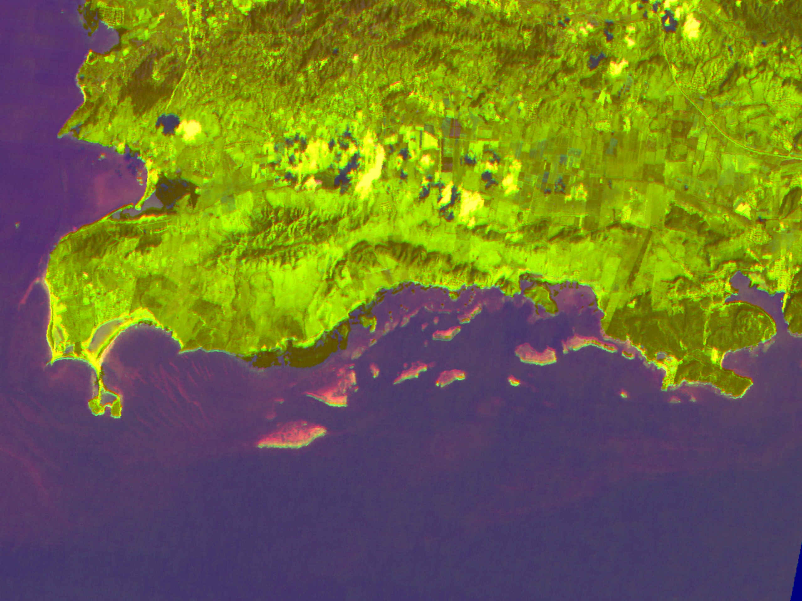
Northwest Corner of Puerto Rico Showing Shallow Waters and Coral Reefs
For More Information
Visualization Credits
Please give credit for this item to:
NASA/Goddard Space Flight Center Scientific Visualization Studio
NASA/Goddard Space Flight Center Scientific Visualization Studio
Short URL to share this page:
https://svs.gsfc.nasa.gov/934
Mission:
Landsat
Data Used:
Note: While we identify the data sets used in these visualizations, we do not store any further details nor the data sets themselves on our site.
Keywords:
DLESE >> Biological oceanography
SVS >> Coral Reefs
DLESE >> Physical geography
DLESE >> Physical oceanography
GCMD >> Location >> Puerto Rico
NASA Science >> Earth
GCMD keywords can be found on the Internet with the following citation: Olsen, L.M., G. Major, K. Shein, J. Scialdone, S. Ritz, T. Stevens, M. Morahan, A. Aleman, R. Vogel, S. Leicester, H. Weir, M. Meaux, S. Grebas, C.Solomon, M. Holland, T. Northcutt, R. A. Restrepo, R. Bilodeau, 2013. NASA/Global Change Master Directory (GCMD) Earth Science Keywords. Version 8.0.0.0.0
https://svs.gsfc.nasa.gov/934
Mission:
Landsat
Data Used:
Landsat-5/TM
Keywords:
DLESE >> Biological oceanography
SVS >> Coral Reefs
DLESE >> Physical geography
DLESE >> Physical oceanography
GCMD >> Location >> Puerto Rico
NASA Science >> Earth
GCMD keywords can be found on the Internet with the following citation: Olsen, L.M., G. Major, K. Shein, J. Scialdone, S. Ritz, T. Stevens, M. Morahan, A. Aleman, R. Vogel, S. Leicester, H. Weir, M. Meaux, S. Grebas, C.Solomon, M. Holland, T. Northcutt, R. A. Restrepo, R. Bilodeau, 2013. NASA/Global Change Master Directory (GCMD) Earth Science Keywords. Version 8.0.0.0.0


