Earth
ID: 899
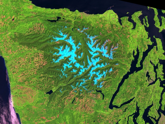
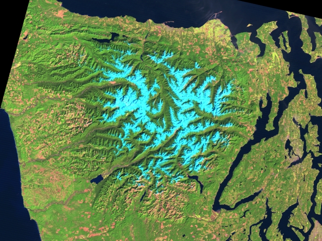
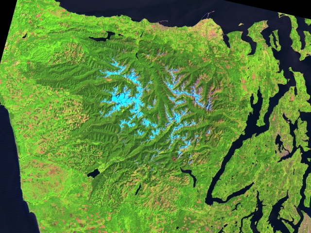
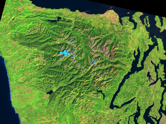
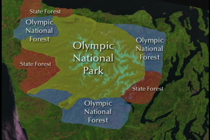
The four large scenes show the Olympic Peninsula in northwestern Washington State, centered on the Olympic National Park and the national and state forests immediately surrounding the national park. Mount Olympus dominates the scene with its (usually) snow-capped peaks. Clear cutting in the national and state forests around the national park was well underway at the time of the first Landsat scene. In the late 1980s, public land use policies changed and clear cutting by the timber industry migrated from public lands to private land holdings predominately to the south of the national park. Clear cutting shows as red patches around the perimeter of the essentially pristine dark green of the national park. A set of close-up scenes showing a one mile square area to the northwest of the National Park is also available (see animation 900). North is up in all these images. The Landsat scenes use Thematic Mapper data from bands 5, 4, and 2 displayed as red, green, and blue respectively. In this color scheme, dense conifer coverage appears dark green, bare soil or cultivated land appears reddish, while the light blue on the peaks of mountains and ridges is snow.
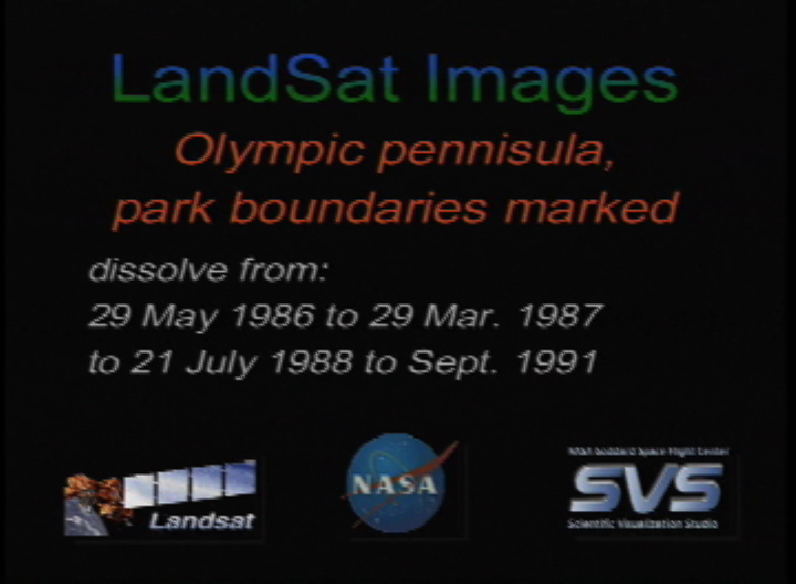
Olympic Peninsula Time Lapse with Park Boundaries: Dissolve through different dates
For More Information
Visualization Credits
Please give credit for this item to:
NASA/Goddard Space Flight Center Scientific Visualization Studio
NASA/Goddard Space Flight Center Scientific Visualization Studio
Short URL to share this page:
https://svs.gsfc.nasa.gov/899
Mission:
Landsat
Data Used:
Note: While we identify the data sets used in these visualizations, we do not store any further details nor the data sets themselves on our site.
Keywords:
DLESE >> Human geography
SVS >> Olympic National Park
SVS >> Olympic Peninsula
DLESE >> Physical geography
GCMD >> Location >> Washington
NASA Science >> Earth
GCMD keywords can be found on the Internet with the following citation: Olsen, L.M., G. Major, K. Shein, J. Scialdone, S. Ritz, T. Stevens, M. Morahan, A. Aleman, R. Vogel, S. Leicester, H. Weir, M. Meaux, S. Grebas, C.Solomon, M. Holland, T. Northcutt, R. A. Restrepo, R. Bilodeau, 2013. NASA/Global Change Master Directory (GCMD) Earth Science Keywords. Version 8.0.0.0.0
https://svs.gsfc.nasa.gov/899
Mission:
Landsat
Data Used:
Landsat-5/TM
1986/05/29, 1987/03/29, 1988/07/21, 1991/09/16Keywords:
DLESE >> Human geography
SVS >> Olympic National Park
SVS >> Olympic Peninsula
DLESE >> Physical geography
GCMD >> Location >> Washington
NASA Science >> Earth
GCMD keywords can be found on the Internet with the following citation: Olsen, L.M., G. Major, K. Shein, J. Scialdone, S. Ritz, T. Stevens, M. Morahan, A. Aleman, R. Vogel, S. Leicester, H. Weir, M. Meaux, S. Grebas, C.Solomon, M. Holland, T. Northcutt, R. A. Restrepo, R. Bilodeau, 2013. NASA/Global Change Master Directory (GCMD) Earth Science Keywords. Version 8.0.0.0.0


