Planets and Moons
ID: 871
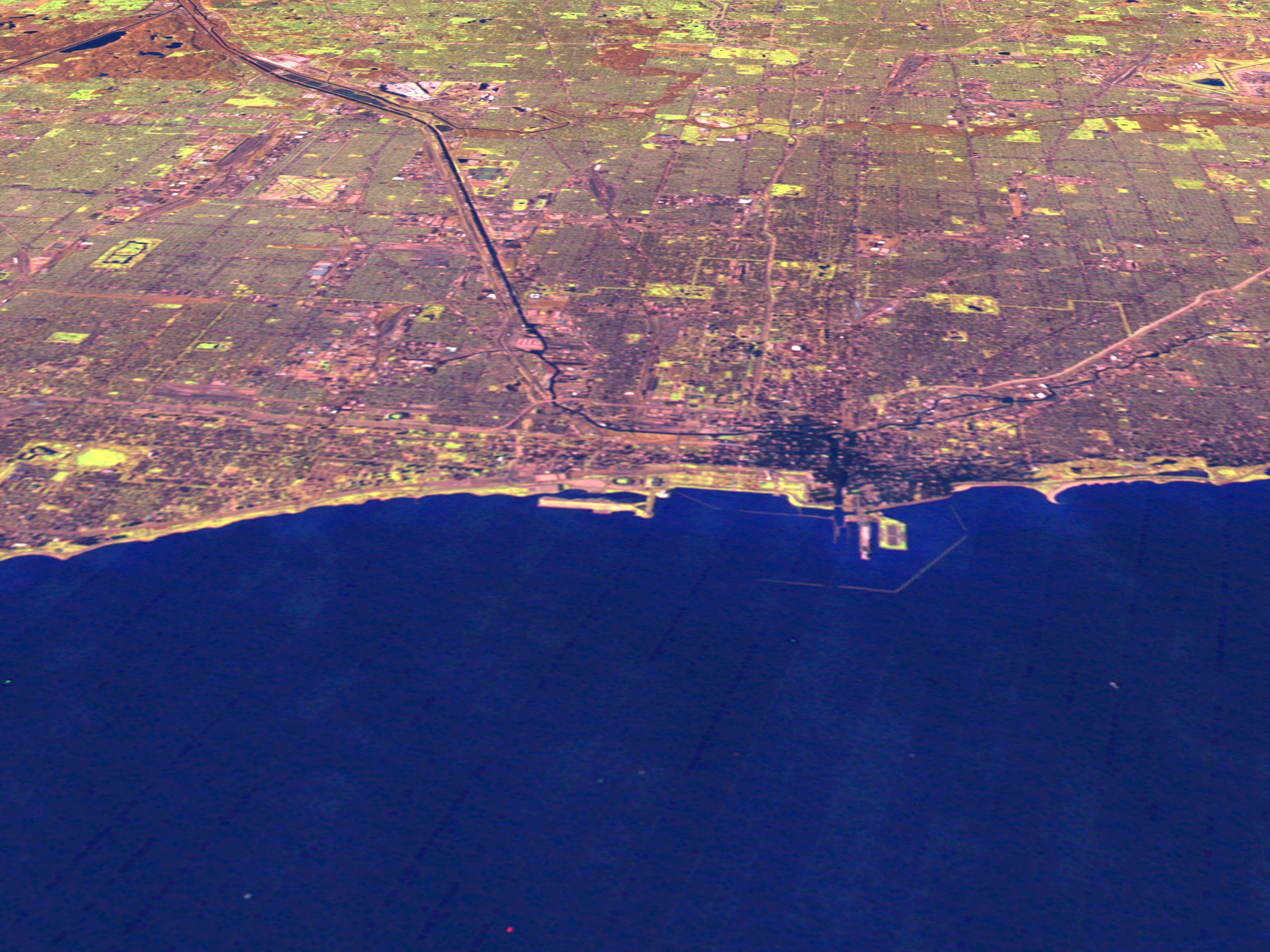
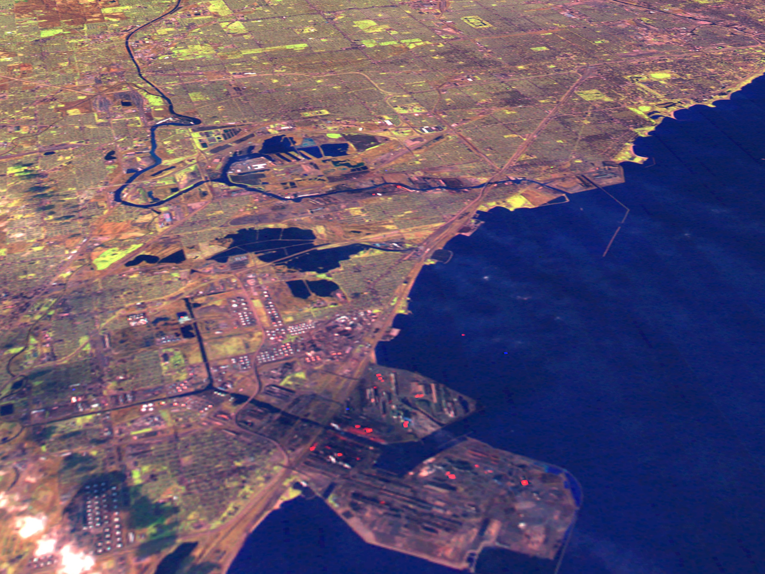
This scene shows Landsat Thematic Mapper data from the shortwave infrared (TM band 5), infrared (TM band 4), and visible green (TM band 2) channels of Chicago. The downtown area and Lakeshore Drive appears in the center of the downtown scene, with the Adler Planetarium in the foreground. The Chicago regional image shows the suburbs to the west and north of the city and includes O'Hare Airfield. The South Chicago image shows the southern portion of the city as well as the industrial area of Gary, Indiana. The bright red pixels are flame plumes from the steel mills along Lake Michigan's edge. North is up in the regional image, and to the right in the downtown and South Chicago/Gary images in which the camera is facing west from above Lake Michigan.


Chicago Flyby Along Lake Shore Drive
For More Information
Visualization Credits
Please give credit for this item to:
NASA/Goddard Space Flight Center Scientific Visualization Studio
NASA/Goddard Space Flight Center Scientific Visualization Studio
Short URL to share this page:
https://svs.gsfc.nasa.gov/871
Mission:
Landsat
Data Used:
Note: While we identify the data sets used in these visualizations, we do not store any further details nor the data sets themselves on our site.
This item is part of this series:
USCities
Keywords:
SVS >> Chicago
DLESE >> Human geography
DLESE >> Physical geography
NASA Science >> Planets and Moons
https://svs.gsfc.nasa.gov/871
Mission:
Landsat
Data Used:
Landsat-5/TM
1993/12/02This item is part of this series:
USCities
Keywords:
SVS >> Chicago
DLESE >> Human geography
DLESE >> Physical geography
NASA Science >> Planets and Moons


