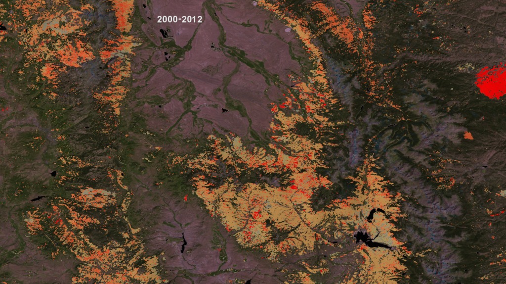
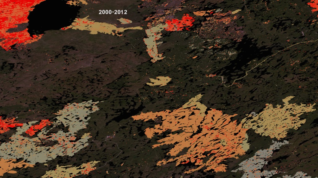
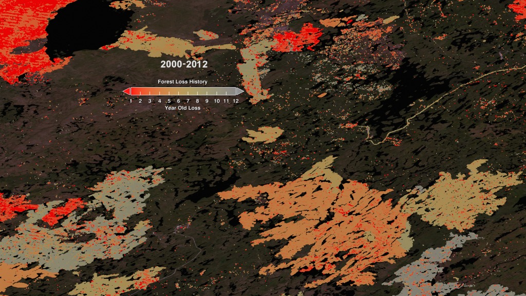
Forest Cover Loss 2000-2012 in Colorado, Oklahoma, and Saskatechewan
Hansen and colleagues analyzed 143 billion pixels in 654,000 Landsat images to compile maps of forest loss and gain between 2000 and 2012. During that period, 888,000 square miles (2.3 million square kilometers) of forest was lost, and 308,900 square miles (0.8 million square kilometers) regrew. The researchers, including scientists from the University of Maryland, Google, the State University of New York, Woods Hole Research Center, the U.S. Geological Survey and South Dakota State University, published their work in the Nov. 15, 2013, issue of the journal Science.
Key to the project was collaboration with team members from Google Earth Engine, who reproduced in the Google Cloud the models developed at the University of Maryland for processing and characterizing the Landsat data; Google Earth Engine contains a complete copy of the Landsat record. The computing required to generate these maps would have taken 15 years on a single desktop computer, but with cloud computing was performed in a few days.
Since 1972, the Landsat program has played a critical role in monitoring, understanding and managing the resources needed to sustain human life such as food, water and forests. Landsat 8 launched Feb. 11, 2013, and is jointly managed by NASA and USGS to continue the 40-plus years of Earth observations.
To view the forest cover maps in Google Earth Engine, visit: http://earthenginepartners.appspot.com/google.com/science-2013-global-forest

For More Information
Visualization Credits
Greg Shirah (NASA/GSFC): Animator
Matthew R. Radcliff (USRA): Producer
Alison Schuyler Ogden (NASA/GSFC): Producer
Matt C. Hansen (University of Maryland): Scientist
Kate Ramsayer (Telophase): Writer
NASA's Goddard Space Flight Center, using data from Hansen, Potapov, Moore, Hancher, et al., Science Nov. 15, 2013.High-Resolution Global Maps of 21st-Century Forest Cover Change. Data available on-line from: http://earthenginepartners.appspot.com/science-2013-global-forest.
https://svs.gsfc.nasa.gov/4209
Mission:
Landsat
Data Used: Note: While we identify the data sets used in these visualizations, we do not store any further details nor the data sets themselves on our site.
This item is part of these series:
Geophysical Changes Over Time
Landsat 7
Narrated Movies
Keywords:
DLESE >> Biology
SVS >> HDTV
SVS >> Landsat
GCMD >> Earth Science >> Biosphere >> Terrestrial Ecosystems >> Forests
GCMD >> Earth Science >> Human Dimensions >> Habitat Conversion/Fragmentation >> Deforestation
SVS >> Hyperwall
NASA Science >> Earth
GCMD keywords can be found on the Internet with the following citation: Olsen, L.M., G. Major, K. Shein, J. Scialdone, S. Ritz, T. Stevens, M. Morahan, A. Aleman, R. Vogel, S. Leicester, H. Weir, M. Meaux, S. Grebas, C.Solomon, M. Holland, T. Northcutt, R. A. Restrepo, R. Bilodeau, 2013. NASA/Global Change Master Directory (GCMD) Earth Science Keywords. Version 8.0.0.0.0


